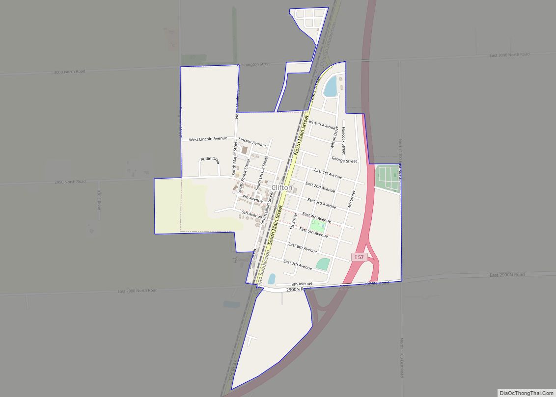
Iroquois County is a county located in the northeast part of the U.S. state of Illinois. According to the 2020 United States Census, it has a population of 27,077. It is the only county in the United States to be named Iroquois, after the American Indian people. The county seat is Watseka. The county is located along the border with Indiana.
| Name: | Iroquois County |
|---|---|
| FIPS code: | 17-075 |
| State: | Illinois |
| Founded: | 1833 |
| Named for: | Iroquois River |
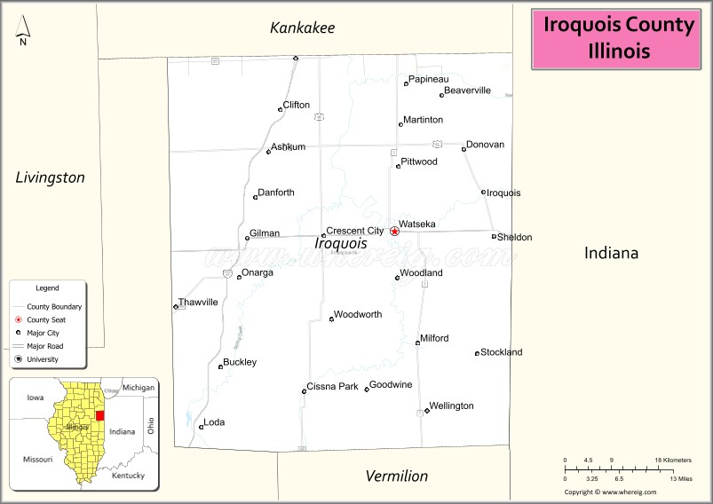
| Seat: | Watseka |
| Largest city: | Watseka |
| Total Area: | 1,119 sq mi (2,900 km²) |
| Land Area: | 1,117 sq mi (2,890 km²) |
| Total Population: | 29,718 |
| Population Density: | 27/sq mi (10/km²) |
| Time zone: | UTC−6 (Central) |
| Summer Time Zone (DST): | UTC−5 (CDT) |
| Website: | www.co.iroquois.il.us |
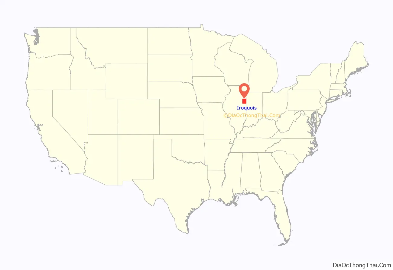
Iroquois County location map. Where is Iroquois County?
History
Iroquois County was created on February 26, 1833, out of a portion of Vermilion County. It was named for the Iroquois River, which was itself named for the Iroquois people. The first county seat was established at the town of Iroquois in 1837, though no official buildings were constructed there and offices were rented. Several other sites for the county seat were examined, and in 1839 it was moved to Middleport; a court house and jail were built there. There was a long battle between Middleport and Watseka (also known as South Middleport) as to which should be the county seat; in 1865, it was finally moved to Watseka. The town of Middleport no longer exists, but there is a township of that name. A courthouse was built in Watseka in 1866 at a cost of $28,000 and included a jail in the basement; this building was expanded in 1881, and a new jail was built in 1893 just east of the courthouse.
Iroquois County from the time of its creation to 1836
Iroquois County between 1836 and 1853
Iroquois County in 1853, when the creation of Kankakee County reduced it to its current size.
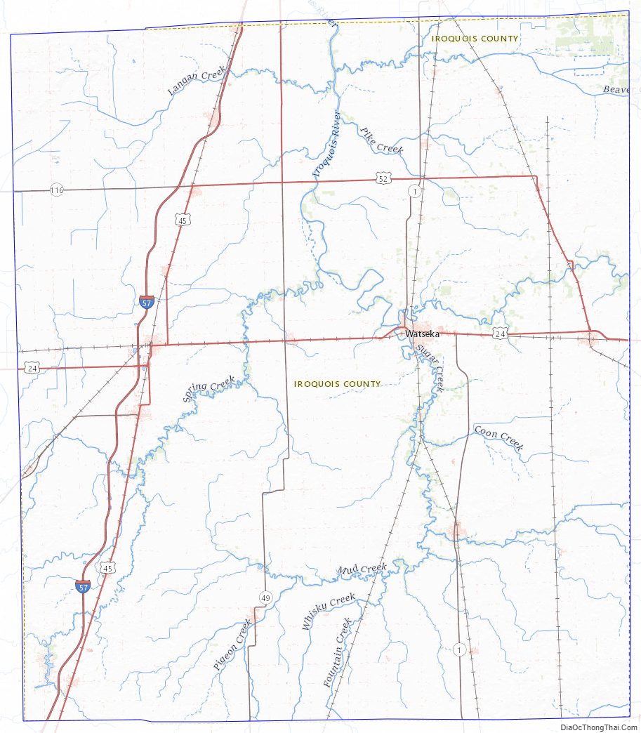
Iroquois County Road Map

Geography
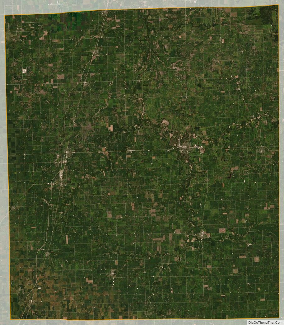
According to the U.S. Census Bureau, the county has a total area of 1,119 square miles (2,900 km), of which 1,117 square miles (2,890 km) is land and 1.6 square miles (4.1 km) (0.1%) is water. It is the third-largest county in Illinois by land area and the fifth-largest by total area.
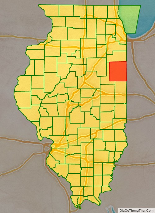
The northern border of the county is about 60 miles (97 km) south of the city of Chicago. The county is bordered on the east by the state of Indiana and its counties of Benton and Newton. To the north lies Kankakee County. Vermilion County, out of which Iroquois County was originally formed, lies to the south. To the west is Ford County.
The Iroquois River enters the county from Indiana and flows westward along the south side of the village of Iroquois, then along the north side of the city of Watseka, whereupon it veers to the north and joins the larger Kankakee River near the city of Kankakee in the county of the same name; the Kankakee River then flows into the Illinois River further to the northwest in Will County. Sugar Creek, further to the south, also flows from the east to the west, entering from Indiana east of Stockland; it passes through the south edge of Milford, is joined by Mud Creek coming up from the south, and winds to the north past the village of Woodland and meets the Iroquois River near Watseka.
The Iroquois County State Wildlife Area, a 2,400-acre (970 ha) state park, is located in the northeast corner of the county. There are also three nature preserves: Bonnie’s Prairie, Hooper Branch Savanna, and Loda Cemetery Prairie.
Climate and weather
In recent years, average temperatures in the county seat of Watseka have ranged from a low of 14 °F (−10 °C) in January to a high of 84 °F (29 °C) in July, although a record low of −28 °F (−33 °C) was recorded in January 1999 and a record high of 105 °F (41 °C) was recorded in August 1988. Average monthly precipitation ranged from 1.61 inches (41 mm) in January to 4.62 inches (117 mm) in June.
Adjacent counties
- Kankakee County – north
- Newton County, Indiana – east
- Benton County, Indiana – east
- Vermilion County – south
- Ford County – west
Iroquois County Topographic Map
Iroquois County Satellite Map
Iroquois County Outline Map