Kherson Oblast (Ukrainian: Херсо́нська о́бласть, romanized: Khersónsʹka óblastʹ, IPA: [xerˈsɔnʲsʲkɐ ˈɔbɫɐsʲtʲ]), also known as Khersonshchyna (Херсо́нщина, IPA: [xerˈsɔnʃt͡ʃɪnɐ]), is an oblast (province) in southern Ukraine. It is located just north of Crimea. Its administrative center is Kherson, on the west bank of the Dnieper which bisects the oblast. The area of the region is 28,461 km and the population 1,001,598 (2022 est.). It is considered the ‘fruit basket’ of the country, as much of its agricultural production is dispersed throughout the country, with production peaking during the summer months.
Most of the area of the oblast has been under Russian military occupation since the 2022 Russian invasion of Ukraine. Territory in the northwest, including Kherson city, was recaptured by Ukraine in the southern counteroffensive.
On 30 September 2022, Russia annexed the Donetsk (Donetsk People’s Republic), Luhansk (Luhansk People’s Republic), Zaporizhzhia, and Kherson Oblasts. However, the referendums and subsequent annexations are internationally unrecognized.
| Unit Name | Kherson Oblast |
|---|---|
| Administrative center | Kherson (de jure) |
| Total area | 28.461 km² (10.989 sq mi) |
| Area Rank | Rank 7th |
| Population (2021) | 1.016.707 |
| Time zone | UTC+2 (EET) |
| Summer (DST) | UTC+3 (EEST) |
| Postal code | 73-75 |
| Area code | +380-55 |
| ISO 3166 code | UA-65 |
| Website | www.oda.kherson.ua |
| Flag |  |
| Coat of arms |  |
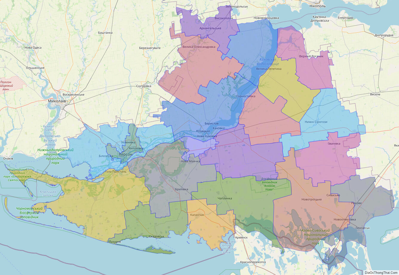
Online subdivision map of Kherson oblast
If you’re planning to explore the beauty of Kherson oblast in Ukraine, you’ll want to check out its online subdivision map. This online map provides a detailed view of the oblast’s sub-administrative units, including cities, towns, and villages. You can easily navigate through the map to see different areas of the oblast, zoom in for a closer look at specific locations, and even switch between satellite and base maps for different views.
One of the key features of this online subdivision map is the use of color-coded layers to distinguish between the different sub-administrative units. Each city, town, and village is highlighted with a unique color, making it easy to identify and differentiate between them. The map also includes labels for major roads and landmarks, so you can easily find your way around the oblast and locate key points of interest.
Whether you’re planning a trip to Kherson oblast or just want to explore its many towns and villages from the comfort of your own home, this online subdivision map is an invaluable resource. With its detailed information and easy-to-use interface, you’ll be able to discover all the beauty and charm that this region of Ukraine has to offer.
Click on ![]() to view map in "full screen" mode.
to view map in "full screen" mode.
List administrative sub-division of Kherson oblast
| # | Name | Type |
|---|---|---|
| 1 | Khersons’ka | Mis’ka Rada |
| 2 | Novokahovs’ka | Mis’ka Rada |
| 3 | Beryslavs’kyi | Raion |
| 4 | Bilozers’kyi | Raion |
| 5 | Chaplyns’kyi | Raion |
| 6 | Heniches’kyi | Raion |
| 7 | Holoprystans’kyi | Raion |
| 8 | Hornosta‹vs’kyi | Raion |
| 9 | Ivanivs’kyi | Raion |
| 10 | Kakhovs’kyi | Raion |
| 11 | Kalanchats’kyi | Raion |
| 12 | Novotro‹ts’kyi | Raion |
| 13 | Novovorontsovs’kyi | Raion |
| 14 | Nyzhn’osirohoz’kyi | Raion |
| 15 | Skadovs’kyi | Raion |
| 16 | Tsiurupyns’kyi | Raion |
| 17 | Velykolepetys’kyi | Raion |
| 18 | Velykooleksandrivs’kyi | Raion |
| 19 | Verkhn’orohachyts’kyi | Raion |
| 20 | Vysokopil’s’kyi | Raion |
Explaination:
- Mis’ka Rada: City municipalities (governed by a mayor and a city council)
- Misto: city at least 10,000 people (not a town).
- Raion: often translated as “district”.
Location map of Kherson oblast, Ukraine
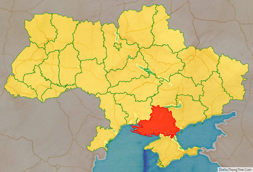

Political map of Kherson oblast

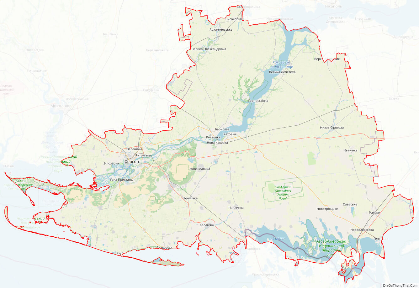
Kherson oblast streeet map
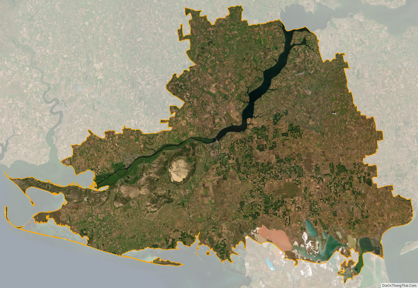
Kherson oblast satellite map