Zaporizhzhia Oblast (Ukrainian: Запорі́зька о́бласть, romanized: Zaporizka oblast), also referred to as Zaporizhzhia (Ukrainian: Запорі́жжя), is an oblast (province) of southeast Ukraine. Its capital is Zaporizhzhia. The oblast covers an area of 27,183 km (10,495 sq mi), and its population is 1,638,462 (2022 est.).
This oblast is an important part of Ukraine’s industry and agriculture. Most of the area of the oblast has been under Russian military occupation since the 2022 Russian invasion of Ukraine, including all of the coast, although the capital and the majority of the population remains under Ukrainian administration.
On 30 September 2022 Russia annexed the Donetsk (Donetsk People’s Republic), Luhansk (Luhansk People’s Republic), Zaporizhzhia, and Kherson Oblasts. However, the referendums and subsequent annexations are internationally unrecognized.
| Unit Name | Zaporizhzhya Oblast |
|---|---|
| Administrative center | Zaporizhzhia |
| Total area | 27.183 km² (10.495 sq mi) |
| Area Rank | Rank 9th |
| Population (2021) | 1.666.515 |
| Time zone | UTC+2 (EET) |
| Summer (DST) | UTC+3 (EEST) |
| Postal code | 69-72 |
| Area code | +380-61 |
| ISO 3166 code | UA-23 |
| Website | www.zoda.gov.ua |
| Flag |  |
| Coat of arms |  |
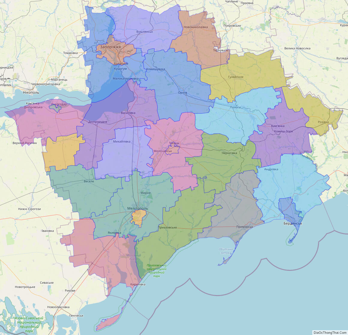
Online subdivision map of Zaporizhzhya oblast
Zaporizhzhya Oblast, located in the southeast region of Ukraine, is home to a variety of landscapes and attractions. The region has a rich history and cultural heritage, making it an ideal destination for those interested in exploring the country’s past and present.
By using an online subdivision map of Zaporizhzhya Oblast, visitors can gain a detailed understanding of the region’s geography and administrative structure. The map includes a cover layer with different colors to indicate the boundaries and borders of each sub-administrative unit. Users can zoom in and out of the map to explore the different towns, villages, and cities that make up the region.
From the bustling city of Zaporizhzhya to the serene beauty of the Kakhovka Reservoir, the online subdivision map allows visitors to discover the unique charm of each area within the oblast. The map also provides information on transportation routes and major landmarks, making it a valuable resource for planning travel within the region.
In addition to its natural and cultural attractions, Zaporizhzhya Oblast is also an important industrial center, with a variety of manufacturing and production facilities. By using the online subdivision map, researchers and investors can gain insights into the economic and industrial landscape of the region.
Overall, the online subdivision map of Zaporizhzhya Oblast is an essential tool for anyone looking to explore the region’s diverse offerings. Its detailed information and user-friendly interface make it an invaluable resource for researchers, investors, and visitors alike.
Click on ![]() to view map in "full screen" mode.
to view map in "full screen" mode.
List administrative sub-division of Zaporizhzhya oblast
| # | Name | Type |
|---|---|---|
| 1 | Berdians’ka | Mis’ka Rada |
| 2 | Zaporiz’ka | Mis’ka Rada |
| 3 | Enerhodars’ka | Misto |
| 4 | Melitopol’s’ka | Misto |
| 5 | Tokmats’ka | Misto |
| 6 | Berdians’kyi | Raion |
| 7 | Chernihivs’kyi | Raion |
| 8 | Huliaipil’s’kyi | Raion |
| 9 | Iakymivs’kyi | Raion |
| 10 | Kamians’ko-Dniprovs’kyi | Raion |
| 11 | Kuibyshevs’kyi | Raion |
| 12 | Melitopol’s’kyi | Raion |
| 13 | Mykhailivs’kyi | Raion |
| 14 | Novomykola‹vs’kyi | Raion |
| 15 | Orikhivs’kyi | Raion |
| 16 | Polohivs’kyi | Raion |
| 17 | Pryazovs’kyi | Raion |
| 18 | Prymors’kyi | Raion |
| 19 | Rozivs’kyi | Raion |
| 20 | Tokmats’kyi | Raion |
| 21 | Vasylivs’kyi | Raion |
| 22 | Velykobilozers’kyi | Raion |
| 23 | Veselivs’kyi | Raion |
| 24 | Vil’nians’kyi | Raion |
| 25 | Zaporiz’kyi | Raion |
Explaination:
- Mis’ka Rada: City municipalities (governed by a mayor and a city council)
- Misto: city at least 10,000 people (not a town).
- Raion: often translated as “district”.
Location map of Zaporizhzhya oblast, Ukraine


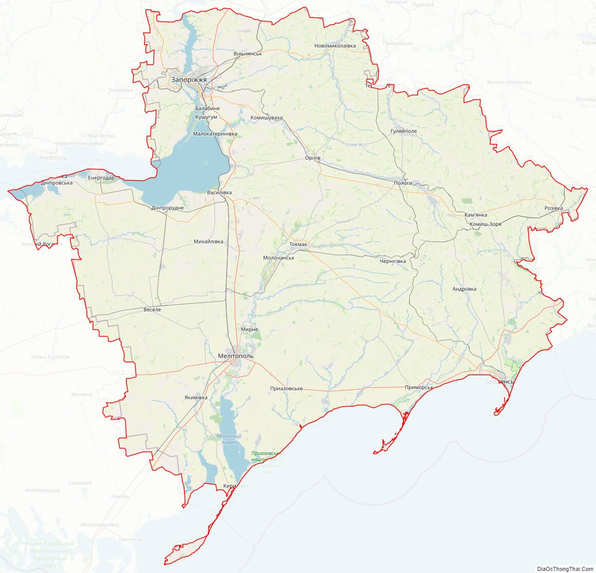
Political map of Zaporizhzhya oblast

Zaporizhzhya oblast streeet map
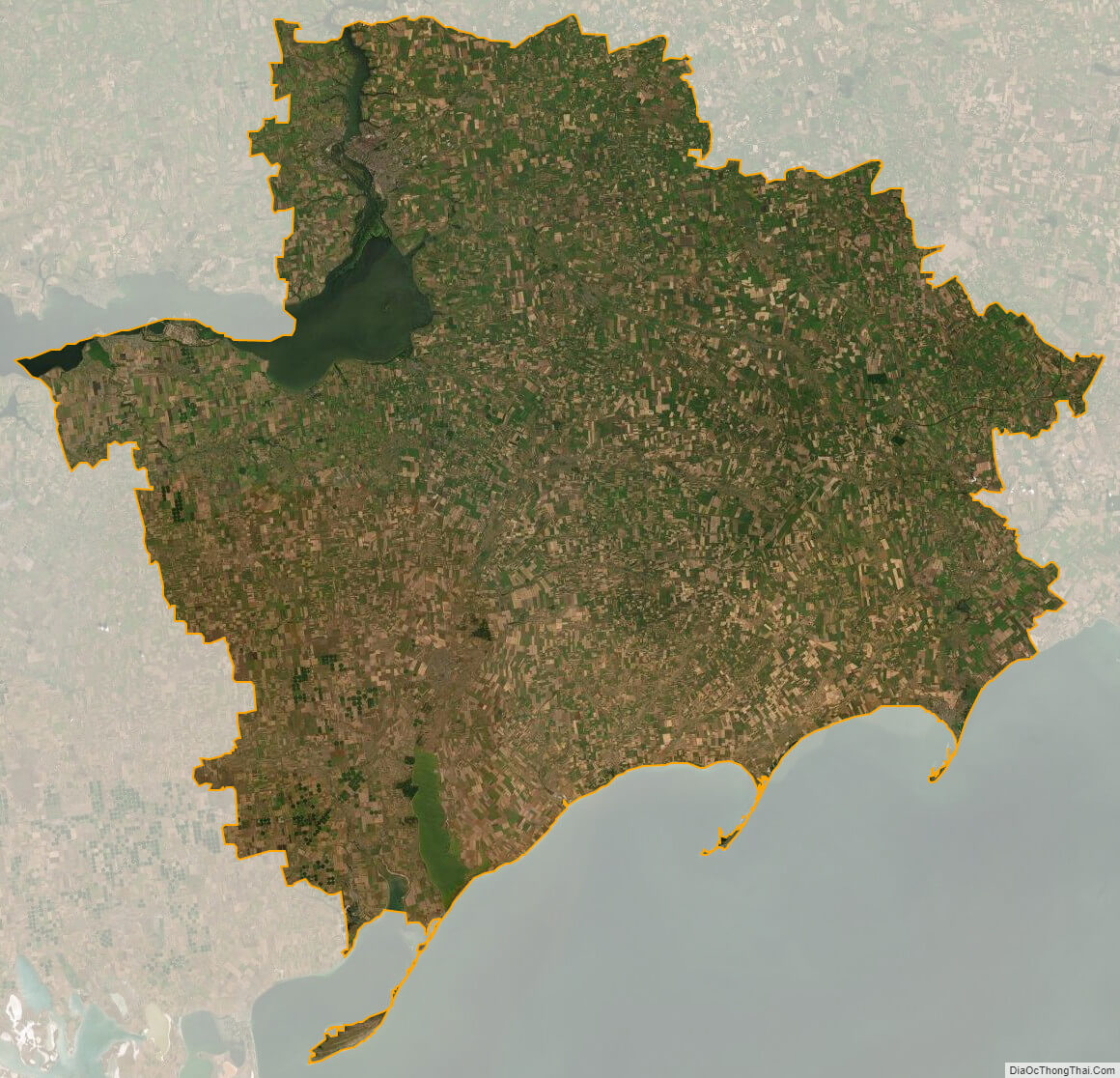
Zaporizhzhya oblast satellite map