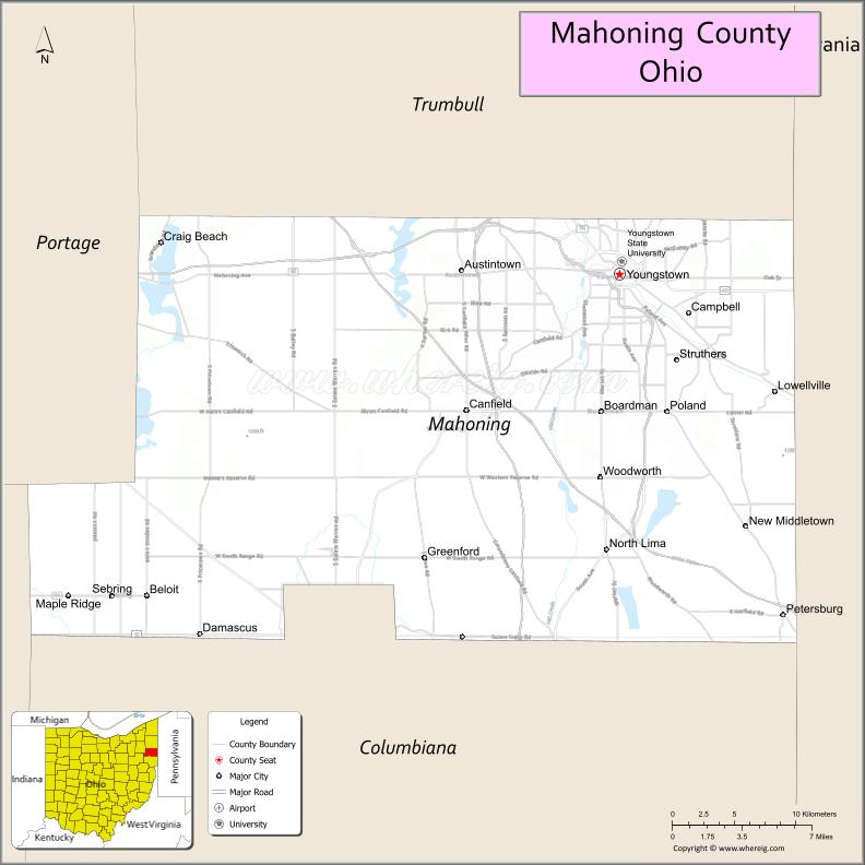
Mahoning County is a county in the U.S. state of Ohio. As of the 2020 census, the population was 228,614. Its county seat and largest city is Youngstown. The county is named after the Mahoning River and was formed on March 1, 1846; the 83rd county in Ohio. Until 1846, the area that is now Mahoning County was part of Trumbull and Columbiana counties, when the counties in the area were redefined and Mahoning County emerged as a new county. Mahoning County is part of the Youngstown-Warren-Boardman, OH-PA Metropolitan Statistical Area.
| Name: | Mahoning County |
|---|---|
| FIPS code: | 39-099 |
| State: | Ohio |
| Founded: | March 1, 1846 |
| Named for: | A Native American word for salt lick |
| Seat: | Youngstown |
| Largest city: | Youngstown |
| Total Area: | 425 sq mi (1,100 km²) |
| Land Area: | 412 sq mi (1,070 km²) |
| Total Population: | 228,614 |
| Population Density: | 540/sq mi (210/km²) |
| Time zone: | UTC−5 (Eastern) |
| Summer Time Zone (DST): | UTC−4 (EDT) |
| Website: | www.mahoningcountyoh.gov |
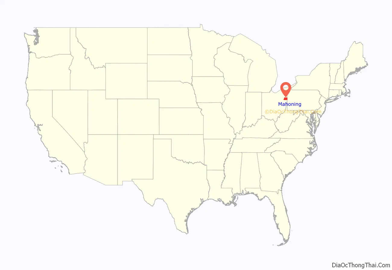
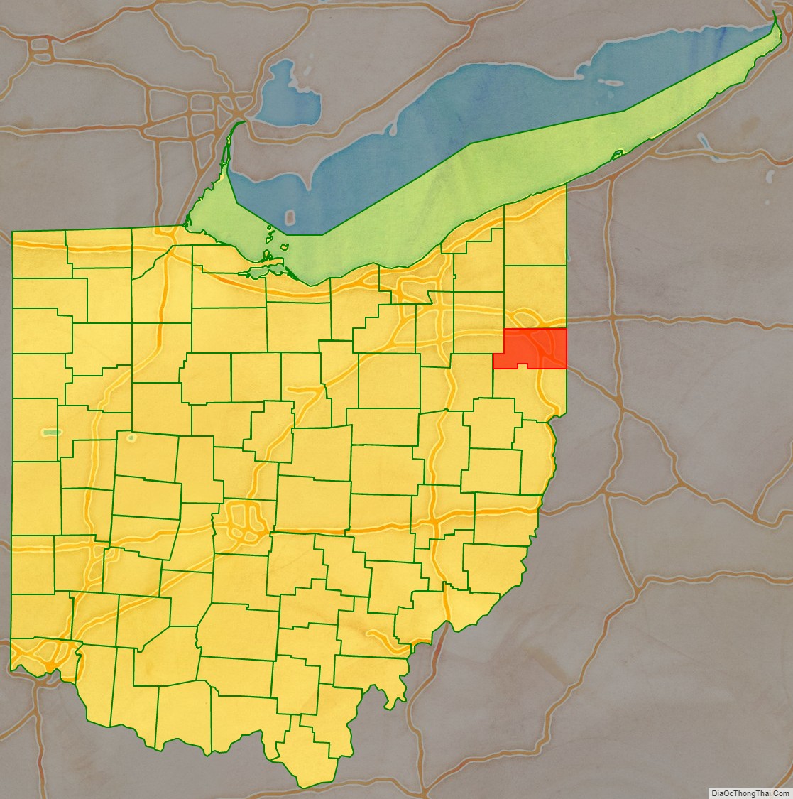
Mahoning County location map. Where is Mahoning County?
History
In the year 1600, Mahoning County was likely divided between two nations of Native Americans, the Erie people in the east and the Whittlesey culture in the west. It is unknown where the actual boundaries between these cultures lied, though the nearest confirmed Whittlesey settlement was at Cleveland and the nearest confirmed Erie settlement was just barely across the Ohio-Pennsylvania border, in Ashtabula County. The Erie were an Iroquoian people who likely arrived sometime between the years 1100-1300 AD, after chasing out an older nation of “Mound Builders.” The Whittlesey were likely Algonquian, but lived in longhouses rather than the traditional Algonquian wigwams.
Following the Beaver Wars, when the Iroquois Confederacy declared war on many of the tribes of the Great Lakes region over several decades and destroyed them, new tribes moved into this area. The tribes who shared the resources of the Mahoning Valley included the Seneca, Lenape (Delaware), Shawnee, and Wyandot. The Seneca and Wyandot were Iroquoians, and the Lenape and Shawnee were Algonquians. As northeast Ohio later came to be under control of the settlers as part of the Connecticut Western Reserve, all tribes were pushed further westward or southward, before eventually being removed from Ohio by the United States in the early-mid 1800s.
Some former known Native American sites that existed in Mahoning County include the council rock and the North Benton burial mound. Council Rock was where the Shawnee and Lenape were known to gather for collective holiday celebrations, religion ceremonies and political meetings and once sat in the center of Youngstown. Though the rock was moved long ago, it still rests in what is now Lincoln Park. The North Benton burial mound was once located on the outskirts of North Benton and was removed by archeologists. It was attributed to the Hopewell culture, but contained unique features, such as sculptures of constellations made of white rocks and clay laid out at ground level and a pit full of mixed human bones in one corner. It shared features with two other burial mounds found and excavated in Kent, Ohio and Warren, Pennsylvania represents a completely unique style of burial mound in Ohio.
Prior to its formation of a county in 1846, Mahoning County was a destination for a family of Huguenot refugees in the early 1800s.
In the 1900s, Youngstown was a hub for the American steel industry and for local mob groups, who gained their power through the liquor and gambling industries during prohibition, remaining a key safety issue for the region until the 1970s. It was also the home to Warner Theatre, where the Warner Bros. film studio got its start and remained a hub for early film and television for decades. An extensive German community used to exist in the township of Berlin, until pressure to fully assimilate after the World Wars against Germany ended it. Brier Hill Pizza was invented in Youngstown’s Brier Hill neighborhood and is considered a local delicacy.
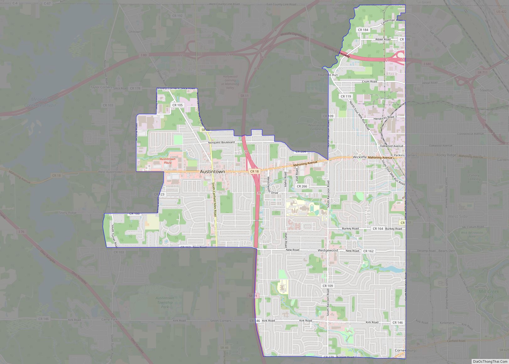
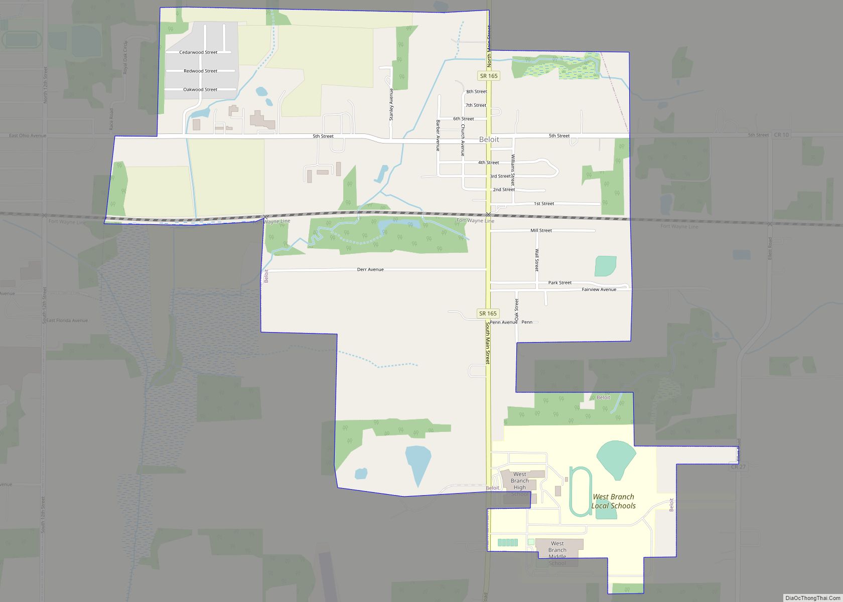
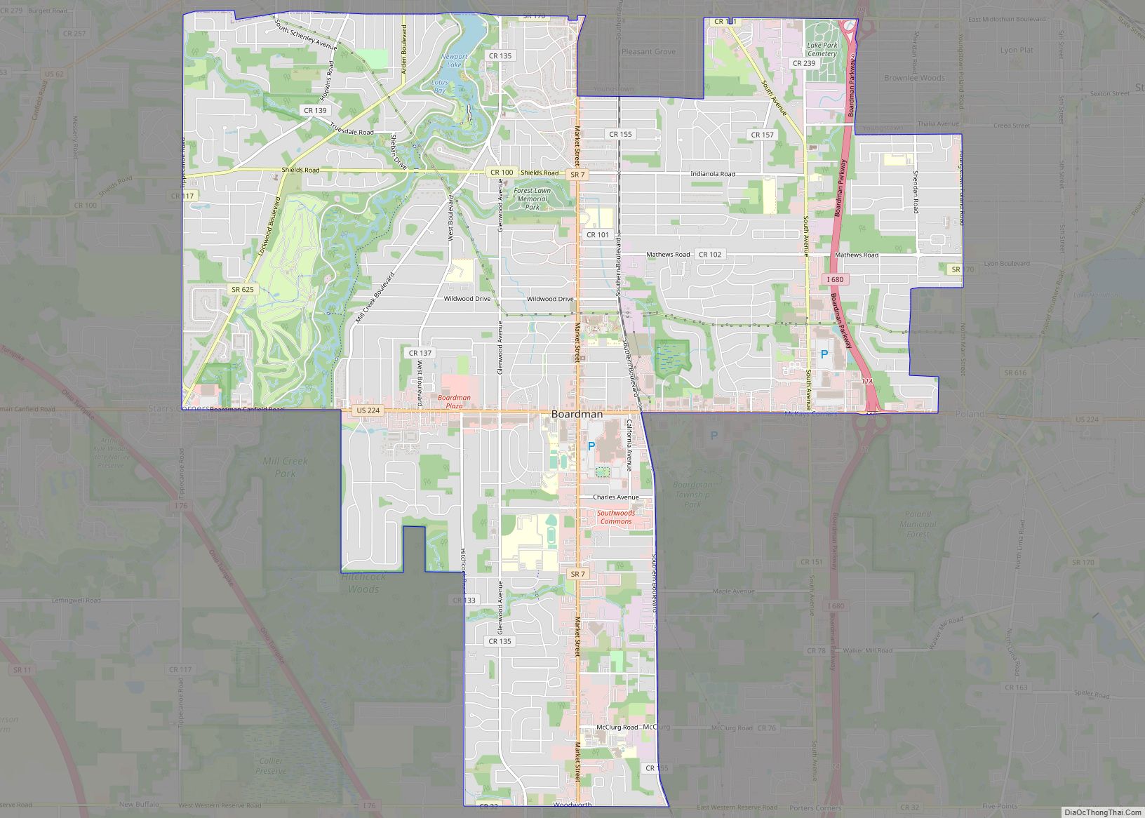
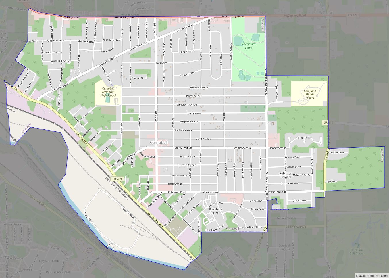
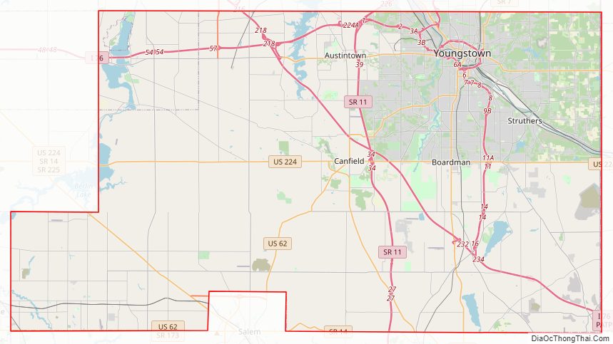
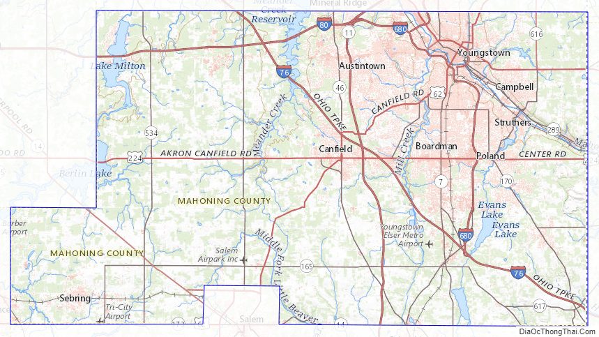
Mahoning County Road Map
Geography
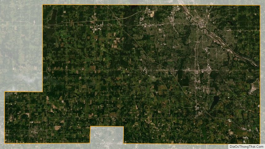
According to the United States Census Bureau, the county has an area of 425 square miles (1,100 km), of which 412 square miles (1,070 km) is land and 14 square miles (36 km) (3.2%) is water.
Adjacent counties
- Trumbull County (north)
- Mercer County, Pennsylvania (northeast)
- Lawrence County, Pennsylvania (east)
- Columbiana County (south)
- Stark County (southwest)
- Portage County (northwest)
Major Highways
- I-76
- I-76 / Ohio Turnpike
- I-80 / Ohio Turnpike
- I-80
- I-680
- US 62
- US 224
- US 422
- SR 7
- SR 11
- SR 14
- SR 45
- SR 46
- SR 164
- SR 165
- SR 170
- SR 193
- SR 289
- SR 446
- SR 534
- SR 616
- SR 617
- SR 625
- SR 626
- SR 630
Mahoning County Topographic Map
Mahoning County Satellite Map
Mahoning County Outline Map