Ocala (/oʊˈkælə/ oh-KAL-ə) is a city in and the county seat of Marion County within the northern region of Florida, United States. As of the 2020 United States Census, the city’s population was 63,591, making it the 54th most populated city in Florida.
Home to over 400 thoroughbred farms and training centers, Ocala was officially named the Horse Capital of the World in 2007. Notable attractions include the Ocala National Forest, Silver Springs State Park, Rainbow Springs State Park, the College of Central Florida, and the World Equestrian Center.
Ocala is the principal city of the Ocala, Florida Metropolitan Statistical Area, which had an estimated 2017 population of 354,353.
| Name: | Ocala city |
|---|---|
| LSAD Code: | 25 |
| LSAD Description: | city (suffix) |
| State: | Florida |
| County: | Marion County |
| Elevation: | 104 ft (32 m) |
| Land Area: | 47.26 sq mi (122.39 km²) |
| Water Area: | 0.01 sq mi (0.01 km²) |
| Population Density: | 1,345.64/sq mi (519.56/km²) |
| ZIP code: | 34470-34483 |
| Area code: | 352 |
| FIPS code: | 1250750 |
| GNISfeature ID: | 0288030 |
| Website: | OcalaFL.org |
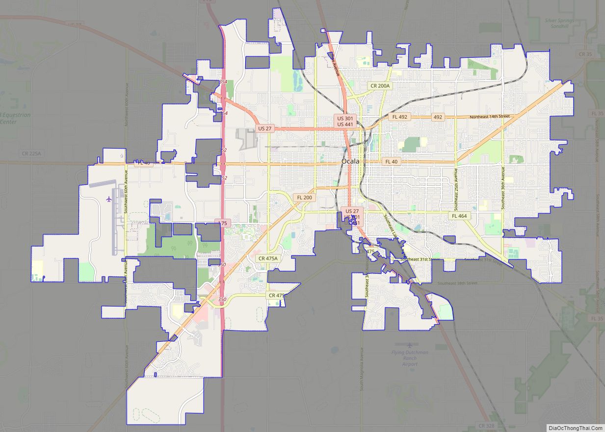
Online Interactive Map
Click on ![]() to view map in "full screen" mode.
to view map in "full screen" mode.
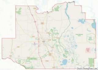
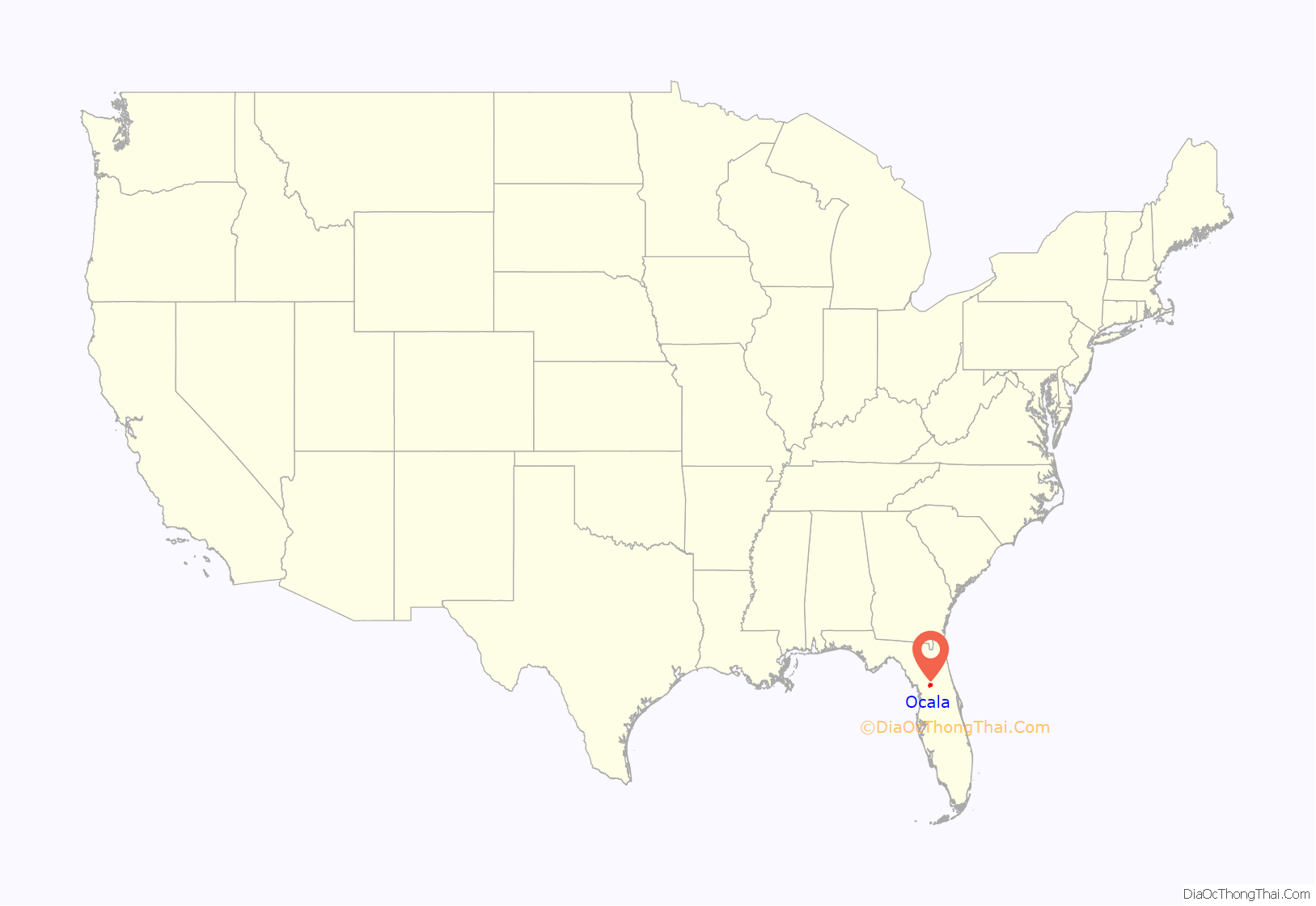
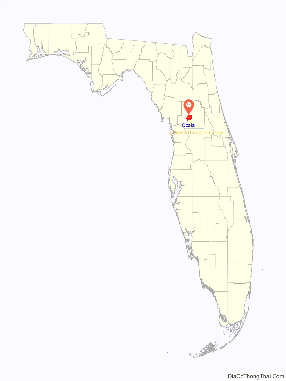
Ocala location map. Where is Ocala city?
History
Ocala is located near what is thought to have been the site of Ocale or Ocali, a major Timucua village and chiefdom recorded in the 16th century. The modern city takes its name from the historical village, the name of which is believed to mean “Big Hammock” in the Timucua language. The Spaniard Hernando de Soto’s expedition recorded Ocale in 1539 during his exploration through what is today the southeastern United States. Ocale is not mentioned in later Spanish accounts; it appears to have been abandoned in the wake of de Soto’s attack.
In the late eighteenth and early nineteenth centuries, Creek people and other Native Americans, and free and fugitive African Americans sought refuge in Florida. The Seminole people formed. After foreign colonial rule shifted between Spain and Great Britain and back again, in 1821 the United States acquired the territory of Florida. After warfare to the north, in 1827 the U.S. Army built Fort King near the present site of Ocala as a buffer between the Seminole, who had long occupied the area, and white settlers moving into the region. The fort was an important base during the Second Seminole War and later served in 1844 as the first courthouse for Marion County.
The modern city of Ocala, which was established in 1849, developed around the fort site. Greater Ocala is known as the “Kingdom of the Sun”. Plantations and other agricultural development dependent on slave labor were prevalent in the region. Ocala was an important center of citrus production until the Great Freeze of 1894–1895. During the Reconstruction era Ocala was represented by several African Americans in the Florida House of Representatives and on the local level.
Rail service reached Ocala in June 1881, encouraging economic development with greater access to markets for produce. Two years later, much of the Ocala downtown area was destroyed by fire on Thanksgiving Day, 1883. The city encouraged rebuilding with brick, granite and steel rather than lumber. By 1888, Ocala was known statewide as “The Brick City”.
In December 1890, the Farmers’ Alliance and Industrial Union, a forerunner of the Populist Party, held its national convention in Ocala. At the convention, the Alliance adopted a platform that would become known as the “Ocala Demands”. This platform included abolition of national banks, promoting low-interest government loans, free and unlimited coinage of silver, reclamation of excess railroad lands by the government, a graduated income tax, and direct election of United States senators. Most of the “Ocala Demands” were to become part of the Populist Party platform.
Late 20th-century establishment as horse capital
The first thoroughbred horse farm in Florida was developed in Marion County in 1943 by Carl G. Rose. Other farms were developed, making Ocala the center of a horse-breeding area. Local horses have won individual races of the Triple Crown series; in 1978, Affirmed, who was bred and trained in Marion County, won all three races, boosting interest in the industry there.
Ocala is one of only five cities (four in the US and one in France) permitted under Chamber of Commerce guidelines to use the title, “Horse Capital of the World”, based on annual revenue produced by the horse industry. 44,000 jobs are sustained by breeding, training, and related support of the equine industry, which generates over $2.2 billion in annual revenue. Postime Farms and Ocala serve as host to one of the largest horse shows in the country: H.I.T.S or “Horses in the Sun”, a Dressage/Jumper event lasting about two months. It generates some 6 to 7 million dollars for the local Marion County economy each year. The show features classes for over 100 different breeds, including Tennessee Walker, Paso Fino, Morgan horse, Saddlebred, Draft horse and the American Quarter Horse. Other equine events in the area include mounted shooting by the Florida Outlaws, as well as endurance rides, barrel races, extreme cowboy events, jumper shows, trick shows, parades, draft pulls, rodeo events and more.
Growth
In the last decades of the twentieth century, the greater Ocala area had one of the highest growth rates in the country for a city its size. The population of Marion County in 2000 was more than 250,000, up from under 100,000 in 1975.
Ocala Historic District
Many historic homes are preserved in Ocala’s large residential Historic District, designated in 1984. East Fort King Street features many excellent examples of Victorian architecture. Ocala structures listed on the National Register of Historic Places include the Coca-Cola Building, the E. C. Smith House, East Hall, the Marion Hotel, Mount Zion A.M.E. Church, the Ritz Historic Inn, and Union Train Station.
The original Fort King site was designated as a National Historic Landmark in 2004.
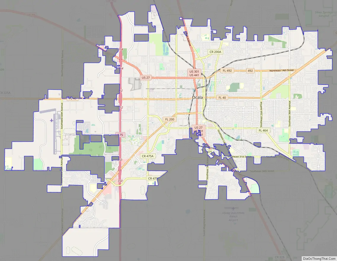
Ocala Road Map
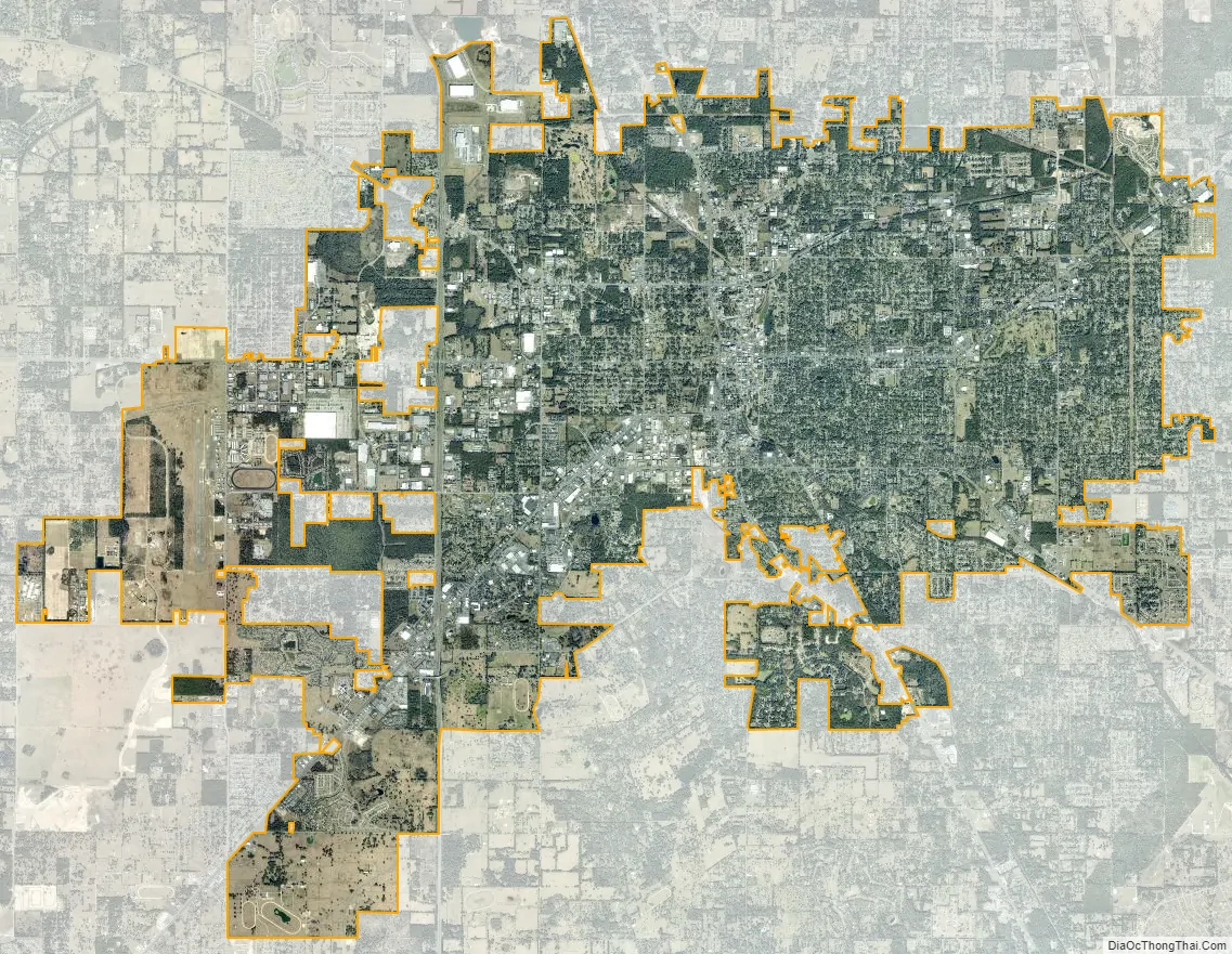
Ocala city Satellite Map
Geography
Ocala is located at 29°11′16″N 82°07′50″W / 29.187704°N 82.130613°W / 29.187704; -82.130613.
According to the United States Census Bureau, the city has a total area of 47.31 square miles (122.5 km), all land. The surrounding farms are famous for their thoroughbred horses, in terrain similar to Kentucky bluegrass. Ocala is also known for nearby Silver Springs, site of one of the largest artesian spring formations in the world and Silver Springs Nature Theme Park, one of the earliest tourist attractions in Florida.
The 110-mile (180 km) long Ocklawaha River passes 10 miles (16 km) east of Ocala, flowing north from Central Florida until it joins the St. Johns River near Palatka.
Marion County is also home to the Ocala National Forest which was established in 1908 and is now the second largest national forest in the state. The Florida Trail, also known as the Florida National Scenic Trail, cuts through Ocala National Forest. Silver Springs State Park was formed as Silver River State Park in 1987, out of land the state purchased around the Silver Springs attraction to spare it from development. The state took over Silver Springs itself in 1993 and incorporated it into the park in 2013.
Climate
Ocala has a humid subtropical climate (Cfa), with hot, humid summers and mild winters.
See also
Map of Florida State and its subdivision:- Alachua
- Baker
- Bay
- Bradford
- Brevard
- Broward
- Calhoun
- Charlotte
- Citrus
- Clay
- Collier
- Columbia
- Desoto
- Dixie
- Duval
- Escambia
- Flagler
- Franklin
- Gadsden
- Gilchrist
- Glades
- Gulf
- Hamilton
- Hardee
- Hendry
- Hernando
- Highlands
- Hillsborough
- Holmes
- Indian River
- Jackson
- Jefferson
- Lafayette
- Lake
- Lee
- Leon
- Levy
- Liberty
- Madison
- Manatee
- Marion
- Martin
- Miami-Dade
- Monroe
- Nassau
- Okaloosa
- Okeechobee
- Orange
- Osceola
- Palm Beach
- Pasco
- Pinellas
- Polk
- Putnam
- Saint Johns
- Saint Lucie
- Santa Rosa
- Sarasota
- Seminole
- Sumter
- Suwannee
- Taylor
- Union
- Volusia
- Wakulla
- Walton
- Washington
- Alabama
- Alaska
- Arizona
- Arkansas
- California
- Colorado
- Connecticut
- Delaware
- District of Columbia
- Florida
- Georgia
- Hawaii
- Idaho
- Illinois
- Indiana
- Iowa
- Kansas
- Kentucky
- Louisiana
- Maine
- Maryland
- Massachusetts
- Michigan
- Minnesota
- Mississippi
- Missouri
- Montana
- Nebraska
- Nevada
- New Hampshire
- New Jersey
- New Mexico
- New York
- North Carolina
- North Dakota
- Ohio
- Oklahoma
- Oregon
- Pennsylvania
- Rhode Island
- South Carolina
- South Dakota
- Tennessee
- Texas
- Utah
- Vermont
- Virginia
- Washington
- West Virginia
- Wisconsin
- Wyoming