Wake County is located in the U.S. state of North Carolina. In the 2020 census, its population was 1,129,410, making it North Carolina’s most-populous county. From July 2005 to July 2006, Wake County was the 9th-fastest growing county in the United States, with the town of Cary and the city of Raleigh being the 8th- and 15th-fastest growing cities, respectively.
Its county seat is Raleigh, which is also the state capital. Eleven other municipalities are in Wake County, the largest of which is Cary, the third-largest city of the Research Triangle region and the seventh-largest municipality in North Carolina.
It is governed by the Wake County Board of Commissioners, coterminous with the Wake County Public School System school district, with law enforcement provided by the Wake County Sheriff’s Department. It is also part of the wider Triangle J Council of Governments, which governs regional planning.
| Name: | Wake County |
|---|---|
| FIPS code: | 37-183 |
| State: | North Carolina |
| Founded: | 1771 |
| Named for: | Margaret Wake |
| Seat: | Raleigh |
| Largest city: | Raleigh |
| Total Area: | 857 sq mi (2,220 km²) |
| Land Area: | 835 sq mi (2,160 km²) |
| Total Population: | 1,150,204 |
| Population Density: | 1,377.5/sq mi (531.9/km²) |
| Time zone: | UTC−5 (Eastern) |
| Summer Time Zone (DST): | UTC−4 (EDT) |
| Website: | www.wake.gov |
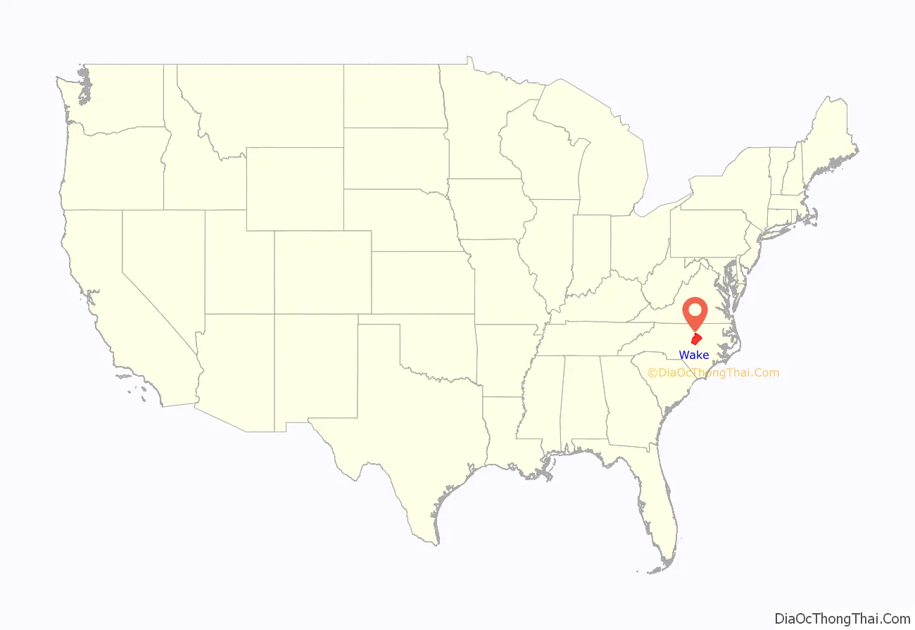
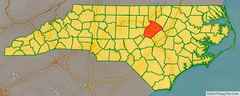
Wake County location map. Where is Wake County?
History
Early history
Prior to English colonization, present-day Wake County was part of the Tuscarora nation.
18th century
Wake County was formed in 1770 from parts of Cumberland County, Johnston County, and Orange County. The first courthouse was built at a village originally called Wake Courthouse, now known as Bloomsbury. In 1771, the first elections and court were held, and the first militia units were organized.
Wake County lost some of its territory through the formation of other counties. Parts were included in Franklin County in 1787, and in Durham County in both 1881 and 1911.
During the colonial period of North Carolina, the state capital was New Bern. For several years during and after the Revolutionary War, there was no capital, and the General Assembly met in various locations. Fayetteville was the state capital in 1786, 1789, 1790, and 1793, when Raleigh became the permanent state capital in 1794. In 1792, a commission was appointed to select a site to build a permanent state capital. The commission members favored land owned by Colonel John Hinton across the Neuse River, but the night before the final vote, the committee adjourned to the home of Joel Lane for an evening of food and spirits. The next day, the vote went in Lane’s favor.
Lane named Wake County in honor of Margaret Wake Tryon, wife of colonial Governor William Tryon. Raleigh was named after Sir Walter Raleigh, and established in 1792 on 1,000 acres (4.0 km) purchased from Lane. Raleigh had never set foot in North Carolina, but he had sponsored the establishment of the first English colony in North America on North Carolina’s Roanoke Island in 1585. The city of Raleigh became both the state capital and the new seat of Wake County.
19th century
The Battle at Morrisville Station was fought April 13–15, 1865, in Morrisville, North Carolina, during the Carolinas Campaign of the American Civil War. It was the last official battle of the Civil War between the armies of Major General William T. Sherman and General Joseph E. Johnston. General Judson Kilpatrick, commanding officer of the Union cavalry advance, compelled Confederate forces under the command of Generals Wade Hampton III and Joseph Wheeler to withdraw in haste. They had been frantically trying to transport their remaining supplies and wounded by rail westward toward the final Confederate encampment in Greensboro. Kilpatrick used artillery on the heights overlooking Morrisville Station and cavalry charges to push the Confederates out of the small village, leaving many needed supplies behind. However, the trains were able to withdraw with wounded from the Battle of Bentonville and the Battle of Averasboro. Later, General Johnston sent a courier to the federal encampments at Morrisville with a message for Major General Sherman requesting a conference to discuss an armistice. Several days later, the two generals met at Bennett Place near Durham on April 17, 1865, to begin discussing the terms of what would become the largest surrender of the war.
20th century
In the 20th century, the average per capita income for the county was of $54,988, and the median income for a family was of $67,149. In the same period, the per capita income decreased from $44,472 to $31,579, especially for women. About 7.80% of the population was below the federal poverty line.
A county courthouse was built in 1915. Space for county government in the building grew increasingly inadequate in the 1960s, and another courthouse was built in 1970.
21st century
In August 2014, the county population surpassed 1,000,000 people.
In November 2017, commissioners of Wake and Harnett Counties discussed the possibility of redrawing the line between the counties using the latest technology. This could affect 27 homeowners, who would end up in a different county or have their property divided between the two.
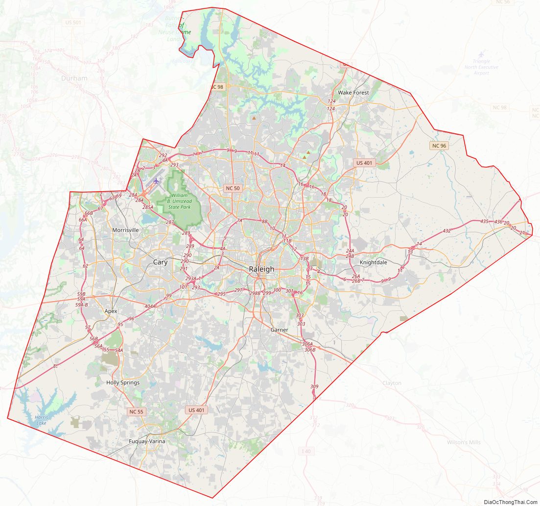
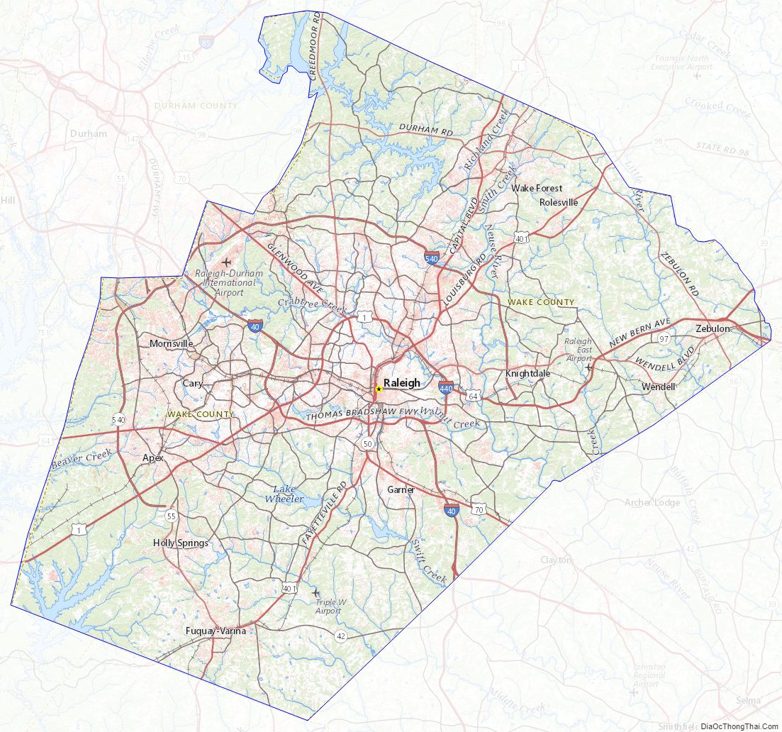
Wake County Road Map
Geography
According to the U.S. Census Bureau, the county has a total area of 857 square miles (2,220 km), of which 22 square miles (57 km) (2.6%) are covered by water.
Wake County is located in the northeast central region of North Carolina, where the North American Piedmont and Atlantic Coastal Plain regions meet. This area is known as the “fall line” because it marks the elevation inland at which waterfalls begin to appear in creeks and rivers. As a result, most of Wake County features gently rolling hills that slope eastward toward the state’s flat coastal plain. Its central Piedmont location situates the county about three hours west of Atlantic Beach by car and four hours east of the Great Smoky Mountains.
Bodies of water that are located in Wake County include Lake Crabtree, Crabtree Creek, Lake Johnson, the Neuse River, and portions of Falls Lake and Jordan Lake.
State and local protected areas/sites
- Annie Louise Wilkerson, MD Nature Preserve Park
- Beaverdam Lake State Recreation Area
- Blue Jay Point County Park
- Carl Alwin Schenck Memorial Forest
- Carroll Howard Johnson Environmental Park
- Clemmons Educational State Forest (part)
- Falls Lake Dam Recreation Area
- Falls Lake State Recreation Area (part)
- Forest Ridge Park
- Harris Lake County Park
- Hemlock Bluffs Nature Preserve
- Hilltop Needmore Town Park & Preserve
- Lake Crabtree County Park
- Mitchell Mill State Natural Area
- NC Executive Mansion
- North Carolina State Capitol, historic site
- Robertson Millpond Preserve
- Rolling View State Recreation Area (part)
- Sandling Beach State Recreation Area
- Sandy Pines Preserve
- Turnipseed Nature Preserve
- William B. Umstead State Park
Major water bodies
- Beaver Dam Lake
- Briar Creek Reservoir
- Crabtree Creek (Neuse River tributary)
- Jordan Lake
- Lake Benson
- Lake Betz
- Lake Crabtree
- Lake Johnson
- Lake Wheeler
- Little River (Neuse River tributary)
- Neuse River
- Shearon Harris Reservoir
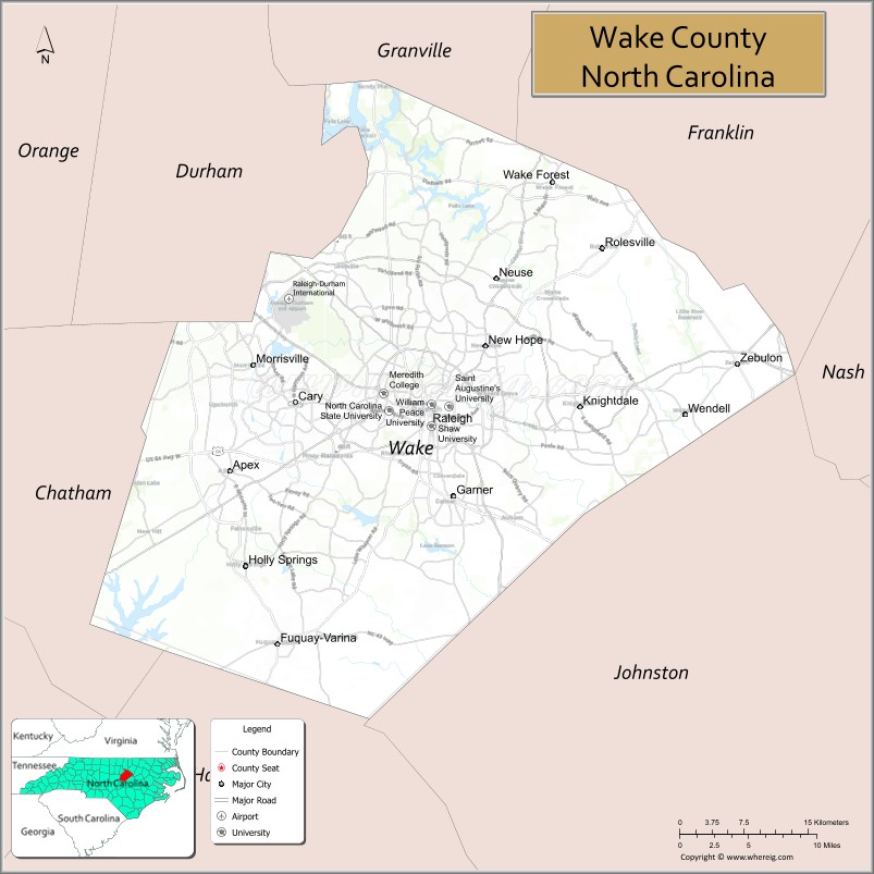
Adjacent counties
- Granville County – north
- Franklin County – northeast
- Nash County – east
- Johnston County – southeast
- Harnett County – southwest
- Chatham County – west
- Durham County – northwest
Major highways
- I-40 is the only major Interstate Highway that runs through the county. It offers direct access to RDU International Airport, Morrisville, Cary, Raleigh and Garner. It has two auxiliary routes in Wake County:
- Future I-42 (Concurrency with US 70)
- I-87 will eventually connect I-40 to Norfolk, Virginia. Its Wake County section is concurrent with U.S. 64. The highway is currently signed as I-87 only where it already meets Interstate standards: along the Raleigh Beltline (where its southern terminus is at I-440’s Exit 16 and I-40’s Exit 301) and along the Knightdale Bypass, which runs from I-440 to the Business 64 exit between Knightdale and Wendell. East of this point, the road is a controlled-access freeway but does not meet interstate standards, so it is marked with “Future” I-87 signs. The “future” designation will be removed as the road is eventually upgraded by improving the road’s shoulders, which are currently too narrow to qualify for an Interstate Highway designation. There is no timetable for these improvements. Interstate 87 will run along the same routing, and will eventually will be extended along US 64, US 17, and other roads (some yet to be built) to Norfolk.
- I-440 is the northern, western, and eastern portion of the “Beltline” that encircles most of central Raleigh. The southern portion of the Beltline is I-40.
- I-540 / NC 540 Toll is a 66-mile (106 km) partially completed loop that currently connects the satellite towns of Knightdale, Cary, Morrisville, Apex and Holly Springs. The completed portion in northern Wake County is called the Northern Wake Expressway (I-540). It continues as a non-Interstate route, NC 540, in western Wake County, almost all of which is a toll road. The remaining segments to be constructed will also be designated as NC 540 and will be tolled, with an approximate cost of $2.2 billion.
- Future I-587
- I-885 / NC 885 Toll (Originally NC 147 Toll)
- US 1
- US 64
- US 64 Bus.
- US 70
- US 70 Bus.
- US 264
- US 401
- US 401 Bus.
- NC 39
- NC 42
- NC 50
- NC 54
- NC 55
- NC 96
- NC 97
- NC 98
- NC 98 Bus.
- NC 231
The “mountains-to-the-sea” North Carolina Bicycle Route 2 travels through Wake County, as does the Maine-to-Florida U.S. Bicycle Route 1. North Carolina Bicycle Route 5, the “Cape Fear run”, connects Apex to the coastal city of Wilmington.
Major infrastructure
- Cary Station
- North Carolina State Fair Station
- Raleigh-Durham International Airport (RDU) is located in northwestern Wake county off I-40. The airport offers service to more than 35 domestic and international destinations. The airport currently serves more than 9 million passengers a year.
- Raleigh Union Station
- Regional Rail– Plans are being made for a light rail system that would be built over the next 10 to 20 years.
- Triangle Transit Authority operates buses that serve the region and connect to municipal bus systems in Raleigh, Durham, and Chapel Hill.
Wake County Topographic Map
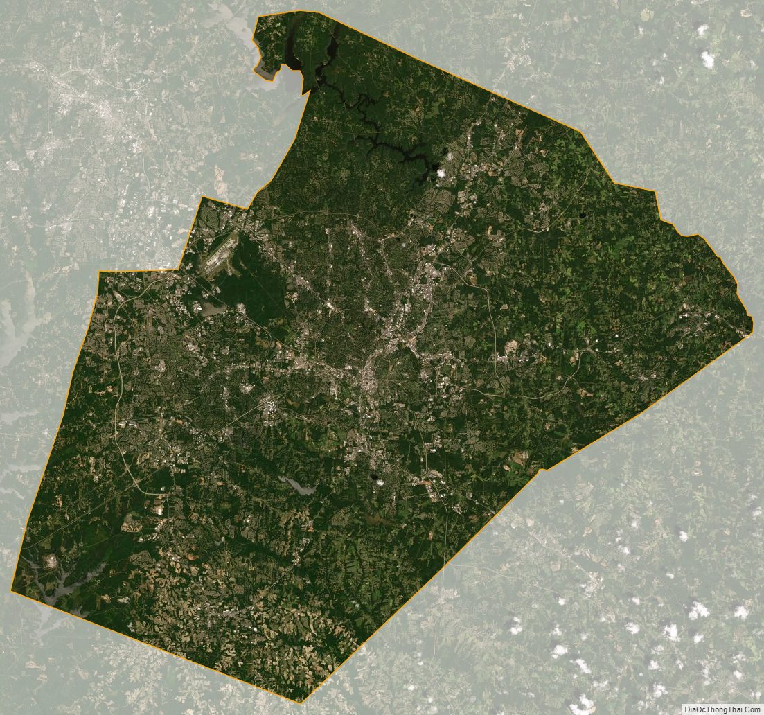
Wake County Satellite Map
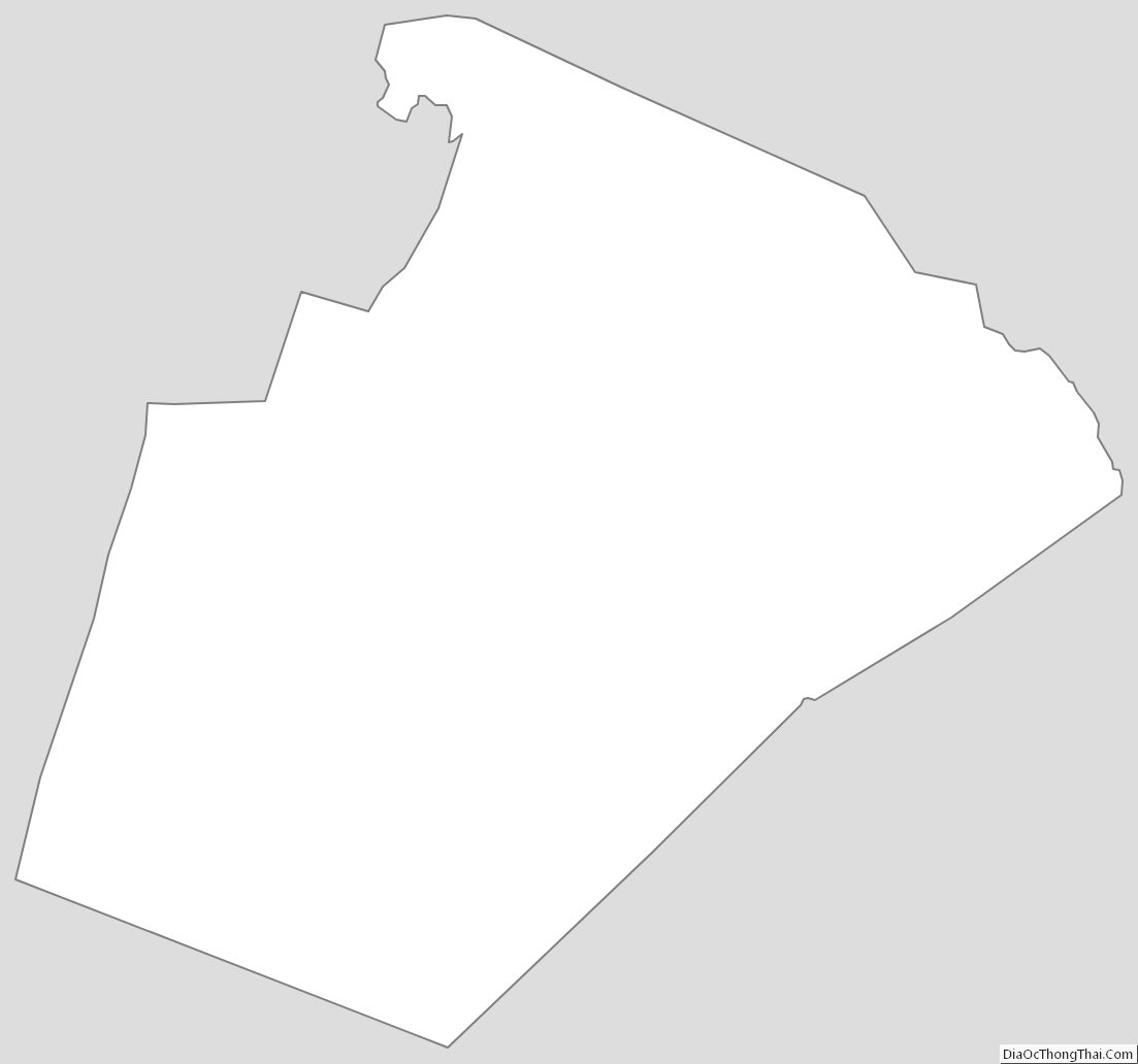
Wake County Outline Map