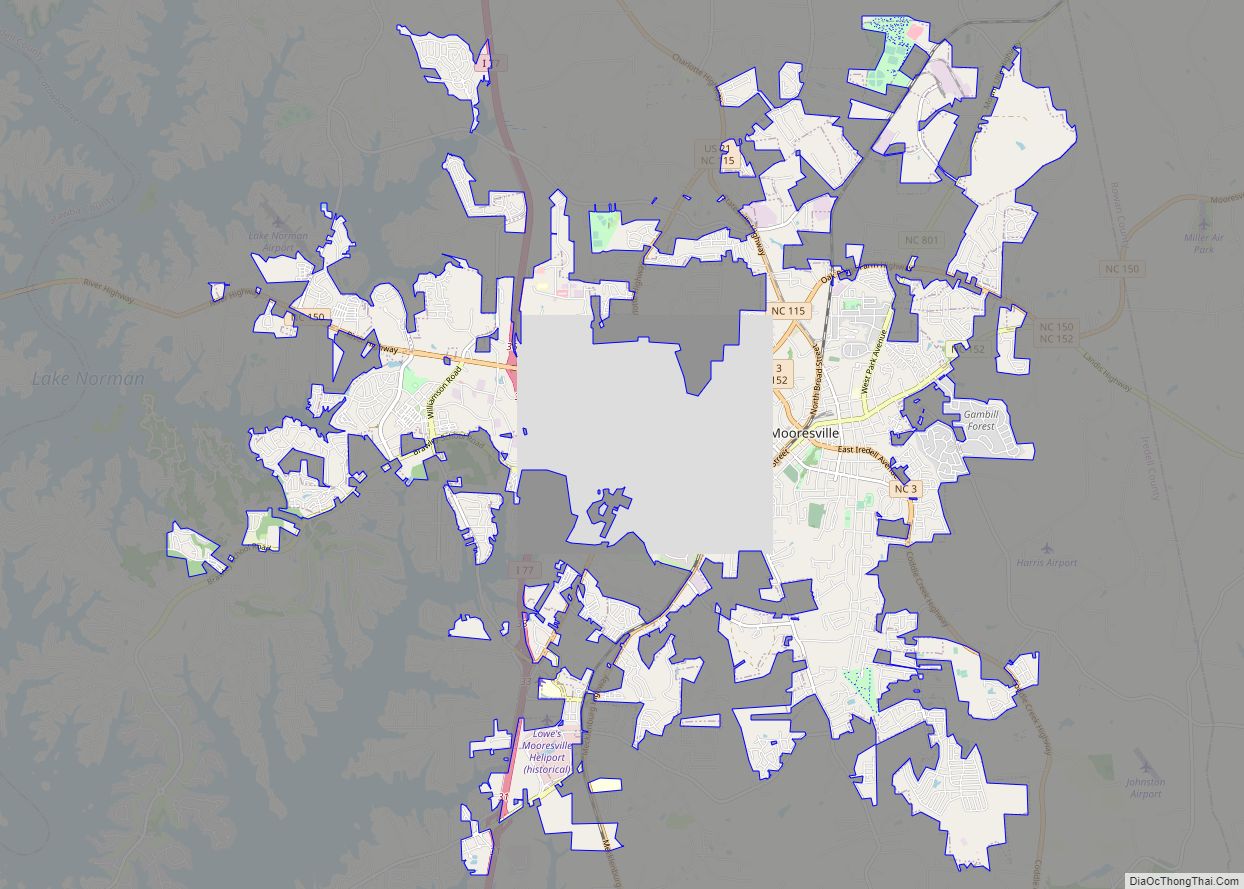
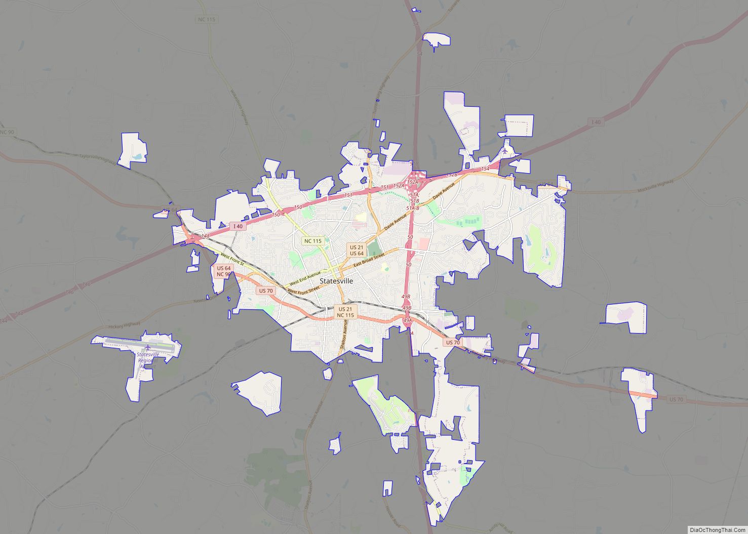
Iredell County is a county located in the U.S. state of North Carolina. As of the 2020 census, the population was 186,693. Its county seat is Statesville, and its largest town is Mooresville. The county was formed in 1788, subtracted from Rowan County. It is named for James Iredell, one of the first justices of the Supreme Court of the United States. Iredell County is included in the Charlotte–Concord–Gastonia, NC–SC Metropolitan Statistical Area, as defined in 2013 by the Office of Management and Budget with data from the U.S. Census Bureau.
| Name: | Iredell County |
|---|---|
| FIPS code: | 37-097 |
| State: | North Carolina |
| Founded: | 1788 |
| Named for: | James Iredell |
| Seat: | Statesville |
| Largest town: | Mooresville |
| Total Area: | 597 sq mi (1,550 km²) |
| Land Area: | 574 sq mi (1,490 km²) |
| Total Population: | 186,693 |
| Population Density: | 310/sq mi (120/km²) |
| Time zone: | UTC−5 (Eastern) |
| Summer Time Zone (DST): | UTC−4 (EDT) |
| Website: | www.iredellcountync.gov |
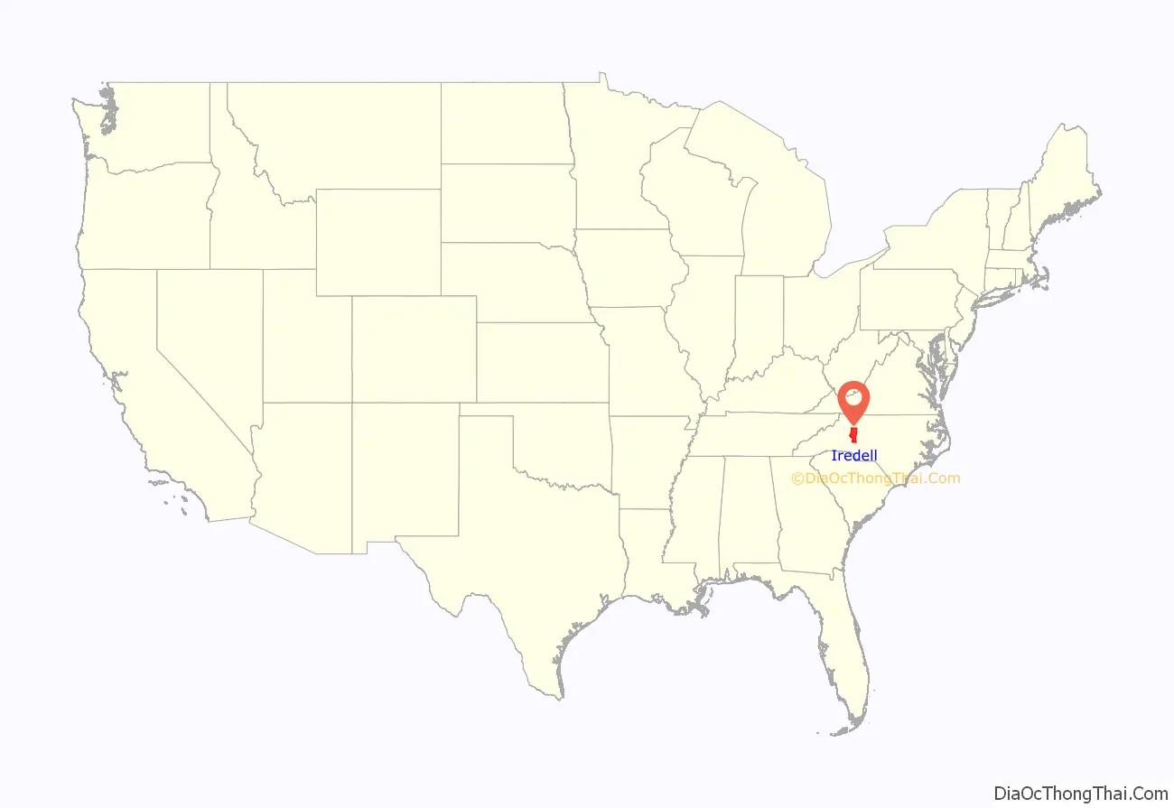
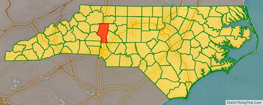
Iredell County location map. Where is Iredell County?
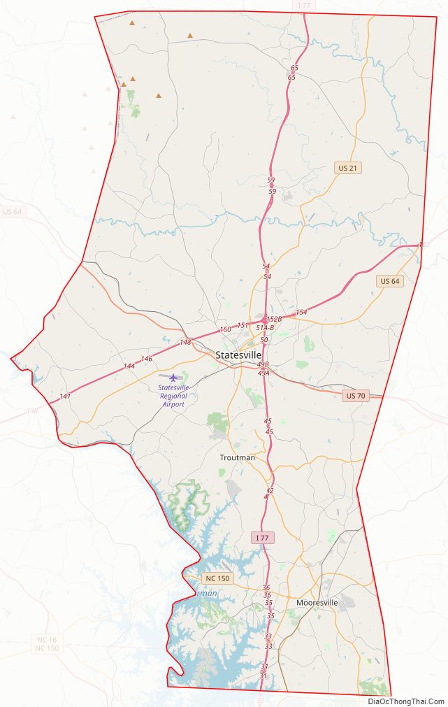
Iredell County Road Map
Geography
According to the U.S. Census Bureau, the county has a total area of 597 square miles (1,550 km), of which 574 square miles (1,490 km) is land and 23 square miles (60 km) (3.9%) is water.
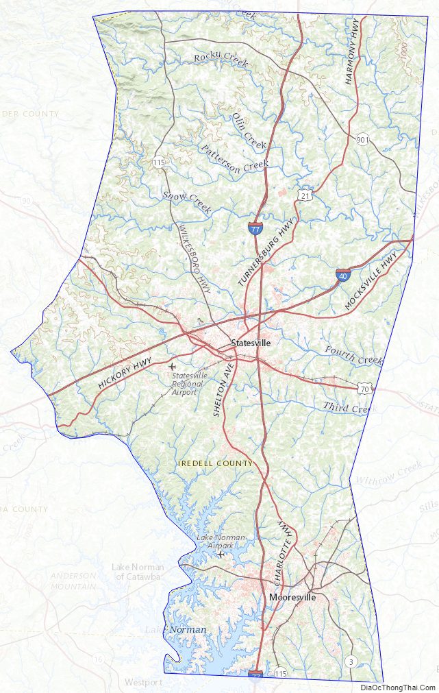
Iredell County is located within the Piedmont Region of central North Carolina. The northwestern section of the county contains the Brushy Mountains, a deeply eroded spur of the Blue Ridge Mountains far to the west. The highest point in Iredell County, Fox Mountain, is in the Brushies; it rises to 1,760 feet. Although the “Brushies”, as they are often called locally, are not high in the normal sense, they do rise prominently above the surrounding countryside. The remainder of Iredell County consists of gently rolling countryside occasionally broken by low hills and small river valleys. The county’s largest river, the Catawba, forms much of its western border. Lake Norman, North Carolina’s largest manmade lake, is the most prominent geographic feature of southern Iredell County; it is often called North Carolina’s “inland sea”.
Iredell County is an important transportation center for the state, as Interstate 77 and Interstate 40 cross in northeast Statesville. This has given birth to the county’s slogan “Crossroads for the Future.” Residents have easy access going south on I-77 to Charlotte; north on I-77 to Elkin, North Carolina and Roanoke, Virginia; east on I-40 to Winston-Salem, Greensboro and Raleigh; and west along I-40 to Hickory, North Carolina and Asheville.
The northern third of Iredell county is highly rural and contains no large towns. Due to the thinly populated nature of this portion of the state, it is one of the select places in North Carolina where the speed limit on Interstate Highways exceeds 65 mph, as Interstate 77 north of Statesville has a speed limit of 70 mph.
Iredell County is one of the longest counties in the state and stretches for nearly fifty miles north to south from Yadkin County in the north to Mecklenburg in the south.
State and local protected areas/sites
- Fort Dobbs State Historic Site
- Happy Oaks Recreation Park
- Lake Norman State Park
- Rimrock Preserve
- Stumpy Creek Park
Major water bodies
- Back Creek
- Beaver Creek
- Beaverdam Creek
- Buffalo Shoals Creek
- Catawba River
- Dutchman Creek
- Fifth Creek
- Fourth Creek
- Hick Creek
- Kinder Creek
- Lake Norman
- Little Rocky Creek
- Lookout Shoals Lake
- Morrison Creek
- Norwood Creek
- Olin Creek
- Rocky Creek
- Rocky River
- Snow Creek
- South Yadkin River
- Third Creek
Adjacent counties
- Yadkin County – north (created from Surry County in 1850)
- Davie County – east (created from Rowan County in 1836)
- Rowan County – east (created from Anson County in 1753)
- Cabarrus County – southeast (created from Mecklenburg County in 1792)
- Mecklenburg County – south (created from Anson County in 1762)
- Lincoln County – southwest (created from Tryon County in 1779)
- Catawba County – southwest (created from Lincoln County in 1842)
- Alexander County – west (created from Caldwell, Iredell, and Wilkes Counties in 1847)
- Wilkes County – north (created from Surry County and parts of Washington District in 1777)
Major highways
- I-40
- I-77
- US 21
- US 64
- US 70
- NC 3
- NC 90
- NC 115
- NC 150
- NC 152
- NC 801
- NC 901
Major infrastructure
- City of Statesville Regional Airport
- Davis Regional Heliport, near Statesville
- Iredell County is served by two railroads, Alexander Railroad and Norfolk Southern Railway
- Lake Norman Airpark (14A), near Mooresville
Iredell County Topographic Map
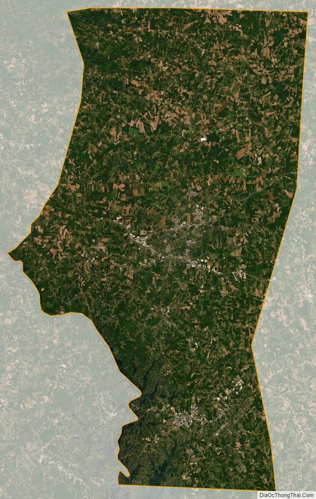
Iredell County Satellite Map
Iredell County Outline Map