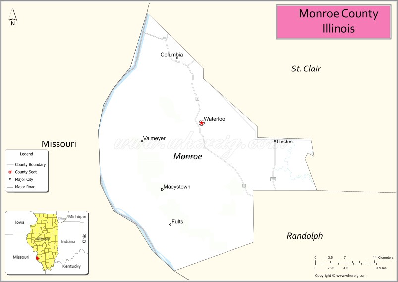
Monroe County is a county located in the U.S. state of Illinois. According to the 2020 census, it had a population of 34,962. Its county seat and largest city is Waterloo.
Monroe County is included in the St. Louis, MO-IL Metropolitan Statistical Area. It is located in the southern portion of Illinois known historically as “Little Egypt”.
| Name: | Monroe County |
|---|---|
| FIPS code: | 17-133 |
| State: | Illinois |
| Founded: | 1816 |
| Named for: | James Monroe |
| Seat: | Waterloo |
| Largest city: | Waterloo |
| Total Area: | 398 sq mi (1,030 km²) |
| Land Area: | 385 sq mi (1,000 km²) |
| Total Population: | 34,962 |
| Population Density: | 88/sq mi (34/km²) |
| Time zone: | UTC−6 (Central) |
| Summer Time Zone (DST): | UTC−5 (CDT) |
| Website: | monroecountyil.gov |
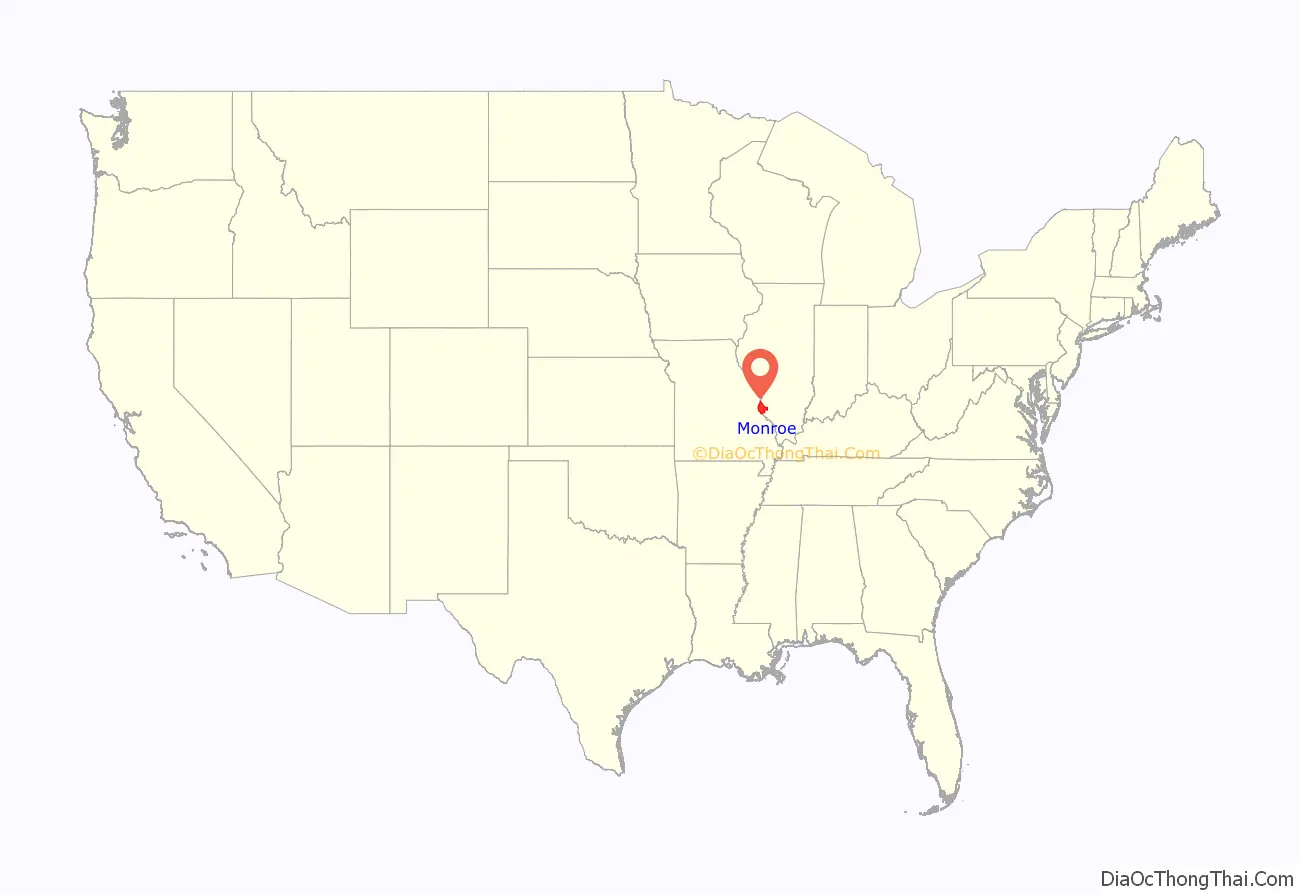
Monroe County location map. Where is Monroe County?

History
Indigenous peoples lived along the Mississippi River and related waterways for thousands of years before European contact. French Jesuit priests in the Illinois Country encountered the Kaskaskia and Cahokia, bands of the Illiniwek confederacy.
The first European settlement in this area was St. Philippe, founded in 1723 by Philippe François Renault, a French courtier, on his concession about three miles north of Fort de Chartres along the Mississippi River. This early agricultural community quickly produced a surplus, and grains were sold to the lower Louisiana colony for years. They were integral to that community’s survival, as its climate did not allow cultivation of such staple grains.
Monroe County was formed in 1816 out of Randolph and St. Clair counties, as the 8th county created from the then Illinois Territory.
It was named in honor of James Monroe, who had just served as United States Secretary of War and who was elected President later that same year. Its first county seat was Harrisonville, named for William Henry Harrison, former governor of the Northwest Territory and future President. Harrison invested in several tracts of land in the American Bottoms above Harrisonville, mostly in the present precinct of Moredock, ownership of which he retained until his death.
Waterloo was designated as the mantle of county seat in 1825. The sites of the colonial towns of St. Philippe and Harrisonville were submerged by the Mississippi River, in flooding caused by deforestation of river banks during the steamboat years. Crews cut so many trees that banks destabilized and collapsed in the current, making the river wider and more shallow from St. Louis to the confluence with the Ohio River. This change caused more severe flooding, as well as lateral channel changes, such as the one that cut off the village of Kaskaskia from the Illinois mainland.
An unincorporated community of Harrisonville was re-established east of the original site. The bounds of Monroe County in 1816 did not include Precincts 1 and 6 (village of Hecker and Prairie du Long), Precinct 1 and most of 6 was added in 1825 from St. Clair County. The strip of Precinct 6 from the survey township line east to the Kaskaskia was added, once again from St. Clair, two years later in 1827. Some minor adjustments and clarifications of the boundaries have taken place, but the borders have remained essentially static since 1827.
Monroe County from the time of its creation to 1825
Monroe County between 1825 and 1827
In 1827, an adjustment to Monroe County’s border with St. Clair brought it to its present territory
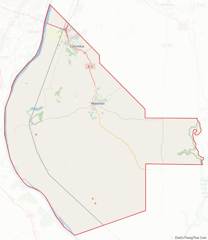
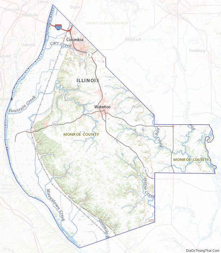
Monroe County Road Map
Geography
According to the U.S. Census Bureau, the county has a total area of 398 square miles (1,030 km), of which 385 square miles (1,000 km) is land and 13 square miles (34 km) (3.3%) is water.
The western part of the county on the Mississippi River is part of the American Bottom floodplain, while the eastern portion of the county is relatively flat and was originally prairie. The transition zone between has high bluffs of limestone and dolomite and has distinctive Karst topography with numerous sinkholes, caves, and springs.
Climate and weather
In recent years, average temperatures in the county seat of Waterloo have ranged from a low of 20 °F (−7 °C) in January to a high of 89 °F (32 °C) in July, although a record low of −18 °F (−28 °C) was recorded in December 1989 and a record high of 107 °F (42 °C) was recorded in August 1962. Average monthly precipitation ranged from 2.32 inches (59 mm) in January to 4.25 inches (108 mm) in July.
Major highways
- Interstate 255
- U.S. Highway 50
- Illinois Route 3
- Illinois Route 156
- Illinois Route 159
- Illinois Route 158
Adjacent counties
- St. Clair County – northeast
- Randolph County – southeast
- Ste. Genevieve County, Missouri – south
- Jefferson County, Missouri – west
- St. Louis County, Missouri – northwest
Monroe County Topographic Map
Monroe County Satellite Map

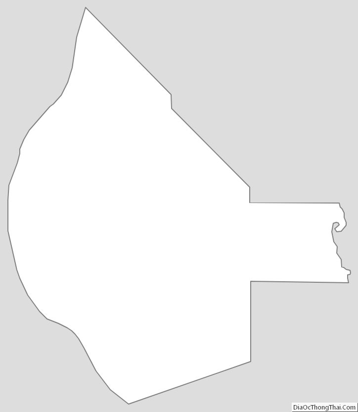
Monroe County Outline Map