Columbia is a city mainly in Monroe County with a small portion in St. Clair County in the U.S. state of Illinois, about 12 miles (19 km) south of St. Louis, Missouri. The population was 10,999 at the 2020 census.
| Name: | Columbia city |
|---|---|
| LSAD Code: | 25 |
| LSAD Description: | city (suffix) |
| State: | Illinois |
| County: | Monroe County, St. Clair County |
| Founded: | 1859 |
| Elevation: | 453 ft (138 m) |
| Total Area: | 10.38 sq mi (26.88 km²) |
| Land Area: | 10.32 sq mi (26.74 km²) |
| Water Area: | 0.06 sq mi (0.14 km²) |
| Total Population: | 10,999 |
| Population Density: | 1,065.48/sq mi (411.37/km²) |
| Area code: | 618 |
| FIPS code: | 1715833 |
| GNISfeature ID: | 2393604 |
| Website: | www.columbiaillinois.com |
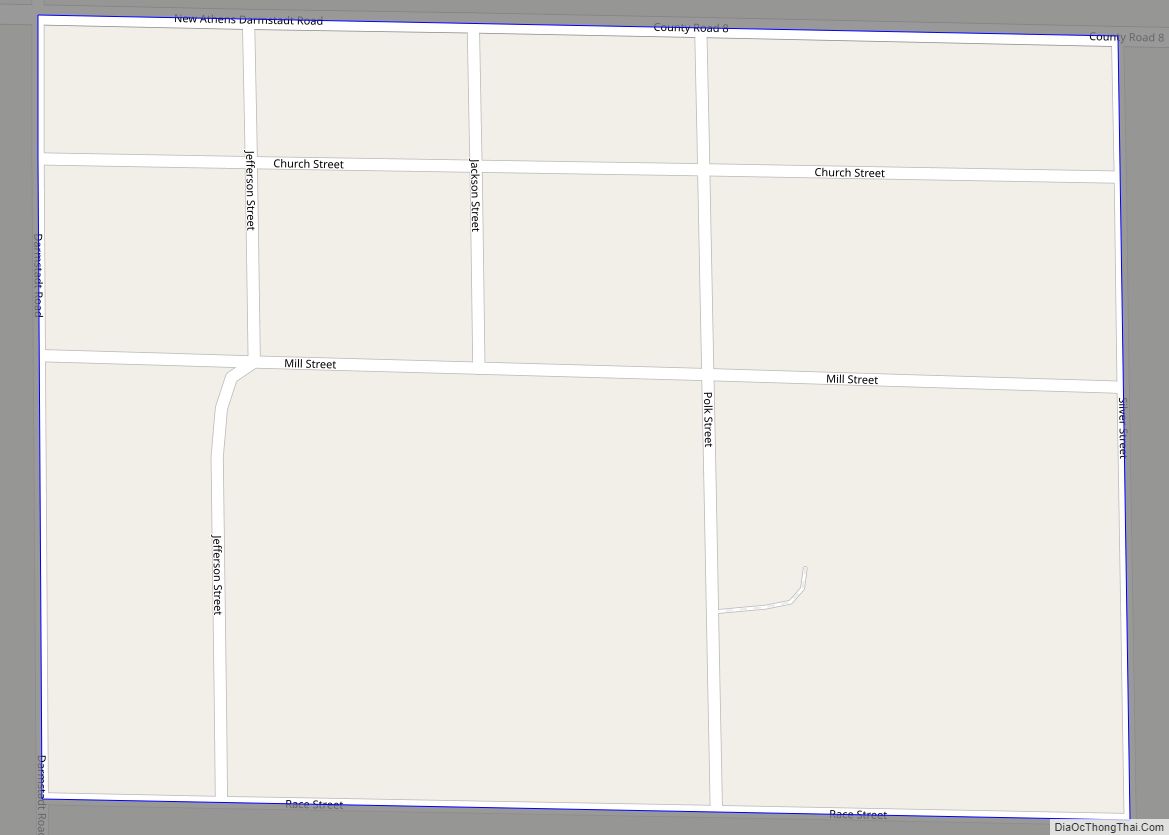
Online Interactive Map
Click on ![]() to view map in "full screen" mode.
to view map in "full screen" mode.
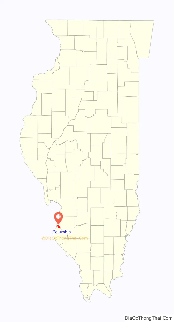
Columbia location map. Where is Columbia city?

History
Columbia was first incorporated in 1859 as a small farming settlement, but had been occupied by various Native American cultures for 12,000 years. The earliest group encountered by European settlers were members of what became the Illinois Confederation, though they had moved to the area from the Great Lakes region only a few centuries before.
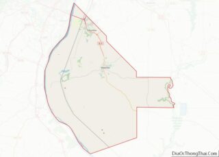
Columbia Road Map

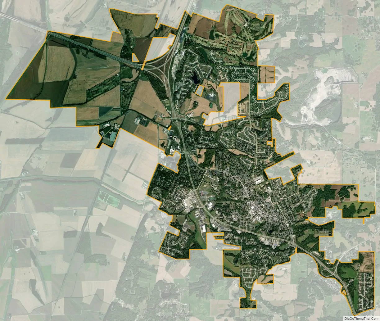
Columbia city Satellite Map
Geography
Columbia is located at 38°26′57″N 90°12′31″W / 38.44917°N 90.20861°W / 38.44917; -90.20861 (38.449172, -90.208500).
According to the 2010 census, Columbia has a total area of 10.476 square miles (27.13 km), of which 10.41 square miles (26.96 km) (or 99.37%) is land and 0.066 square miles (0.17 km) (or 0.63%) is water.
Columbia is bounded on the west by the Mississippi River. Running in a diagonal line just northeast of Columbia is the border of St. Clair County, beyond which lies Dupo to the north and Millstadt to the east. To the south is Waterloo. Waterloo and Columbia are expected to grow right up to the borders of the other, in effect extending St. Louis’s urban sprawl from South St. Louis County across the Jefferson Barracks Bridge into the heart of the formerly rural Monroe County.
See also
Map of Illinois State and its subdivision:- Adams
- Alexander
- Bond
- Boone
- Brown
- Bureau
- Calhoun
- Carroll
- Cass
- Champaign
- Christian
- Clark
- Clay
- Clinton
- Coles
- Cook
- Crawford
- Cumberland
- De Kalb
- De Witt
- Douglas
- Dupage
- Edgar
- Edwards
- Effingham
- Fayette
- Ford
- Franklin
- Fulton
- Gallatin
- Greene
- Grundy
- Hamilton
- Hancock
- Hardin
- Henderson
- Henry
- Iroquois
- Jackson
- Jasper
- Jefferson
- Jersey
- Jo Daviess
- Johnson
- Kane
- Kankakee
- Kendall
- Knox
- La Salle
- Lake
- Lake Michigan
- Lawrence
- Lee
- Livingston
- Logan
- Macon
- Macoupin
- Madison
- Marion
- Marshall
- Mason
- Massac
- McDonough
- McHenry
- McLean
- Menard
- Mercer
- Monroe
- Montgomery
- Morgan
- Moultrie
- Ogle
- Peoria
- Perry
- Piatt
- Pike
- Pope
- Pulaski
- Putnam
- Randolph
- Richland
- Rock Island
- Saint Clair
- Saline
- Sangamon
- Schuyler
- Scott
- Shelby
- Stark
- Stephenson
- Tazewell
- Union
- Vermilion
- Wabash
- Warren
- Washington
- Wayne
- White
- Whiteside
- Will
- Williamson
- Winnebago
- Woodford
- Alabama
- Alaska
- Arizona
- Arkansas
- California
- Colorado
- Connecticut
- Delaware
- District of Columbia
- Florida
- Georgia
- Hawaii
- Idaho
- Illinois
- Indiana
- Iowa
- Kansas
- Kentucky
- Louisiana
- Maine
- Maryland
- Massachusetts
- Michigan
- Minnesota
- Mississippi
- Missouri
- Montana
- Nebraska
- Nevada
- New Hampshire
- New Jersey
- New Mexico
- New York
- North Carolina
- North Dakota
- Ohio
- Oklahoma
- Oregon
- Pennsylvania
- Rhode Island
- South Carolina
- South Dakota
- Tennessee
- Texas
- Utah
- Vermont
- Virginia
- Washington
- West Virginia
- Wisconsin
- Wyoming