Hecker is a village in Monroe County in the U.S state of Illinois. The population was 429 at the 2020 census, down from 481 in 2010.
| Name: | Hecker village |
|---|---|
| LSAD Code: | 47 |
| LSAD Description: | village (suffix) |
| State: | Illinois |
| County: | Monroe County, St. Clair County |
| Founded: | 1895 |
| Elevation: | 476 ft (145 m) |
| Total Area: | 0.26 sq mi (0.66 km²) |
| Land Area: | 0.25 sq mi (0.65 km²) |
| Water Area: | 0.00 sq mi (0.01 km²) |
| Total Population: | 429 |
| Population Density: | 1,695.65/sq mi (655.60/km²) |
| ZIP code: | 62248 |
| Area code: | 618 |
| FIPS code: | 1733877 |
| GNISfeature ID: | 2398483 |
| Website: | hecker.illinois.gov |
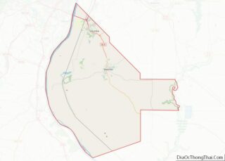
Online Interactive Map
Click on ![]() to view map in "full screen" mode.
to view map in "full screen" mode.
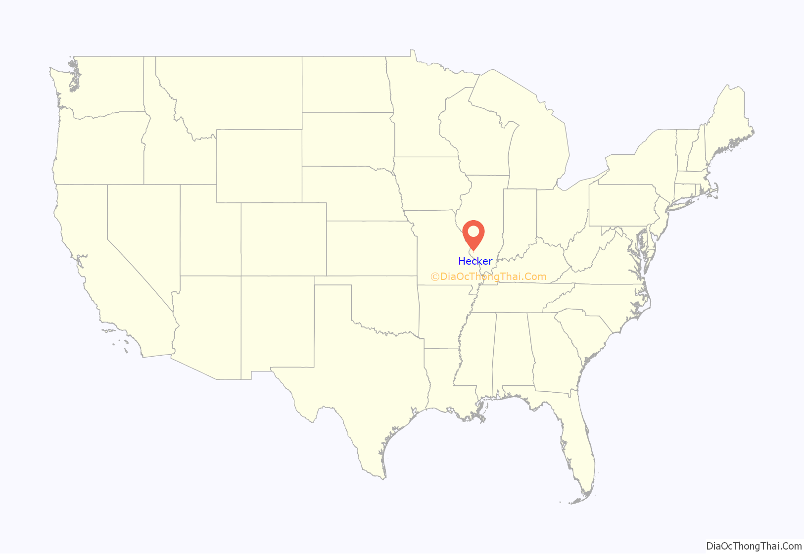
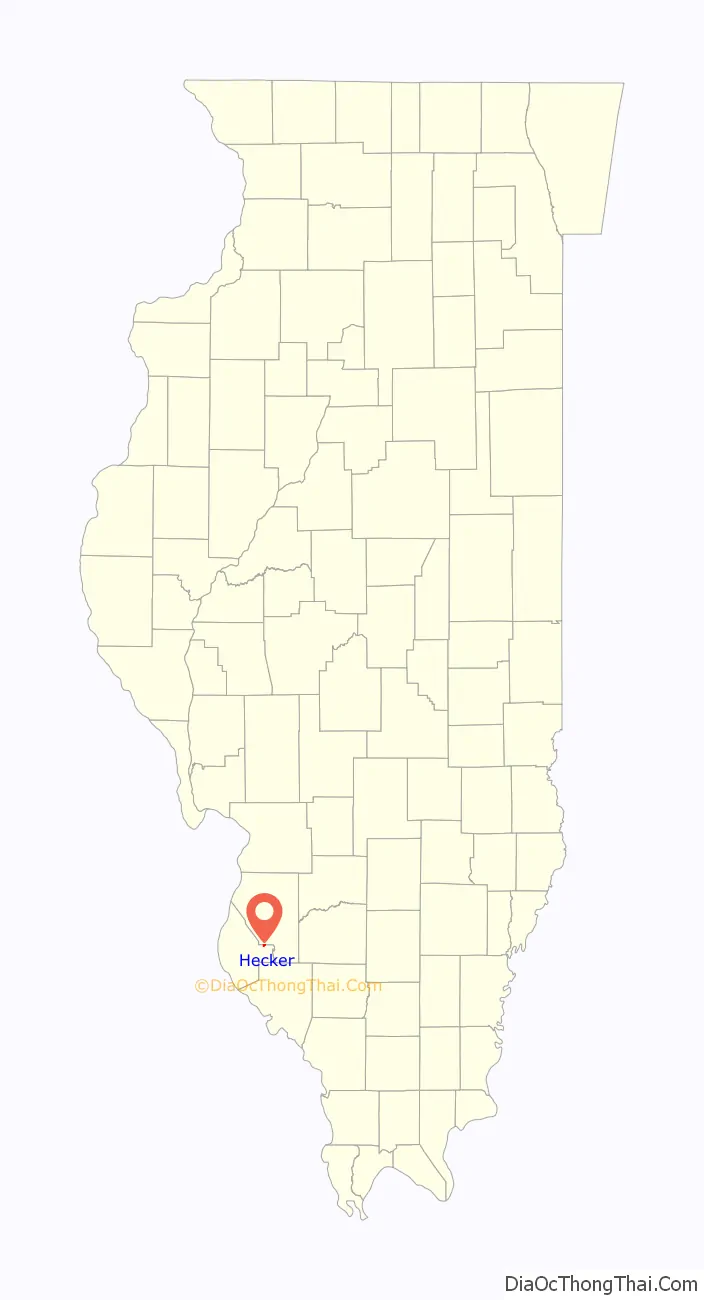
Hecker location map. Where is Hecker village?
History
Hecker was originally named “Freedom”. The town was laid out on land of Theodore Hilgard. It was platted and surveyed by Thomas Singleton, county surveyor, December 18, 1840, the first home being built in 1849. In 1895 the citizens of what was then Freedom decided to incorporate, to facilitate improvements to the nascent town’s infrastructure. Due to complaints from the Post Office, there being another town calling itself Freedom in Illinois, they were forced to change the name. Friedrich Franz Karl Hecker, a former German revolutionary, orator, and American Civil War colonel, whose farm was near Summerfield in adjacent St. Clair County, was known to and well respected by the town’s inhabitants, and they decided to honor him by naming the town after him.
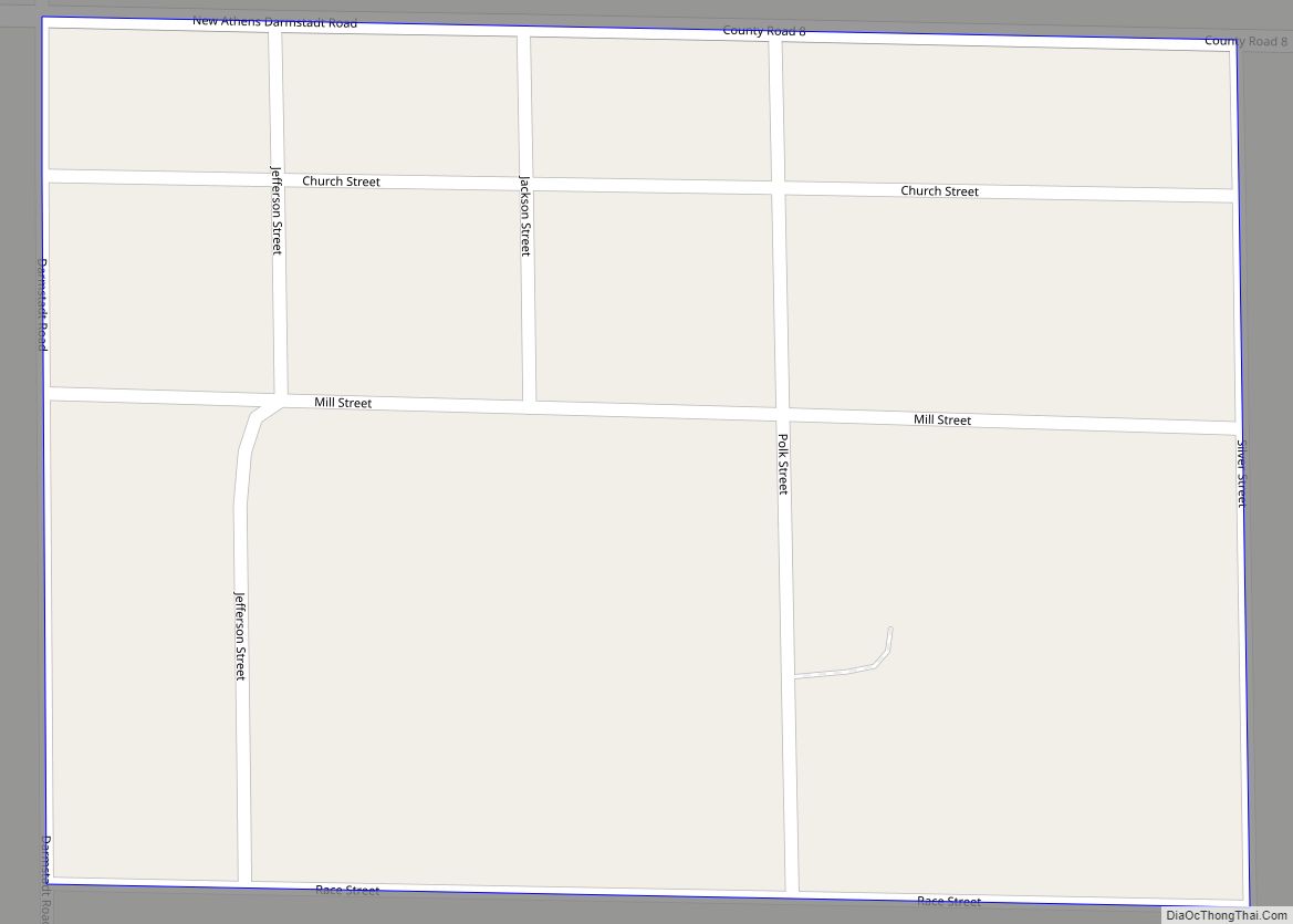
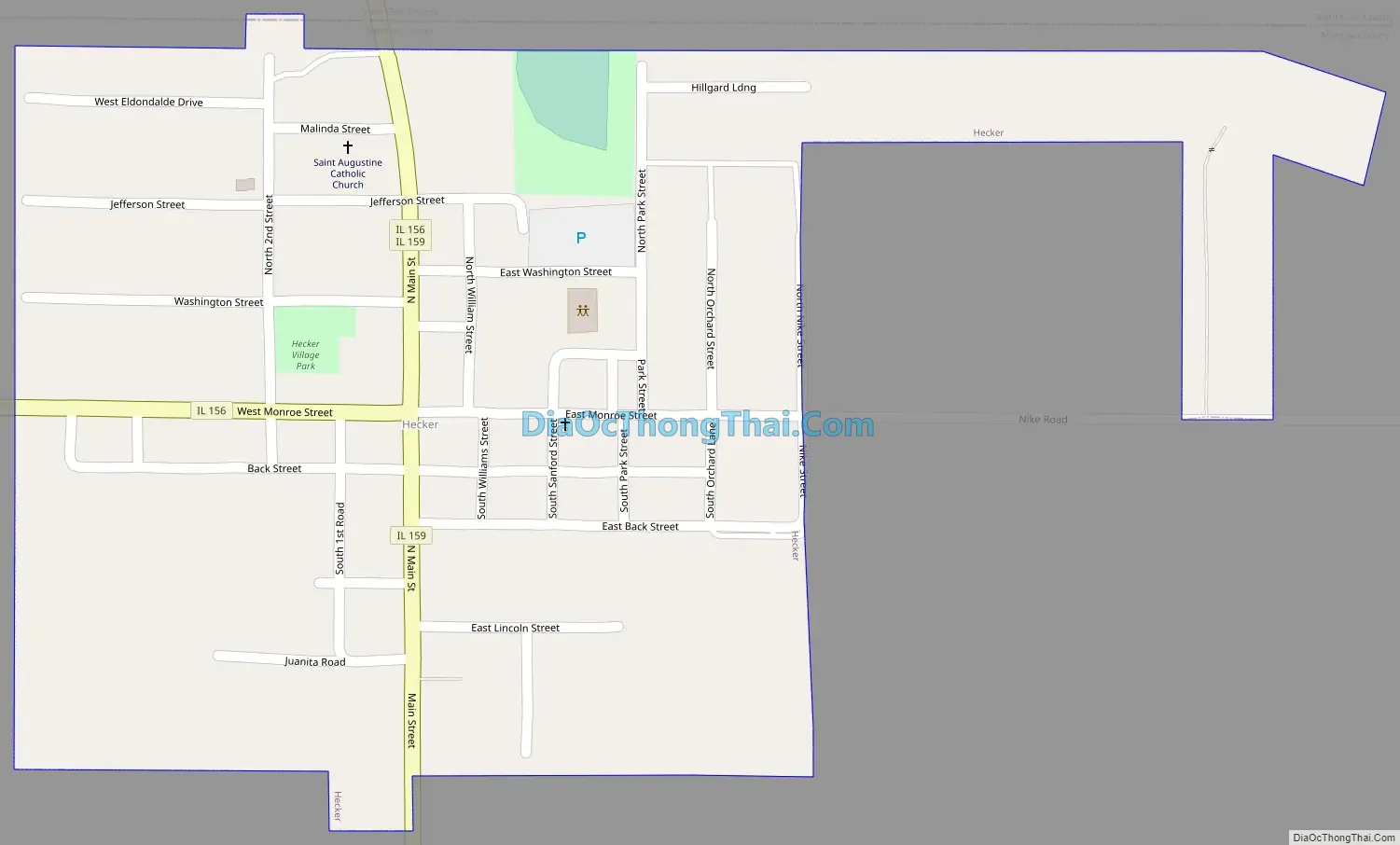
Hecker Road Map
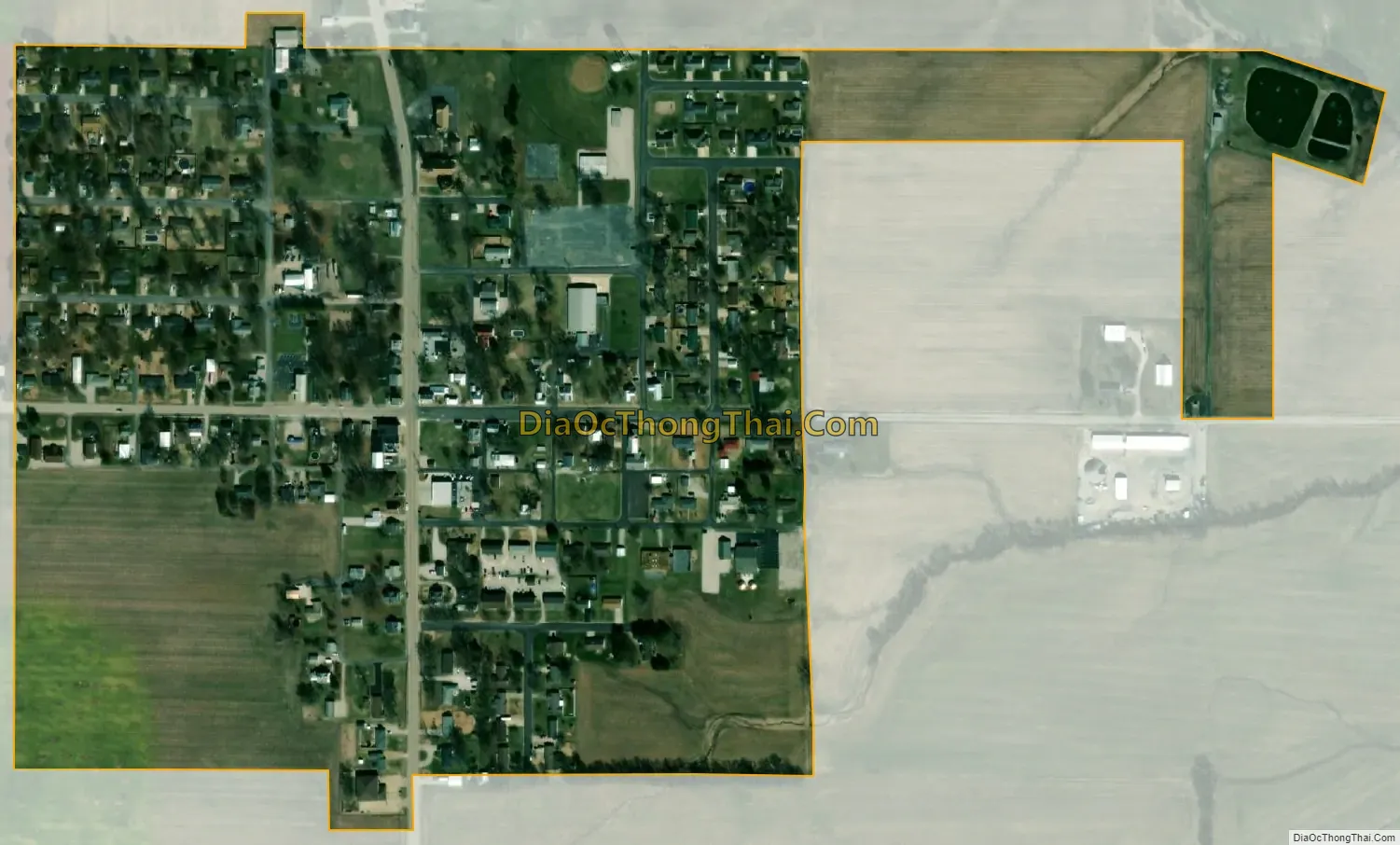
Hecker city Satellite Map
Geography
Hecker is in eastern Monroe County, with its northern border following the St. Clair County line. Illinois Route 159 passes through the village on Main Street, leading north 15 miles (24 km) to Belleville and south 6 miles (10 km) to Red Bud. Illinois Route 156 enters the village on West Monroe Street and departs to the north with IL 159; it leads west 9 miles (14 km) to Waterloo, the Monroe county seat, and east 8 miles (13 km) to New Athens.
According to the U.S. Census Bureau, the village of Hecker has a total area of 0.27 square miles (0.70 km), of which 0.003 square miles (0.008 km), or 1.11%, are water. The village drains east to a tributary of Richland Creek and west toward Toole Branch, a tributary of Prairie du Long Creek, which itself is a tributary of Richland Creek. The entire village is part of the Kaskaskia River watershed.
See also
Map of Illinois State and its subdivision:- Adams
- Alexander
- Bond
- Boone
- Brown
- Bureau
- Calhoun
- Carroll
- Cass
- Champaign
- Christian
- Clark
- Clay
- Clinton
- Coles
- Cook
- Crawford
- Cumberland
- De Kalb
- De Witt
- Douglas
- Dupage
- Edgar
- Edwards
- Effingham
- Fayette
- Ford
- Franklin
- Fulton
- Gallatin
- Greene
- Grundy
- Hamilton
- Hancock
- Hardin
- Henderson
- Henry
- Iroquois
- Jackson
- Jasper
- Jefferson
- Jersey
- Jo Daviess
- Johnson
- Kane
- Kankakee
- Kendall
- Knox
- La Salle
- Lake
- Lake Michigan
- Lawrence
- Lee
- Livingston
- Logan
- Macon
- Macoupin
- Madison
- Marion
- Marshall
- Mason
- Massac
- McDonough
- McHenry
- McLean
- Menard
- Mercer
- Monroe
- Montgomery
- Morgan
- Moultrie
- Ogle
- Peoria
- Perry
- Piatt
- Pike
- Pope
- Pulaski
- Putnam
- Randolph
- Richland
- Rock Island
- Saint Clair
- Saline
- Sangamon
- Schuyler
- Scott
- Shelby
- Stark
- Stephenson
- Tazewell
- Union
- Vermilion
- Wabash
- Warren
- Washington
- Wayne
- White
- Whiteside
- Will
- Williamson
- Winnebago
- Woodford
- Alabama
- Alaska
- Arizona
- Arkansas
- California
- Colorado
- Connecticut
- Delaware
- District of Columbia
- Florida
- Georgia
- Hawaii
- Idaho
- Illinois
- Indiana
- Iowa
- Kansas
- Kentucky
- Louisiana
- Maine
- Maryland
- Massachusetts
- Michigan
- Minnesota
- Mississippi
- Missouri
- Montana
- Nebraska
- Nevada
- New Hampshire
- New Jersey
- New Mexico
- New York
- North Carolina
- North Dakota
- Ohio
- Oklahoma
- Oregon
- Pennsylvania
- Rhode Island
- South Carolina
- South Dakota
- Tennessee
- Texas
- Utah
- Vermont
- Virginia
- Washington
- West Virginia
- Wisconsin
- Wyoming