Montgomery County is a county located in the U.S. state of Illinois. According to the 2010 census, it had a population of 30,104. Its county seat is Hillsboro.
| Name: | Montgomery County |
|---|---|
| FIPS code: | 17-135 |
| State: | Illinois |
| Founded: | 1821 |
| Named for: | Richard Montgomery |
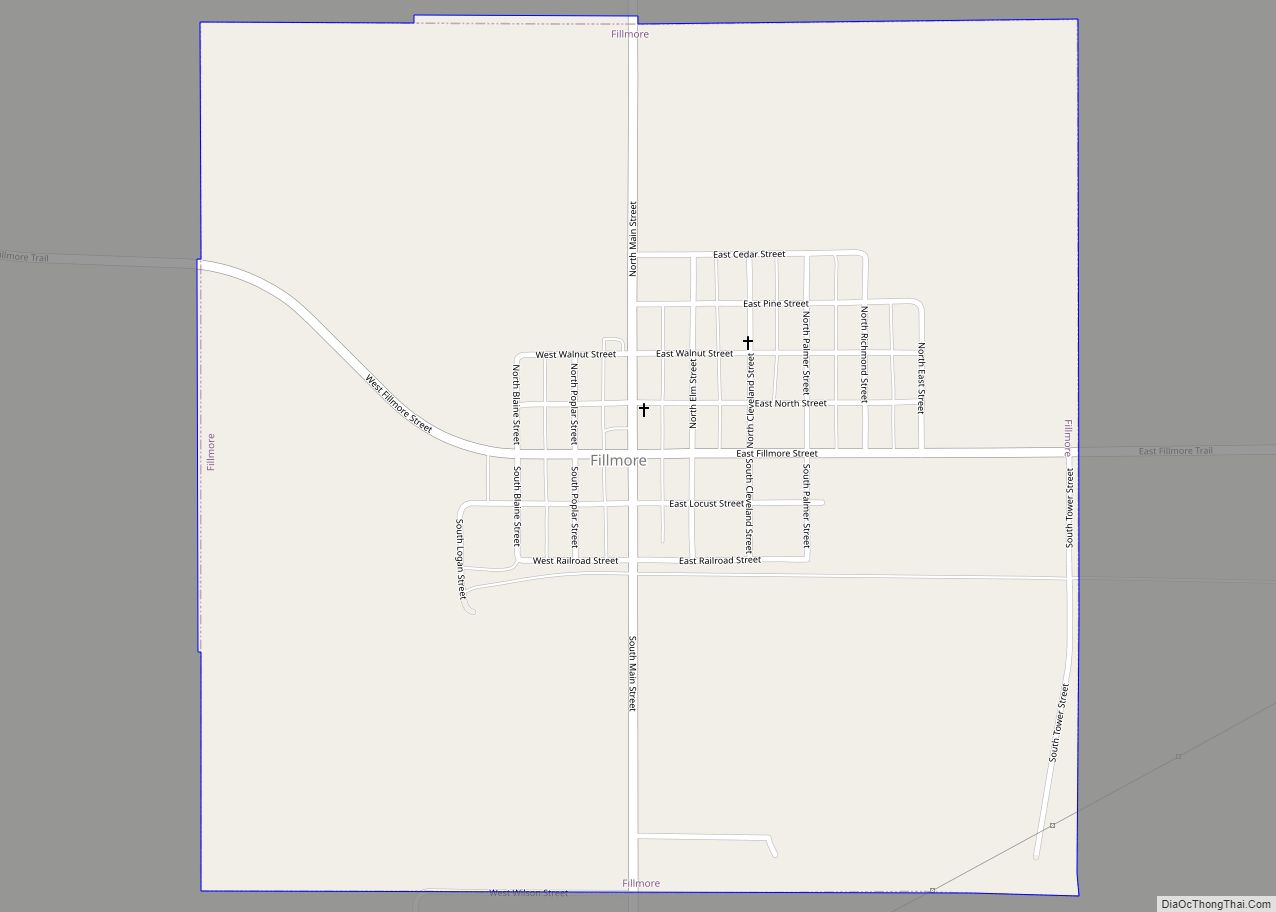
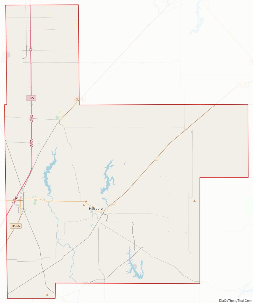
| Seat: | Hillsboro |
| Largest city: | Litchfield |
| Total Area: | 710 sq mi (1,800 km²) |
| Land Area: | 704 sq mi (1,820 km²) |
| Total Population: | 30,104 |
| Population Density: | 42/sq mi (16/km²) |
| Time zone: | UTC−6 (Central) |
| Summer Time Zone (DST): | UTC−5 (CDT) |
| Website: | www.montgomeryco.com |
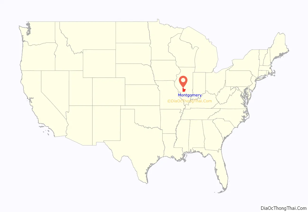
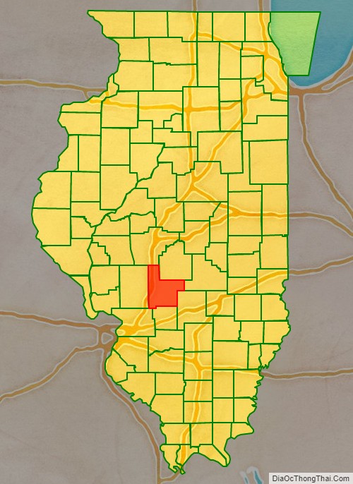
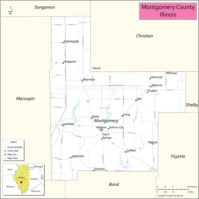
Montgomery County location map. Where is Montgomery County?
History
Montgomery County was formed in 1821 out of Bond and Madison counties. It was named in honor of Richard Montgomery, an American Revolutionary War general killed in 1775 while attempting to capture Quebec City, Canada. Perrin’s 1882 History of Montgomery County relates that the county was named in honor of Gen. Montgomery, but goes on to say that “others are dubious as to whence it received its name.”
Montgomery County from the time of its creation to 1827
Montgomery County between 1827 and 1839
Montgomery in 1839, reduced to its present borders
Montgomery County Road Map
Geography
According to the U.S. Census Bureau, the county has a total area of 710 square miles (1,800 km), of which 704 square miles (1,820 km) is land and 6.0 square miles (16 km) (0.8%) is water.
Climate and weather
In recent years, average temperatures in the county seat of Hillsboro have ranged from a low of 21 °F (−6 °C) in January to a high of 91 °F (33 °C) in July, although a record low of −22 °F (−30 °C) was recorded in February 1905 and a record high of 114 °F (46 °C) was recorded in July 1954. Average monthly precipitation ranged from 2.00 inches (51 mm) in February to 4.31 inches (109 mm) in May.
Adjacent counties
- Sangamon County – north
- Christian County – northeast
- Shelby County – east
- Fayette County – southeast
- Bond County – south
- Madison County – southwest
- Macoupin County – west
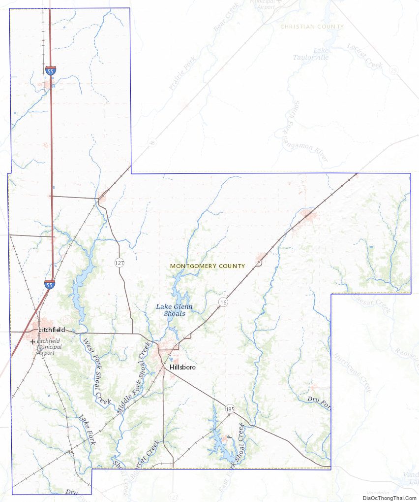
Montgomery County Topographic Map
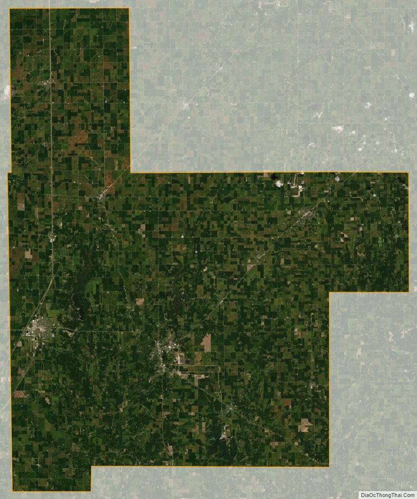
Montgomery County Satellite Map
Montgomery County Outline Map