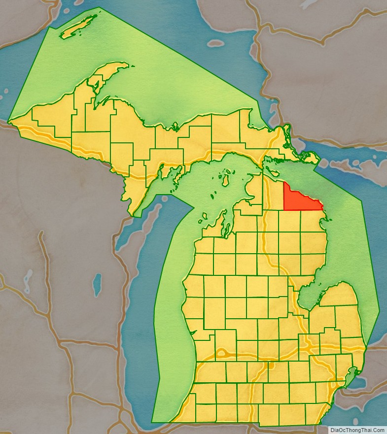
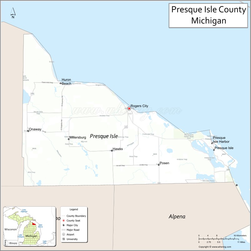
Presque Isle County (/ˈprɛskiːl/ PRESK-eel) is a county in the Lower Peninsula of the U.S. state of Michigan. As of the 2020 Census, the population was 12,982. The county seat is Rogers City. The county was authorized by state legislative action on April 1, 1840, but the county government was not established until 1871. The government was reorganized in 1875.
Both the county and Presque Isle Township are named for Presque Isle (French, “almost an island”; the term for a narrow peninsula). A large part of the township consists of that peninsula, with Lake Huron on the east, Grand Lake on the west, and narrow strips of land connecting it to the mainland at the north and south ends. The community of Presque Isle is near the center of this peninsula.
| Name: | Presque Isle County |
|---|---|
| FIPS code: | 26-141 |
| State: | Michigan |
| Founded: | 1840 |
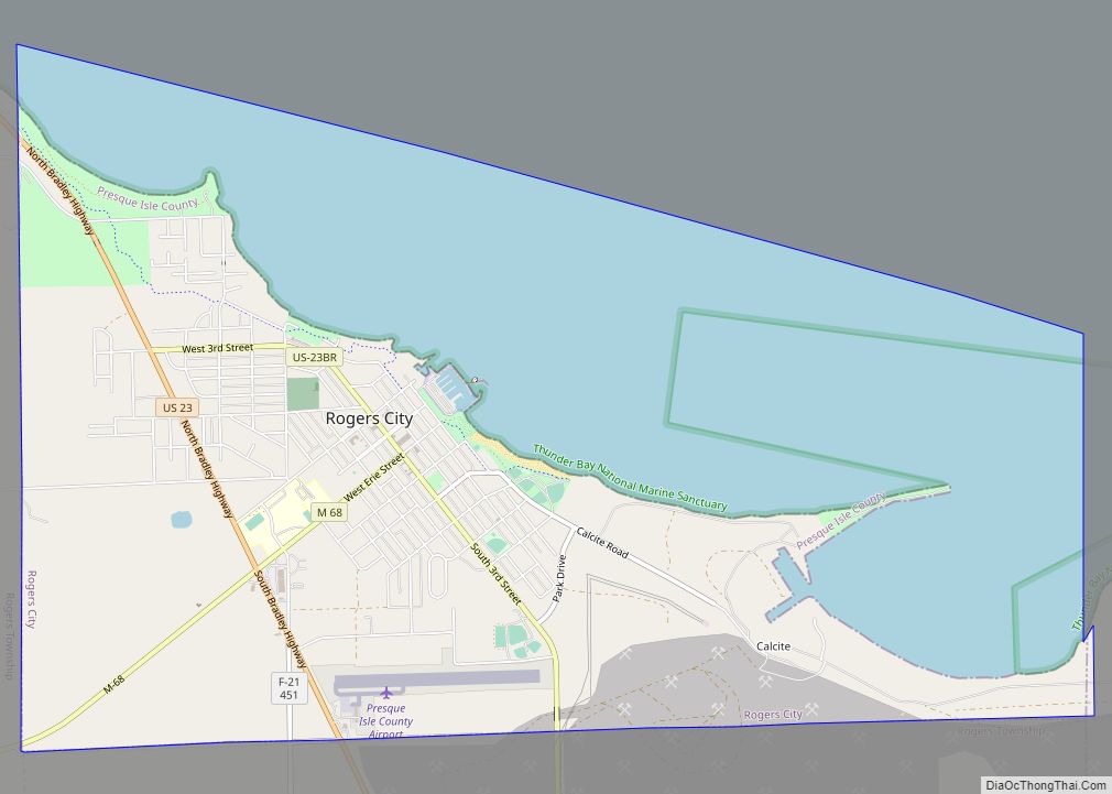
| Seat: | Rogers City |
| Largest city: | Rogers City |
| Total Area: | 2,573 sq mi (6,660 km²) |
| Land Area: | 659 sq mi (1,710 km²) |
| Total Population: | 12,982 |
| Population Density: | 20/sq mi (8/km²) |
| Time zone: | UTC−5 (Eastern) |
| Summer Time Zone (DST): | UTC−4 (EDT) |
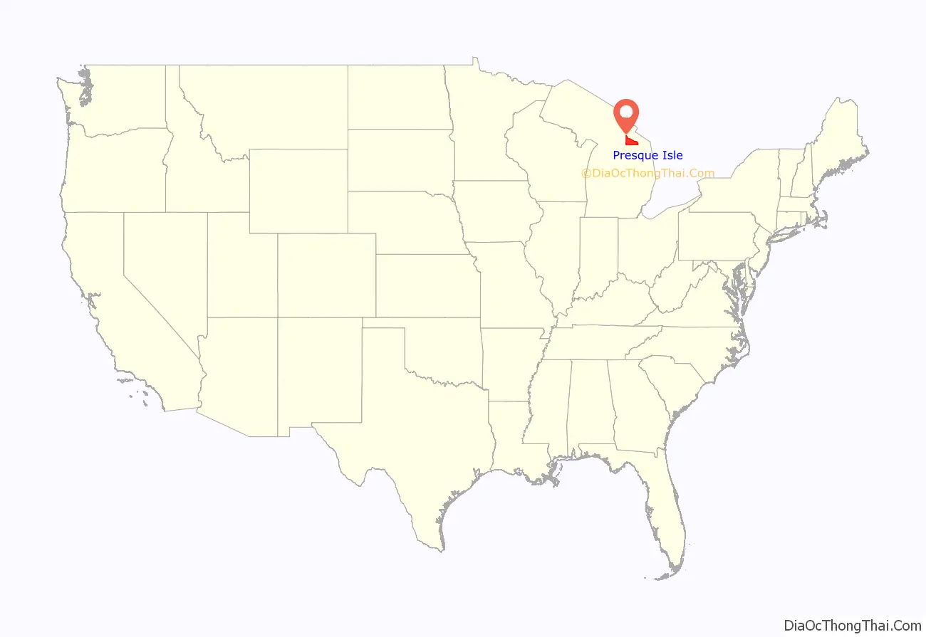
Presque Isle County location map. Where is Presque Isle County?
History
Early Native Americans living in the area were nomadic, using the land as hunting grounds. To them the land between the Ocqueoc and Swan Rivers was sacred ground. The name “Presque Isle” was given to the area by fur traders who portaged over the strip of land that attaches Presque Isle to the mainland.
Early development of the area was delayed because it had no navigable river. The Ocqueoc River was Presque Isle’s largest river but it was shallow and crooked, with many rapids. In the spring of 1839 a surveying party, contracted by the state of Michigan, reported that the land of this area was worthless. This further discouraged development until the 1860s when the Crawford family settled into a quiet cove of Lake Huron, south of present-day Rogers City. They intended to develop a stone quarry, but found the stone too flaky to be used as building material. Turning to lumbering, they sold the wood to steamers traveling the Great Lakes.
In 1868 W.E. Rogers, an Army officer, organized a surveying party to Presque Isle, with Albert Molitor as supervisor. Seeing the huge forests, they attempted to purchase Crawford’s Quarry but were refused. They formed the Molitor-Rogers Company purchasing the land at the site of Rogers City. The following year a large party of German and Polish immigrants arrived and settled in the area. The Molitor-Rogers Company built a sawmill, store, boarding house, and blacksmith shop. The small city was solely supplied by the company. After a difficult winter in 1870–71, the community began to thrive.
The county’s original settlers were lumbermen, fishermen and farmers. In 1907 a mining engineer/geologist from New York, H.H. Hindshaw, visited Crawford’s Quarry and found it to be rich in limestone. Following this discovery, the Michigan Limestone and Chemical Company of Calcite, Michigan, was founded. The company purchased 8,000 acres (32 km) at Calcite, the new name for Crawford’s Quarry. Needing a means of shipping their product, the Bradley Transportation Company was formed. The company is known in the area for being the chief business, employing a significant portion of the area’s residents. One of the darker aspects of the county’s history involved the Bradley Transportation Company when one of their cargo ships, the Carl D. Bradley sank on Lake Michigan during a windstorm in November 1958 with the loss of 33 lives, 28 of whom resided in Presque Isle County (23 were from Rogers City, three were from Onaway and two were from Posen or Metz Township).
Today the world’s largest limestone processing plant is in Rogers City, which is also a major Great Lakes Port. This is the best natural harbor on Lake Huron between Port Huron and Mackinaw City.
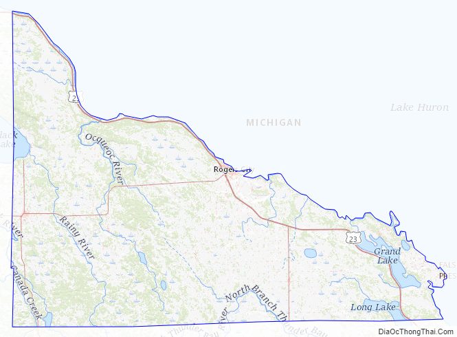
Presque Isle County Road Map
Geography
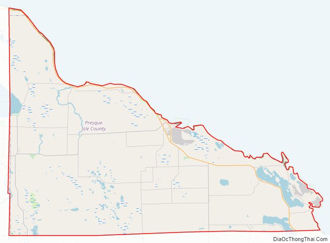
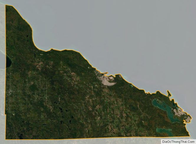
According to the U.S. Census Bureau, the county has an area of 2,573 square miles (6,660 km), of which 659 square miles (1,710 km) is land and 1,914 square miles (4,960 km) (74%) is water. Although Presque Isle County is on Michigan’s Lower Peninsula, it is considered to be part of Northern Michigan.
Geographic features
- Ocqueoc Falls
- Sacred Rock
Lakes
- Grand Lake (Presque Isle, Michigan)
- Long Lake (Preque Isle, Michigan)
- Black Lake
- Sunken Lake
- Tomahawk Creek Flood
- Rainy Lake
- Ocqueoc Lake
Adjacent counties
By land
- Alpena County (southeast)
- Montmorency County (southwest)
- Cheboygan County (west)
By water
- Mackinac County (northwest)
- Chippewa County (north)
- Manitoulin District, Ontario, Canada (east)
Presque Isle County Topographic Map
Presque Isle County Satellite Map
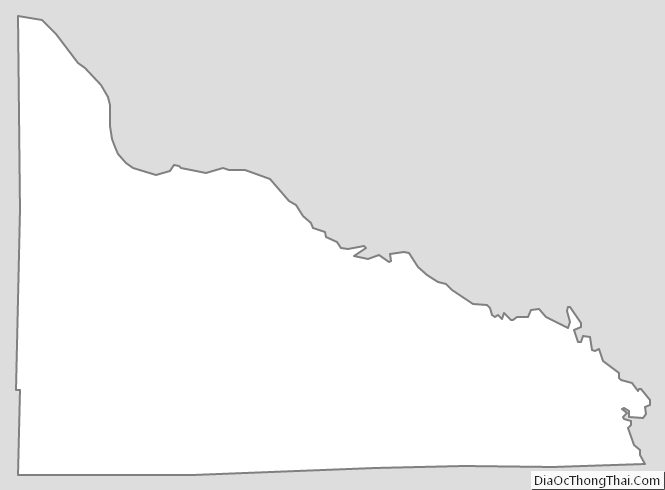
Presque Isle County Outline Map