Port Huron is a city in the U.S. state of Michigan. It is the county seat of and largest city within St. Clair County. The population was 28,983 at the 2020 census. The city is adjacent to Port Huron Township, although the two are administered separately.
Port Huron is located at the southern end of Lake Huron, and sits upon the St. Clair River, which forms part of the United States–Canada border. The city sits directly across the river from Sarnia, Ontario, and is connected to that city by the Blue Water Bridge. Port Huron is the easternmost city in Michigan, and contains the state’s easternmost point of land. Port Huron is also the second-largest American city on Lake Huron, behind Bay City. It is also bisected by the Black River.
Port Huron is included within the Detroit–Warren–Dearborn Metropolitan Statistical Area by the Office of Management and Budget. It is also considered by the State of Michigan to be a part of The Thumb, a large peninsula surrounded by Lake Huron in the east of the state. This area is sometimes referred to as the Blue Water Area.
| Name: | Port Huron city |
|---|---|
| LSAD Code: | 25 |
| LSAD Description: | city (suffix) |
| State: | Michigan |
| County: | St. Clair County |
| Incorporated: | 1857 |
| Elevation: | 604 ft (184 m) |
| Total Area: | 12.27 sq mi (31.78 km²) |
| Land Area: | 8.10 sq mi (20.98 km²) |
| Water Area: | 4.17 sq mi (10.80 km²) |
| Total Population: | 28,983 |
| Population Density: | 3,577.26/sq mi (1,381.14/km²) |
| Area code: | 810 |
| FIPS code: | 2665820 |
| GNISfeature ID: | 1624839 |
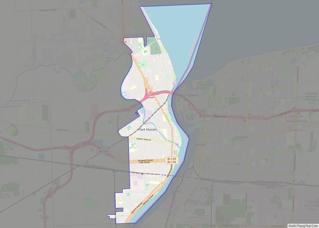
Online Interactive Map
Click on ![]() to view map in "full screen" mode.
to view map in "full screen" mode.
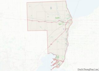
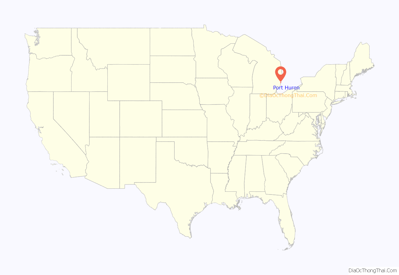
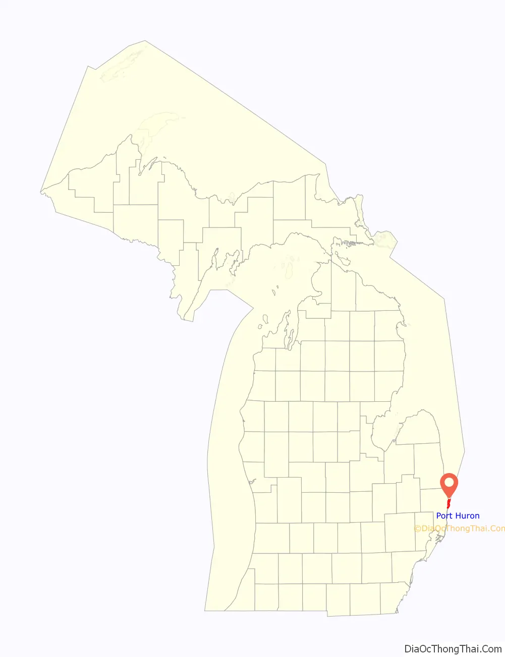
Port Huron location map. Where is Port Huron city?
History
This area was long occupied by the Ojibwa people. French colonists had a temporary trading post and fort at this site in the 17th century.
In 1814, following the War of 1812, the United States established Fort Gratiot at the base of Lake Huron. A community developed around it. The early 19th century was the first time a settlement developed here with a permanent European-American population. In the 19th century, the United States established an Ojibwa reservation in part of what is now Port Huron, in exchange for their cession of lands under treaty for European-American settlement. But in 1836, under Indian Removal, the US forced the Ojibwa to move west of the Mississippi River and resettle in what are now the states of Wisconsin and Minnesota.
In 1857, Port Huron became incorporated. Its population grew rapidly after the 1850s due a high rate of immigration: workers leaving poverty, famine, and revolutions in Europe were attracted to the successful shipbuilding and lumber industries in Michigan. These industries supported development around the Great Lakes and in the Midwest. In 1859 the city had a total of 4,031 residents; some 1855, or 46%, were foreign-born or their children (first-generation Americans).
By 1870, Port Huron’s population exceeded that of surrounding villages. In 1871, the State Supreme Court designated Port Huron as the county seat of St. Clair County.
On October 8, 1871, the city, as well as places north in Sanilac and Huron counties, burned in the Port Huron Fire of 1871. A series of other fires leveled Holland and Manistee, as well as Peshtigo, Wisconsin and Chicago, Illinois on the same day. The Thumb Fire that occurred a decade later, also engulfed Port Huron.
In 1895 the village of Fort Gratiot, in the vicinity of the former Fort Gratiot, was annexed by the city of Port Huron.
The following historic sites have been recognized by the State of Michigan through its historic marker program.
- Fort St. Joseph. The fort was built in 1686 by the French explorer Duluth. This fort was the second European settlement in lower Michigan. This post guarded the upper end of the St. Clair River, the vital waterway joining Lake Erie and Lake Huron. Intended by the French to bar English traders from the upper lakes, the fort in 1687 was the base of a garrison of French and Indian allies. In 1688 the French abandoned this fort. The site was incorporated into Fort Gratiot in 1814. A park has been established at the former site of the fort.
- Fort Gratiot Light. The Fort Gratiot Lighthouse was built in 1829 to replace a tower destroyed by a storm. In the 1860s workers extended the tower to its present height of 84 feet (26 m). The light, automated in 1933, continues to guide shipping on Lake Huron into the narrow and swift-flowing St. Clair River. It was the first lighthouse established in the State of Michigan.
- Lightship Huron. From 1935 until 1970, the Huron was stationed in southern Lake Huron to mark dangerous shoals. After 1940 the Huron was the only lightship operating on the Great Lakes. Retired from Coast Guard Service in 1970, she was presented to the City of Port Huron in 1971.
- Grand Trunk Railway Depot. The depot, which is now part of the Port Huron Museum, is where 12-year-old Thomas Edison departed daily on the Port Huron–Detroit run. In 1859, the railroad’s first year of operation, Edison convinced the railroad company to let him sell newspapers and confections on the daily trips. He became so successful that he soon placed two newsboys on other Grand Trunks running to Detroit. He made enough money to support himself and to buy chemicals and other experimental materials.
- Port Huron Public Library. In 1902 the city of Port Huron secured money from philanthropist Andrew Carnegie to erect a municipal library and arranged for matching operating funds. In 1904, a grand Beaux-Arts-style structure was built at a cost of $45,000. At its dedication, Melvil Dewey, creator of a widely used book classification system, delivered the opening address. The Port Huron Public Library served in its original capacity for over sixty years. In 1967, a larger public library was constructed. The following year the former library was renovated and re-opened as the Port Huron Museum of Arts and History. An addition was constructed in 1988.
- Harrington Hotel. The hotel opened in 1896 and is a blend of Romanesque, Classical and Queen Anne architecture. The hotel closed in 1986, but a group of investors bought the structure that same year to convert it into housing for senior citizens. The Harrington Hotel is listed on the National Register of Historic Places.
- Grand Trunk Western Railroad Tunnel. The tunnel was opened in 1891 and links Port Huron with Canada. This international submarine railway tunnel was the first international tunnel in the world. The tunnel’s total length is 6,025 feet (1,836 m), with 2,290 feet (700 m) underwater. The tunnel operations were electrified in 1908; half a century later they were converted to use diesel fuel. Tracks were lowered in 1949 to accommodate larger freight cars. During World War I, a plot to blast the tunnel was foiled. A new tunnel has since been opened.
The city was hit by a violent F4 tornado on May 21, 1953, damaging or destroying over 400 structures, killing two, and injuring 68.
The city received the All-America City Award in 1955 and 2005.
In June 1962, the Port Huron Statement, a New Left manifesto, was adopted at a convention of the Students for a Democratic Society. The convention did not take place within the actual city limits of Port Huron, but instead was held at a United Auto Workers retreat north of the city (now part of Lakeport State Park).
Port Huron is the only site in Michigan where a lynching of an African-American man took place. On May 27, 1889, in the early morning, a mob of white men stormed the county jail to capture 23-year-old Albert Martin. A mixed-race man, he was accused of attacking a woman. They hanged him from the 7th Street Bridge. A memorial was installed in 2018 at the site, recounting Martin’s history. The city collaborated with the Equal Justice Initiative on this memorialization.
In April 2021, the Pere Marquette Railway bascule bridge was demolished after a nearly decade long battle between preservationists and the Port Huron Yacht Club. Built in 1931, the structure was eligible for listing on the National Register of Historic Places, and was one of only six similar bridges remaining in the US.
Historic photographs
Port Huron circa 1902
Huron Avenue in 1912
St. Clair Tunnel in 1907
Gratiot Lighthouse in 1902
Fort Gratiot Lighthouse
The Pere Marquette Railway bridge as seen in 2021, it was demolished in 2023.
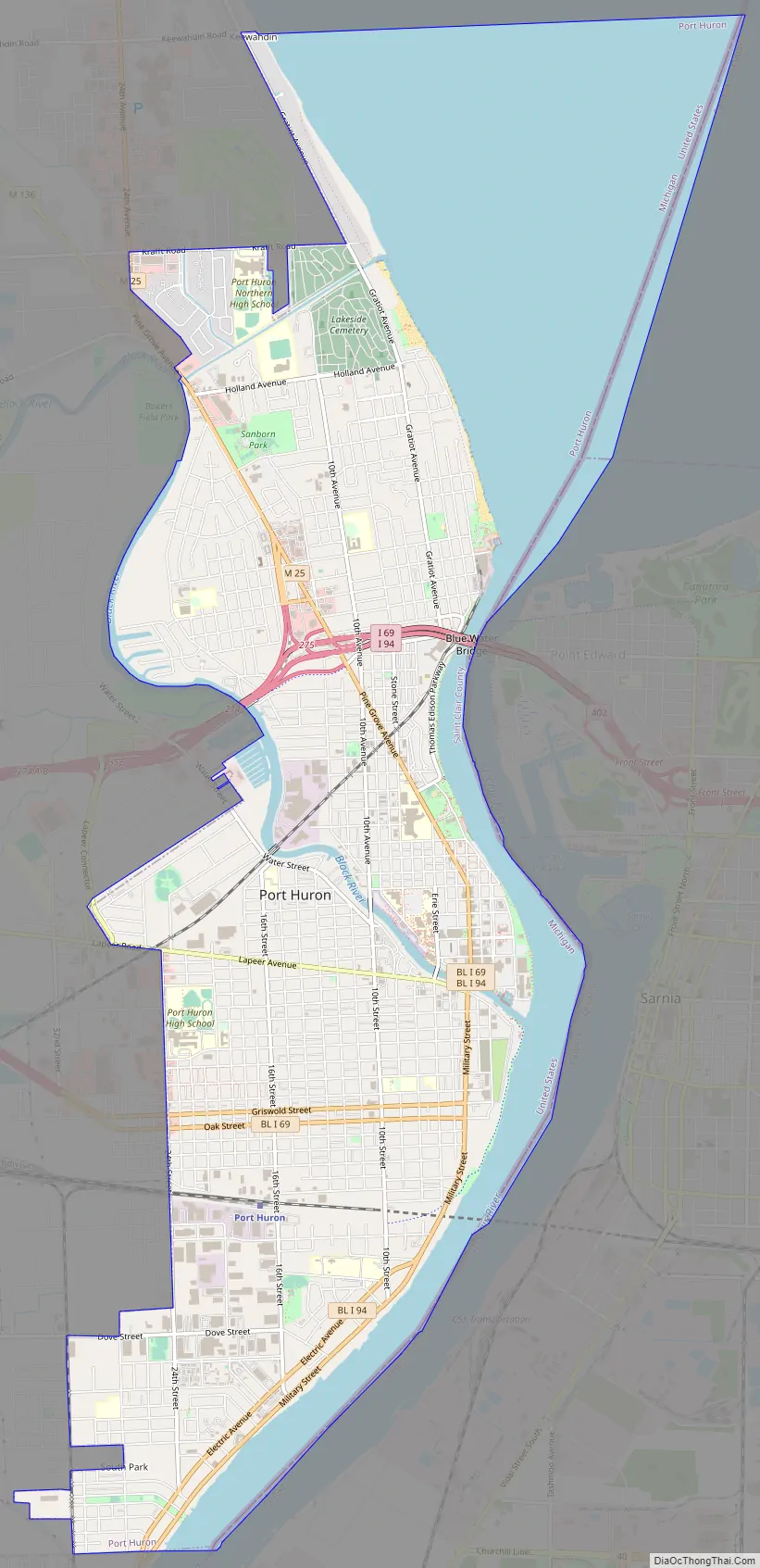
Port Huron Road Map
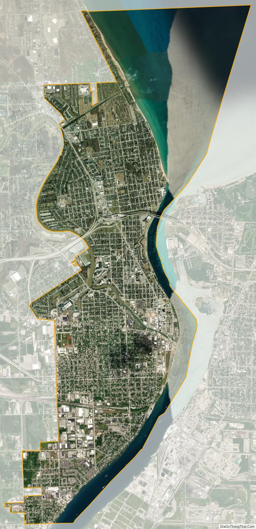
Port Huron city Satellite Map
Geography
According to the United States Census Bureau, the city has a total area of 12.26 square miles (31.75 km), of which 8.08 square miles (20.93 km) is land and 4.18 square miles (10.83 km) is water. The city is considered to be part of the Thumb area of East-Central Michigan, also called the Blue Water Area. The easternmost point (on land) of Michigan can be found in Port Huron, near the site of the Municipal Office Center and the wastewater treatment plant. The Black River divides the city in half, snaking through Port Huron and emptying into the St. Clair River near Downtown.
Climate
Port Huron has a humid continental climate (Köppen climate classification Dfa) with hot summers, cold winters and rain or snow in all months of the year.
See also
Map of Michigan State and its subdivision:- Alcona
- Alger
- Allegan
- Alpena
- Antrim
- Arenac
- Baraga
- Barry
- Bay
- Benzie
- Berrien
- Branch
- Calhoun
- Cass
- Charlevoix
- Cheboygan
- Chippewa
- Clare
- Clinton
- Crawford
- Delta
- Dickinson
- Eaton
- Emmet
- Genesee
- Gladwin
- Gogebic
- Grand Traverse
- Gratiot
- Hillsdale
- Houghton
- Huron
- Ingham
- Ionia
- Iosco
- Iron
- Isabella
- Jackson
- Kalamazoo
- Kalkaska
- Kent
- Keweenaw
- Lake
- Lake Hurron
- Lake Michigan
- Lake St. Clair
- Lake Superior
- Lapeer
- Leelanau
- Lenawee
- Livingston
- Luce
- Mackinac
- Macomb
- Manistee
- Marquette
- Mason
- Mecosta
- Menominee
- Midland
- Missaukee
- Monroe
- Montcalm
- Montmorency
- Muskegon
- Newaygo
- Oakland
- Oceana
- Ogemaw
- Ontonagon
- Osceola
- Oscoda
- Otsego
- Ottawa
- Presque Isle
- Roscommon
- Saginaw
- Saint Clair
- Saint Joseph
- Sanilac
- Schoolcraft
- Shiawassee
- Tuscola
- Van Buren
- Washtenaw
- Wayne
- Wexford
- Alabama
- Alaska
- Arizona
- Arkansas
- California
- Colorado
- Connecticut
- Delaware
- District of Columbia
- Florida
- Georgia
- Hawaii
- Idaho
- Illinois
- Indiana
- Iowa
- Kansas
- Kentucky
- Louisiana
- Maine
- Maryland
- Massachusetts
- Michigan
- Minnesota
- Mississippi
- Missouri
- Montana
- Nebraska
- Nevada
- New Hampshire
- New Jersey
- New Mexico
- New York
- North Carolina
- North Dakota
- Ohio
- Oklahoma
- Oregon
- Pennsylvania
- Rhode Island
- South Carolina
- South Dakota
- Tennessee
- Texas
- Utah
- Vermont
- Virginia
- Washington
- West Virginia
- Wisconsin
- Wyoming