The town of Washington, Virginia, is a historic village located in the eastern foothills of the Blue Ridge Mountains near Shenandoah National Park. The entire town is listed on the National Register of Historic Places as a historic district, Washington Historic District. It is the county seat of Rappahannock County, Virginia.
The town was established by an act of the Virginia General Assembly in 1796 and as the county seat of Rappahannock County, Virginia, in 1833. The town was incorporated in 1894 and was rechartered by the Virginia General Assembly in 1985. A large portion of the town was designated as the Washington Historic District on the Virginia Landmarks Register and the National Register of Historic Places in 1975 and is considered to be the best preserved of county-seat communities in the Piedmont. The town is led by a 7-member elected Town Council composed of a mayor, a treasurer, and five other members, all of whom serve 4-year terms. The internationally recognized Inn at Little Washington is located in the town. The town combines a mixture of open spaces, residences, village commerce, tourism facilities, historic buildings, cultural offerings, and local government activities. Its population was 135 people in the 2010 census and was estimated to be 127 people in 2019. The area of the town is 182 acres (74 ha).
| Name: | Washington town |
|---|---|
| LSAD Code: | 43 |
| LSAD Description: | town (suffix) |
| State: | Virginia |
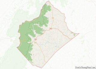
| County: | Rappahannock County |
| Elevation: | 682 ft (208 m) |
| Total Area: | 0.26 sq mi (0.68 km²) |
| Land Area: | 0.26 sq mi (0.68 km²) |
| Water Area: | 0.00 sq mi (0.00 km²) |
| Total Population: | 86 |
| Population Density: | 330/sq mi (130/km²) |
| ZIP code: | 22747 |
| Area code: | 540 |
| FIPS code: | 5183248 |
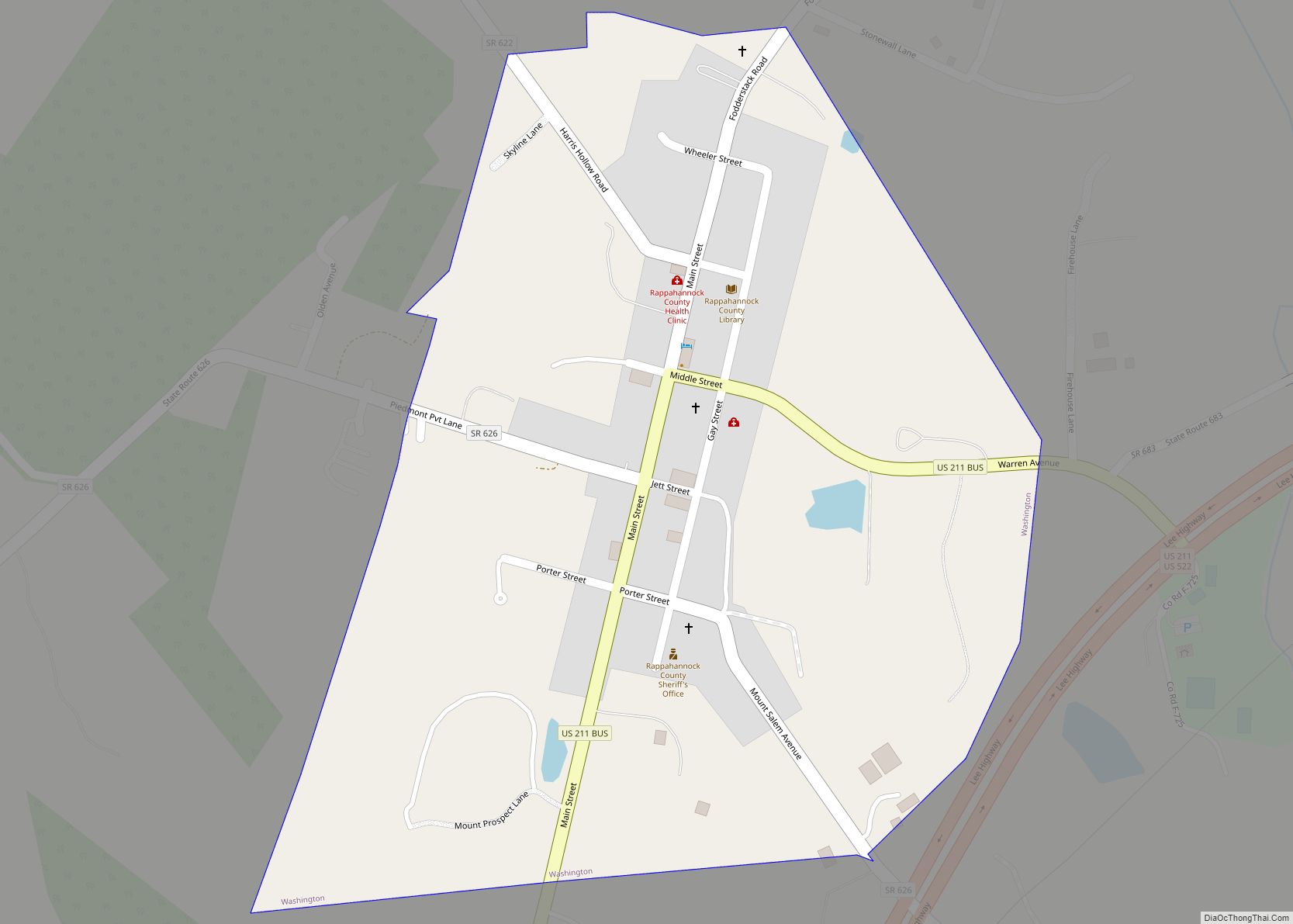
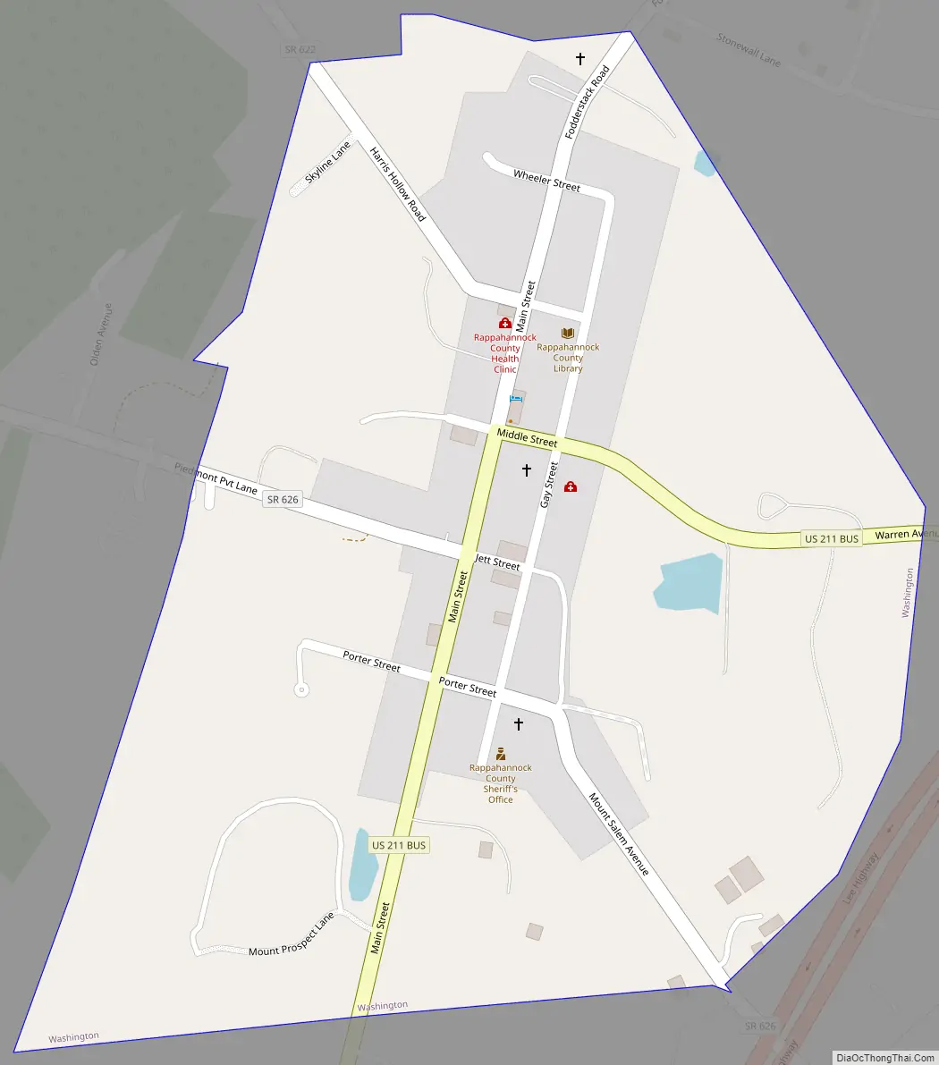
Online Interactive Map
Click on ![]() to view map in "full screen" mode.
to view map in "full screen" mode.
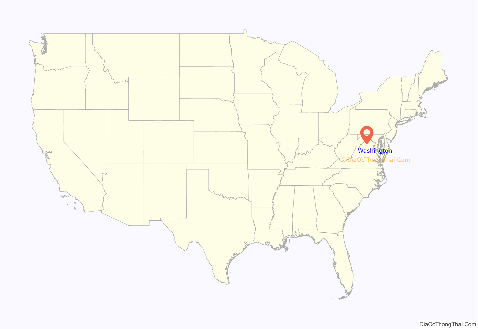
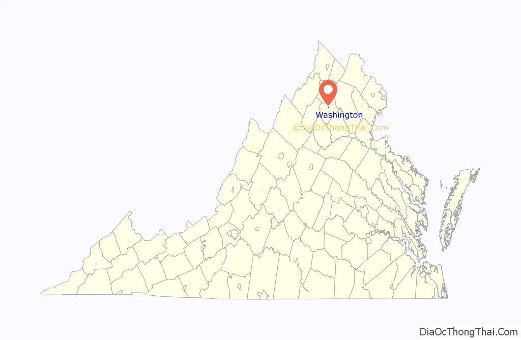
Washington location map. Where is Washington town?
History
The first recorded official document relating to the land that became the town of Washington was a land grant in the year 1735 from King George II of Great Britain to Thomas, James, and Elizabeth Kennerly. The three siblings received 1,750 acres of land located “between the mountains and the fork of the Rushy River,” in what was then Orange County, for importing six people into the colony of Virginia, payment of seven pounds five shillings of “good and lawful money,” and an annual fee of one shilling for every fifty acres of land. At this time there were virtually no Native Americans in the area and the way was open to English settlement of the Piedmont region of Virginia.
In 1745, the Kennerlys divided their land into three parts. Thomas received the central part, adjacent to and south of the Rush River and containing the land that would become the town of Washington. Thomas sold his land to Henry Gambill in 1753 and moved to South Carolina. Gambill divided the land: in 1754 he sold the western part, which contained what became the western portion of the town of Washington, to John Minor; in 1761 he gave the eastern part, which contained what became the northeastern portion of the town, to his son William Gambill. The border between these two parts would become part of the original road to Chester Gap and, later, Gay Street when the town of Washington was established.
These two parts were bought and sold multiple times during the next 30 years. However, four important individuals acquired the land in the 1790s. In 1791 William Porter was given 247 acres of the western land, and in 1795 George Calvert purchased 230 acres of the adjacent eastern land. During 1792–1795, Porter sold 2 acres to James Wheeler, 2 acres to James Jett Jr., and 6 acres to George Calvert, all of which were located on land that became the town of Washington. Only a few buildings were mentioned in these deeds; these included Wheeler’s storehouse, Jett’s store, and a schoolhouse, located along the road to Chesters Gap. The rest of the land was apparently only farmland owned by Porter and by Calvert.
On 1 November 1796, George Calvert, James Jett Jr., and James Wheeler petitioned the Virginia General Assembly to “establish a town by the name of Washington on twenty five acres of land of your said petitioners”. The General Assembly responded by passing an act on 14 December 1796 establishing thirteen new towns in Virginia, one of which was the town of Washington. One year later, Calvert, Jett, Wheeler, and William Porter sent a second petition to the General Assembly of Virginia, asking that part of Porter’s land be added to the town. A plan of the proposed streets and lots of the town was attached to the petition; four of the six streets were named after the four petitioners. On 25 December 1797, the General Assembly approved this request. The local legend that George Washington surveyed and laid out the town in 1749 is believed to have been created from fictitious documents in 1932.
The trustees of the new town of Washington quickly proceeded to sell the fifty-one lots of the town. In 1803 Mrs. Anne Cox established a tavern in the center of town; this building survives today as the gift shops of the Inn at Little Washington. Mary Resor also established a tavern, on Gay Street, which was next owned by George Thorn and later became the home “Avon Hall.” The Washington post office was situated in the town by 1804 and still remains in the town. The town became known as “Little Washington” as early as 1804, to distinguish it from the new capital of Washington, D.C. located only 70 miles to the northeast.
In 1833, Rappahannock County was created from part of Culpeper County and the town of Washington was selected to be the county seat. The courthouse and Court Clerk’s office were constructed by Malcolm F. Crawford of Albemarle County in 1833-1834 and the jail was built by John W. Fant of Shenandoah County in 1833–1836. The town was governed by a 7-member Board of Trustees. As the town prospered and grew in importance as the seat of government of Rappahannock County, new homes were constructed and businesses were established to serve the town and the county. Two schools were created in the town to provide private education in the years before the Commonwealth of Virginia instituted public education. The Washington Presbyterian church was built in 1856–1858, Trinity Episcopal church in 1857, Washington Baptist church in 1875, the African-American First Baptist church in 1881, and the Washington Methodist church in 1890. The Blue Ridge Guide newspaper served the town and the county from 1886 to 1936.
In 1894, the town was incorporated by an act of the Virginia General Assembly and governance of the town was vested in a council of seven members. The Rappahannock National Bank was established in the town in 1903, and electricity and telephones were introduced in the 1920s. Thornton’s garage was constructed in the middle of town; this became the Inn at Little Washington in 1978. Partlow’s General Store was created in the town in the early 1900s, Stuart’s merchandise store in 1908, and Lea Brothers Store in 1928. A new water system was constructed for the town in the mid-1930s through Franklin Roosevelt’s Works Progress Administration, and a volunteer fire department was created at that time. In the later 1930s, caravans of tourists began visiting the town on their way to Skyline Drive in Shenandoah National Park. A major event heralded the beginning of the second half of the 20th century with the election of seven women to serve as the Town Council of Washington, replacing the seven men who had comprised the council. Nationwide publicity was given to the election and to the town (nicknamed “She-town” temporarily). These women accomplished a great deal to improve the ambiance and governance of the town. Over the next 50 years, the town flourished because of the influx of tourism, with many new stores, art galleries, restaurants, and overnight lodging. The weekly Rappahannock News newspaper was begun. Two performance arts theaters and a public library were established in the town.
In 1975, the town was listed on the National Register of Historic Places as “Washington Historic District”, and the Town Council passed an ordinance establishing a review board charged with preserving the town’s historic character. (More below.)
One of the most important events in the modern history of the town is the opening of The Inn at Little Washington in 1978. This restaurant and inn celebrated its 40th anniversary in 2018 and has gained national and international fame. It is a member of the luxury hotel association, Relais & Châteaux. It is the first inn to receive the Mobil Travel Guide’s 5-Star award, and it has been rated by the American Automobile Association with 5 diamonds for its restaurant and 5 diamonds for its overnight lodging for 28 years. In 2001, the owner and chef of the Inn, Patrick O’Connell, was given the prestigious Outstanding Chef in America Award. La Liste, the French guide to the world’s best restaurants, ranked the Inn as the fifth highest rated restaurant in the world. The Inn attracts a discerning clientele from Washington, D.C., and its suburbs. Largely due to the Inn’s influence, the town is also home to several art galleries, unique shops, bed and breakfasts, and restaurants. The town attracts art lovers, history buffs, and hikers that come into the county for day hikes or weekend camping trips.
In 1985 the town was rechartered by the Virginia General Assembly. By this new charter, the town was granted much broader powers and increased responsibilities. Washington has evolved to be a safe and quiet community within the rural agricultural environment of Rappahannock County. It still has the same grid of streets and the same street names shown in the 1797 town plan. However, the 51 lots have been subdivided extensively and the boundaries of the town have been significantly enlarged, from the original 25 acres to 182.0171 acres. The town is a community without any large commercial businesses or heavy industry. It is governed by a 7-member Town Council guided by the town’s Comprehensive Plan, Planning Commission, Board of Zoning Appeals, and town ordinances.
Washington Road Map
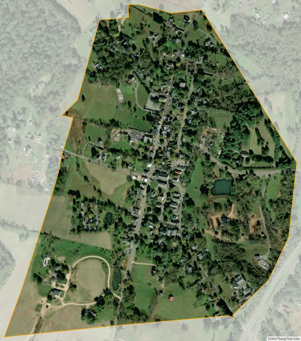
Washington city Satellite Map
Geography
Washington is located at 38°42′46″N 78°9′34″W / 38.71278°N 78.15944°W / 38.71278; -78.15944 (38.712914, −78.159474).
The town has a total area of 0.284 square miles (0.737 km), all of it land except for the Avon Hall pond.
The town is located on the eastern side of the Blue Ridge Mountains near the northern part of Shenandoah National Park.
See also
Map of Virginia State and its subdivision:- Accomack
- Albemarle
- Alexandria
- Alleghany
- Amelia
- Amherst
- Appomattox
- Arlington
- Augusta
- Bath
- Bedford
- Bedford City
- Bland
- Botetourt
- Bristol
- Brunswick
- Buchanan
- Buckingham
- Buena Vista
- Campbell
- Caroline
- Carroll
- Charles City
- Charlotte
- Charlottesville
- Chesapeake
- Chesterfield
- Clarke
- Clifton Forge City
- Colonial Heights
- Covington
- Craig
- Culpeper
- Cumberland
- Danville
- Dickenson
- Dinwiddie
- Emporia
- Essex
- Fairfax
- Fairfax City
- Falls Church
- Fauquier
- Floyd
- Fluvanna
- Franklin
- Frederick
- Fredericksburg
- Galax
- Giles
- Gloucester
- Goochland
- Grayson
- Greene
- Greensville
- Halifax
- Hampton
- Hanover
- Harrisonburg
- Henrico
- Henry
- Highland
- Hopewell
- Isle of Wight
- James City
- King and Queen
- King George
- King William
- Lancaster
- Lee
- Lexington
- Loudoun
- Louisa
- Lunenburg
- Lynchburg
- Madison
- Manassas
- Manassas Park
- Martinsville
- Mathews
- Mecklenburg
- Middlesex
- Montgomery
- Nelson
- New Kent
- Newport News
- Norfolk
- Northampton
- Northumberland
- Norton
- Nottoway
- Orange
- Page
- Patrick
- Petersburg
- Pittsylvania
- Poquoson
- Portsmouth
- Powhatan
- Prince Edward
- Prince George
- Prince William
- Pulaski
- Radford
- Rappahannock
- Richmond
- Roanoke
- Roanoke City
- Rockbridge
- Rockingham
- Russell
- Salem
- Scott
- Shenandoah
- Smyth
- Southampton
- Spotsylvania
- Stafford
- Staunton
- Suffolk
- Surry
- Sussex
- Tazewell
- Virginia Beach
- Warren
- Washington
- Waynesboro
- Westmoreland
- Williamsburg
- Winchester
- Wise
- Wythe
- York
- Alabama
- Alaska
- Arizona
- Arkansas
- California
- Colorado
- Connecticut
- Delaware
- District of Columbia
- Florida
- Georgia
- Hawaii
- Idaho
- Illinois
- Indiana
- Iowa
- Kansas
- Kentucky
- Louisiana
- Maine
- Maryland
- Massachusetts
- Michigan
- Minnesota
- Mississippi
- Missouri
- Montana
- Nebraska
- Nevada
- New Hampshire
- New Jersey
- New Mexico
- New York
- North Carolina
- North Dakota
- Ohio
- Oklahoma
- Oregon
- Pennsylvania
- Rhode Island
- South Carolina
- South Dakota
- Tennessee
- Texas
- Utah
- Vermont
- Virginia
- Washington
- West Virginia
- Wisconsin
- Wyoming