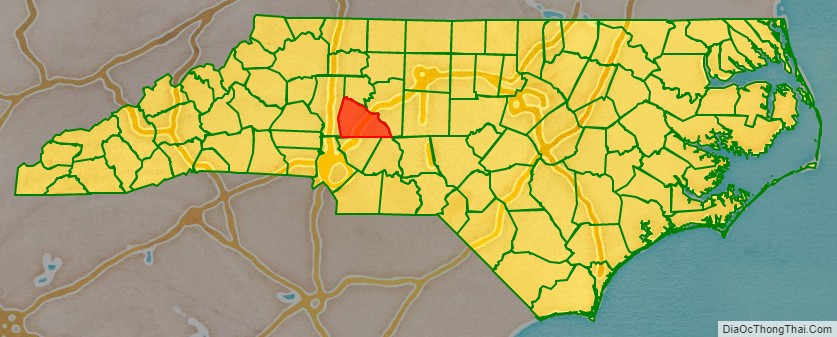
Rowan County is a county in the U.S. state of North Carolina that was formed in 1753, as part of the British Province of North Carolina. It was originally a vast territory with unlimited western boundaries, but its size was reduced to 524 sq mi after several counties were formed from Rowan County in the 18th and 19th centuries. As of the 2020 census, its population was 146,875. Its county seat, Salisbury, is the oldest continuously populated European-American town in the western half of North Carolina. Rowan County is located northeast of Charlotte, and is considered part of the Charlotte Metropolitan Area.
| Name: | Rowan County |
|---|---|
| FIPS code: | 37-159 |
| State: | North Carolina |
| Founded: | April 12, 1753 |
| Named for: | Matthew Rowan |
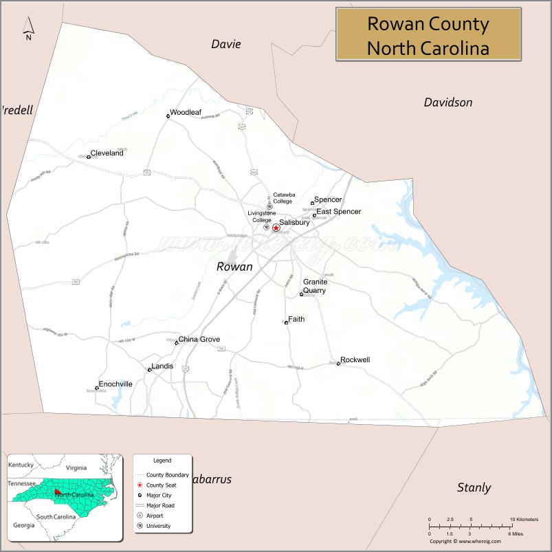
| Seat: | Salisbury |
| Largest city: | Salisbury |
| Total Area: | 524 sq mi (1,360 km²) |
| Land Area: | 511 sq mi (1,320 km²) |
| Total Population: | 148,150 |
| Population Density: | 289.9/sq mi (111.9/km²) |
| Time zone: | UTC−5 (Eastern) |
| Summer Time Zone (DST): | UTC−4 (EDT) |
| Website: | www.rowancountync.gov |
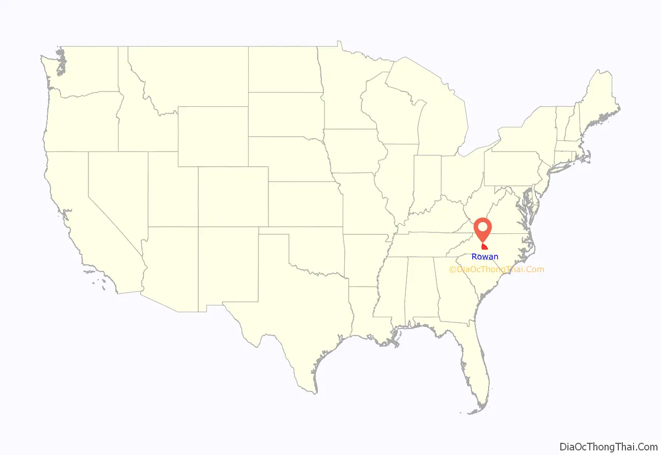
Rowan County location map. Where is Rowan County?
History
Early history
The first Europeans to enter what is now Rowan County were members of the Spanish expedition of Juan Pardo in 1567. They established a fort and a mission in the native village of Guatari, believed to be located near the Yadkin River and inhabited by the Wateree. At the time, the area was ruled by a female chief whom the Spaniards called Guatari Mico (Mico was the Wateree’s term for chief). The Spaniards called the village Salamanca in honor of the city of Salamanca in western Spain, and established a mission, headed by a secular priest named Sebastián Montero.
This fort was one of six that Pardo’s expedition established before he returned separately to Spain in 1568. Small garrisons were stationed at each fort. They were built into the interior, including across the mountains in what is now southeastern Tennessee. In 1568, Native Americans at each fort massacred all but one soldier in the garrisons. The Spanish never returned to this interior area in other colonizing attempts, instead concentrating their efforts in Spanish Florida.
18th century
English colonial settlement of North Carolina came decades later, starting in the coastal areas, where settlers migrated south from Virginia. Explorers and fur traders were the first to reach the Piedmont, paving the way for eventual settlers. Rowan County was formed in 1753 from the northern part of Anson County. It was named for Matthew Rowan, acting governor of North Carolina from 1753 to 1754. It was intended to incorporate all of the lands of the Granville District that had previously been included in Anson County.
A house several miles west of present-day Salisbury in “the Irish settlement” served as the first courthouse starting June 15, 1753. Daniel Boone’s father Squire Boone served as one of the first magistrates. By mid-1754 a new courthouse site was selected near “the place where the Old Waggon Road (crosses) over Grant’s Creek.”
As was typical of the time, Rowan County was originally a vast territory with an indefinite western boundary. As the population increased in the region, portions were taken to organize other counties and their seats. In 1770, the eastern portion was combined with the western part of Orange County to form Guilford County. In 1771 the northeastern portion of what was left became Surry County. In 1777 the western part of Rowan County was organized as Burke County.
After the American Revolutionary War, in 1788, the western portion of the now much smaller Rowan County was organized as Iredell County.
19th century
In 1822, Davidson County was formed from an eastern section. Finally, in 1836, that part of Rowan County north of the South Yadkin River became Davie County, and Rowan County took its present form and size.
Since Rowan County was developed for tobacco, cotton cultivation, and mixed farming in the antebellum period, many of the plantation owners and some farmers were dependent on enslaved labor. Cotton and tobacco continued as a commodity crop after the war and into the 20th century. The population of Rowan County was 27.1 percent slaves in 1860.
During and following the Reconstruction era, the state legislature encouraged investment in railways, which had not occurred before. In addition, textile mills were built here and elsewhere in the Piedmont, bringing back cotton processing and manufacturing from centers in New York and New England. Urban populations increased.
20th century
At the turn of the 20th century, after losing to Republican-Populist fusionist candidates, Democrats regained power and passed laws erecting barriers to voter registration to disenfranchise most Blacks. Together with the passage of Jim Crow laws, which suppressed Blacks socially, these measures ended the progress of African Americans in the state, after Republican men had already been serving in Congress. Charles Aycock and Robert Glenn, who were elected as state governors in 1900 and 1904, respectively, ran political campaigns to appeal to Whites. Six lynchings of African Americans were recorded in Rowan County from the late 19th into the early 20th centuries. This was the second-highest total of killings in the state, a number of extrajudicial murders that two other counties also had.
The racial terrorism of lynchings enforced White suppression of African Americans. In 1902, brothers James and Harrison Gillespie, aged 11 and 13, were lynched by a White mob for allegedly killing a young White woman working in a field. In August 1906, six African-American men were arrested as suspects in the murder of a farm family. That evening, a White mob stormed the county jail in Salisbury, freeing all the White prisoners, interrogating the Black ones, and taking out Jack Dillingham, Nease Gillespie, and his son John. The mob hanged the three men from a tree in a field, mutilated and tortured them, and shot them numerous times.
A center of textile manufacturing spanning from the late 19th to the late 20th century, the county has worked to attract new industries, after many textile manufacturing occupations moved offshore to lower wage markets during the late 20th century.
21st century
In 2003, the county held the “250 Fest”, celebrating its 250th anniversary.
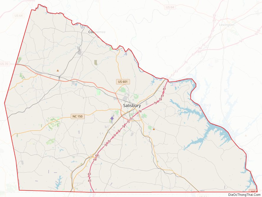
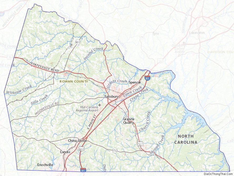
Rowan County Road Map
Geography
According to the U.S. Census Bureau, the county has a total area of 524 square miles (1,360 km), of which 12 square miles (31 km) (2.4%) are covered by water.
The county’s eastern border is formed by the Yadkin River. North of Ellis Crossroads, the South Yadkin River meets the Yadkin. The South Yadkin forms the county’s northern border with Davie County. The southern border is an east-west line that bisects the city of Kannapolis.
State and local protected areas/sites
- Eagle Point Nature Preserve
- Gold Hill Mines Historic Park
- Lake Corriher Wilderness Park
- North Carolina Transportation Museum
Major water bodies
- Cold Water Creek (Irish Buffalo Creek tributary)
- Dutch Buffalo Creek
- High Rock Lake
- Irish Buffalo Creek
- Kannapolis Lake
- Lake Corriher
- Lake Fisher
- Lake Wright
- South Yadkin River
- Tuckertown Reservoir
- Yadkin River
Adjacent counties
- Cabarrus County – south
- Davidson County – east
- Davie County – north
- Iredell County – west
- Stanly County – southeast
Major highways
- I-85
- US 29
- US 52
- US 70
- US 601
- NC 8
- NC 49
- NC 150
- NC 152
- NC 153
- NC 801
Interstate 85 passes through the county from southwest to northeast. In the early 2000s, I-85 was widened in the central and northern part of the county, from exit 68, US 29 Connector, north almost to the Davidson County line. A new bridge over the Yadkin River was also built.
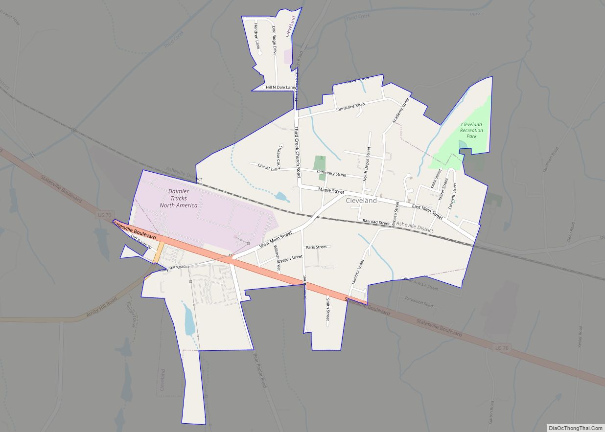
U.S. Route 70 enters the northwestern part of Rowan County, west of Cleveland. It runs southeast into Salisbury, where it follows Jake Alexander Boulevard to the southeast and joins US 29 North as Main Street. US 70 continues northeast as Main Street; it is called Salisbury Avenue in Spencer before crossing into Davidson County.
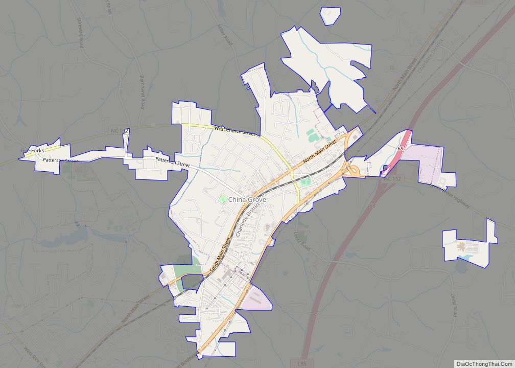
U.S. Route 29 forms Main Street in Kannapolis, China Grove, and Landis in the southern part of the county. It joins US 70 as Main Street through Salisbury, and as Salisbury Avenue in Spencer.
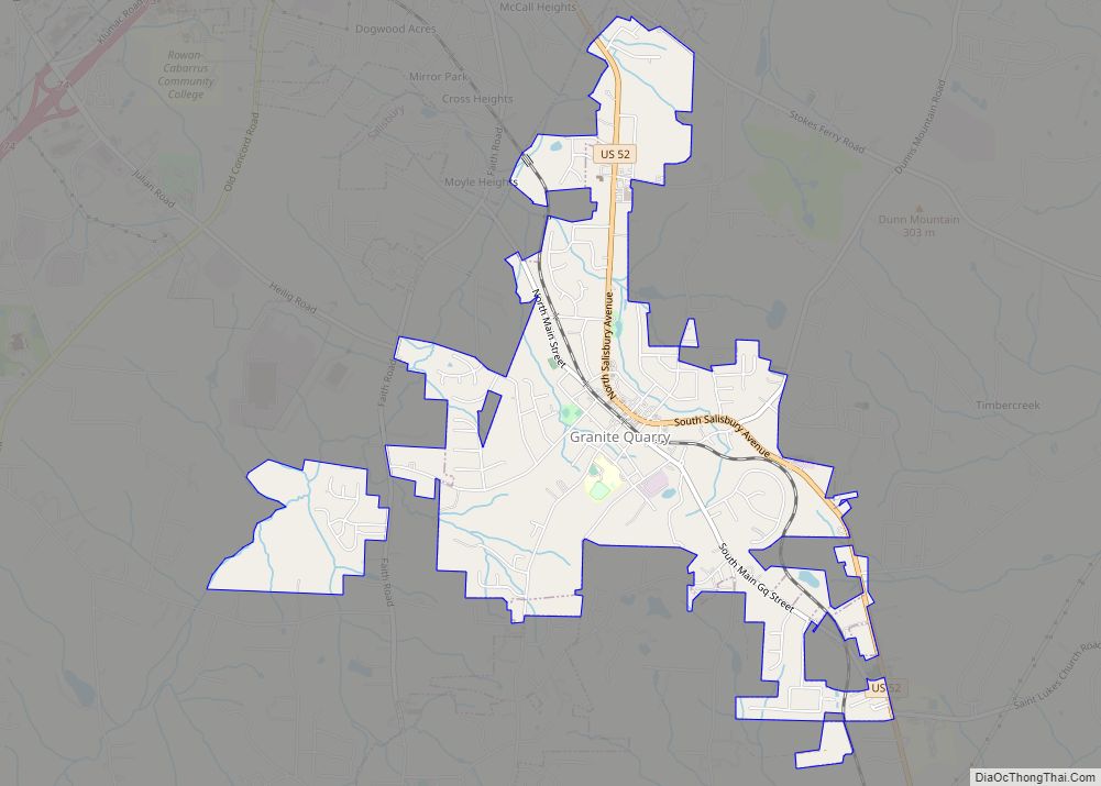
U.S. Route 52 is the main artery for the southeastern part of the county, serving the towns of Gold Hill, Rockwell, and Granite Quarry. Just before reaching downtown Salisbury, US-52 joins Interstate 85, which it follows into Davidson county.
Major infrastructure
- Mid-Carolina Regional Airport, near Salisbury.
- Salisbury Station
Rowan County Topographic Map
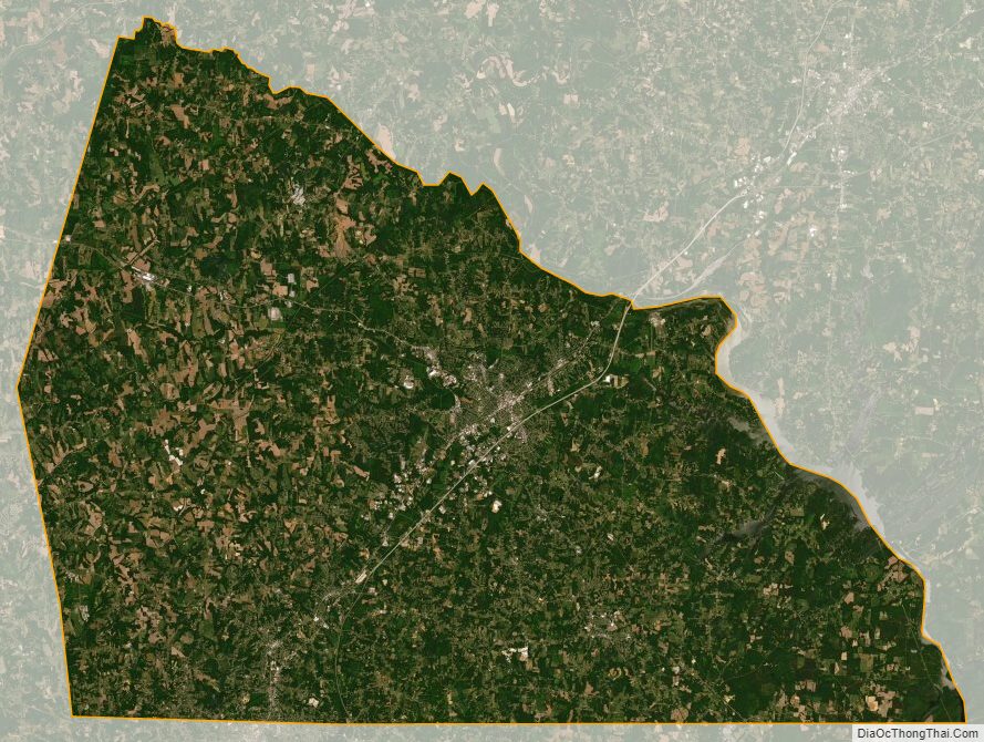
Rowan County Satellite Map
Rowan County Outline Map