Perth Amboy is a city in Middlesex County, in the U.S. state of New Jersey. Perth Amboy is part of the New York metropolitan area. As of the 2020 United States census, the city’s population was 55,436, an increase of 4,622 (+9.1%) from the 2010 census count of 50,814, which in turn reflected an increase of 3,511 (+7.4%) from the 47,303 counted in the 2000 census. Perth Amboy has a Hispanic majority population. In the 2010 census, the Hispanic population made up 78.1% of the population, the second-highest in the state, behind Union City at 84.7%. Perth Amboy is known as the “City by the Bay”, referring to its location adjoining Raritan Bay. The Census Bureau’s Population Estimates Program calculated that the city’s population was 55,291 in 2021, ranking the city as the 719th-most-populous in the country.
The earliest residents of the area were the Lenape Native Americans, who called the point on which the city lies “Ompoge”. Perth Amboy was settled in 1683 by Scottish colonists and was called “New Perth” after James Drummond, 4th Earl of Perth; the native name was eventually corrupted and the two names were merged. Perth Amboy was formed by Royal charter in 1718, and the New Jersey Legislature reaffirmed its status in 1784, after independence. The city was a capital of the Province of New Jersey from 1686 to 1776. During the mid-1800s, the Industrial Revolution and immigration grew the city, developing a variety of neighborhoods which residents from a diverse range of ethnicities lived in. The city developed into a resort town for the Raritan Bayshore near it, but the city has grown in other industries since its redevelopment starting in the 1990s.
Perth Amboy borders the Arthur Kill and features a historic waterfront. The Perth Amboy Ferry Slip was once an important ferry slip on the route south from New York City; it was added to the National Register of Historic Places in 1978. The Raritan Yacht Club, one of the oldest yacht clubs in the United States, is located in the city. Perth Amboy is connected to the Staten Island borough of New York City via the Outerbridge Crossing.
| Name: | Perth Amboy city |
|---|---|
| LSAD Code: | 25 |
| LSAD Description: | city (suffix) |
| State: | New Jersey |
| County: | Middlesex County |
| Incorporated: | December 21, 1784 |
| Elevation: | 62 ft (19 m) |
| Total Area: | 5.96 sq mi (15.44 km²) |
| Land Area: | 4.66 sq mi (12.07 km²) |
| Water Area: | 1.30 sq mi (3.37 km²) 21.37% |
| Total Population: | 55,436 |
| Population Density: | 11,891.0/sq mi (4,591.1/km²) |
| Area code: | 732 Exchanges: 293,324,376,442,697,826 |
| FIPS code: | 3458200 |
| GNISfeature ID: | 0885349 |
| Website: | www.perthamboynj.org |
Online Interactive Map
Click on ![]() to view map in "full screen" mode.
to view map in "full screen" mode.
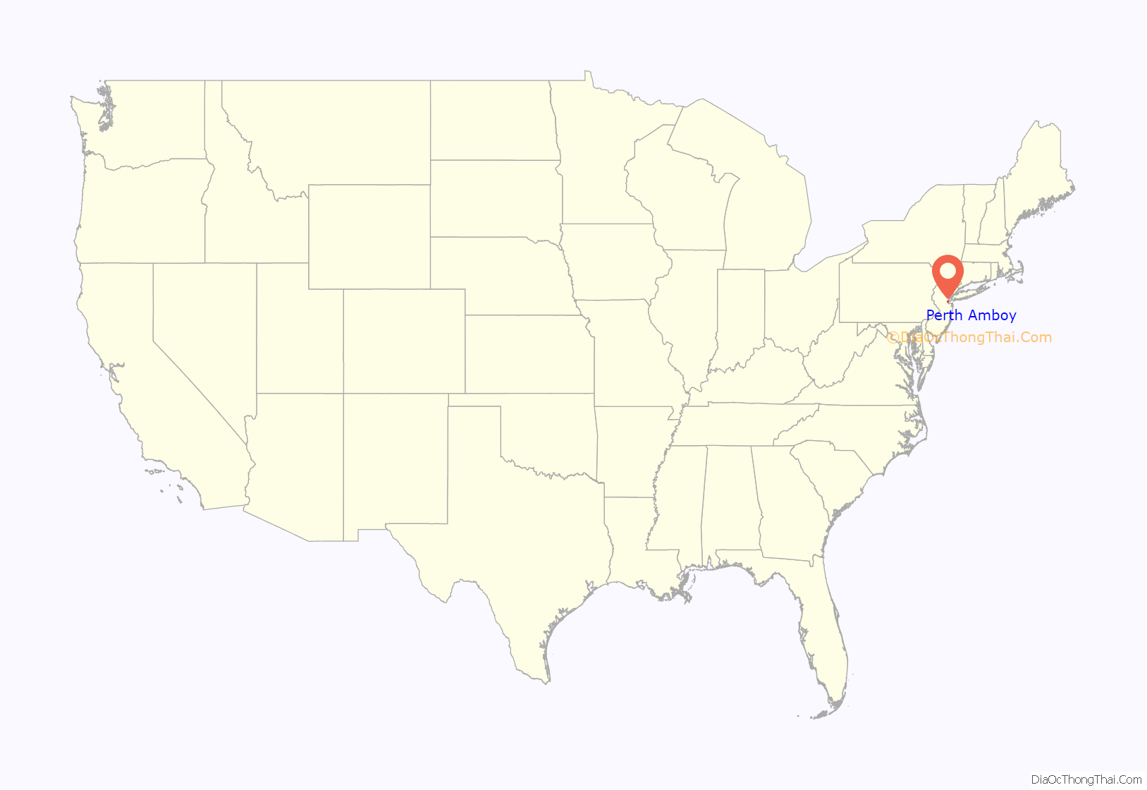
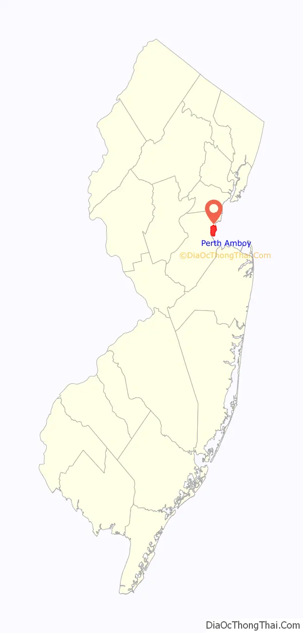
Perth Amboy location map. Where is Perth Amboy city?
History
Name
The Lenape Native Americans called the point on which the city is built “Ompoge”, meaning “level ground” or “standing or upright”. When settled in 1683, the new city was dubbed “New Perth” in honor of James Drummond, Earl of Perth, one of the 12 associates of a company of Scottish proprietors; Drummond has been honored with a statue located outside of city hall. The Algonquian language name persisted, corrupted to Ambo, or Point Amboy, and eventually a combination of the native and colonial names emerged, also appearing in South Amboy.
Scottish colony
Perth Amboy was settled by Scottish colonists around 1683 who had been recruited to inhabit the share of the East Jersey colony owned by Robert Barclay, a Quaker who would later become the absentee governor of the province.
Charter and incorporation
Perth Amboy was formed by Royal charter on August 4, 1718, within various townships and again by New Jersey Legislature on December 21, 1784, within Perth Amboy Township and from part of Woodbridge Township. Perth Amboy Township was formed on October 31, 1693, and was enlarged during the 1720s to encompass Perth Amboy city. Perth Amboy Township was incorporated as one of New Jersey’s initial 104 townships through the Township Act of 1798 on February 21, 1798. The township was replaced by Perth Amboy city on April 8, 1844.
Provincial capital
Elizabeth (then known as Elizabethtown) was designated in 1668 as the first capital of New Jersey. In 1686, Perth Amboy was designated as the capital of East Jersey, while Burlington was the capital of West Jersey. After the two were united as a royal colony in 1702, the two cities alternated as the capital of the Province of New Jersey until November 1790, when Trenton was designated as the unified state capital, chosen based on its location midway between New York City and Philadelphia.
A few of the buildings from this early period can still be seen today. Most notably, the Proprietary House, the home of William Franklin, the last Royal Governor of New Jersey and estranged son of Benjamin Franklin, still stands in the waterfront area of the city. Architect John Edward Pryor was hired in 1761 to design and construct the building, which was completed in September 1764, years late and over budget. Franklin preferred his alternate home in Burlington. Franklin finally moved in 1774 into the Proprietary House. Franklin’s father, Ben, tried unsuccessfully to convince his son to support the Colonial cause. William Franklin was arrested and detained at Proprietary House in 1776 until he was tried and convicted of treason.
Perth Amboy City Hall was first built as a court house for Middlesex County in 1714, having been designated as the county seat the previous year. The building was later used as the home of the East Jersey Provincial Assembly. The building was destroyed by a major fire in 1731 and rebuilt in 1745. Another fire was deliberately set in 1764, forcing a rebuilding that was completed in 1767. It is the oldest city hall in continuous use in the United States. On November 20, 1789, City Hall was the site where the New Jersey General Assembly met to ratify the Bill of Rights, becoming the first state in the nation to do so.
Market Square, located across from City Hall, is a park that had been an outdoor marketplace during the Colonial era. Market Square includes a replica of the Liberty Bell, a statue of George Washington and the Bill of Rights Arch, which commemorates the fact that New Jersey was the first state to ratify the Bill of Rights.
St. Peter’s Church, which held its first service in 1685 and received a royal charter in 1718, has been recognized as the first Episcopal congregation in the state. Its current building, dating from the 1850s, is surrounded by a graveyard of early inhabitants and displays a collection of stained-glass windows with religious scenes as well as early depictions of New Jersey receiving her charter and a meeting between William Franklin and his father, Ben.
Perth Amboy was New Jersey’s primary inbound port for African slaves.
The Kearny Cottage is a remaining example of 18th-century vernacular architecture. Operated as a historic house museum and operated by the Kearny Cottage Historical Society. Built in 1781 on High Street, the house was moved to Sadowski Parkway in the 1920s, and was later relocated to its current site at 63 Catalpa Avenue, just inland from the mouth of the Raritan River.
During the colonial period and for a significant time thereafter, Perth Amboy was an important way-station for travelers between New York City and Philadelphia, as it was the site of a ferry that crossed the Arthur Kill to Tottenville, Staten Island. The first ferry operated in 1684 and regular service began operating in 1709. This ferry became less important when the Outerbridge Crossing opened in 1928, but continued to operate until 1963. In 1998, the Perth Amboy Ferry Slip was restored to its 1904 appearance. A replica of the ticket office has been constructed and is used as a small museum.
On March 31, 1870, Thomas Mundy Peterson became the first African-American in the United States to vote in an election under the recently enacted provisions of the Fifteenth Amendment to the United States Constitution. Peterson voted in an election to update the Perth Amboy city charter.
Industrialization and immigration
By the middle of the 19th century, immigration and industrialization transformed Perth Amboy. Factories such as A. Hall and Sons Terra Cotta, Guggenheim and Sons and the Copper Works Smelting Company fueled a thriving downtown and employed many area residents. Growth was further stimulated by becoming the tidewater terminal for the Lehigh Valley Railroad and a coal shipping point. Perth Amboy developed tightly-knit and insular ethnic neighborhoods such as Budapest, Dublin, and Chickentown. Immigrants from Denmark, Poland, Hungary, Czechoslovakia, Italy, Russia, and Austria quickly dominated the factory jobs.
In 1903, the Perth Amboy Public Library, one of the first Carnegie libraries in the state, made possible through grants from Andrew Carnegie and donations by local philanthropists, opened to the public.
In 1914, Perth Amboy hosted a minor league baseball team called the Perth Amboy Pacers, who played as members of the Class D level Atlantic League. The Atlantic League folded after one season.
In late August 1923, an estimated 6,000 persons rioted, breaking through police lines after the Ku Klux Klan attempted to organize a meeting in the city.
The city was a resort town in the 19th century and early 20th century, located on the northern edge of the Raritan Bayshore. Since the early 1990s Perth Amboy has seen redevelopment. Small businesses have started to open up, helped by the city’s designation as an Urban Enterprise Zone. The waterfront has also seen a rebirth. The marina has been extended, and there are new promenades, parks, and housing overlooking the bay.
The chapter “More Alarms at Night” in humorist James Thurber’s biography My Life and Hard Times involves Perth Amboy. One night during his adolescence in Ohio, young Thurber is unable to go to sleep because he cannot remember the name of this New Jersey community. He wakens his father, demanding that he start naming towns in New Jersey. When the startled father names several towns with single-word names, Thurber replies that the name he is seeking is “two words, like helter skelter”. This convinces his father that Thurber has become dangerously insane. Thurber also wrote the story later made into the film The Secret Life of Walter Mitty, about an “inconsequential guy from Perth Amboy, New Jersey”. Perth Amboy’s water pumping station is located in Old Bridge Township.
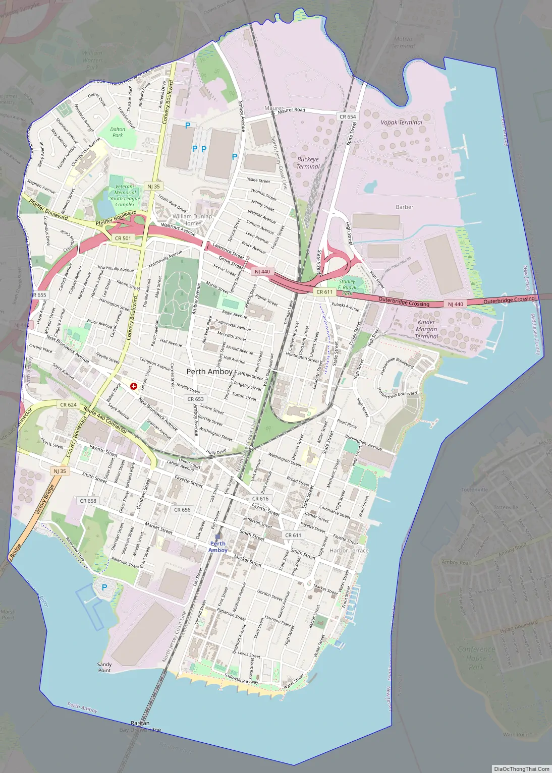
Perth Amboy Road Map
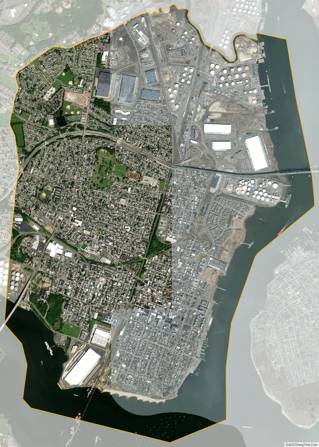
Perth Amboy city Satellite Map
Geography
According to the U.S. Census Bureau, the city had a total area of 5.93 square miles (15.36 km), including 4.66 square miles (12.07 km) of land and 1.27 square miles (3.28 km) of water (21.37%).
Perth Amboy, and South Amboy across the Raritan River, are collectively referred to as The Amboys. Signage for Exit 11 on the New Jersey Turnpike refers to “The Amboys” as a destination. The Amboys are the northern limit of the area informally referred to as the Bayshore.
Perth Amboy borders Woodbridge (adjacent by land to the north and west), Sayreville (to the southwest, across the Raritan River), South Amboy (south across the upper reaches of Raritan Bay, directly connected only by rail), and the New York City borough of Staten Island (east across the Arthur Kill).
Unincorporated communities, localities and place names located partially or completely within the city include Barber, Eagleswood and Florida Grove.
Perth Amboy sits on a geological layer of clay several hundred feet thick. Consequently, clay mining and factories such as A. Hall and Sons Terra Cotta located in Perth Amboy in the late 19th century.
In its September 2005 issue, Golf Magazine named Perth Amboy the unofficial “Golf Capital of the U.S.”, despite the fact that there are no golf courses within the city limits, citing the city’s access to 25 of the magazine’s Top 100 Golf Courses in the U.S., which can be found within 150 mi (240 km) of Perth Amboy.
Waterfront
Perth Amboy features a historic waterfront, which has gone through significant revitalization. Local attractions include the Perth Amboy Ferry Slip, two small museums, an art gallery, a yacht club, and a marina. Near the marina lies a park with a small bandshell. On Sunday afternoons in the summertime, Perth Amboy hosts the Concerts by the Bay in the park’s bandshell. Every Thursday evening in the summer, Perth Amboy hosts the Mayor’s Concert Series in Bayview Park. Perth Amboy also hosts an annual Waterfront Arts Festival. The waterfront is also characterized by a redbrick promenade near the water and many stately Victorian homes, some on hills overlooking the bay and tree lined streets with well-manicured lawns. The land rises steeply after two blocks. This hides the rest of the town, making the waterfront look like a quiet fishing village. Points of interest on the waterfront include St. Peter’s Episcopal Church, and the Proprietary House, which is now the former governor’s mansion and houses a museum and some offices. Kearny Cottage, which also has a museum, is here. This section of Perth Amboy once had a thriving Jewish community with yeshivas, synagogues, kosher butchers and bakers. Today, however, there are only two synagogues left, each with only a few older members.
A project called ‘The Landings at Harborside’ was to have featured 2,100 residential units along with indoor parking, 150,000 sq ft (14,000 m) of retail space, a community center, and recreation amenities for the public as well. However, after meeting with Charles Kushner, the developer who spent two years in prison after being convicted of witness tampering, tax evasion and making illegal campaign contributions, Mayor Wilda Diaz endorsed a scaled-back design concept for the development, allowing Section 8 housing rentals instead of owner-occupied units as originally promised.
The Raritan Yacht Club is the state’s second-oldest and one of the oldest yacht clubs in the United States, founded in 1882 from the merger of two older clubs, one founded in 1865 and the other in 1874. Also located on the waterfront and founded in 1917, St. Demetrios was one of the first Greek Orthodox churches in central New Jersey. Established by the Greek immigrants who came to the United States at the turn of the 19th century, this community has stood as a beacon of the Orthodox Faith and Hellenism in Middlesex County.
Downtown Perth Amboy
Perth Amboy was settled by Europeans in 1683 and incorporated as a city in 1718. It was founded by English merchants, Scots seeking religious freedom, and French Protestants, who sought to make use of Perth Amboy’s harbor to its full potential. Downtown is the main commercial district, and is centered on Smith Street. It is an Urban Enterprise Zone, and the reduced sales tax rate (half of the statewide rate) funds revitalization of Smith Street with newly planted trees, Victorian streetlights, benches, garbage cans, and redbrick sidewalks. Smith Street is a shopping center seven blocks wide, with stores catering to working-class customers. The street is flanked by mainly two- to three-story buildings of varied architecture. It also has a lone bank skyscraper called ‘Amboy Towers’, 10 stories tall, located at Five Corners, the intersection of Smith Street, New Brunswick Avenue and State Street. Once home to several department stores downtown, the largest today is discount retailer Bargain Man.
Harbortown
Harbortown is a townhouse development on the waterfront which continues to be expanded since construction started in 1987. “Section 8” housing along with more affluent homes can be found in Harbortown, an economically and ethnically diverse townhouse development in the city.
This area was the Lehigh Valley Railroad marshaling yards where coal was loaded onto barges for shipment to New York City and elsewhere until the LVRR went bankrupt in 1976.
Hall Avenue
Hall Avenue is a neighborhood centered on Hall Avenue east of the NJ Transit train tracks. The street itself, Hall Avenue, is no longer the commercial strip it once was. However, there is a recently built strip mall on the corner of Hall Avenue and State Street called the “Firehouse Plaza”. There is also a “Banco Popular” branch of the bank headquartered in Puerto Rico. However, Hall Avenue is now primarily residential. Most of the homes are aging apartments, but there are also some newly constructed homes. Hall Avenue remains a traditional Puerto Rican neighborhood, and it hosts the city’s annual Puerto Rican Day Festival, which is held on the same day of the historic Puerto Rican Day Parade in New York City. Rudyk Park is north of Route 440 and features the Roberto Clemente Baseball Field and an industrial park.
Southwestern section
The southwestern section is a mainly working-class residential neighborhood with some light industry, once the site of Eagleswood Military Academy. The city’s largest strip mall is located here. This neighborhood has a large and diversified Hispanic neighborhood with many Dominicans, Puerto Ricans, and recently, South Americans. Much of the city’s Mexican population also lives in this section. Previously, this section of Perth Amboy had a large Irish population and was once named “Dublin”. Following the Irish came the Eastern Europeans, primarily Polish and Hungarian. Most of the housing consists of small one- or two-family houses. The main commercial strip is Smith Street, west of the NJ Transit train tracks.
Western section
The western section of the waterfront is west of Kearny Avenue. It is an overwhelmingly blue-collar Hispanic neighborhood. Most of the homes are over 100 years old; many are modest row houses. Sadowski Parkway Park lines through the southern end of the neighborhood and has a walkway with a beach. The park also hosts the Dominican festival and other festivals during the summer.
State Street
State Street is a neighborhood east of the NJ Transit train tracks, north of Fayette Street, and south of Harbortown. Like the southwestern section of Perth Amboy, it is predominantly working-class Hispanic. In addition, this neighborhood had many industries and factories before they moved overseas. The neighborhood is mainly Caribbean Hispanic. This section once had a large Cuban community. The State and Fayette Gardens, an apartment complex in the neighborhood, were called “The Cuban Buildings” at one time. The Landings at Harborside redevelopment project is being constructed in this neighborhood.
Amboy Avenue
Amboy Avenue is a quasi-suburban, working to middle-class neighborhood. It is also referred to as the “Hospital section” or the “High School section” due to the fact that these places are located in the neighborhood. Today most residents are Hispanic; Amboy Avenue once had a strong Italian population.
Maurer
Maurer is a chiefly working to middle-class neighborhood that lies in the northern part of Route 440. It is heavily industrial with many oil refineries and brownfields. Like Amboy Avenue, it is quasi-suburban.
Chickentown
Chickentown is a neighborhood in the western part of Route 35 south of Spa Springs, just south of Route 440. It shares many of the same characteristics of Spa Springs but to a lesser extent. The city’s largest park, Washington Park, is located here. It received its name from all the chicken farms (hens and eggs) that were located here before World War II.
See also
Map of New Jersey State and its subdivision: Map of other states:- Alabama
- Alaska
- Arizona
- Arkansas
- California
- Colorado
- Connecticut
- Delaware
- District of Columbia
- Florida
- Georgia
- Hawaii
- Idaho
- Illinois
- Indiana
- Iowa
- Kansas
- Kentucky
- Louisiana
- Maine
- Maryland
- Massachusetts
- Michigan
- Minnesota
- Mississippi
- Missouri
- Montana
- Nebraska
- Nevada
- New Hampshire
- New Jersey
- New Mexico
- New York
- North Carolina
- North Dakota
- Ohio
- Oklahoma
- Oregon
- Pennsylvania
- Rhode Island
- South Carolina
- South Dakota
- Tennessee
- Texas
- Utah
- Vermont
- Virginia
- Washington
- West Virginia
- Wisconsin
- Wyoming


