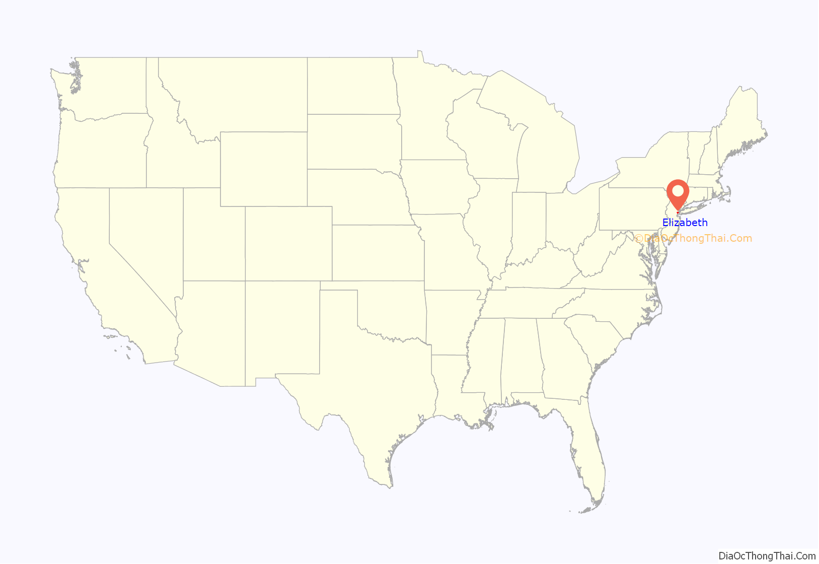
Elizabeth is a city and the county seat of Union County, in the U.S. state of New Jersey. As of the 2020 United States census, the city retained its ranking as the state’s fourth-most-populous city (behind neighboring Newark, Jersey City, and Paterson), with a population of 137,298, an increase of 12,329 (+9.9%) from the 2010 census count of 124,969, which in turn reflected an increase of 4,401 (3.7%) from the 120,568 counted in the 2000 census. The Census Bureau’s Population Estimates Program calculated that the city’s population was 134,283 in 2022, ranking the city the 210th-most-populous in the country, making it the fifth-most-populous municipality of any type in the state, falling behind Lakewood Township, where the population was estimated to be 139,506, as of that year.
| Name: | Elizabeth city |
|---|---|
| LSAD Code: | 25 |
| LSAD Description: | city (suffix) |
| State: | New Jersey |
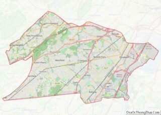
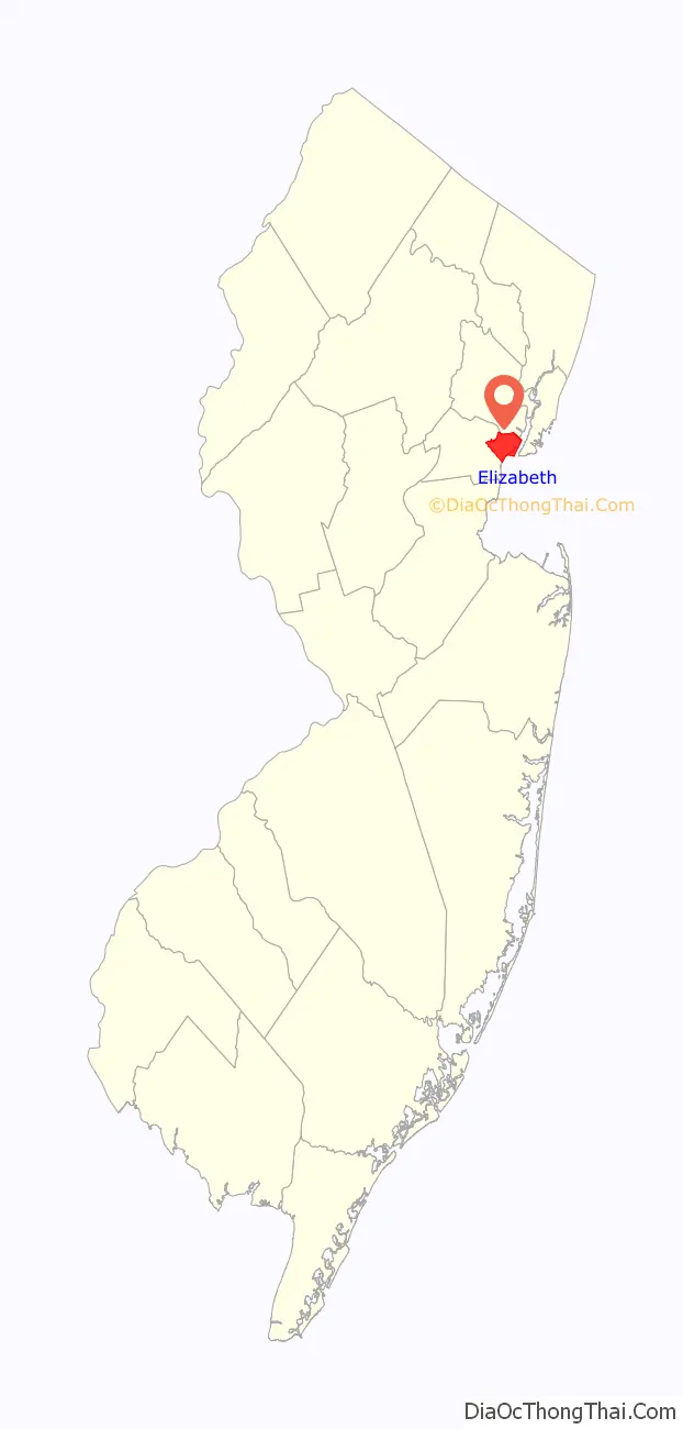
| County: | Union County |
| Founded: | 1664 |
| Incorporated: | March 13, 1855 |
| Elevation: | 16 ft (5 m) |
| Total Area: | 13.64 sq mi (35.32 km²) |
| Land Area: | 12.32 sq mi (31.91 km²) |
| Water Area: | 1.32 sq mi (3.42 km²) 9.78% |
| Total Population: | 137,298 |
| Population Density: | 11,145.22/sq mi (4,303.27/km²) |
| Area code: | 908 |
| FIPS code: | 3421000 |
| GNISfeature ID: | 0885205 |
| Website: | www.elizabethnj.org |
Online Interactive Map
Click on ![]() to view map in "full screen" mode.
to view map in "full screen" mode.
Elizabeth location map. Where is Elizabeth city?
History
Elizabeth, originally called “Elizabethtown” and part of the Elizabethtown Tract, was founded in 1664 by English settlers. The town was not named for Queen Elizabeth I as many people may assume, but rather for Elizabeth, wife of Sir George Carteret, one of the two original Proprietors of the colony of New Jersey. She was the daughter of Philippe de Carteret II, 3rd Seigneur de Sark and Anne Dowse. The town served as the first capital of New Jersey. During the American Revolutionary War, Elizabethtown was continually attacked by British forces based on Manhattan and Staten Island, culminating in the Battle of Springfield which decisively defeated British attempts to gain New Jersey. After independence, it was from Elizabethtown that George Washington embarked by boat to Manhattan for his 1789 inauguration. There are numerous memorials and monuments of the American Revolution in Elizabeth.
On March 13, 1855, the City of Elizabeth was created by an act of the New Jersey Legislature, combining and replacing both Elizabeth Borough (which dated back to 1740) and Elizabeth Township (which had been formed in 1693), subject to the results of a referendum held on March 27, 1855. On March 19, 1857, the city became part of the newly created Union County. Portions of the city were taken to form Linden Township on March 4, 1861.
The first major industry, the Singer Sewing Machine Company came to Elizabeth and employed as many as 2,000 people. In 1895, it saw one of the first car companies, when Electric Carriage and Wagon Company was founded to manufacture the Electrobat, joined soon by another electric car builder, Andrew L. Riker. The Electric Boat Company got its start building submarines for the United States Navy in Elizabeth, New Jersey, beginning with the launch of USS Holland (SS-1) in 1897. These pioneering naval craft [known as A-Class] were developed at Lewis Nixon’s Crescent Shipyard in Elizabeth between the years 1896–1903. Elizabeth grew in parallel to its sister city of Newark for many years, but has been more successful in retaining a middle-class presence and was mostly spared riots in the 1960s.
On September 18, 2016, a backpack holding five bombs was discovered outside NJ Transit’s Elizabeth train station. One bomb detonated accidentally when a bomb squad robot failed to disarm the contents of the backpack; no one was hurt. Police were initially unsure if this event was related to bombs in Seaside Park, New Jersey and Manhattan that had exploded the previous day. On September 19, police arrested Ahmad Khan Rahami, a 28-year-old Afghan-born naturalized U.S. citizen, for questioning in connection with all three incidents; the FBI considered Rahami, whose last known address was within 0.5 miles (0.8 km) of the train station, to be armed and dangerous.
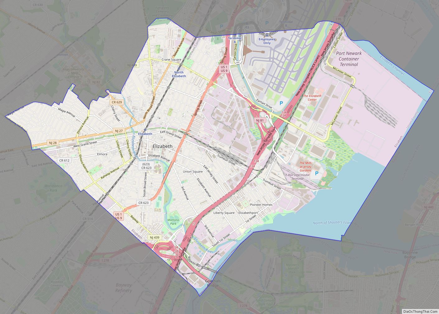
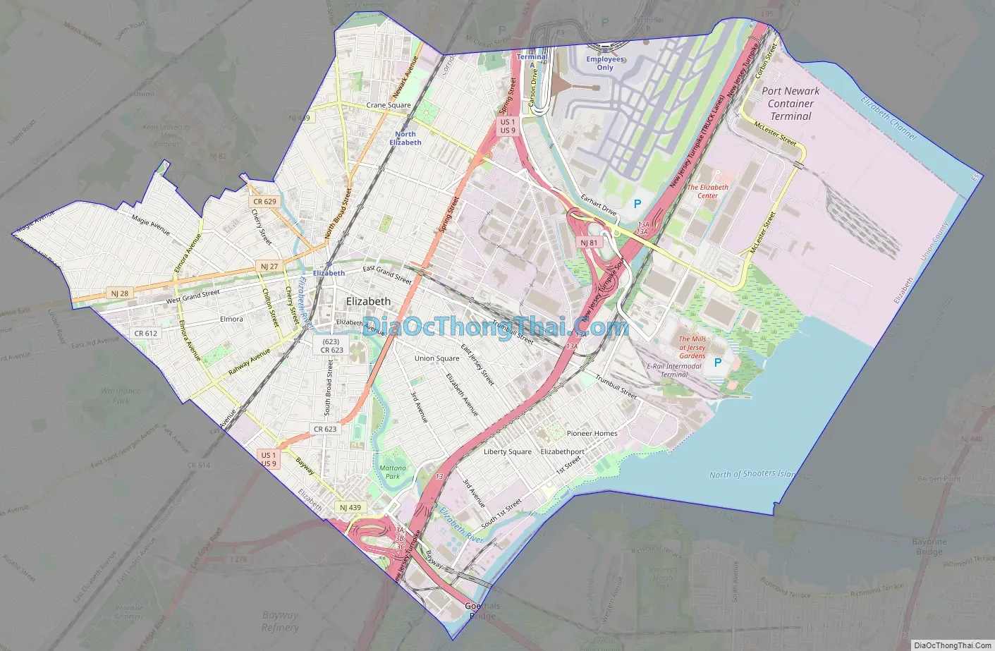
Elizabeth Road Map
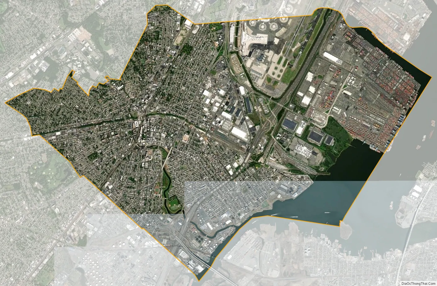
Elizabeth city Satellite Map
Geography
According to the U.S. Census Bureau, the city had a total area of 13.66 square miles (35.37 km), including 12.32 square miles (31.91 km) of land and 1.34 square miles (3.46 km) of water (9.78%).
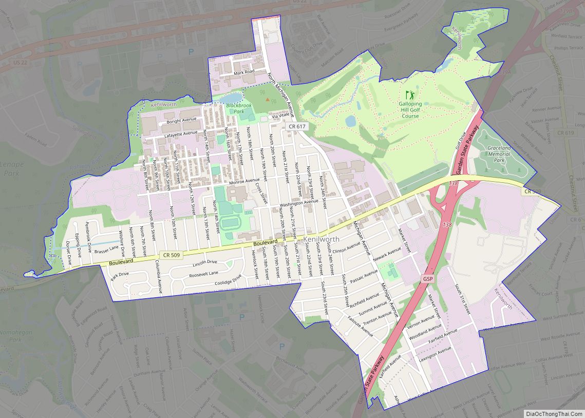
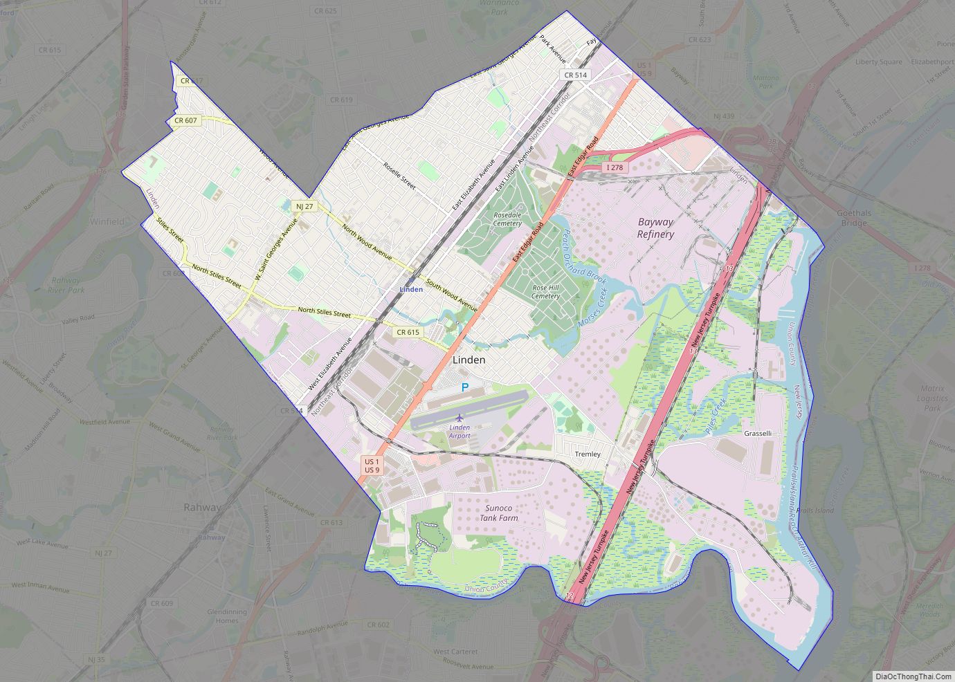
Elizabeth is bordered to the southwest by Linden, to the west by Roselle and Roselle Park, to the northwest by Union and Hillside, to the north by Newark (in Essex County). To the east the city is across Newark Bay from Bayonne in Hudson County and the Arthur Kill from Staten Island, New York.
The borders of Elizabeth, Bayonne, and Staten Island meet at one point on Shooters Island, of which 7.5 acres (3.0 ha) of the island is owned by Elizabeth, though the island is managed by the New York City Department of Parks and Recreation.
The Elizabeth River is a waterway that courses through the city for 4.2 miles (6.8 km) and is largely channelized, before draining into the Arthur Kill.
See also
Map of New Jersey State and its subdivision: Map of other states:- Alabama
- Alaska
- Arizona
- Arkansas
- California
- Colorado
- Connecticut
- Delaware
- District of Columbia
- Florida
- Georgia
- Hawaii
- Idaho
- Illinois
- Indiana
- Iowa
- Kansas
- Kentucky
- Louisiana
- Maine
- Maryland
- Massachusetts
- Michigan
- Minnesota
- Mississippi
- Missouri
- Montana
- Nebraska
- Nevada
- New Hampshire
- New Jersey
- New Mexico
- New York
- North Carolina
- North Dakota
- Ohio
- Oklahoma
- Oregon
- Pennsylvania
- Rhode Island
- South Carolina
- South Dakota
- Tennessee
- Texas
- Utah
- Vermont
- Virginia
- Washington
- West Virginia
- Wisconsin
- Wyoming