Newton, officially the Town of Newton, is an incorporated municipality and the county seat of Sussex County in the U.S. state of New Jersey, situated approximately 60 miles (97 km) northwest of New York City. As of the 2020 United States census, the town’s population was 8,374, its highest decennial population ever, an increase of 377 (+4.7%) from the 2010 census count of 7,997, which in turn reflected a decrease of 247 (−3.0%) from the 8,244 counted at the 2000 census.
One of 15 municipalities in the state organized as a town, the municipal government operates under a council-manager structure provided by the Faulkner Act, or Optional Municipal Charter Law. Newton was incorporated by an act of the New Jersey Legislature on April 11, 1864, from portions of Newton Township, which was also partitioned to create Andover Township and Hampton Township, and was then dissolved. Additional land was acquired from Andover Township in 1869 and 1927, and from Fredon Township in 1920.
| Name: | Newton town |
|---|---|
| LSAD Code: | 43 |
| LSAD Description: | town (suffix) |
| State: | New Jersey |
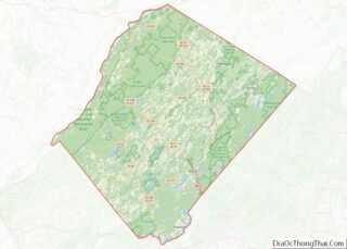
| County: | Sussex County |
| Incorporated: | April 11, 1864 |
| Elevation: | 663 ft (202 m) |
| Total Area: | 3.38 sq mi (8.76 km²) |
| Land Area: | 3.36 sq mi (8.70 km²) |
| Water Area: | 0.02 sq mi (0.06 km²) 0.65% |
| Total Population: | 8,374 |
| Population Density: | 2,492.3/sq mi (962.3/km²) |
| ZIP code: | 07860 |
| Area code: | 973 exchanges: 300, 383, 579, 940 |
| FIPS code: | 3451930 |
| GNISfeature ID: | 0885322 |
| Website: | www.newtontownhall.com |
Online Interactive Map
Click on ![]() to view map in "full screen" mode.
to view map in "full screen" mode.
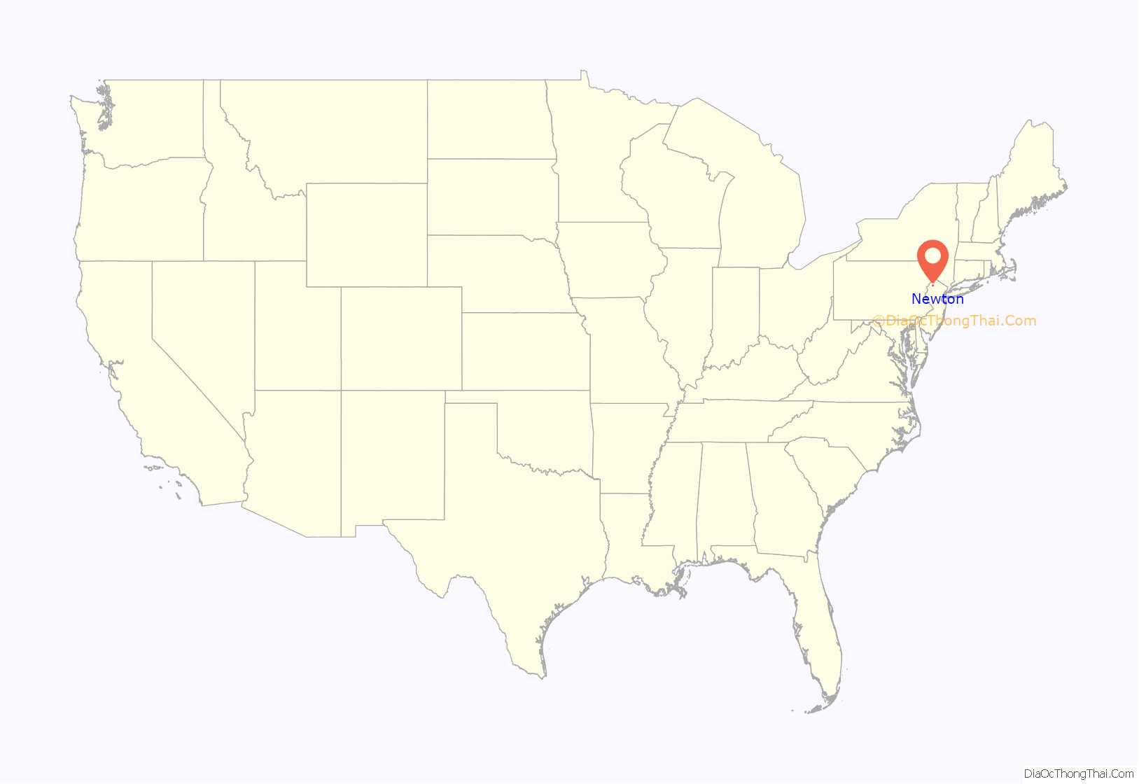
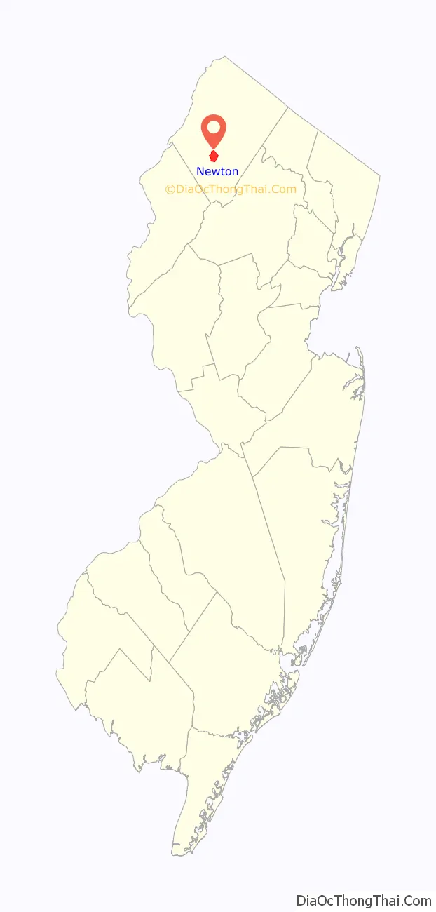
Newton location map. Where is Newton town?
History
In the eighteenth century
Newton is located near the headwaters of the east branch of the Paulins Kill, a 41.6-mile (66.9 km) tributary of the Delaware River. In October 1715, Colonial surveyor Samuel Green plotted a tract of 2,500 acres (1,000 ha) at the head of the Paulins Kill, then known as the Tohokenetcunck River, on behalf of William Penn. This tract, which would not be settled for approximately 30–35 years, was part of the survey and division of the last acquisition of Native American land by the West Jersey Board of Proprietors. At the time of Green’s survey, northwestern New Jersey was populated with bands of the Munsee, the northern branch of the Lenape Native Americans.
The first recorded European settler within the boundaries of present-day Newton was a German Palatine immigrant named Henry Hairlocker who arrived sometime before 1751 when he appears in Morris County records as receiving a tavern license. The Newtown Precinct, a large township, was created in 1751, and Sussex County was created from Morris two years later on June 8, 1753. The township would be named Newtown after the colonial village of Newtown in Queens, New York from where the Pettit family originated (the six Pettit brothers, all prominent landowners and influential figures in early local government, settled in northwestern New Jersey in the 1740s) or from its status as a “new town”.
In 1762, Jonathan Hampton, of Elizabethtown, surveyed the location for a county courthouse and town green at the intersection of a military supply road he built during the French and Indian War and a major north–south artery called the King’s Highway (present-day New Jersey Route 94). The construction of the courthouse was completed in 1765 and the village that developed around it became known as Sussex Court House. The county courthouse was the site of a raid by British partisan Lieutenant James Moody during the American Revolution.
In 1797, the village’s post office was renamed Newtown and later, in 1825, the spelling was altered to Newton. Newton Township would cede land to create new townships on several occasions in the eighteenth and nineteenth-centuries, until a final division dissolved the township on April 11, 1864, through a legislative act of New Jersey Legislature that created the village of Newton as an incorporated town and two rural townships—Hampton and Andover.
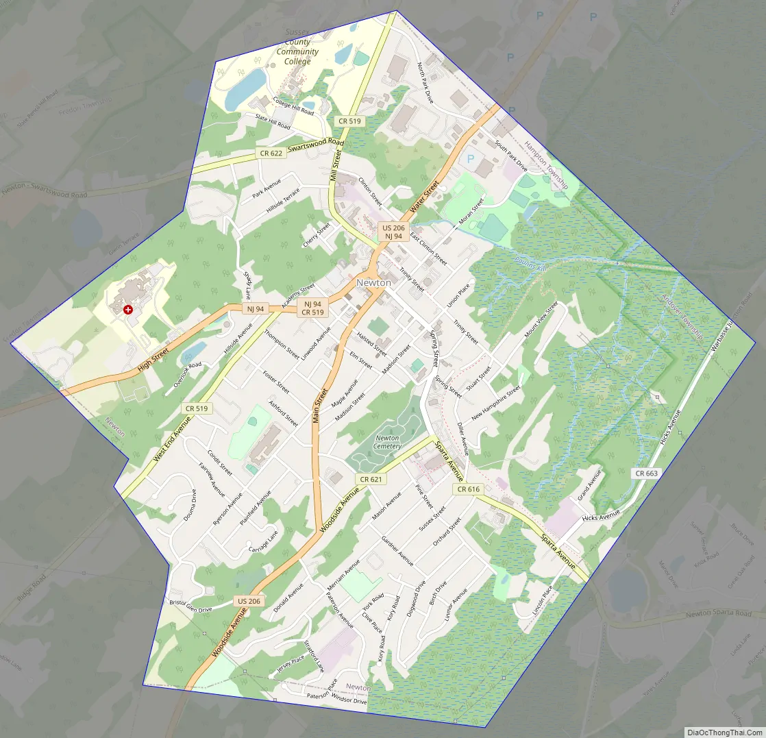
Newton Road Map
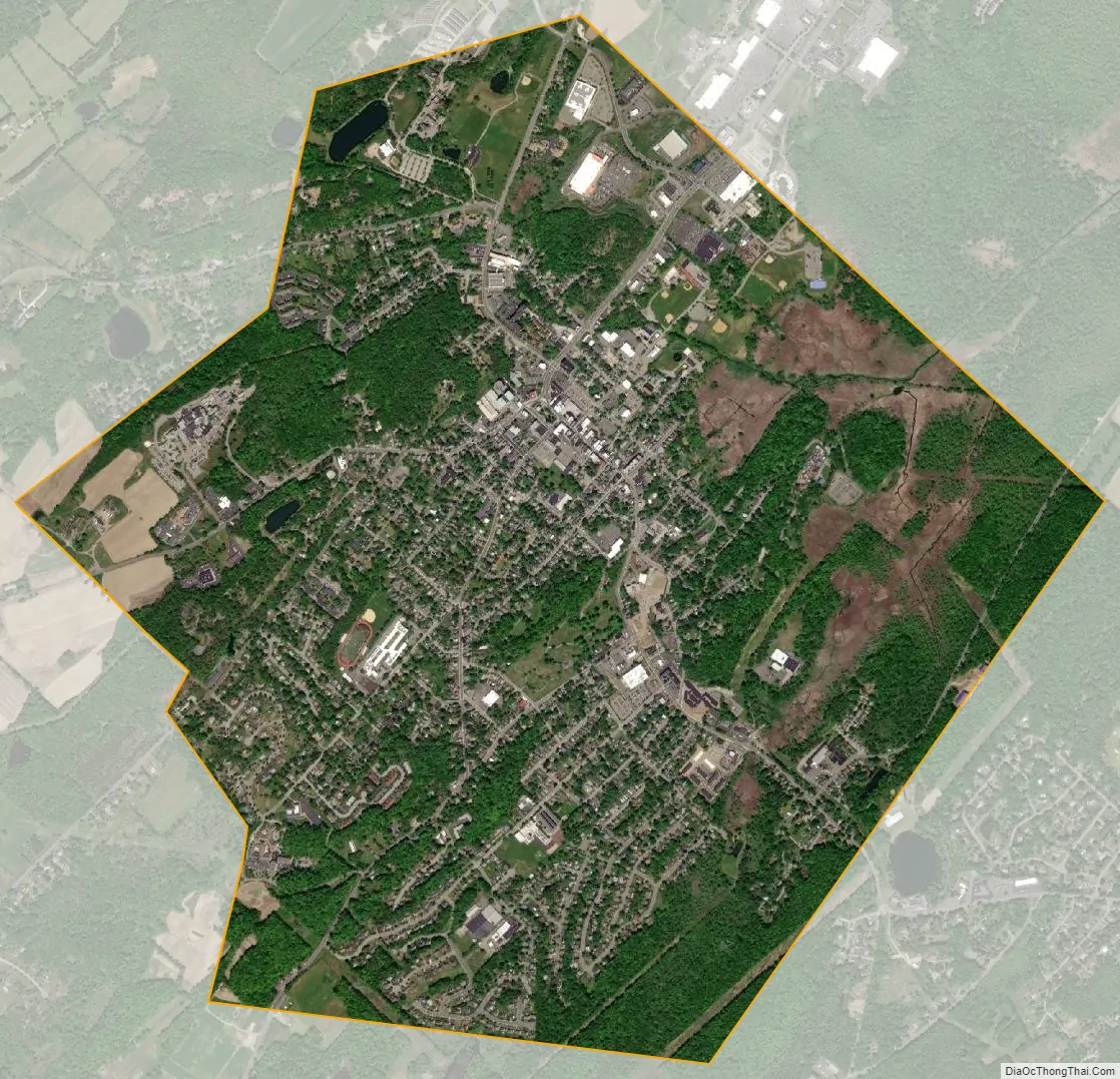
Newton city Satellite Map
Geography
Geological features
Newton is located in the Kittatinny Valley, a segment of the Great Appalachian Valley. The Great Appalachian Valley is a gigantic trough—a 1,200-mile-long (1,900 km) chain of valley lowlands that stretches about from Quebec to Alabama and is the easternmost edge of Ridge and Valley Appalachians physiographic province. This physiographic province, one of five in New Jersey, occupies approximately two-thirds of the county’s area (the county’s western and central sections) dominated by Kittatinny Mountain and the Kittatinny Valley. This province’s contour is characterized by long, even ridges with long, continuous valleys in between that generally run parallel from southwest to northeast. The features of the Ridge and Valley province were created approximately 300–400 million years ago during the Ordovician period and Appalachian orogeny—a period of tremendous pressure and rock thrusting that caused the creation of the Appalachian Mountains. This region is largely formed by sedimentary rock.
Newton’s land area drains into the watersheds of the Paulins Kill and Pequest River—two rivers that are tributaries of the Delaware River. These watersheds are separated by slate ridges that are part of the Martinsburg Formation. These slate ridges were quarried for slate for roofs and other industrial purposes beginning with a quarry opened by Elijah Blackwell in 1859 that operated under a series of different owners and commercial entities until 1930.
Political geography
According to the United States Census Bureau, the town had a total area of 3.38 square miles (8.76 km), including 3.36 square miles (8.70 km) of land and 0.02 square miles (0.06 km) of water (0.65%).
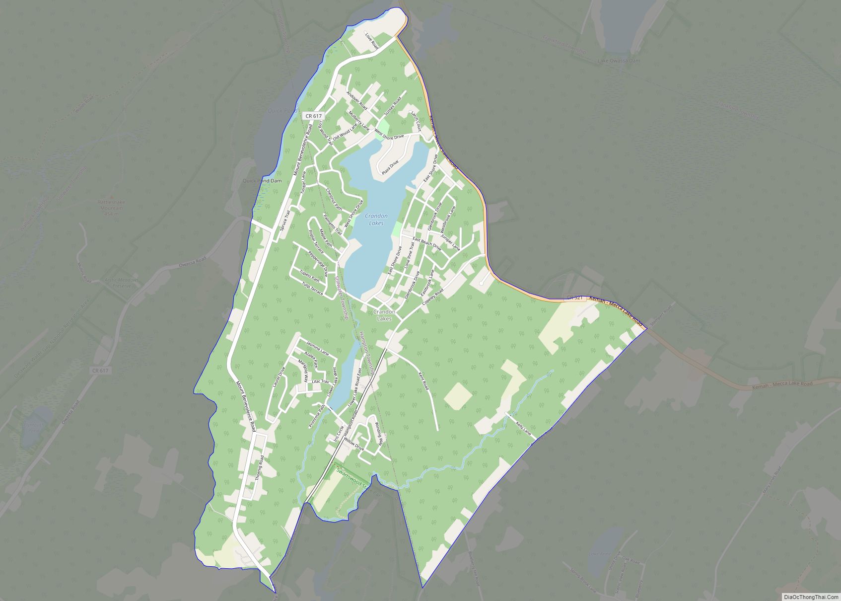
The Town of Newton is bordered to the north and east by Hampton Township, to the west by Fredon Township, and to the south by Andover Township.
Climate and weather
Because of its location in the higher elevations of northwestern New Jersey’s Appalachian mountains, Newton, as well as the rest of Sussex County, has a cooler humid continental climate or microthermal climate (Köppen climate classification Dfb) which indicates patterns of significant precipitation in all seasons and at least four months where the average temperature rises above 10 °C (50 °F) This differs from the rest of the state which is generally a humid mesothermal climate, in which temperatures range between −3 °C (27 °F) and 18 °C (64 °F) during the year’s coldest month. Sussex County is part of USDA Plant Hardiness Zone 6.
During winter and early spring, New Jersey in some years is subject to “nor’easters”—significant storm systems that have proven capable of causing blizzards or flooding throughout the northeastern United States. Hurricanes and tropical storms, tornadoes, and earthquakes are relatively rare. The Kittatinny Valley to the north of Newton, part of the Great Appalachian Valley, experiences a snowbelt phenomenon and has been categorized as a microclimate region known as the “Sussex County Snow Belt.” This region receives approximately 40 to 50 inches (1,000 to 1,300 mm) of snow per year and generally more snowfall that the rest of Northern New Jersey and the Northern Climate Zone. This phenomenon is attributed to the orographic lift of the Kittatinny Ridge which impacts local weather patterns by increasing humidity and precipitation.
In recent years, average temperatures in the county seat of Newton have ranged from a low of 17 °F (−8 °C) in January to a high of 84 °F (29 °C) in July. Average monthly precipitation ranged from 2.86 inches (73 mm) in February to 4.76 inches (121 mm) in June.
According to the USDA Natural Resource Conservation Service soil survey, the area receives sunshine approximately 62% of the time in summer and 48% in winter. Prevailing winds are typically from the southwest for most of year; but in late winter and early spring come from the northwest. The lowest recorded temperature was −26 °F on January 21, 1994. The highest recorded temperature was 104 °F (40 °C) on September 3, 1953. The heaviest one-day snowfall was 24 inches (610 mm) recorded on January 8, 1996 (combined with the next day, total snowfall was 40 inches). The heaviest one-day rainfall—6.70 inches (170 mm)— was recorded on August 19, 1955.
See also
Map of New Jersey State and its subdivision: Map of other states:- Alabama
- Alaska
- Arizona
- Arkansas
- California
- Colorado
- Connecticut
- Delaware
- District of Columbia
- Florida
- Georgia
- Hawaii
- Idaho
- Illinois
- Indiana
- Iowa
- Kansas
- Kentucky
- Louisiana
- Maine
- Maryland
- Massachusetts
- Michigan
- Minnesota
- Mississippi
- Missouri
- Montana
- Nebraska
- Nevada
- New Hampshire
- New Jersey
- New Mexico
- New York
- North Carolina
- North Dakota
- Ohio
- Oklahoma
- Oregon
- Pennsylvania
- Rhode Island
- South Carolina
- South Dakota
- Tennessee
- Texas
- Utah
- Vermont
- Virginia
- Washington
- West Virginia
- Wisconsin
- Wyoming