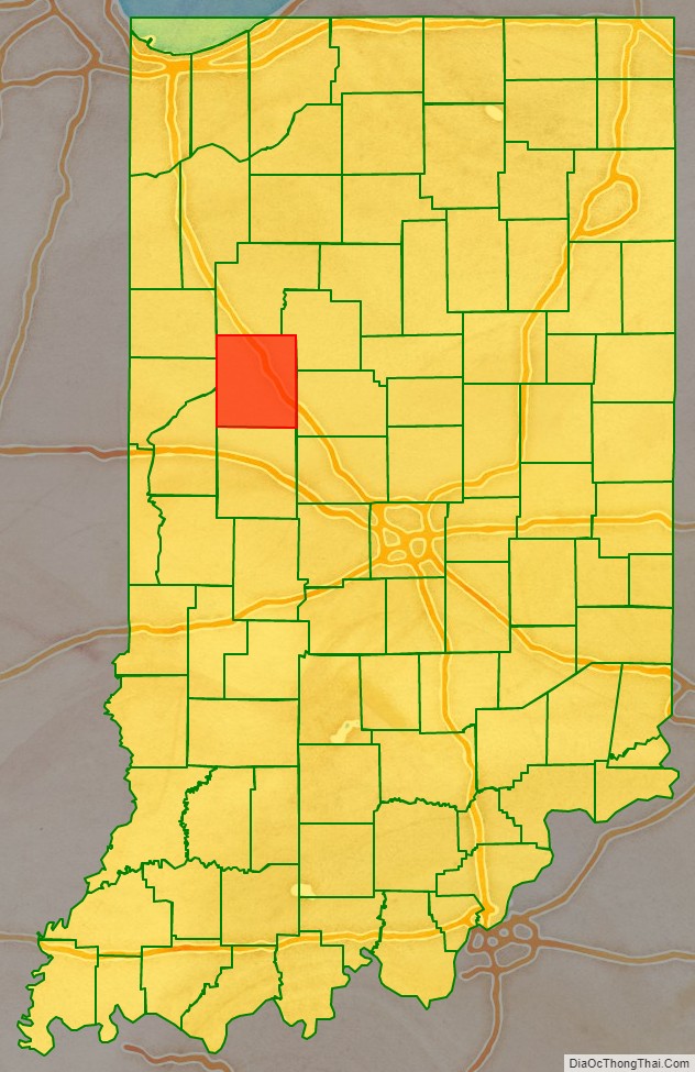
Tippecanoe County is located in the west-central portion of the U.S. state of Indiana about 22 miles east of the Illinois state line and less than 50 miles from the Chicago and the Indianapolis metro areas. As of the 2010 census, the population was 172,780. The county seat and largest city is Lafayette. It was created in 1826 from Wabash County portion of New Purchase and unorganized territory.
Tippecanoe County was formed March 1, 1826, and named for the anglicization of “Kiteepihkwana”, a Miami people term meaning “place of the buffalo fish people.” The county is best known for Purdue University, the 1811 Battle of Tippecanoe, and the Tippecanoe County Courthouse, a structure built in 1881 and included in the National Register of Historic Places.
Tippecanoe County is part of the Lafayette, Indiana, Metropolitan Statistical Area.
| Name: | Tippecanoe County |
|---|---|
| FIPS code: | 18-157 |
| State: | Indiana |
| Founded: | March 1, 1826 |
| Named for: | Kethtippecanoogi (“Place of the Succor Fish People” in Miami) |
| Seat: | Lafayette |
| Largest city: | Lafayette |
| Total Area: | 503.24 sq mi (1,303.4 km²) |
| Land Area: | 499.81 sq mi (1,294.5 km²) |
| Population Density: | 381/sq mi (147/km²) |
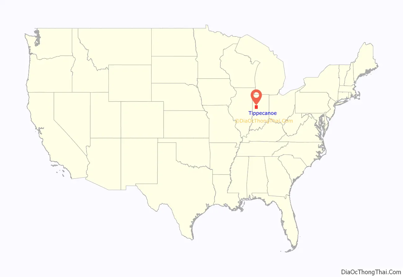
Tippecanoe County location map. Where is Tippecanoe County?
History
The history of Tippecanoe County spans six distinct political and cultural periods: Native American lands from at least 8000BC, including the Mississippian culture, French occupation (part of New France beginning in the 1670s), British occupation starting in 1763, part of the United States Northwest Territory in 1787, part of Indiana Territory in 1800, and finally part of the State of Indiana in 1816. The political organization of the county began in 1826 by the act of the Indiana Legislature.
The first European explorers arrived in the 1670s and the first permanent settlement was Fort Ouiatenon by the French established in 1717. Lafayette was platted in 1825 and Purdue University founded in 1869.
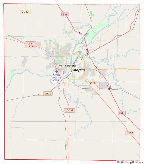
Tippecanoe County Road Map
Geography
According to the 2010 census, the county has a total area of 503.24 square miles (1,303.4 km), of which 499.81 square miles (1,294.5 km) (or 99.32%) is land and 3.44 square miles (8.9 km) (or 0.68%) is water. The county’s highest point is in the Lauramie Township.
Adjacent counties
- White County (north)
- Carroll County (northeast)
- Clinton County (east)
- Montgomery County (south)
- Fountain County (southwest)
- Warren County (west)
- Benton County (northwest)
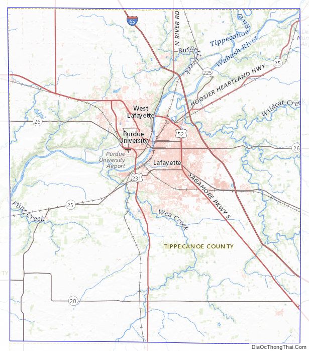
Tippecanoe County Topographic Map
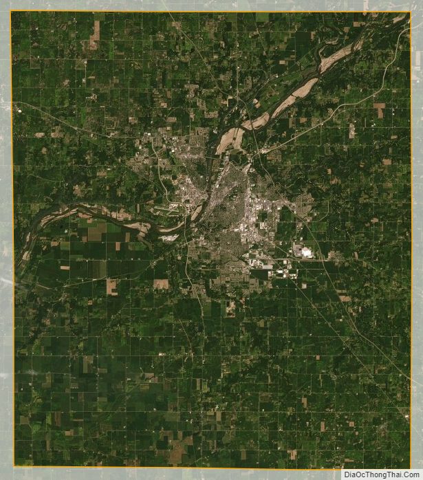
Tippecanoe County Satellite Map
Tippecanoe County Outline Map