Lafayette (/ˌlɑːfiːˈɛt, ˌlæf-/ LAH-fee-ET, LAF-ee-ET) is a city in and the county seat of Tippecanoe County, Indiana, United States, located 63 miles (101 km) northwest of Indianapolis and 125 miles (201 km) southeast of Chicago. West Lafayette, on the other side of the Wabash River, is home to Purdue University, which contributes significantly to both communities. Together, Lafayette and West Lafayette form the core of the Lafayette metropolitan area, which had a population of 224,709 in the 2021 US Census Bureau estimates.
According to the 2020 United States Census, the population of Lafayette was 70,783, a 25% increase from 56,397 in 2000. Meanwhile, the 2020 Census listed the neighboring city of West Lafayette at 44,595 and the Tippecanoe County population at 186,291.
Lafayette was founded in 1825 on the southeast bank of the Wabash River near where the river becomes impassable for riverboats upstream, though a French fort and trading post had existed since 1717 on the opposite bank and three miles downstream. It was named for the French general Marquis de Lafayette, a Revolutionary War hero.
| Name: | Lafayette city |
|---|---|
| LSAD Code: | 25 |
| LSAD Description: | city (suffix) |
| State: | Indiana |
| County: | Tippecanoe County |
| Incorporated: | 1853 |
| Elevation: | 692 ft (211 m) |
| Land Area: | 29.38 sq mi (76.09 km²) |
| Water Area: | 0.13 sq mi (0.33 km²) |
| Population Density: | 2,409.39/sq mi (930.27/km²) |
| ZIP code: | 47901, 47904, 47905, 47909 |
| Area code: | 765 |
| FIPS code: | 1840788 |
| GNISfeature ID: | 437501 |
| Website: | www.lafayette.in.gov |
Online Interactive Map
Click on ![]() to view map in "full screen" mode.
to view map in "full screen" mode.
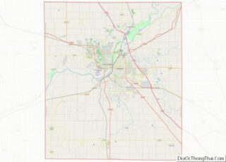
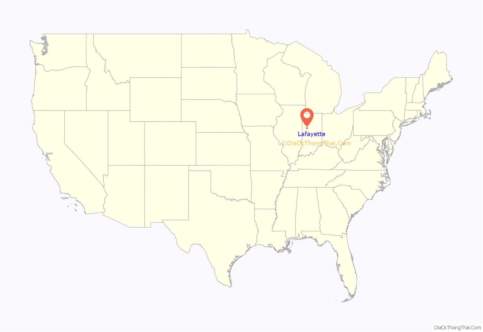
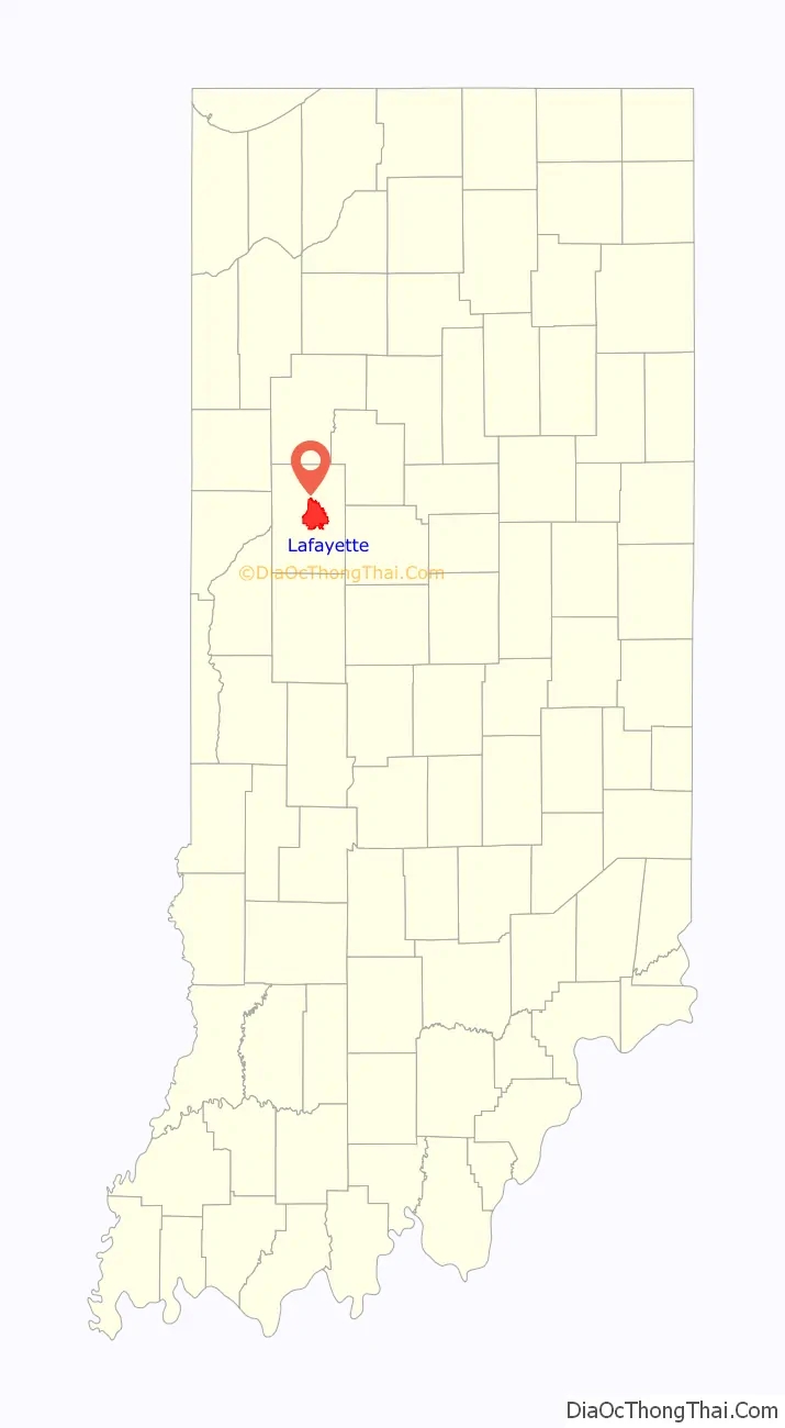
Lafayette location map. Where is Lafayette city?
History
When European explorers arrived at this area, it was inhabited by a tribe of Miami Indians known as the Ouiatenon or Weas. In 1717, the French government established Fort Ouiatenon across the Wabash River and three miles (5 km) south of present-day Lafayette. The fort became the center of trade for fur trappers, merchants and Indians. An annual reenactment and festival known as Feast of the Hunters’ Moon is held there each autumn.
The town of Lafayette was platted in May 1825 by William Digby, a trader. It was designated as the county seat of the newly formed Tippecanoe County the following year. Like many frontier towns, Lafayette was named for General Lafayette, a French officer who significantly aided George Washington’s Continental Army during the American Revolutionary War. Lafayette toured the United States in 1824 and 1825.
In its earliest days, Lafayette was a shipping center on the Wabash River. In 1838, Henry Leavitt Ellsworth, the first United States Patent Commissioner, published a booklet titled Valley of the Upper Wabash, Indiana, with Hints on Its Agricultural Advantages, to promote settlement of the region. By 1845, Ellsworth had purchased 93,000 acres (380 km) of farmland around Lafayette and moved there from Connecticut to supervise land sales. By 1847 Ellsworth was distributing broadsides looking for farmers to purchase his farmland. He became president of the Tippecanoe County Agricultural Society in April 1851 – despite some local resentment over what was called “the Yale Crowd” – but he was defeated the same year when he ran for the Indiana House of Representatives. Ellsworth Street and Ellsworth Historic District are named for him.
The Wabash and Erie Canal in the 1840s stimulated trade and affirmed Lafayette’s regional prominence. Railroads arrived in the town in the 1850s, connecting it with other major markets. The Monon Railroad connected Lafayette with other sections of Indiana.
Lafayette was the site of the first official airmail delivery in the United States on 17 August 1859, when John Wise piloted a balloon starting on the Lafayette courthouse grounds. Wise hoped to reach New York; however, weather conditions forced the balloon down near Crawfordsville, Indiana, and the mail reached its final destination by train. In 1959, the US Postal Service issued a 7¢ airmail stamp commemorating the centennial of the event.
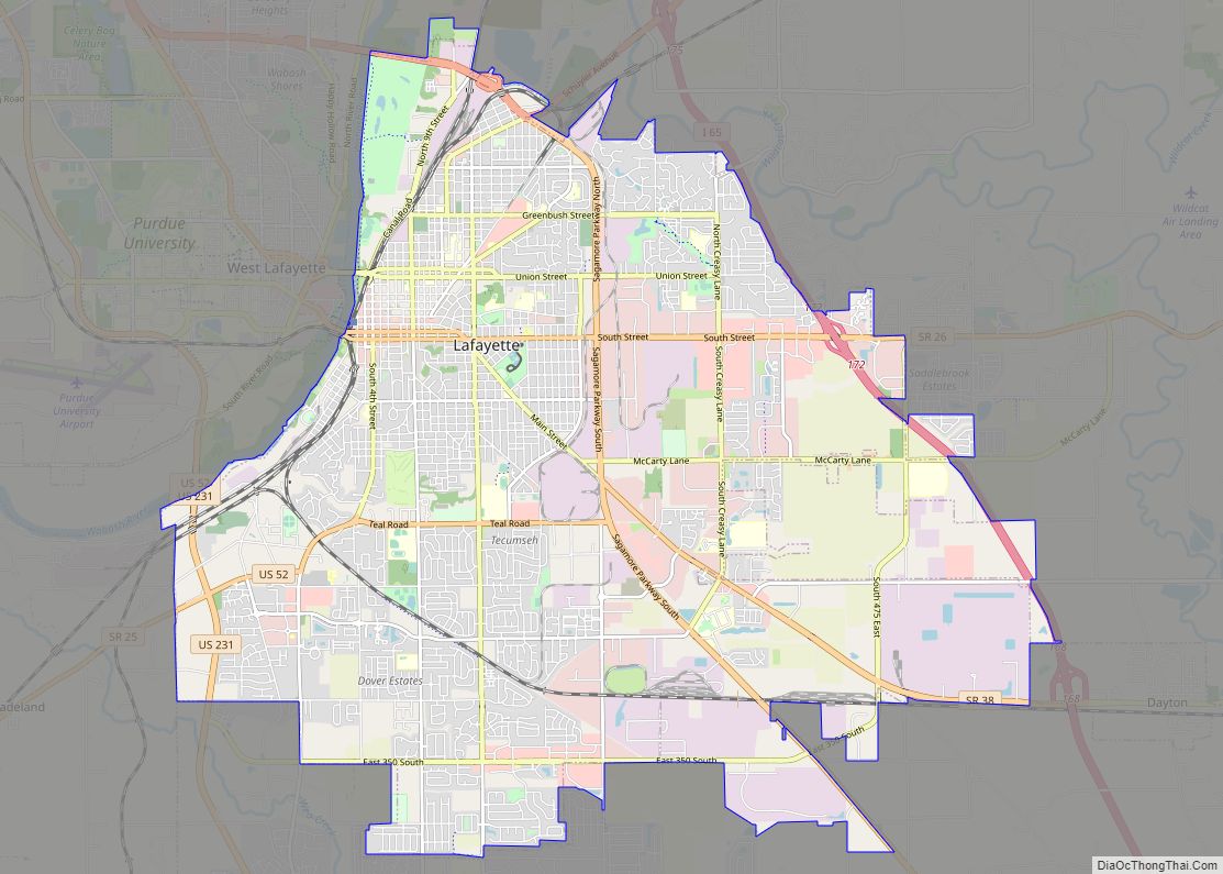
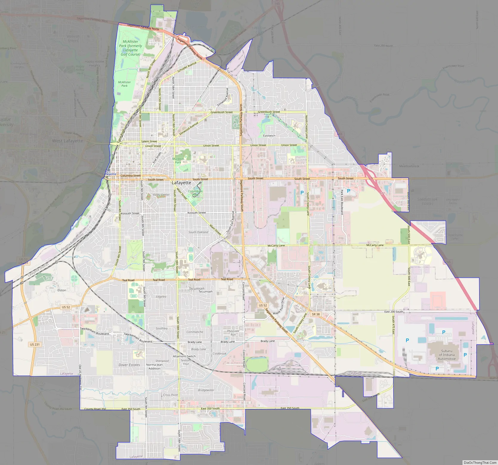
Lafayette Road Map
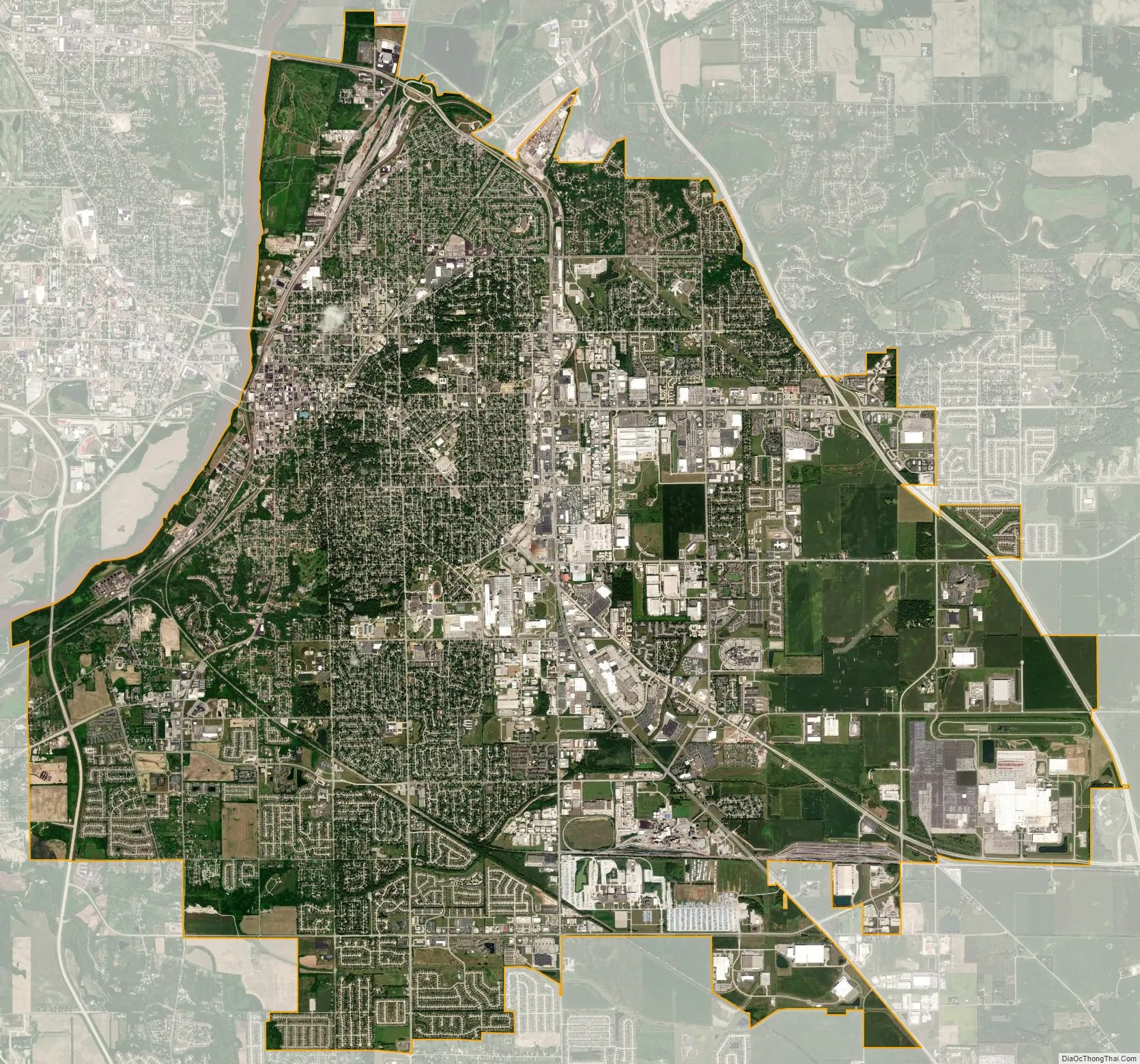
Lafayette city Satellite Map
Geography
Lafayette is located at 40°24′38″N 86°52′29″W / 40.410585°N 86.874681°W / 40.410585; -86.874681 (40.410585, −86.874681) and is located in Fairfield and Wea Townships. Elevation at the court house is 550 feet (168 m), but city elevations range from a little over 500 feet (150 m) at the Wabash River to approximately 700 feet (210 m) in the areas of Murdock Park and Columbian Park.
According to the 2010 census, Lafayette has a total area of 27.74 square miles (71.85 km), all land.
Neighborhoods
- Columbian Park [3]
- Hanna
- Hedgewood
- Lincoln
- Monon
- Saint Lawrence/McAllister
- Vinton
- Wallace Triangle
- Wildcat Valley
Historic Neighborhoods
- Centennial Neighborhood District
- Downtown Lafayette Historic District
- Ellsworth Historic District
- Highland Park Neighborhood Historic District
- Jefferson Historic District
- Ninth Street Hill Neighborhood Historic District
- Perrin Historic District
- St. Mary Historic District
- Upper Main Street Historic District
Climate
In recent years, temperatures in Lafayette have ranged from an average low of 17 °F (−8 °C) in January to a high of 86 °F (30 °C) in July, although a record low of −33 °F (−36 °C) was recorded in January 1985 and again in January 1994; and a record high of 105 °F (41 °C) was recorded in June 1988. Average monthly precipitation ranged from 1.58 inches (40 mm) in February to 4.24 inches (108 mm) in June.
See also
Map of Indiana State and its subdivision:- Adams
- Allen
- Bartholomew
- Benton
- Blackford
- Boone
- Brown
- Carroll
- Cass
- Clark
- Clay
- Clinton
- Crawford
- Daviess
- De Kalb
- Dearborn
- Decatur
- Delaware
- Dubois
- Elkhart
- Fayette
- Floyd
- Fountain
- Franklin
- Fulton
- Gibson
- Grant
- Greene
- Hamilton
- Hancock
- Harrison
- Hendricks
- Henry
- Howard
- Huntington
- Jackson
- Jasper
- Jay
- Jefferson
- Jennings
- Johnson
- Knox
- Kosciusko
- LaGrange
- Lake
- Lake Michigan
- LaPorte
- Lawrence
- Madison
- Marion
- Marshall
- Martin
- Miami
- Monroe
- Montgomery
- Morgan
- Newton
- Noble
- Ohio
- Orange
- Owen
- Parke
- Perry
- Pike
- Porter
- Posey
- Pulaski
- Putnam
- Randolph
- Ripley
- Rush
- Saint Joseph
- Scott
- Shelby
- Spencer
- Starke
- Steuben
- Sullivan
- Switzerland
- Tippecanoe
- Tipton
- Union
- Vanderburgh
- Vermillion
- Vigo
- Wabash
- Warren
- Warrick
- Washington
- Wayne
- Wells
- White
- Whitley
- Alabama
- Alaska
- Arizona
- Arkansas
- California
- Colorado
- Connecticut
- Delaware
- District of Columbia
- Florida
- Georgia
- Hawaii
- Idaho
- Illinois
- Indiana
- Iowa
- Kansas
- Kentucky
- Louisiana
- Maine
- Maryland
- Massachusetts
- Michigan
- Minnesota
- Mississippi
- Missouri
- Montana
- Nebraska
- Nevada
- New Hampshire
- New Jersey
- New Mexico
- New York
- North Carolina
- North Dakota
- Ohio
- Oklahoma
- Oregon
- Pennsylvania
- Rhode Island
- South Carolina
- South Dakota
- Tennessee
- Texas
- Utah
- Vermont
- Virginia
- Washington
- West Virginia
- Wisconsin
- Wyoming