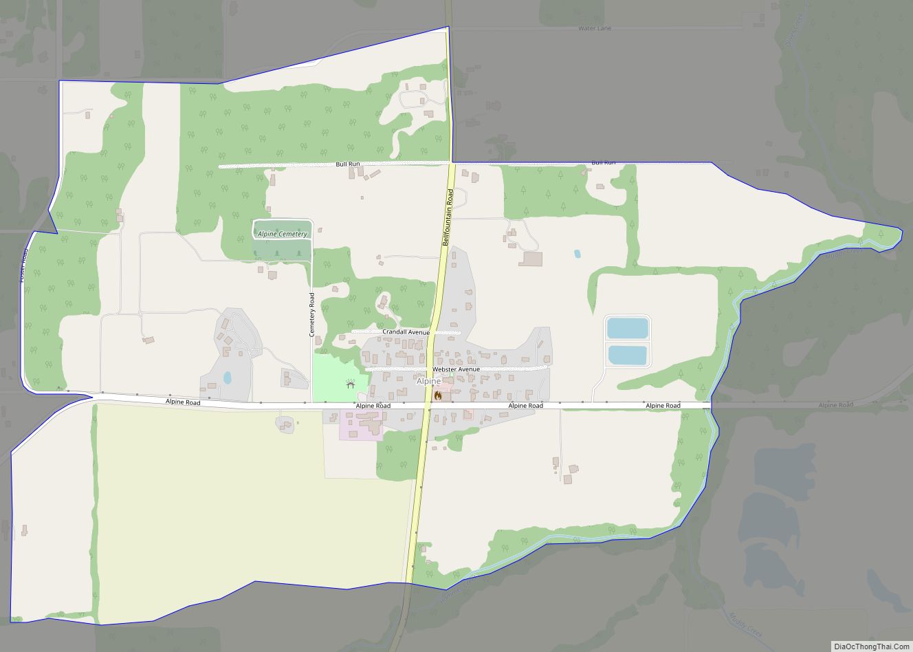
Alpine is an unincorporated rural community and census-designated place in Benton County, Oregon, United States. It is west of Monroe off Oregon Route 99W. As of the 2010 Census, the population was 171.
| Name: | Alpine CDP |
|---|---|
| LSAD Code: | 57 |
| LSAD Description: | CDP (suffix) |
| State: | Oregon |
| County: | Benton County |
| FIPS code: | 4101700 |
Online Interactive Map
Click on ![]() to view map in "full screen" mode.
to view map in "full screen" mode.
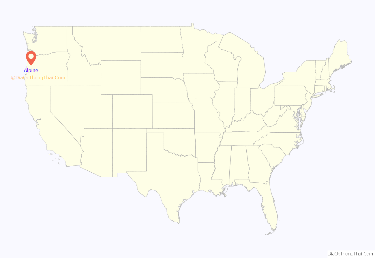
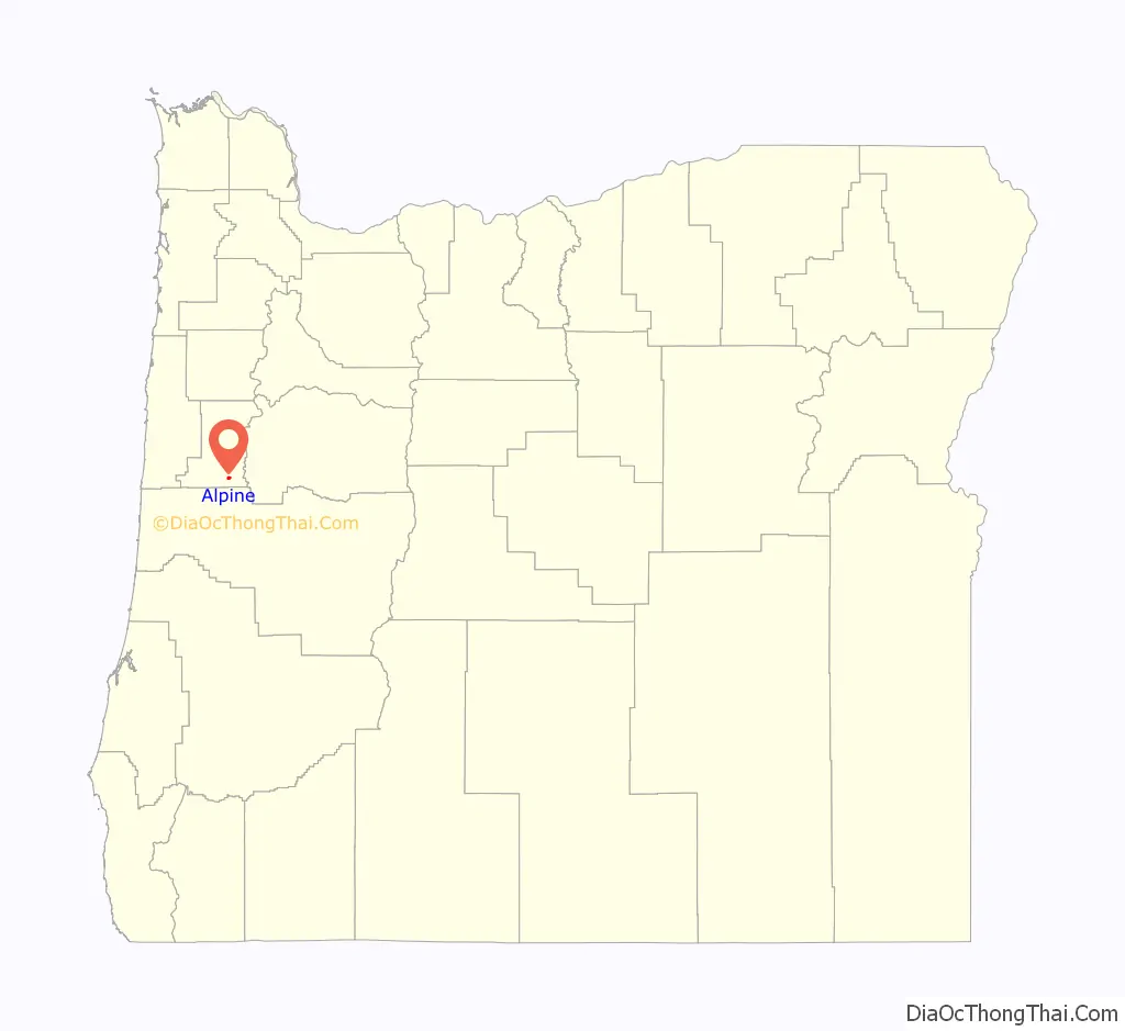
Alpine location map. Where is Alpine CDP?
History
Alpine was so named because it is on the top of one of the foothills of the Central Oregon Coast Range. It is noted that the “situation is not particularly alpine in character”. Alpine School operated for several years before there was a settlement in the location, thus the community took its name from the school. In 1908, the Corvallis and Alsea River Railway Company began construction of a line that ended in the settlement of Alpine when funding ran out. The community has burned three times since its heyday in the early 1900s. A post office was established in 1912 and operated until 1976. Alpine now has a Monroe mailing address. Alpine Elementary School closed in 2003. When the Alpine Market closed in 2004, the Alpine Tavern (built in 1936) started selling groceries. In 2005, a vintage photograph of the tavern was featured in a Miller Beer advertisement, and the market was due to be razed.
As of November 2019, the Alpine Tavern was still a thriving business in the community, preserving area history.
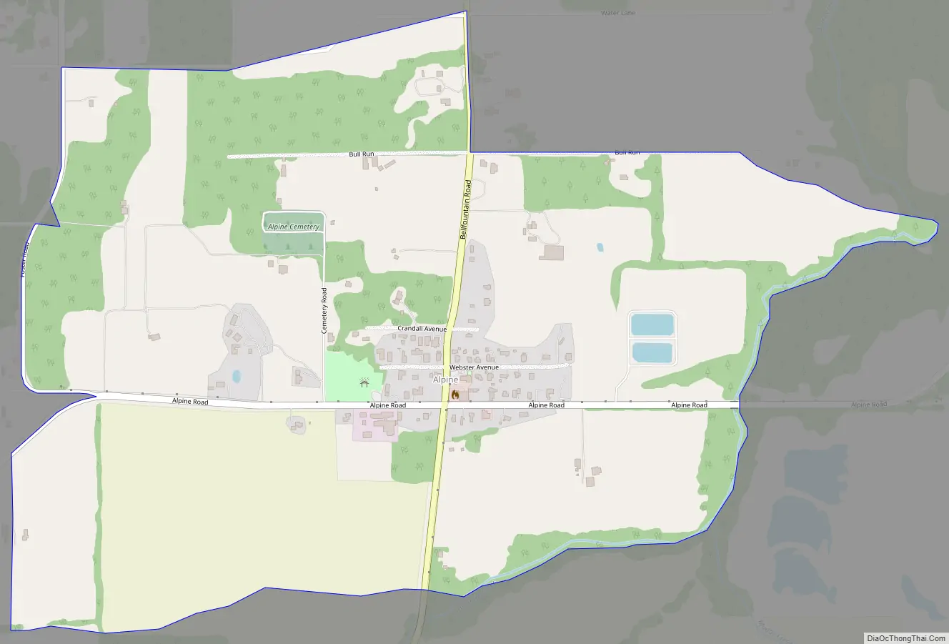
Alpine Road Map
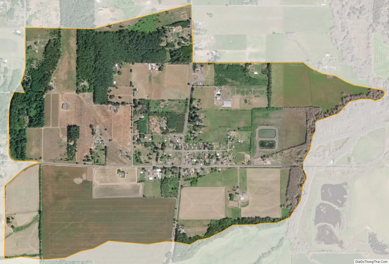
Alpine city Satellite Map
See also
Map of Oregon State and its subdivision: Map of other states:- Alabama
- Alaska
- Arizona
- Arkansas
- California
- Colorado
- Connecticut
- Delaware
- District of Columbia
- Florida
- Georgia
- Hawaii
- Idaho
- Illinois
- Indiana
- Iowa
- Kansas
- Kentucky
- Louisiana
- Maine
- Maryland
- Massachusetts
- Michigan
- Minnesota
- Mississippi
- Missouri
- Montana
- Nebraska
- Nevada
- New Hampshire
- New Jersey
- New Mexico
- New York
- North Carolina
- North Dakota
- Ohio
- Oklahoma
- Oregon
- Pennsylvania
- Rhode Island
- South Carolina
- South Dakota
- Tennessee
- Texas
- Utah
- Vermont
- Virginia
- Washington
- West Virginia
- Wisconsin
- Wyoming