Eugene (/juːˈdʒiːn/ yoo-JEEN) is the second largest city in the U.S. state of Oregon and the seat of Lane County. It is located at the southern end of the Willamette Valley, near the confluence of the McKenzie and Willamette rivers, about 50 miles (80 km) east of the Oregon Coast.
As of the 2020 United States Census, Eugene had a population of 176,654 and covers city area of 44.21 sq mi (114.5 km). The Eugene-Springfield metropolitan statistical area is the third largest in Oregon behind those of Portland and Salem. In 2022, Eugene’s population was estimated to have reached 179,887.
Eugene is home to the University of Oregon, Bushnell University, and Lane Community College. The city is noted for its natural environment, recreational opportunities (especially bicycling, running/jogging, rafting, and kayaking), and focus on the arts, along with its history of civil unrest, protests, and green activism. Eugene’s official slogan is “A Great City for the Arts and Outdoors”. It is also referred to as the “Emerald City” and as “Track Town, USA”. The Nike corporation had its beginnings in Eugene. In July 2022, the city hosted the 18th World Athletics Championship.
| Name: | Eugene city |
|---|---|
| LSAD Code: | 25 |
| LSAD Description: | city (suffix) |
| State: | Oregon |
| County: | Lane County |
| Founded: | 1846 |
| Incorporated: | October 17, 1862 |
| Elevation: | 430 ft (131 m) |
| Land Area: | 44.22 sq mi (114.52 km²) |
| Water Area: | 0.07 sq mi (0.18 km²) |
| Population Density: | 3,995.07/sq mi (1,542.50/km²) |
| Area code: | 458 and 541 |
| FIPS code: | 4123850 |
| GNISfeature ID: | 1120527 |
| Website: | www.eugene-or.gov |
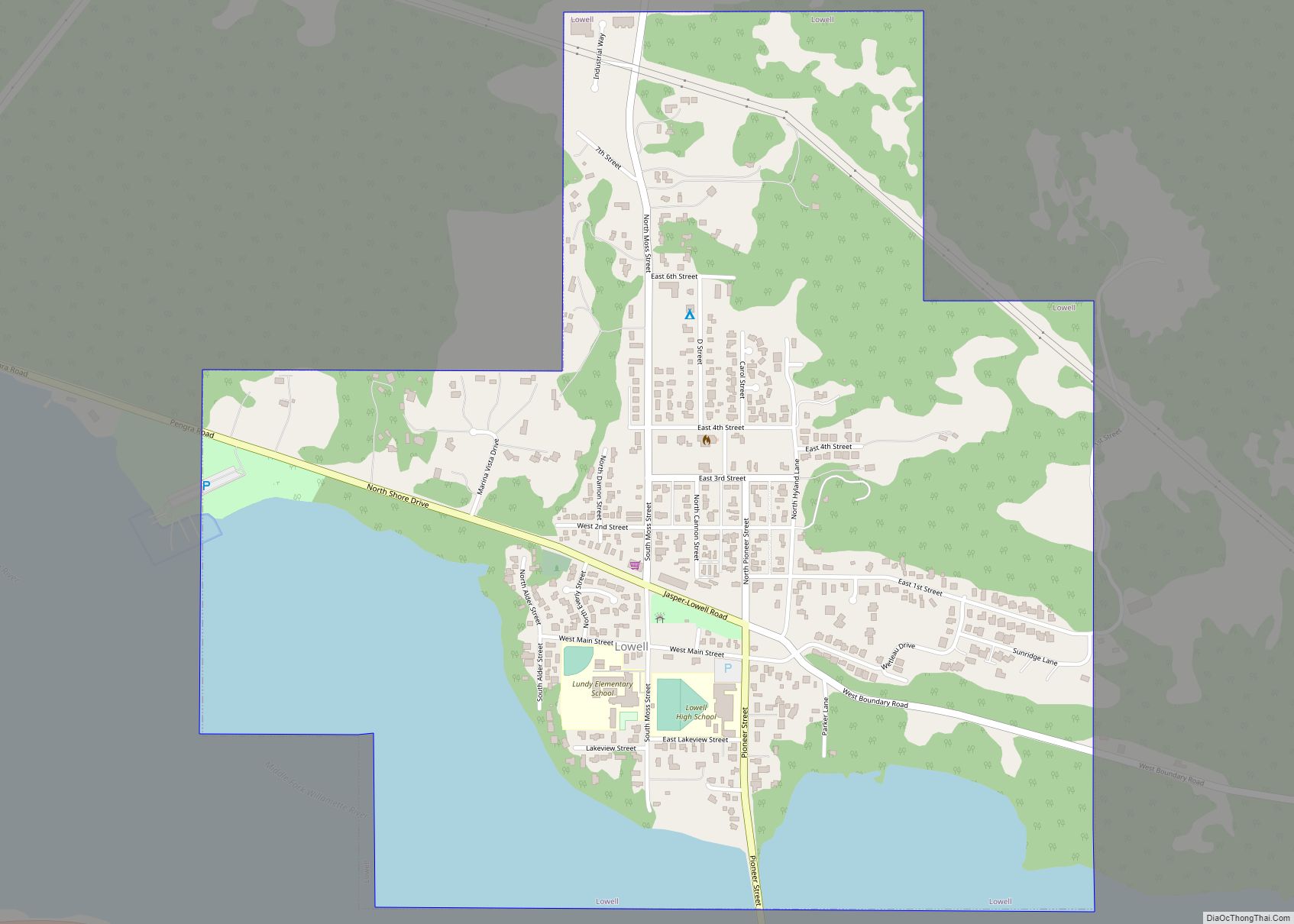
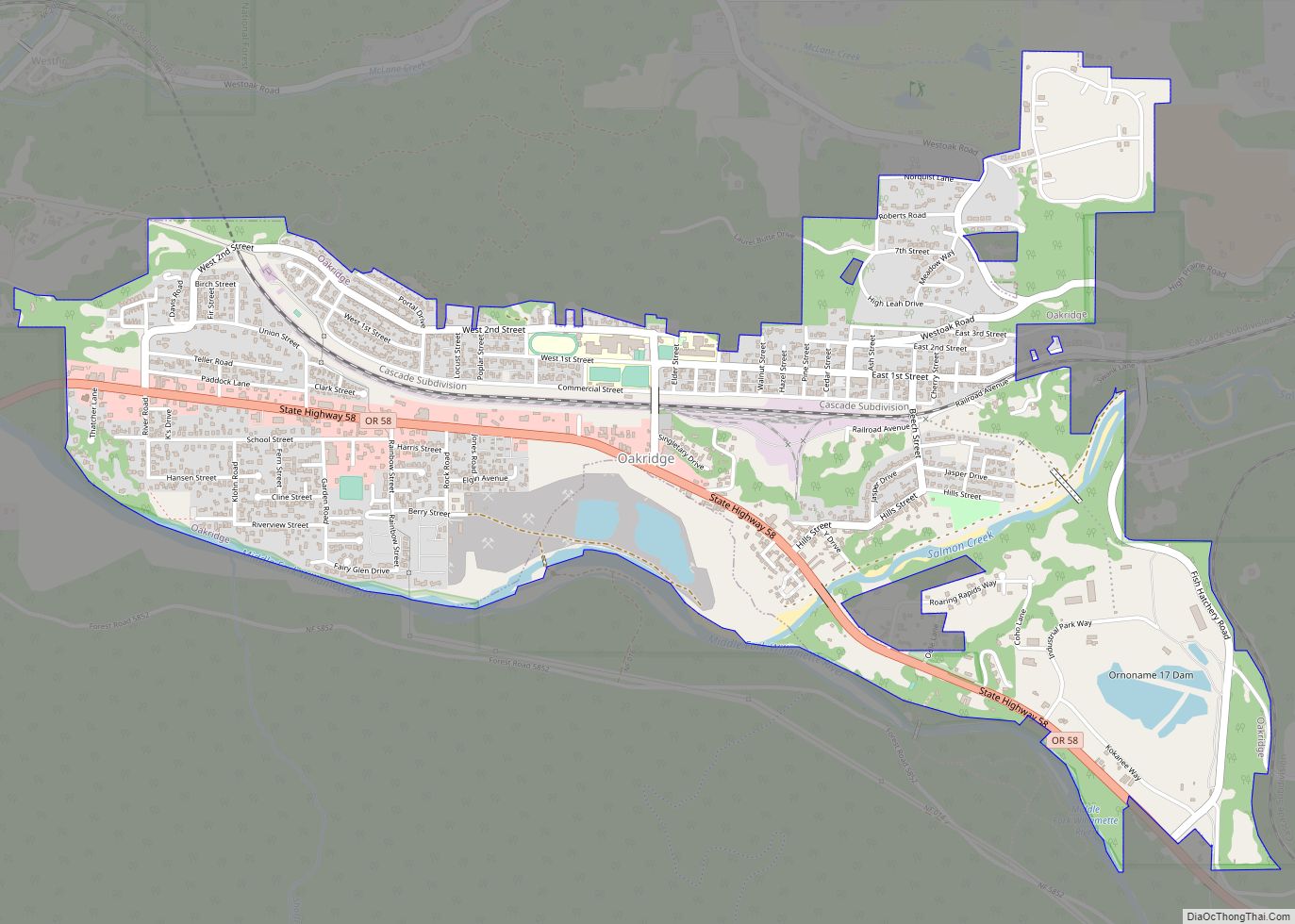
Online Interactive Map
Click on ![]() to view map in "full screen" mode.
to view map in "full screen" mode.
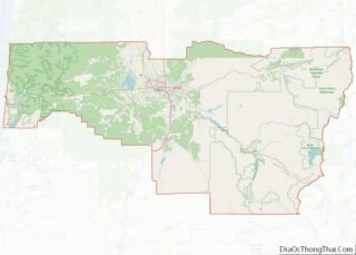
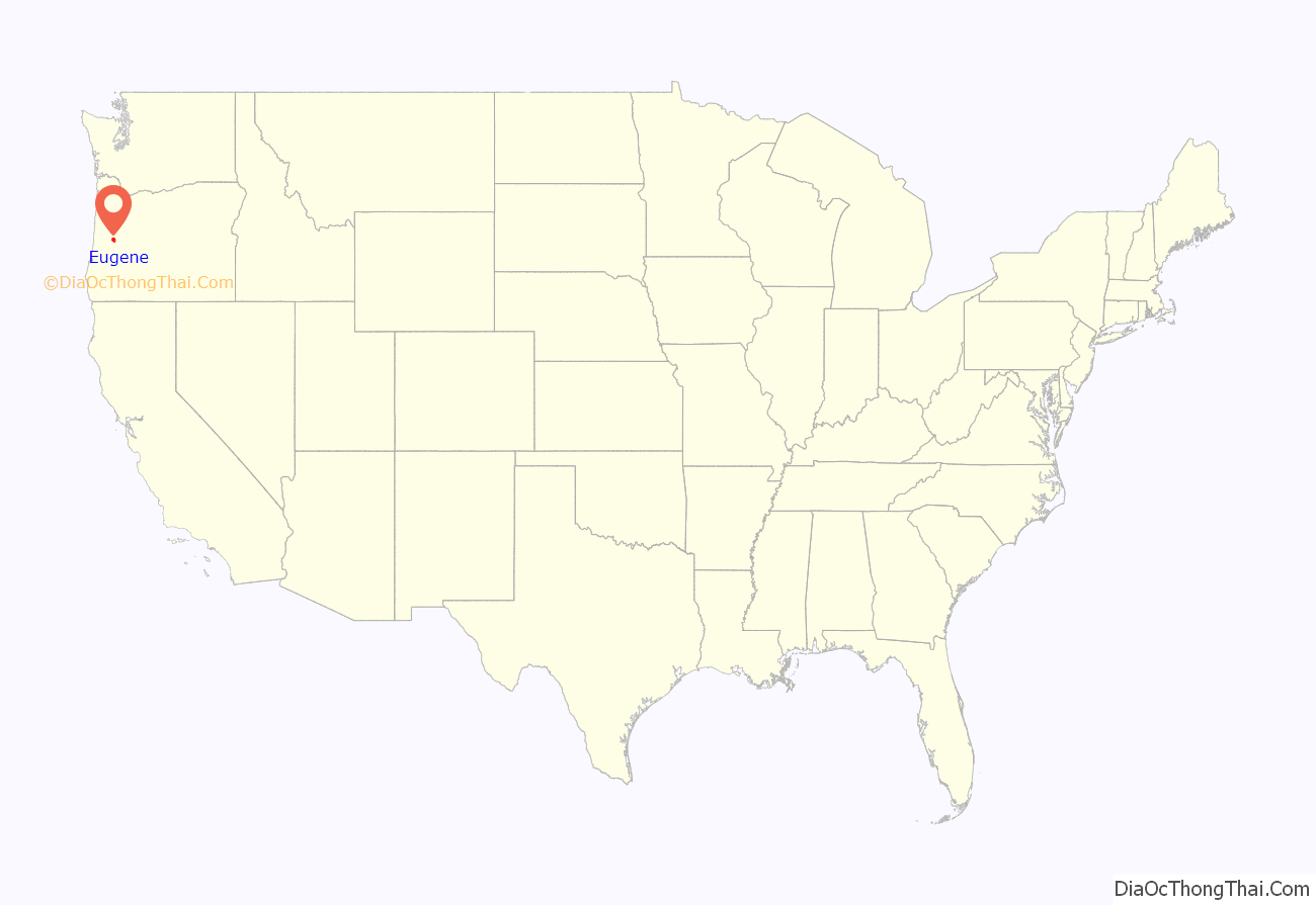
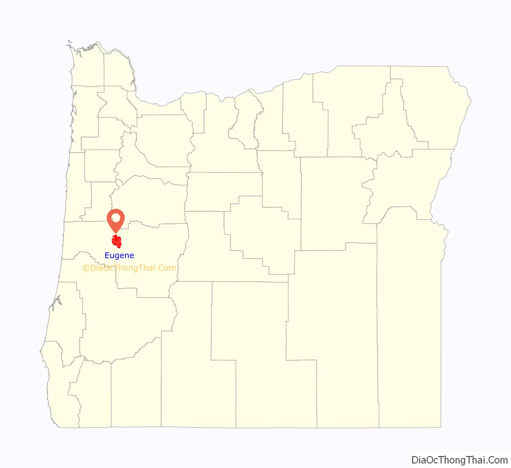
Eugene location map. Where is Eugene city?
History
Indigenous presence
The first people to settle in the Eugene area were the Kalapuyans, also written Calapooia or Calapooya. They made “seasonal rounds,” moving around the countryside to collect and preserve local foods, including acorns, the bulbs of the wapato and camas plants, and berries. They stored these foods in their permanent winter village. When crop activities waned, they returned to their winter villages and took up hunting, fishing, and trading. They were known as the Chifin Kalapuyans and called the Eugene area where they lived “Chifin”, sometimes recorded as “Chafin” or “Chiffin”.
Other Kalapuyan tribes occupied villages that are also now within Eugene city limits. Pee-you or Mohawk Calapooians, Winefelly or Pleasant Hill Calapooians, and the Lungtum or Long Tom. They were close-neighbors to the Chifin, intermarried, and were political allies. Some authorities suggest the Brownsville Kalapuyans (Calapooia Kalapuyans) were related to the Pee-you. It is likely that since the Santiam had an alliance with the Brownsville Kalapuyans that the Santiam influence also went as far at Eugene.
According to archeological evidence, the ancestors of the Kalapuyans may have been in Eugene for as long as 10,000 years. In the 1800s their traditional way of life faced significant changes due to devastating epidemics and settlement, first by French fur traders and later by an overwhelming number of American settlers.
Settlement and impact
French fur traders had settled seasonally in the Willamette Valley by the beginning of the 19th century. Their settlements were concentrated in the “French Prairie” community in Northern Marion County but may have extended south to the Eugene area. Having already developed relationships with Native communities through intermarriage and trade, they negotiated for land from the Kalapuyans. By 1828 to 1830 they and their Native wives began year-round occupation of the land, raising crops and tending animals. In this process, the mixed race families began to impact Native access to land, food supply, and traditional materials for trade and religious practices.
In July 1830, “intermittent fever” struck the lower Columbia region and a year later, the Willamette Valley. Natives traced the arrival of the disease, then new to the Pacific Northwest, to the USS Owyhee, captained by John Dominis. “Intermittent fever” is thought by researchers now to be malaria. According to Robert T. Boyd, an anthropologist at Portland State University, the first three years of the epidemic, “probably constitute the single most important epidemiological event in the recorded history of what would eventually become the state of Oregon”. In his book The Coming of the Spirit Pestilence Boyd reports there was a 92% population loss for the Kalapuyans between 1830 and 1841. This catastrophic event shattered the social fabric of Kalapuyan society and altered the demographic balance in the Valley. This balance was further altered over the next few years by the arrival of Anglo-American settlers, beginning in 1840 with 13 people and growing steadily each year until within 20 years more than 11,000 American settlers, including Eugene Skinner, had arrived.
As the demographic pressure from the settlers grew, the remaining Kalapuyans were forcibly removed to Indian reservations. Though some Natives escaped being swept into the reservation, most were moved to the Grand Ronde reservation in 1856. Strict racial segregation was enforced and mixed race people, known as Métis in French, had to make a choice between the reservation and Anglo society. Native Americans could not leave the reservation without traveling papers and white people could not enter the reservation.
Eugene Franklin Skinner, after whom Eugene is named, arrived in the Willamette Valley in 1846 with 1,200 other settlers that year. Advised by the Kalapuyans to build on high ground to avoid flooding, he erected the first Anglo cabin on south or west slope of what the Kalapuyans called Ya-po-ah. The “isolated hill” is now known as Skinner’s Butte. The cabin was used as a trading post and was registered as an official post office on January 8, 1850.
At this time the settlement was known by Anglos as Skinner’s Mudhole. It was relocated in 1853 and named Eugene City in 1853. Formally incorporated as a city in 1862, it was named simply Eugene in 1889. Skinner ran a ferry service across the Willamette River where the Ferry Street Bridge now stands.
Educational institutions
The first major educational institution in the area was Columbia College, founded a few years earlier than the University of Oregon. It fell victim to two major fires in four years, and after the second fire, the college decided not to rebuild again. The part of south Eugene known as College Hill was the former location of Columbia College. There is no college there today.
The town raised the initial funding to start a public university, which later became the University of Oregon, with the hope of turning the small town into a center of learning. In 1872, the Legislative Assembly passed a bill creating the University of Oregon as a state institution. Eugene bested the nearby town of Albany in the competition for the state university. In 1873, community member J.H.D. Henderson donated the hilltop land for the campus, overlooking the city. The university first opened in 1876 with the regents electing the first faculty and naming John Wesley Johnson as president. The first students registered on October 16, 1876. The first building was completed in 1877; it was named Deady Hall in honor of the first Board of Regents President and community leader Judge Matthew P. Deady.
Other universities in Eugene include Bushnell University and New Hope Christian College.
Twentieth century
Eugene grew rapidly throughout most of the twentieth century, with the exception being the early 1980s when a downturn in the timber industry caused high unemployment. By 1985, the industry had recovered and Eugene began to attract more high-tech industries, earning it the moniker the “Emerald Shire”. In 2012, Eugene and the surrounding metro area was dubbed the Silicon shire.
The first Nike shoe was used in 1972 during the US Olympic trials held in Eugene.
Activism
The 1970s saw an increase in community activism. Local activists stopped a proposed freeway and lobbied for the construction of the Washington Jefferson Park beneath the Washington-Jefferson Street Bridge. Community Councils soon began to form as a result of these efforts. A notable impact of the turn to community-organized politics came with Eugene Local Measure 51, a ballot measure in 1978 that repealed a gay rights ordinance approved by the Eugene City Council in 1977 that prohibited discrimination by sexual orientation. Eugene is also home to Beyond Toxics, a nonprofit environmental justice organization founded in 2000.
One hotspot for protest activity since the 1990s has been the Whitaker district, located in the northwest of downtown Eugene. Whitaker is primarily a working-class neighborhood that has become a vibrant cultural hub, center of community and activism and home to alternative artists. It saw an increase of activity in the 1990s after many young people drawn to Eugene’s political climate relocated there. Animal rights groups have had a heavy presence in the Whiteaker, and several vegan restaurants are located there. According to David Samuels, the Animal Liberation Front and the Earth Liberation Front have had an underground presence in the neighborhood. The neighborhood is home to a number of communal apartment buildings, which are often organized by anarchist or environmentalist groups. Local activists have also produced independent films and started art galleries, community gardens, and independent media outlets. Copwatch, Food Not Bombs, and Critical Mass are also active in the neighborhood.
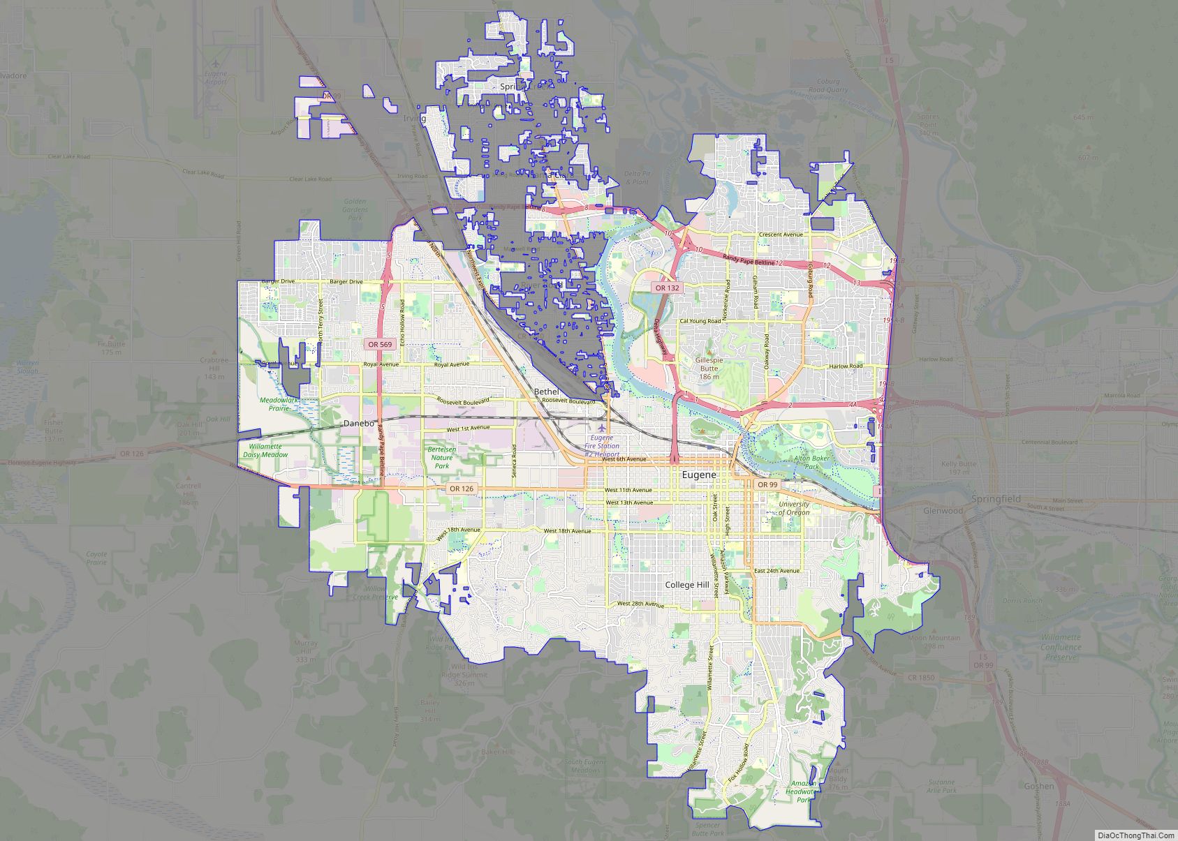
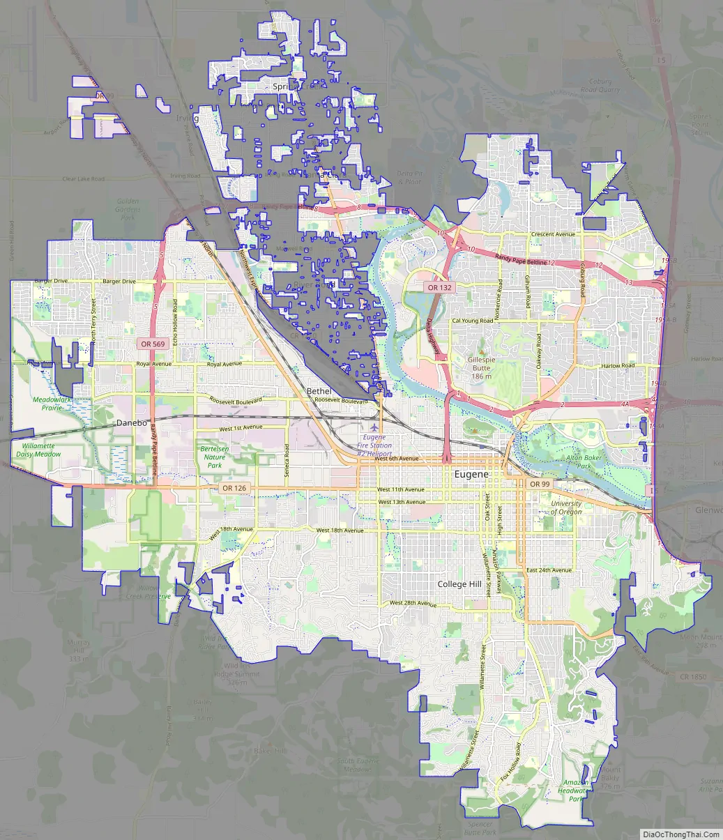
Eugene Road Map
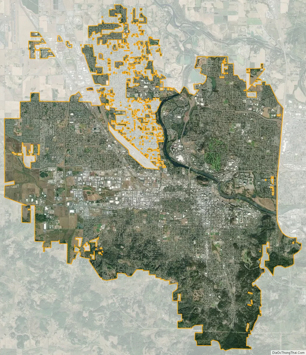
Eugene city Satellite Map
Geography
According to the United States Census Bureau, the city has a total area of 43.74 square miles (113.29 km), of which 43.72 square miles (113.23 km) is land and 0.02 square miles (0.05 km) is water. Eugene is at an elevation of 426 feet (130 m).
To the north of downtown is Skinner Butte. Northeast of the city is the Coburg Hills. Spencer Butte is a prominent landmark south of the city. Mount Pisgah is southeast of Eugene and includes Mount Pisgah Arboretum and Howard Buford Recreation Area, a Lane County Park. Eugene is surrounded by foothills and forests to the south, east, and west, while to the north the land levels out into the Willamette Valley and consists of mostly farmland.
The Willamette and McKenzie Rivers run through Eugene and its neighboring city, Springfield. Another important stream is Amazon Creek, whose headwaters are near Spencer Butte. The creek discharges into the Long Tom River north Fern Ridge Reservoir, maintained for winter flood control by the Army Corps of Engineers. The Eugene Yacht Club hosts a sailing school and sailing regattas at Fern Ridge during summer months.
Neighborhoods
Eugene has 23 neighborhood associations:
- Active Bethel Citizens
- Amazon Neighbors Association
- Cal Young Neighborhood Association
- Churchill Area Neighbors
- Downtown Neighborhood Association
- Fairmount Neighbors Association
- Far West Neighborhood Association
- Friendly Area Neighbors
- Goodpasture Island Neighbors
- Harlow
- Industrial Corridor Community Organization
- Jefferson Westside Neighbors
- Laurel Hill Valley Citizens
- Northeast Neighbors
- River Road Community
- Santa Clara Community (including Irving)
- South University Neighborhood Association
- Southeast Neighbors
- Southwest Hills Neighborhood Association
- Trainsong Neighbors
- West Eugene Community
- West University Neighbors
- Whiteaker Community Council
The River Road and Santa Clara sections, which make up the northwestern part of the city, are within the urban growth boundary and generally perceived as part of Eugene, but are largely outside of the city limits.
Climate
Like the rest of the Willamette Valley, Eugene lies in the Marine West Coast climate zone, with Mediterranean characteristics. Under the Köppen climate classification scheme, Eugene has a warm-summer Mediterranean climate (Köppen: Csb). Temperatures can vary from cool to warm, with warm, dry summers and cool, wet winters. Spring and fall are also moist seasons, with light rain falling for long periods. The average rainfall is 40.83 inches (1,040 mm), with the wettest “rain year” being from July 1973 to June 1974 with 75.59 inches (1,920.0 mm) and the driest from July 2000 to June 2001 with 20.40 inches (518.2 mm). Measurements taken by NOAA over the past four decades have indicated a significant decline in average annual precipitation. From 1981 to 2010 inclusive, the reported annual average precipitation was 46.1 inches (1,170 mm), but for the thirty-year period ending in 2020, the annual average had declined 5.27 inches (134 mm), to 40.83 inches (1,040 mm). The figures from the second half of that period, or 2006 – 2020 inclusive, pointed to a further decline of more than 4 inches (102 mm), down to an annual average of 36.58 inches (929 mm).
Winter snowfall does occur, but it is sporadic and rarely accumulates in large amounts: the normal seasonal amount is 4.9 inches (12 cm), but the median is zero. The record snowfall was 41.7 inches (106 cm) of accumulation due to a pineapple express on January 25–29, 1969. Ice storms, like snowfall, are rare, but occur sporadically.
The hottest months are July and August, with a normal monthly mean temperature of 67.8 to 67.9 °F (19.9 to 19.9 °C), with an average of 16 days per year reaching 90 °F (32 °C). The coolest month is December, with a mean temperature of 40.6 °F (4.8 °C), and there are 52 mornings per year with a low at or below freezing, and 2 afternoons with highs not exceeding the freezing mark. The coldest daytime high of the year averages 32 °F (0 °C), reaching the freezing point.
Eugene’s average annual temperature is 53.1 °F (11.7 °C), and annual precipitation at 40.83 inches (1,040 mm). Eugene is slightly cooler on average than Portland. Despite being located about 100 miles (160 km) south and at an only slightly higher elevation, Eugene has a more continental climate than Portland, less subject to the maritime air that blows inland from the Pacific Ocean via the Columbia River. Eugene’s normal annual mean minimum is 41.9 °F (5.5 °C), compared to 46.2 °F (7.9 °C) in Portland; in August, the gap in the normal mean minimum widens to 51.1 and 58.0 °F (10.6 and 14.4 °C) for Eugene and Portland, respectively. Eugene’s warmest night annually averages a modest 62 °F (17 °C). Average winter temperatures (and summer high temperatures) are similar for the two cities.
Extreme temperatures range from −12 °F (−24 °C), recorded on December 8, 1972, to 111 °F (44 °C) on June 27, 2021; the record cold daily maximum is 19 °F (−7 °C), recorded on December 13, 1919, while, conversely, the record warm daily minimum is 71 °F (22 °C) on July 22, 2006.
Eugene is downwind of Willamette Valley grass seed farms. The combination of summer grass pollen and the confining shape of the hills around Eugene make it “the area of the highest grass pollen counts in the USA (>1,500 pollen grains/m of air).” These high pollen counts have led to difficulties for some track athletes who compete in Eugene. In the Olympic trials in 1972, “Jim Ryun won the 1,500 after being flown in by helicopter because he was allergic to Eugene’s grass seed pollen.” Further, six-time Olympian Maria Mutola abandoned Eugene as a training area “in part to avoid allergies”.
See also
Map of Oregon State and its subdivision: Map of other states:- Alabama
- Alaska
- Arizona
- Arkansas
- California
- Colorado
- Connecticut
- Delaware
- District of Columbia
- Florida
- Georgia
- Hawaii
- Idaho
- Illinois
- Indiana
- Iowa
- Kansas
- Kentucky
- Louisiana
- Maine
- Maryland
- Massachusetts
- Michigan
- Minnesota
- Mississippi
- Missouri
- Montana
- Nebraska
- Nevada
- New Hampshire
- New Jersey
- New Mexico
- New York
- North Carolina
- North Dakota
- Ohio
- Oklahoma
- Oregon
- Pennsylvania
- Rhode Island
- South Carolina
- South Dakota
- Tennessee
- Texas
- Utah
- Vermont
- Virginia
- Washington
- West Virginia
- Wisconsin
- Wyoming