Hillsboro (/ˈhɪlzbəroʊ/ HILZ-burr-oh) is the fifth-largest city in the U.S. state of Oregon and is the county seat of Washington County. Situated in the Tualatin Valley on the west side of the Portland metropolitan area, the city hosts many high-technology companies, such as Intel, locally known as the Silicon Forest. At the 2020 census, the city’s population was 106,447.
For thousands of years the Atfalati tribe of the Kalapuya lived in the Tualatin Valley near the later site of Hillsboro. The climate, moderated by the Pacific Ocean, helped make the region suitable for fishing, hunting, food gathering, and agriculture. Settlers founded a community here in 1842, later named after David Hill, an Oregon politician. Transportation by riverboat on the Tualatin River was part of Hillsboro’s settler economy. A railroad reached the area in the early 1870s and an interurban electric railway about four decades later. These railways, as well as highways, aided the slow growth of the city to about 2,000 people by 1910 and about 5,000 by 1950, before the arrival of high-tech companies in the 1980s.
Hillsboro has a council–manager government consisting of a city manager and a city council headed by a mayor. In addition to high-tech industry, sectors important to Hillsboro’s economy are health care, retail sales, and agriculture, including grapes and wineries. The city operates more than twenty parks and the mixed-use Hillsboro Stadium, and ten sites in the city are listed on the National Register of Historic Places (NRHP). Modes of transportation include private vehicles, public buses and light rail, and aircraft using the Hillsboro Airport. The city is home to Pacific University’s Health Professions Campus. Notable residents include two Oregon governors.
| Name: | Hillsboro city |
|---|---|
| LSAD Code: | 25 |
| LSAD Description: | city (suffix) |
| State: | Oregon |
| County: | Washington County |
| Incorporated: | October 19, 1876 |
| Elevation: | 194 ft (60 m) |
| Total Area: | 25.86 sq mi (66.96 km²) |
| Land Area: | 25.84 sq mi (66.93 km²) |
| Water Area: | 0.01 sq mi (0.03 km²) |
| Total Population: | 106,447 |
| Population Density: | 4,118.99/sq mi (1,590.33/km²) |
| ZIP code: | 97123, 97124, 97006 |
| FIPS code: | 4134100 |
| GNISfeature ID: | 1163049 |
| Website: | www.hillsboro-oregon.gov |
Online Interactive Map
Click on ![]() to view map in "full screen" mode.
to view map in "full screen" mode.
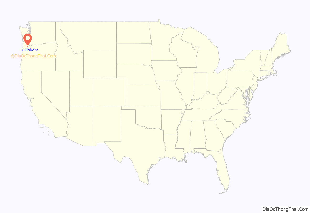
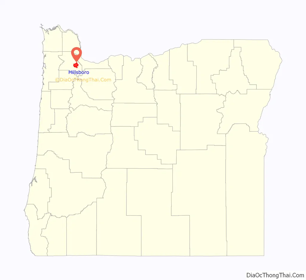
Hillsboro location map. Where is Hillsboro city?
History
The first people of the Tualatin Valley were the Atfalati or Tualaty tribe of the Kalapuya, who inhabited the region for up to 10,000 years before white settlers arrived. The valley consisted of open grassland maintained through annual burning by the Atfalati, with scattered groves of trees along the streams. The Kalapuya moved from place to place in good weather to fish and hunt and to gather nuts, seeds, roots, and berries. Important foods included camas and wapato, and the Atfalati traded for salmon from Chinookan tribes near Willamette Falls on the Willamette River. During the winter, they lived in longhouses in settled villages, some near what became Hillsboro and Beaverton. Their population was greatly reduced after contact in the late 18th century with Europeans, who carried smallpox, syphilis, and malaria. Of the original population of 1,000 to 2,000 Atfalati reported in 1780, only 65 remained in 1851. In 1855, the U.S. government sent the survivors to the Grande Ronde reservation further west.
The European-American community was founded by David Hill, Isaiah Kelsey, and Richard Williams, who arrived in the Tualatin Valley in 1841, followed by six more pioneers in 1842. The locality went by two other names—East Tualatin Plains and Columbia—before it was named “Hillsborough” in February 1850 in honor of Hill, when he sold part of his land claim to the county. On February 5, 1850, commissioners chosen by the territorial legislature selected the community to be the seat of the county government. Hill was to be paid $200 for his land after plots had been sold for the town site, but he died before this occurred, and his widow Lucinda received the funds. The town’s name was later simplified to Hillsboro. A log cabin was built in 1853 to serve as the community’s first school, which opened in October 1854. Riverboats provided transportation to Hillsboro as early as 1867 when the side-wheel steamer Yamhill worked on the Tualatin River.
In 1871, the Oregon and California Railroad line was extended to the area, but it ran just south of town because the city did not want to give the railroad land in exchange for the rail connection. Hillsboro was incorporated as the Town of Hillsboro on October 19, 1876, by the Oregon Legislature. The first mayor was A. Luelling, who took office on December 8, 1876, and served a one-year term. Notable later mayors included Congressman Thomas H. Tongue (1882 and 1886) and state senator William D. Hare (1885). In 1923, the city altered its charter and adopted a council-manager government with a six-person city council, a part-time mayor who determined major policies, and a city manager who ran day-to-day operations.
On September 30, 1908, 5,000 people gathered as the Oregon Electric Railway opened a connection between the city and Portland with an interurban electric rail line, the first to reach the community. In January 1914, the Southern Pacific Railroad introduced its own interurban service, known as the Red Electric, on a separate line and serving different communities between Hillsboro and Portland. SP discontinued its Hillsboro service on July 28, 1929, while the Oregon Electric Railway’s passenger service to Hillsboro lasted until July 1932.
A brick building was constructed in 1852 to house the county government, followed by a brick courthouse in 1873. In 1891, the courthouse was remodeled and a clock tower was added, and the building was expanded with an annex in 1912. A new courthouse replaced the brick structure in 1928. The last major remodel of the 1928 structure occurred in 1972, when the Justice Services Building was built and incorporated into the existing building.
The city’s first fire department was a hook and ladder company organized in 1880 by the board of trustees (now city council). A drinking water and electricity distribution system added in 1892–93 gave the town three fire hydrants and minimal street lighting. Hillsboro built its first sewer system in 1911, but sewage treatment was not added until 1936. In 1913, the city built its own water system, and the first library, Carnegie City Library, opened in December 1914. From 1921 to 1952, the world’s second-tallest radio tower stood on the south side of the city, but in 1952, the wireless telegraph tower was demolished. During the 1950s and 1960s, the privately owned company Tualatin Valley Buses, Inc., provided transit service connecting Hillsboro with Beaverton and Portland. It was taken over by the publicly owned transit agency TriMet in 1970.
In 1972, the Hillsboro City Council passed a Green River Ordinance banning door-to-door solicitation, but it was ruled unconstitutional by the Oregon Supreme Court in a 1988 decision. The court determined that the city ordinance was overly broad, in a case that was seen as a test case for many similar laws in the state. In 1979, Intel opened its first facility in Hillsboro. The Hawthorn Farm campus was followed by the Jones Farm campus adjacent to the airport in 1982, and finally by the Ronler Acres campus in 1994. TriMet opened a Metropolitan Area Express (MAX) light rail line into the city in 1998. A cultural center was added in 2004, and a new city hall was completed in 2005. In 2008, SolarWorld opened a facility producing solar wafers, crystals, and cells, the largest plant of its kind in the Western Hemisphere. U.S. President Barack Obama visited the city and Intel’s Ronler Acres campus in February 2011.
Registered Historic Places
Properties listed on the National Register of Historic Places (NRHP) in and around Hillsboro include the Old Scotch Church, completed in 1876 north of the city. Near the Orenco neighborhood is Imbrie Farm, which includes a house built in 1866 and the Frank Imbrie Barn, both of which McMenamins converted for use as a brewpub. Built in 1935, the Harold Wass Ray House is near Intel’s Hawthorn Farm campus. Historic properties in downtown include the Zula Linklater House (completed 1923), Rice–Gates House (1890), Edward Schulmerich House (c. 1915), and Charles Shorey House (c. 1908). The Richard and Helen Rice House is adjacent to the Sunset Highway on the north side of the city and houses the Rice Northwest Museum of Rocks and Minerals. The Old Washington County Jail had been at the Washington County Fairgrounds (now known as the Westside Commons) in the city, but was restored and moved to the Five Oaks Museum outside the city in 2004, and was de-listed from the NRHP in 2008. In 2007, the Manning–Kamna Farm was added to the NRHP and includes 10 buildings, dating to as early as 1883. The Malcolm McDonald House in Orenco was added to the Registry in 2015.
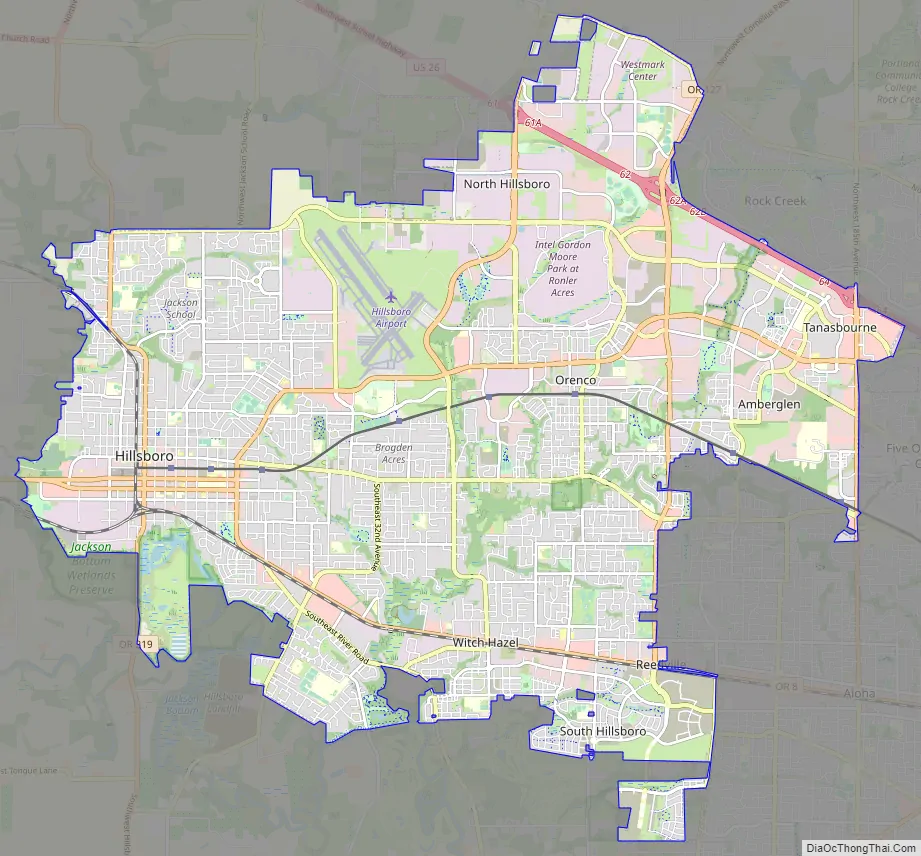
Hillsboro Road Map
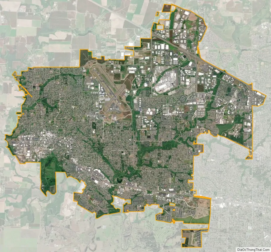
Hillsboro city Satellite Map
Geography
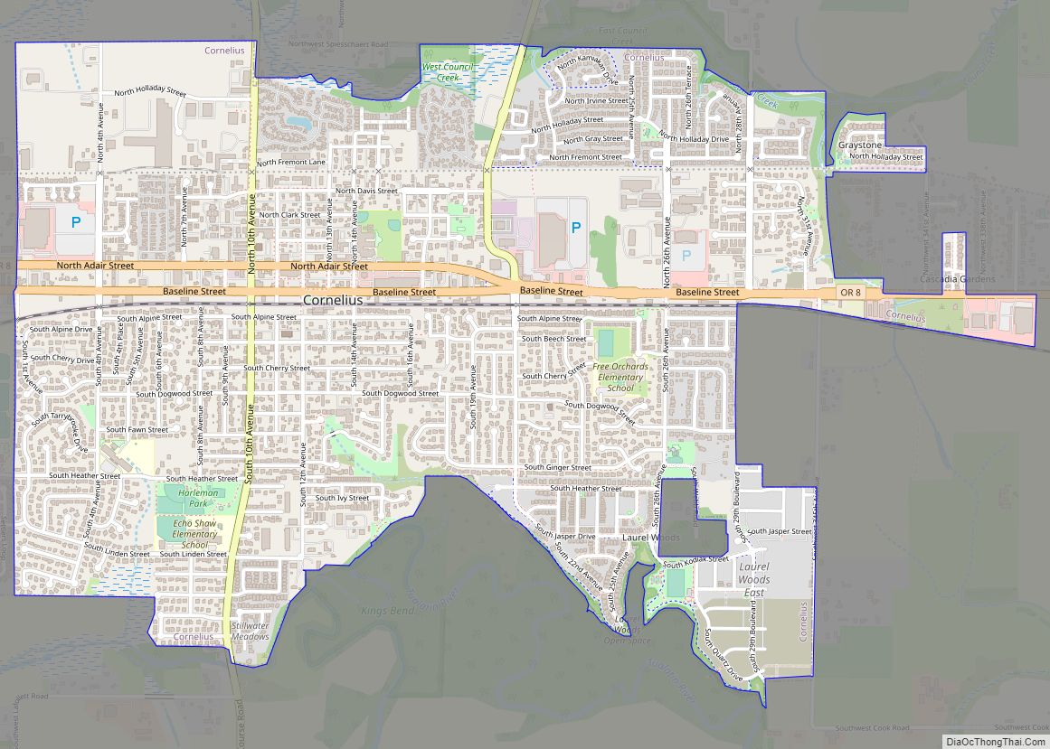
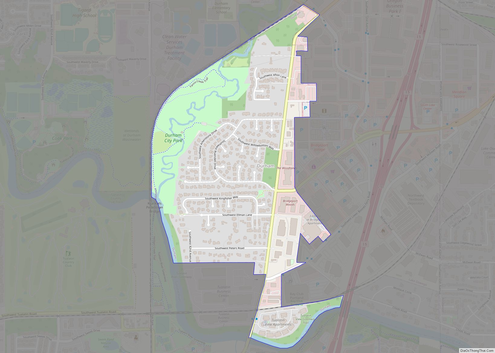
Hillsboro is located at 45°31′N 122°59′W / 45.517°N 122.983°W / 45.517; -122.983 (Hillsboro, Oregon). The United States Census Bureau reports the city has a total area of 21.6 sq mi (55.9 km), all of which is land. In 2013, Hillsboro itself reported an area of 23.88 sq mi (61.8 km), equivalent to 15,283 acres (61.8 km). The city is located in the Tualatin Valley, and the Tualatin River forms part of the southern city limits. The city’s terrain is fairly level, consistent with an agricultural past and the farms still in operation. Hillsboro is about 17 mi (27 km) west of Portland and immediately west of Beaverton, at an elevation of 194 ft (59 m) above sea level. In addition to the Tualatin River, streams include Dairy Creek, McKay Creek, Rock Creek, Dawson Creek, and Turner Creek. Neighboring communities in addition to Beaverton are Aloha, Cornelius, Glencoe, North Plains, Reedville, Scholls, and West Union.
Hillsboro’s street system differs from many others in the county. Most cities in Washington County use a numbering system and cardinal direction orientation based on a grid that begins at the Willamette River in downtown Portland, which was originally part of Washington County. For example, the street names in Beaverton generally include Southwest (SW) prefixes because Beaverton lies in the southwest quadrant of the Portland grid. Previously, some county road names and addresses in Hillsboro conformed to the Portland grid instead of Hillsboro’s internal cardinal direction grid. In January 2015, the city began the process of making all addresses and streets within Hillsboro conform to the internal grid, through the Connecting Hillsboro Address Project.
The internal grid in Hillsboro centers on the downtown intersection of Main Street, which runs east–west, and First Avenue, which runs north–south. Most addresses within the city include a quadrant prefix: NW, NE, SW, or SE. Main Street is simply designated as East Main or West Main, and First Avenue is only North First or South First. Addresses on the streets’ south side and the avenues’ east side have even numbers, while odd numbers are on the opposite side. Hillsboro’s street system contains 20 blocks per mile (12.5 blocks per kilometer).
North–south through roadways are called avenues, while east–west roadways are called streets. All cul-de-sacs are named courts. Private roadways are named ways or places. Roads that curve can be named drives. Alleys are named lanes. Non-city streets may not conform to these naming conventions.
Neighborhoods
The city’s municipal code has designated several special plan areas, each of which follow area-specific plans and codes:
- Downtown encompasses the original city core and the area immediately surrounding it. Blocks in the downtown core are 400 ft (120 m) long on each side.
- Orenco consists of the Orenco Townsite Conservation zone (encompassing a former company town originally created by the Oregon Nursery Company) and the Orenco Station sub-area, which is described in the city code as a “compact, transit-supportive mixed-use neighborhood with reduced automobile reliance”.
- The Hawthorn Farm / Fair Complex Plan District is centered on the Hawthorn Farm LRT station and the Washington County Fairgrounds (known since 2019 as the Westside Commons).
- Amberglen, located just south of the Tanasbourne neighborhood, is envisioned as “a vibrant, regional activity center enlivened with high-quality pedestrian and environmental amenities, taking advantage of the region’s light rail system”. Located within the district is Oregon Health & Science University’s West Campus.
- The South Hillsboro planning district encompasses the newly annexed South Hillsboro neighborhood, described in the city code as “a complete, connected and green community”. The neighborhood, built on land once used as a hobby farm by William Ladd and Simeon Reed, is slated to become “a residential mixed-use community organized around a town center and complemented by a village center”.
- The North Hillsboro Industrial Area Plan District lies within Hillsboro’s Industrial District, where many of the Silicon Forest’s manufacturing and technology businesses reside. Over half of the city’s total employment is located within the Hillsboro Industrial District.
- The city’s Comprehensive Plan outlines several other plan areas not defined in the city code: Quatama, Tanasbourne, NE 28th Ave/East Main Street Plan Area, and Witch Hazel Village.
Climate
Summers in Hillsboro are generally warm, but temperatures year-round are moderated by a marine influence from the Pacific Ocean. The Willamette Valley in which Hillsboro lies receives the majority of its precipitation during the winter months, with the wettest period from November through March. This occasionally includes snowfall. Hillsboro receives precipitation on 161 days per year, on average. The average yearly precipitation between 1930 and 1998 was 38 in (970 mm). August is the warmest month with an average high temperature of 81 °F (27 °C), while January is the coolest month with an average high of 46 °F (8 °C). The highest recorded temperature, 114 °F (46 °C), occurred on June 28, 2021, and the lowest, −10 °F (−23 °C), occurred on January 31, 1950.
According to the Köppen climate classification system, Hillsboro has a warm-summer Mediterranean climate (Köppen Csb).
See also
Map of Oregon State and its subdivision: Map of other states:- Alabama
- Alaska
- Arizona
- Arkansas
- California
- Colorado
- Connecticut
- Delaware
- District of Columbia
- Florida
- Georgia
- Hawaii
- Idaho
- Illinois
- Indiana
- Iowa
- Kansas
- Kentucky
- Louisiana
- Maine
- Maryland
- Massachusetts
- Michigan
- Minnesota
- Mississippi
- Missouri
- Montana
- Nebraska
- Nevada
- New Hampshire
- New Jersey
- New Mexico
- New York
- North Carolina
- North Dakota
- Ohio
- Oklahoma
- Oregon
- Pennsylvania
- Rhode Island
- South Carolina
- South Dakota
- Tennessee
- Texas
- Utah
- Vermont
- Virginia
- Washington
- West Virginia
- Wisconsin
- Wyoming