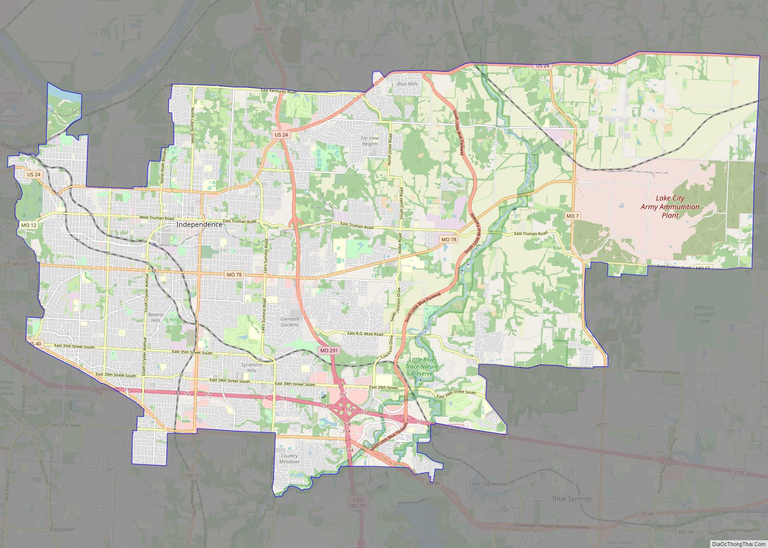
Map of Lafayette city, Louisiana

Map of Lafayette city, Louisiana

Lafayette (/ˌlæfiːˈɛt, ˌlɑːf-/, French: [lafajɛt]) is a city in the U.S. state of Louisiana, and the most populous city and parish seat of Lafayette Parish, located along the Vermilion River. It is Louisiana’s fourth largest incorporated municipality by population with a 2020 census population of 121,374; the consolidated city-parish’s population was 241,753 in 2020. The Lafayette … Read more

Map of Hartford city, Connecticut

Map of Hartford city, Connecticut

Hartford is the capital city of the U.S. state of Connecticut. It was the seat of Hartford County until Connecticut disbanded county government in 1960. It is the largest city in the Capitol Planning Region, and core city of the Greater Hartford metropolitan area. Census estimates since the 2010 United States census have indicated that … Read more

Map of Ann Arbor city

Map of Ann Arbor city

Ann Arbor is a city in the U.S. state of Michigan and the seat of government of Washtenaw County. The 2020 census recorded its population to be 123,851, making it the fifth-largest city in Michigan. It is the principal city of the Ann Arbor Metropolitan Statistical Area, which encompasses all of Washtenaw County. Ann Arbor … Read more

Map of College Station city, Texas

Map of College Station city, Texas

College Station is a city in Brazos County, Texas, situated in East-Central Texas in the heart of the Brazos Valley, towards the eastern edge of the region known as the Texas Triangle. It is 83 miles (130 kilometers) northwest of Houston and 87 miles (140 km) east-northeast of Austin. As of the 2020 census, College Station … Read more

Map of West Palm Beach city

Map of West Palm Beach city

West Palm Beach city overview: Name: West Palm Beach city LSAD Code: 25 LSAD Description: city (suffix) State: Florida County: Palm Beach County Elevation: 13 ft (4 m) Land Area: 53.82 sq mi (139.39 km²) Water Area: 4.17 sq mi (10.79 km²) Population Density: 2,181.66/sq mi (842.35/km²) ZIP code: 33401–33422 Area code: 561 FIPS code: 1276600 GNISfeature ID: 0293097 Website: http://wpb.org Online Interactive Map … Read more

Map of North Charleston city

Map of North Charleston city

North Charleston is a city in Berkeley, Dorchester, and Charleston counties within the U.S. state of South Carolina. As of the 2020 census, North Charleston had a population of 114,852, making it the third-most populous city in the state. North Charleston is a principal city within the Charleston–North Charleston, SC Metropolitan Statistical Area, which had … Read more

Map of Billings city, Montana

Map of Billings city, Montana

Billings is the largest city in the U.S. state of Montana, with a population of 117,116 as of the 2020 census. Located in the south-central portion of the state, it is the seat of Yellowstone County and the principal city of the Billings Metropolitan Area, which had a population of 184,167 in the 2020 census. … Read more

Map of Cambridge city, Massachusetts

Map of Cambridge city, Massachusetts

Cambridge (/ˈkeɪmbrɪdʒ/ KAYM-brij) is a city in Middlesex County, Massachusetts, in the United States. It is a major suburb in the Greater Boston metropolitan area, located directly across the Charles River from Boston. The city’s population as of the 2020 U.S. census was 118,403, making it the largest city in the county, the fourth most … Read more