North Charleston is a city in Berkeley, Dorchester, and Charleston counties within the U.S. state of South Carolina. As of the 2020 census, North Charleston had a population of 114,852, making it the third-most populous city in the state. North Charleston is a principal city within the Charleston–North Charleston, SC Metropolitan Statistical Area, which had a population of 799,636 in 2020.
| Name: | North Charleston city |
|---|---|
| LSAD Code: | 25 |
| LSAD Description: | city (suffix) |
| State: | South Carolina |
| County: | Berkeley County, Charleston County, Dorchester County |
| Incorporated: | June 12, 1972 |
| Elevation: | 25 ft (6 m) |
| Land Area: | 77.63 sq mi (201.06 km²) |
| Water Area: | 3.43 sq mi (8.89 km²) |
| Population Density: | 1,479.50/sq mi (571.24/km²) |
| Area code: | 843 and 854 |
| FIPS code: | 4550875 |
| GNISfeature ID: | 1225072 |
| Website: | www.northcharleston.org |
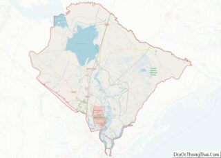
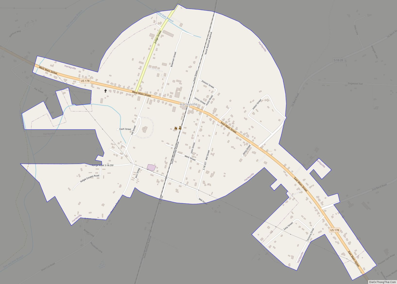
Online Interactive Map
Click on ![]() to view map in "full screen" mode.
to view map in "full screen" mode.
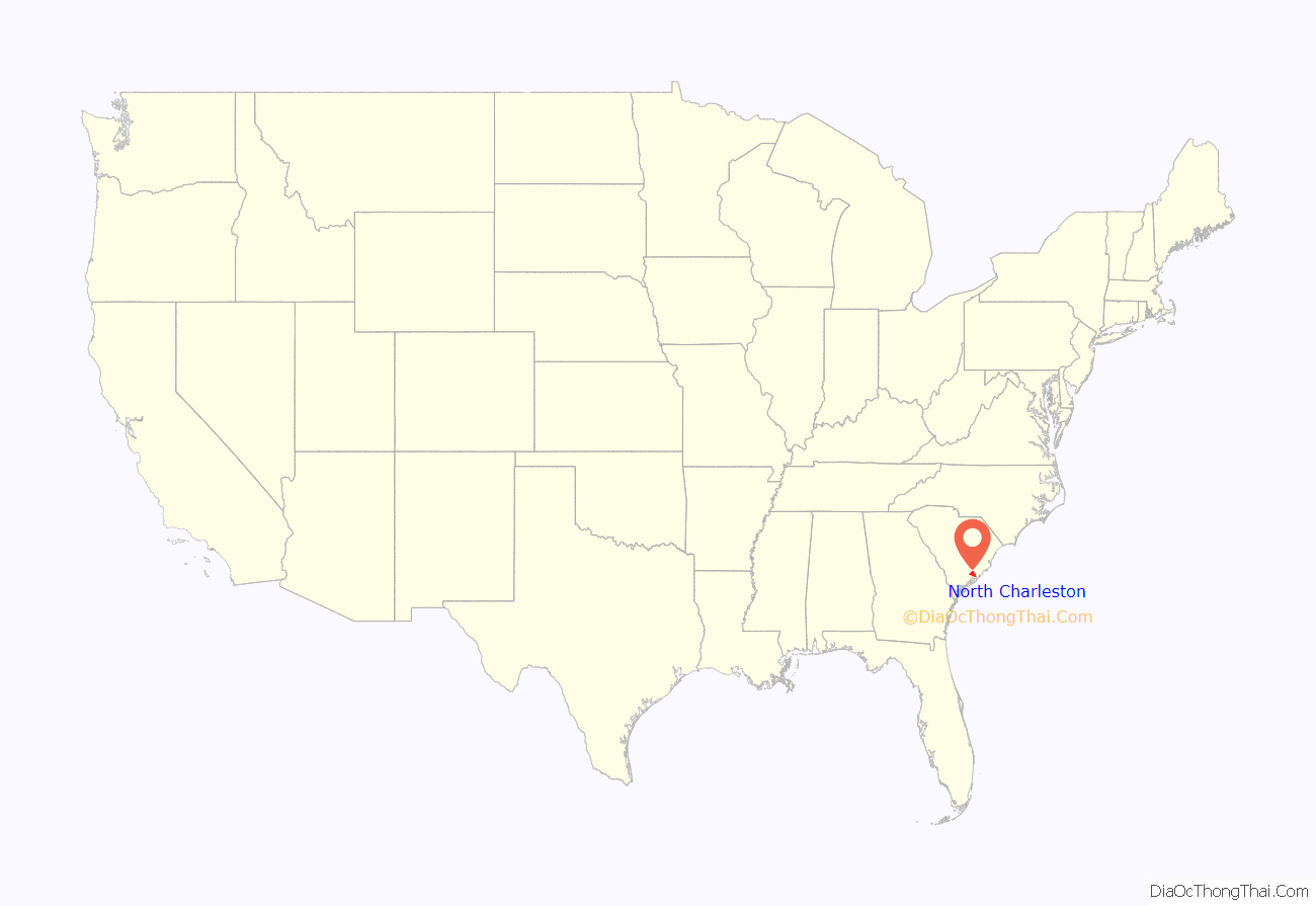
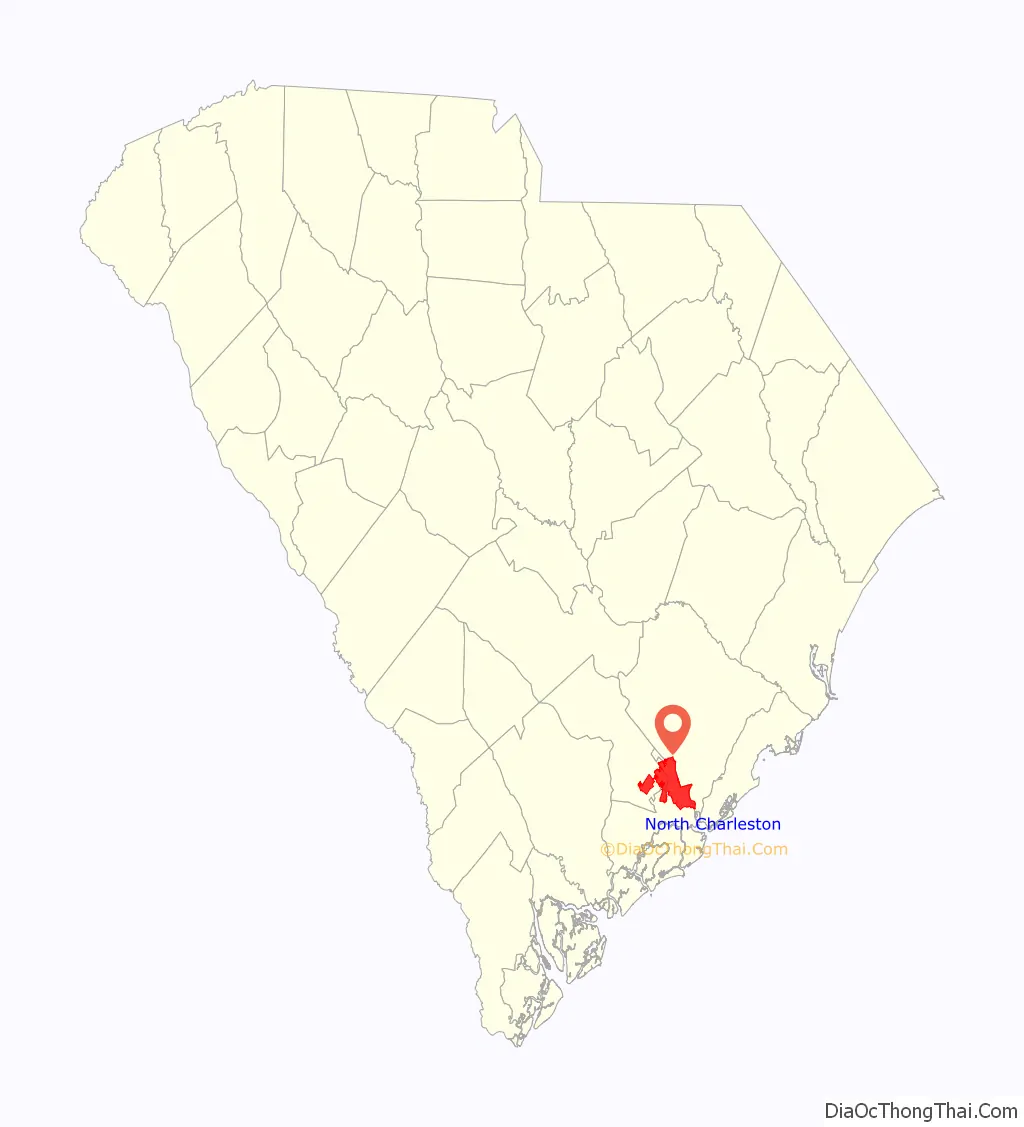
North Charleston location map. Where is North Charleston city?
History
1680–1901: Plantations
From the 17th century until the Civil War, plantations cultivated commodity crops, such as rice and indigo. Some of the plantations located in what is now North Charleston were:
- Archdale Hall Plantation – dating from 1680, Archdale Hall was located on the Ashley River. By 1783, it had grown to almost 3,000 acres (12 km). Its primary crops were indigo and rice. The plantation was the longest family-owned plantation in South Carolina. It has since been redeveloped into the Archdale subdivision. (Archdale subdivision is not in corporate city limits of, but is surrounded by North Charleston)
- Camp Plantation – dating from 1705, Camp Plantation covered around 1,000 acres (4.0 km).
- Elms Plantation – dating from 1682, Elms Plantation was founded by Ralph Izard. Its principal crop was rice. It covered nearly 4,350 acres (17.6 km), stretching across parts of what are now the cities of Goose Creek and North Charleston. Charleston Southern University is located on part of the original plantation lands.
- French Botanical Garden – established between 1786 and 1796, this small plantation/garden area of 111 acres (0.45 km) was owned and maintained by the French botanist André Michaux. It was closed by Michaux’s son in 1803. The garden was located near what is today the Charleston International Airport, and the parkway connecting Dorchester Road with International Boulevard is named in his honor.
- Marshlands, Mons Repos and Retreat plantations – the Retreat Plantation dates from 1672 and the Marshlands Plantation dates from 1682. Mons Repos was developed around 1798. The land from all three plantations was acquired by the federal government for development of the Charleston Naval Base and Charleston Naval Shipyard. The Marshlands Plantation’s main house has been listed on the National Register of Historic Places. To preserve the house, it was moved in 1961 to land at Fort Johnson on James Island and is currently used as offices for the South Carolina Department of Natural Resources.
- Oak Grove Plantation – dating from 1680, Oak Grove originally covered 960 acres (3.9 km) along the Cooper River. By 1750, its owners had expanded the plantation to about 1,127 acres (4.56 km).
- Tranquil Hill Plantation – started in 1683, Tranquil Hill was originally known as White Hall Plantation, a name it would keep until 1773. Its principal crop was rice. It encompassed about 526 acres (2.13 km). Since the late 20th century, it was redeveloped as the Whitehall residential subdivision.
- Windsor Hill Plantation – established in 1701, Windsor Hill was an inland rice plantation that covered nearly 1,348 acres (5.46 km); parts of the cities of Goose Creek and North Charleston now occupy some of this area. General William Moultrie, victor at the Battle of Sullivan’s Island in 1776 and governor from 1785–87 and 1792–94, was originally buried here. His remains were exhumed and reburied at Fort Moultrie on Sullivan’s Island in 1977. The Windsor Hill Plantation subdivision was developed on a portion of the eponymous plantation’s property.
The large plantations were subdivided into smaller farms in the late 19th century as the urban population began moving northward. Due to the large labor forces of enslaved African Americans who worked these properties for over two centuries, the population of Charleston County in 1870 was 73 percent black; however, they were freedmen by this time. After the Civil War, phosphate fertilizer plants were developed, with extensive strip mining occurring between the Ashley River and Broad Path (Meeting Street Road). The main route for transportation of these phosphates eventually became known as Ashley Phosphate Road.
1901–1972: Incorporation
Since the early 20th century, the section of unincorporated Charleston County that later became the city of North Charleston had been designated by Charleston business and community leaders as a place for the development of industry, military and other business sites. The first industry started in this area was the E.P. Burton Lumber Company. In 1901, the Charleston Naval Shipyard was established with agreements between the federal government and local Charleston city leaders. Shortly thereafter, the General Asbestos and Rubber Company (GARCO) built the world’s largest asbestos mill under one roof.
In 1912, a group of businessmen from the city of Charleston formed a development company that bought the E.P. Burton Lumber Company tract and began to lay out an area for further development. The Park Circle area was one of the first to be designed and developed, allocating sections for industrial, commercial, and residential usage. Park Circle was planned as one of only two English Garden Style communities in the US, and most of the original planning concept remains today. Some of the streets in the area still bear the names of these original developers: Durant, Buist, Mixon, Hyde, and O’Hear. During World War II, substantial development occurred as the military bases and industries expanded, increasing the personnel assigned there. New residents moved to the region to be closer to their work.
From World War II through the 1960s, many whites who lived in this region (referred to by Charlestonians as the North Area) were unhappy about the way parts of their community were being developed. They wanted the citizens in the area to have direct control over future development. African Americans were still excluded from the political system due to the state’s 1895 disfranchising constitution. Many of the white Democratic Party’s attempts to create an independent city were defeated via court rulings.
The Voting Rights Act of 1965 gave the federal government the means to enforce citizens’ constitutional rights, and African Americans in South Carolina gradually reclaimed their franchise. As a means of bringing the government closer to the people, an incorporation referendum was held on April 27, 1971. On June 12, 1972, after a series of legal battles, the South Carolina Supreme Court upheld the referendum results. North Charleston became a city and elected John E. Bourne Jr. as its first mayor.
1972–1982: First decade
When North Charleston was incorporated on June 12, 1972, it consisted of several areas including the Russelldale, Ferndale, Morningside, Liberty Park, Palmetto Heights, Singing Pines, Dewey Hill, Liberty Homes and John C. Calhoun Homes neighborhoods. Within the first week of operation, the city passed a 61-page Code and signed a five-year lease for 308 Montague Avenue for $300.00 per month. Also during June, the city hired a police chief, and treasurer and annexed its first industry, which was Textone Incorporated Plywood, Westvaco. On June 21, a ribbon was cut on the first city park on Virginia Avenue. At the end of the first month, the city officials reached an agreement for garbage collection and fire protection by the local public service district. The month concluded with the city’s first big annexation, south of Bexley Street between Spruill Avenue and the Charleston Naval Shipyard. By December, North Charleston had become the fourth-largest city in the state after annexing the Naval Base, the Air Force Base and the Charleston International Airport.
In February 1973, North Charleston doubled its area through annexation, and in March expanded into Berkeley County. In May 1973, the city launched its new police department, which included 21 officers and six cars. By the end of North Charleston’s first year, the population had increased from 22,000 to 53,000, largely through annexation. Through continued growth and the development of 20 churches, a 62-store shopping mall and other large tracts of residential neighborhoods, the city was ranked as the third-largest city in South Carolina on July 3, 1976.
On June 12, 1982, North Charleston had a population of 65,000 in a 30.5-square-mile (79 km) area. In ten years, the city’s growth rate was 250 percent. It had made $15 million in capital investments; $1.95 million invested in parks and recreation facilities, and $2.28 million in economic development.
1982–1996
In 1983, North Charleston became the first city in South Carolina to implement a computer-aided dispatch system. Baker Hospital opened a new facility on the banks of the Ashley River. The following year, Walmart announced plans to open one of the nation’s first Sam’s Clubs in North Charleston. Plans were revealed in 1985 for the 400-acre (1.6 km) Centre Pointe retail development, which included Sam’s Club, Walmart and Tanger Outlet Mall as anchors.
By 1986, North Charleston’s population had reached 78,000 residents spanning 47 square miles (120 km). A monument to honor Vietnam veterans was erected and dedicated in front of City Hall, where it stood for over 20 years before being moved to Patriots Point in 2008. The city celebrated its 15th anniversary the next year, marked by such events as the opening of the Northwoods Center shopping complex and the development of a beach in the middle of the city with the opening of Treasure Lake.
In September 1989, Hurricane Hugo produced devastation to the area, causing a total of over $2.8 billion in damage to the South Carolina Lowcountry.
In 1991, John E. Bourne, Jr., lost his bid for a sixth term as mayor to Bobby Kinard, who became the city’s second mayor. Kinard’s tenure as mayor was tumultuous and was marked by repeated conflict with the City Council; its members stripped Kinard of his mayoral powers during a council meeting. Kinard resigned in 1994 on the grounds that his relationship with the council was damaged irreparably. Following Bobby Kinard’s resignation in 1994, R. Keith Summey was elected the city’s third mayor to fill the vacant seat. Kinard returned to his law practice.
In 1993 a squadron of C-17 Globemaster III aircraft was established at Charleston Air Force Base, bringing more residents and jobs. The North Charleston Coliseum opened, and the South Carolina Stingrays of the ECHL began play later that year.
1996–present: redevelopment
The Charleston Naval Base ranked as the largest employer of civilians in South Carolina into the 1990s. The influence of Lowcountry legislators and the threat of nuclear attack played an important role in keeping North Charleston’s bases open in the face of periodic attempts at closure.
In the early 1990s, with the resolution of the Cold War and the fall of the Soviet Union, plus impending defense budget cuts, the Charleston Navy Base was proposed for closure. In 1993, the Charleston Naval Base was given a closure date of April 1, 1996. Given its annual expenditures of approximately 1.4 billion dollars in the region, the base’s closing represented a major loss of jobs and a blow to the entire Tri-County economy. Over the years, billions of federal dollars had flowed into the region’s economy and hundreds of thousands of jobs were filled by military and civilian personnel, the vast majority being civilians. Much military personnel who worked at or passed through the base returned to the city to retire. Following the closure of the Charleston Naval Base and the Charleston Naval Shipyard, parts of the base and dry docks were leased out to various government and private businesses. Community parks for North Charleston were established on old base grounds, including Riverfront Park.
After years of development, community input and revisions, the Noisette Community Master Plan for the old naval base was finalized in a contractual agreement in early 2004. The plan sought to preserve historic architectural styles, neighborhood diversity, and the area’s unique social fabric. It is also intended to restore environmental stability and beauty, attract jobs, improve services such as education and health care, reduce dependence on car travel, promote recreation, eliminate the foundations of crime and poverty, and strengthen residents’ sense of pride.
In 2005, city officials discovered that Noisette had borrowed $3 million against the land on the former base without their knowledge. The next year, Noisette borrowed $23.7 million from Capmark Investing Group, using the majority of its remaining land on the base as collateral. Noisette failed to make timely repayment to Capmark, and the property went into foreclosure. Representatives of Noisette insisted at the time that they would be able to repay Capmark and make good on their vision for redeveloping the old Navy base.
In July 2014, the City of North Charleston and Chicora Garden Holdings, LLC announced the planned redevelopment of the old Naval Hospital property, to be known as the Chicora Life Center. As part of that announcement, Chicora Garden Holdings announced an initial $3 million investment in the project. The City of North Charleston announced that the Chicora Life Center “will feature myriad social, government, non-profit and care facilities – all in one building conveniently located in the heart of Charleston County.”
On October 7, 2014, Palmetto Business Daily reported that UC Funds was funding $13.9 in loans to the Chicora Life Center for the completion of the project. That newspaper also reported that Bennett Hofford Construction Company also completed Phase 1 of a new Heating, Ventilation and Air Condition (HVAC) for the portion of the building leased by the County of Charleston.
Discussion between city and state officials regarding the industrial development of the remaining portions of the former base stalled in 2009 primarily due to a dispute over rail access to a proposed intermodal terminal to occupy the central portion of the area. Representatives of the state government sought to have rail access from both the north and south. This notion was contradicted by Mayor Summey, who insisted that the northern rail access be abandoned to avoid heavy rail traffic through the slowly revitalizing Park Circle neighborhood.
In October 2009, Boeing announced the selection of North Charleston for its new 787 Dreamliner aircraft assembly and delivery prep center. This positioned North Charleston as one of the major aircraft centers of the world, with the potential for thousands of new jobs to provide quality work for residents of the city and the entire Tri-County area.
In December 2010, a Delaware corporation with ties to former state Commerce Secretary Bob Faith bought the largest parcel (approximately 240 acres (0.97 km) at the north end of the former base) of Noisette land. The corporation transferred the deed for that land to the state’s Commerce Department’s Public Railways Division, which had the impetus to move forward with their proposed rail yard with northern and southern access despite Mayor Summey’s objections. The North Charleston mayor announced his intent to file a lawsuit against the state Commerce Department on the grounds that their plan violated the city’s agreement with the State Ports Authority that no rail be run through the north end of the former base.
On April 4, 2015, a shooting incident took place, in which Walter L. Scott, who was driving a car with a suspected broken taillight in North Charleston, was fatally shot after being stopped by Officer Michael T. Slager. A video by a bystander of the incident was broadcast nationally. Slager was charged with murder. A mistrial was declared on December 5, 2016. The second trial in state court and separate federal charges are still pending.
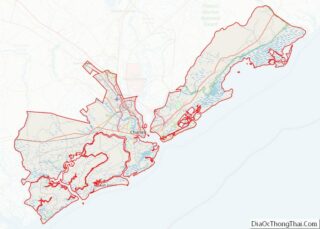
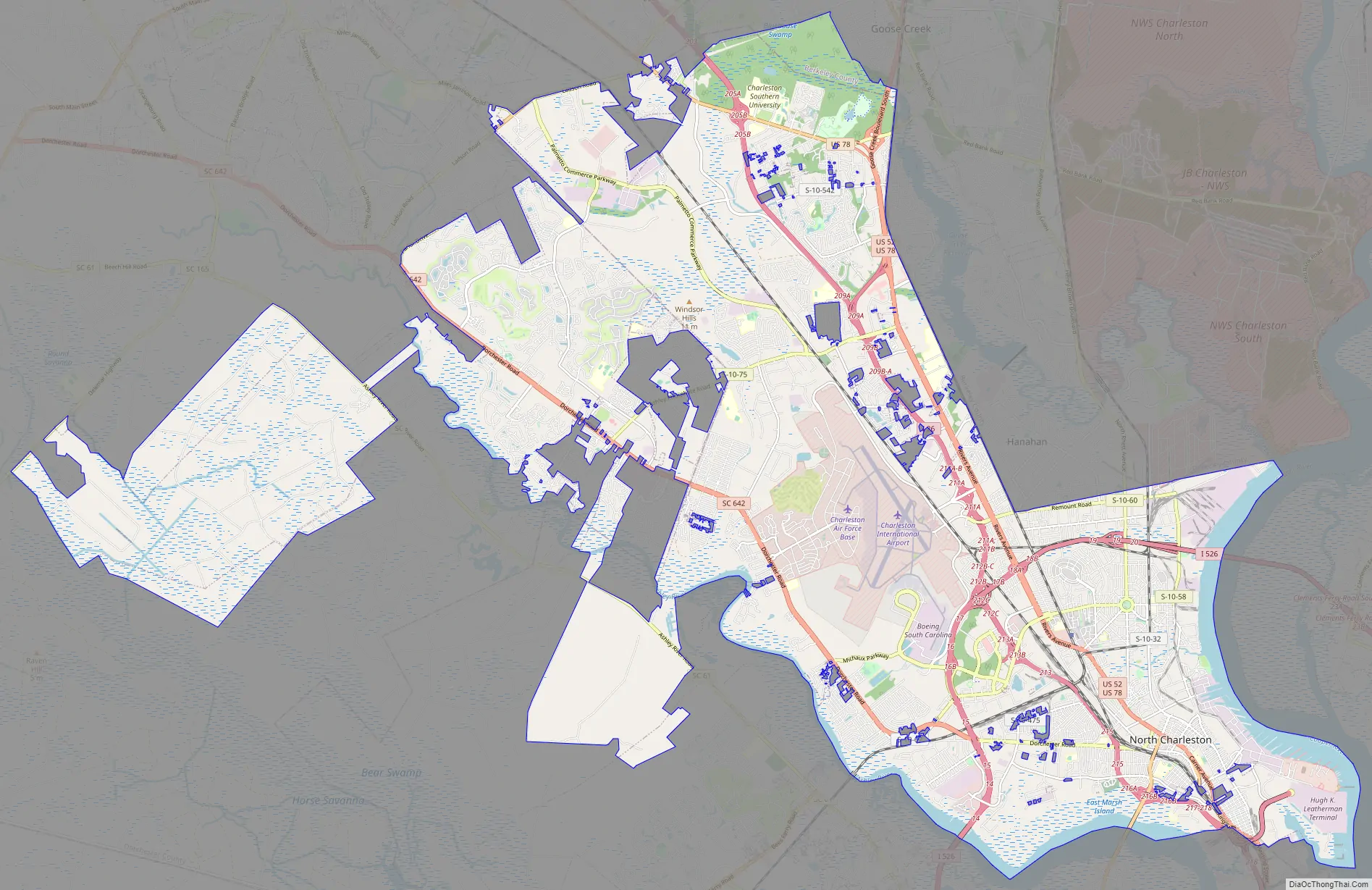
North Charleston Road Map
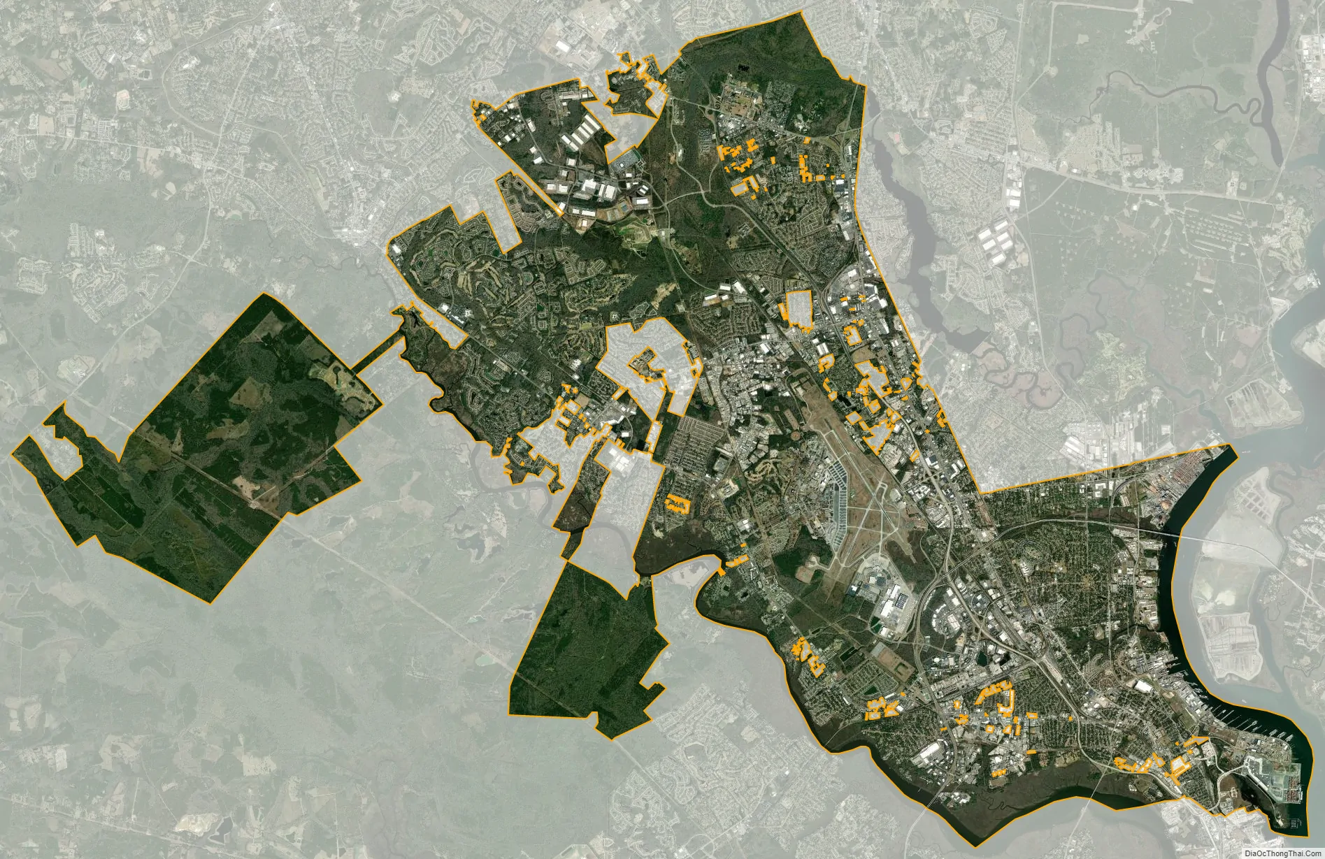
North Charleston city Satellite Map
Geography
North Charleston is located near the Atlantic Ocean in the coastal plain just north of Charleston in South Carolina. According to the 2010 United States Census, the city has a total area of 76.6 square miles (198.5 km), of which 73.2 square miles (189.6 km) is land and 3.5 square miles (9.0 km), or 4.52%, is water.
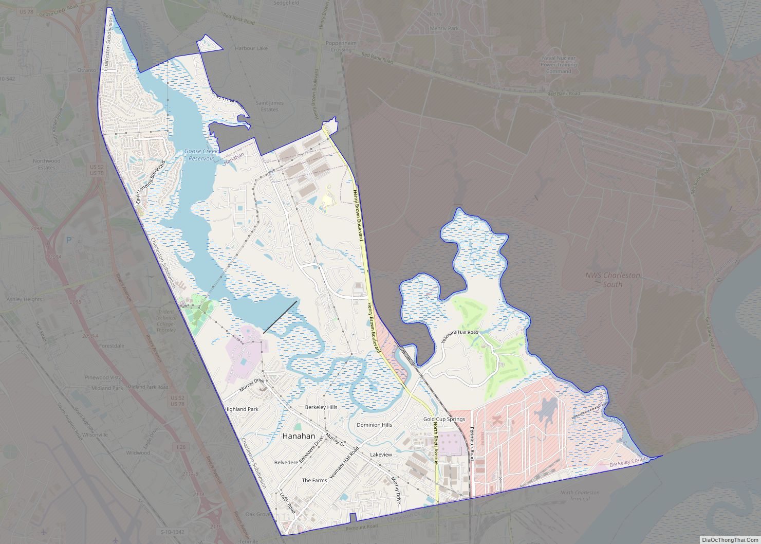
The city is bordered by Charleston to the south and east, the city of Hanahan to the north and east, the city of Goose Creek to the northeast, the unincorporated suburb of Ladson to the north, and the town of Summerville to the northwest. The Ashley River forms a large part of the southwest border of the city, and the Cooper River forms the southeastern border.
Climate
See also
Map of South Carolina State and its subdivision:- Abbeville
- Aiken
- Allendale
- Anderson
- Bamberg
- Barnwell
- Beaufort
- Berkeley
- Calhoun
- Charleston
- Cherokee
- Chester
- Chesterfield
- Clarendon
- Colleton
- Darlington
- Dillon
- Dorchester
- Edgefield
- Fairfield
- Florence
- Georgetown
- Greenville
- Greenwood
- Hampton
- Horry
- Jasper
- Kershaw
- Lancaster
- Laurens
- Lee
- Lexington
- Marion
- Marlboro
- McCormick
- Newberry
- Oconee
- Orangeburg
- Pickens
- Richland
- Saluda
- Spartanburg
- Sumter
- Union
- Williamsburg
- York
- Alabama
- Alaska
- Arizona
- Arkansas
- California
- Colorado
- Connecticut
- Delaware
- District of Columbia
- Florida
- Georgia
- Hawaii
- Idaho
- Illinois
- Indiana
- Iowa
- Kansas
- Kentucky
- Louisiana
- Maine
- Maryland
- Massachusetts
- Michigan
- Minnesota
- Mississippi
- Missouri
- Montana
- Nebraska
- Nevada
- New Hampshire
- New Jersey
- New Mexico
- New York
- North Carolina
- North Dakota
- Ohio
- Oklahoma
- Oregon
- Pennsylvania
- Rhode Island
- South Carolina
- South Dakota
- Tennessee
- Texas
- Utah
- Vermont
- Virginia
- Washington
- West Virginia
- Wisconsin
- Wyoming