Lafayette (/ˌlæfiːˈɛt, ˌlɑːf-/, French: [lafajɛt]) is a city in the U.S. state of Louisiana, and the most populous city and parish seat of Lafayette Parish, located along the Vermilion River. It is Louisiana’s fourth largest incorporated municipality by population with a 2020 census population of 121,374; the consolidated city-parish’s population was 241,753 in 2020. The Lafayette metropolitan area was Louisiana’s third largest metropolitan statistical area with a population of 478,384 at the 2020 census. The Acadiana region containing Lafayette is the largest population and economic corridor between Houston, Texas and New Orleans.
Originally established as Vermilionville in the 1820s and incorporated in 1836, Lafayette developed as an agricultural community until the introduction of retail and entertainment centers, and the discovery of oil in the area in the 1940s. Since the discovery of oil, the city and parish have had the highest number of workers in the oil and natural gas industry in Louisiana as of 2018. With the issuance of a bond ordinance for a series of roads connecting nearby settlements; the establishment of the University of Louisiana System’s Lafayette campus; and the continued diversification of its economy, Lafayette and its metropolitan area have experienced population growth since the 1840 census and was promptly nicknamed “The Hub City.” The city and parish of Lafayette are also known as the “Heart of Acadiana.” As a result of its growth, the city and region have become major centers for the technology industry; Lafayette also became a major center for health care and social services, aerospace, banking and retail. Notable corporations with headquarters or a large presence in the Lafayette area have included Amazon, Brookshire Grocery Company, CGI, JP Morgan Chase, Ochsner Health System, Petroleum Helicopters International, and Rouses Markets.
Lafayette is home to a diverse population from Louisiana Creole and Cajun backgrounds. In 2014, Lafayette was named the “Happiest City in America.” The city and region’s cultural icons include Alexandre Mouton House, Brandt House, Charles H. Mouton House, the Cathedral of Saint John the Evangelist, Daigle House, First United Methodist Church, Holy Rosary Institute, Hope Lodge No. 145, and Old Lafayette City Hall. Its educational institutions include the University of Louisiana at Lafayette, South Louisiana Community College, and Remington College.
| Name: | Lafayette city |
|---|---|
| LSAD Code: | 25 |
| LSAD Description: | city (suffix) |
| State: | Louisiana |
| County: | Lafayette Parish |
| Founded: | 1821 as Vermilionville |
| Elevation: | 49 ft (15 m) |
| Total Area: | 56.00 sq mi (145.03 km²) |
| Land Area: | 55.92 sq mi (144.83 km²) |
| Water Area: | 0.08 sq mi (0.20 km²) auto% |
| Total Population: | 121,374 |
| Population Density: | 2,170.57/sq mi (838.07/km²) |
| ZIP code: | 70501–9, 70593, 70596, 70598 |
| Area code: | 337 |
| FIPS code: | 2240735 |
| Website: | www.lafayettela.gov |
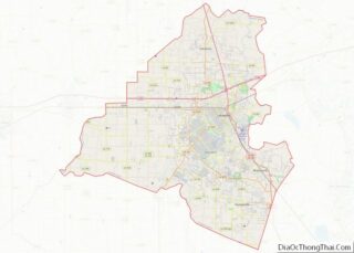
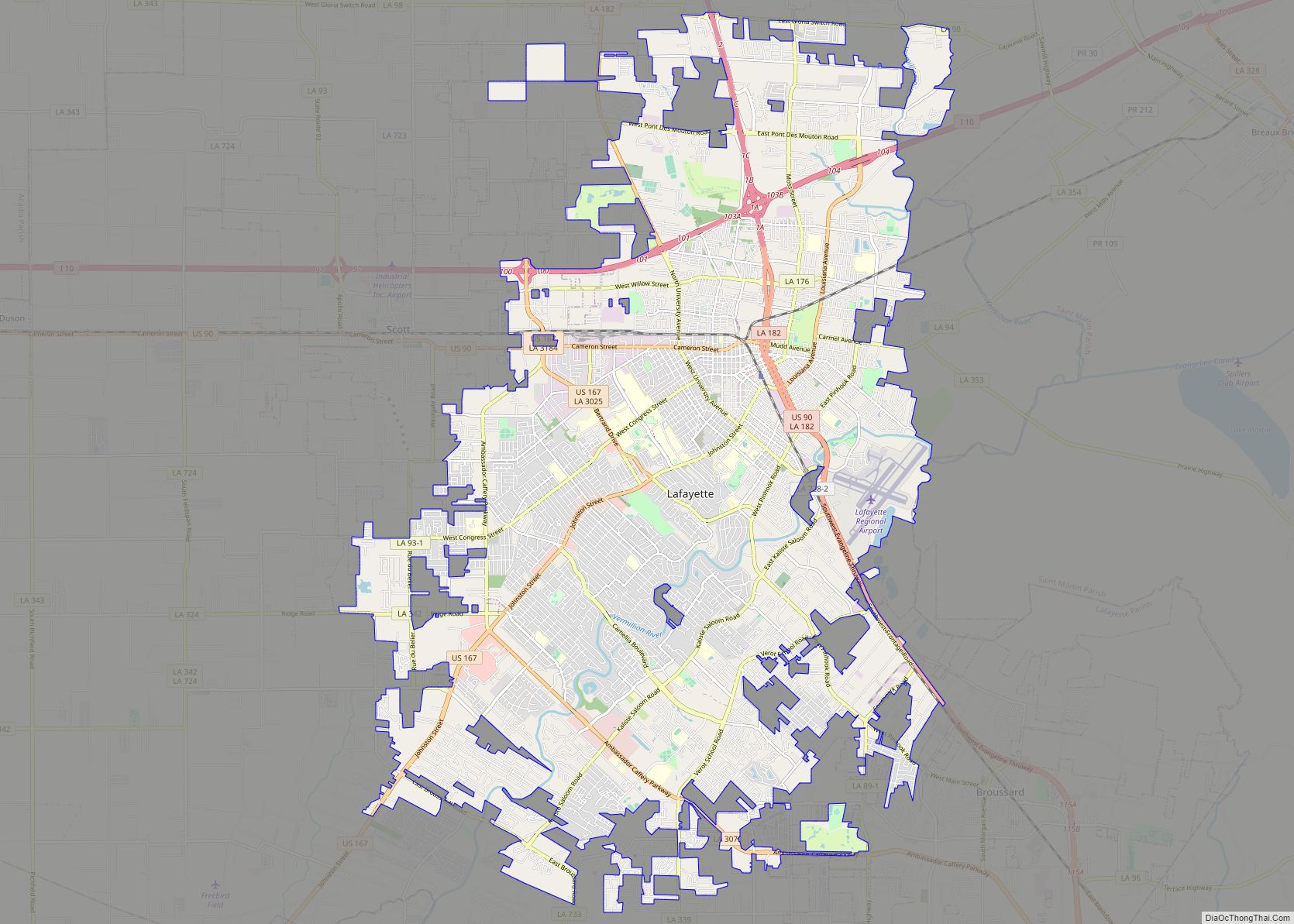
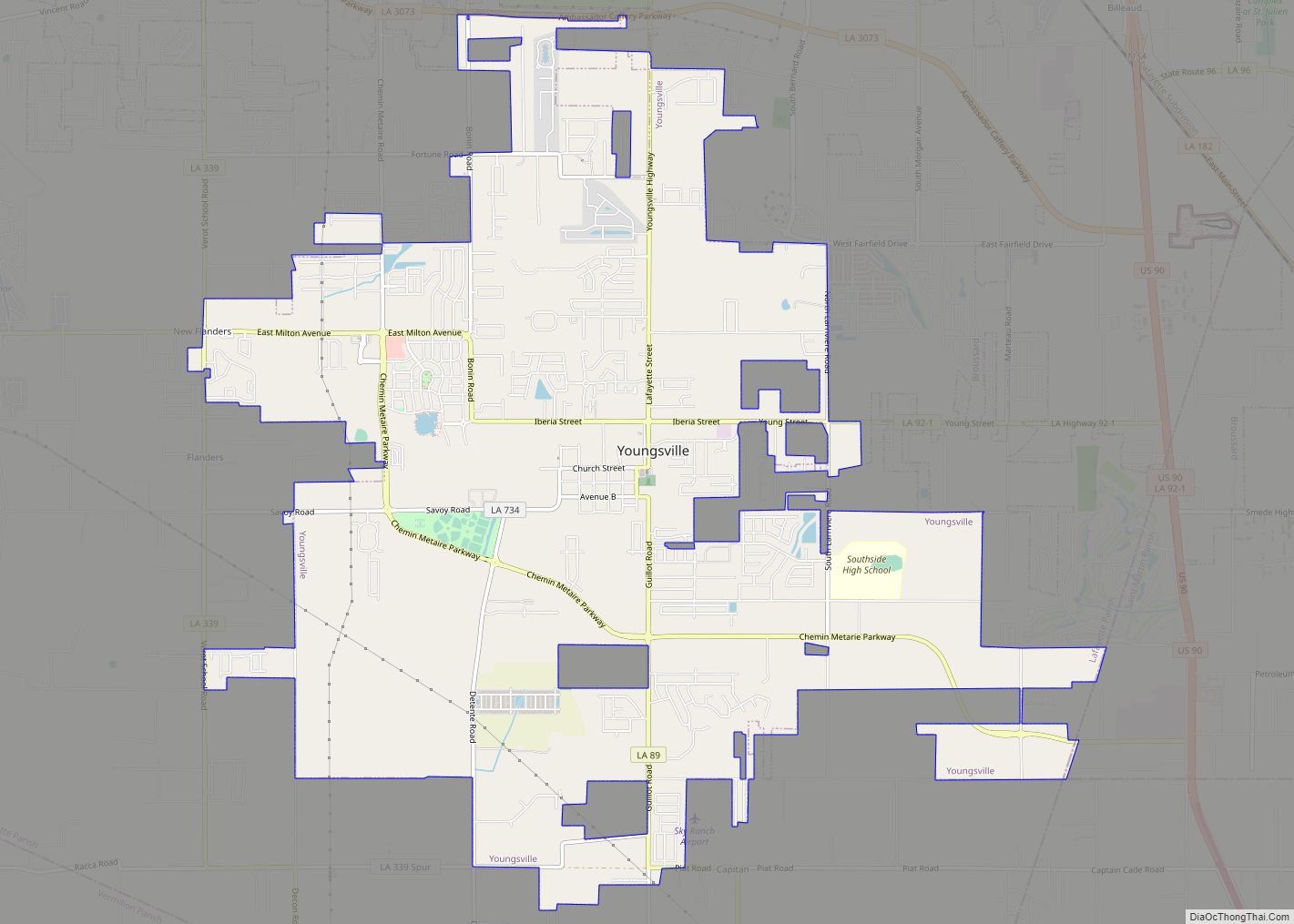
Online Interactive Map
Click on ![]() to view map in "full screen" mode.
to view map in "full screen" mode.
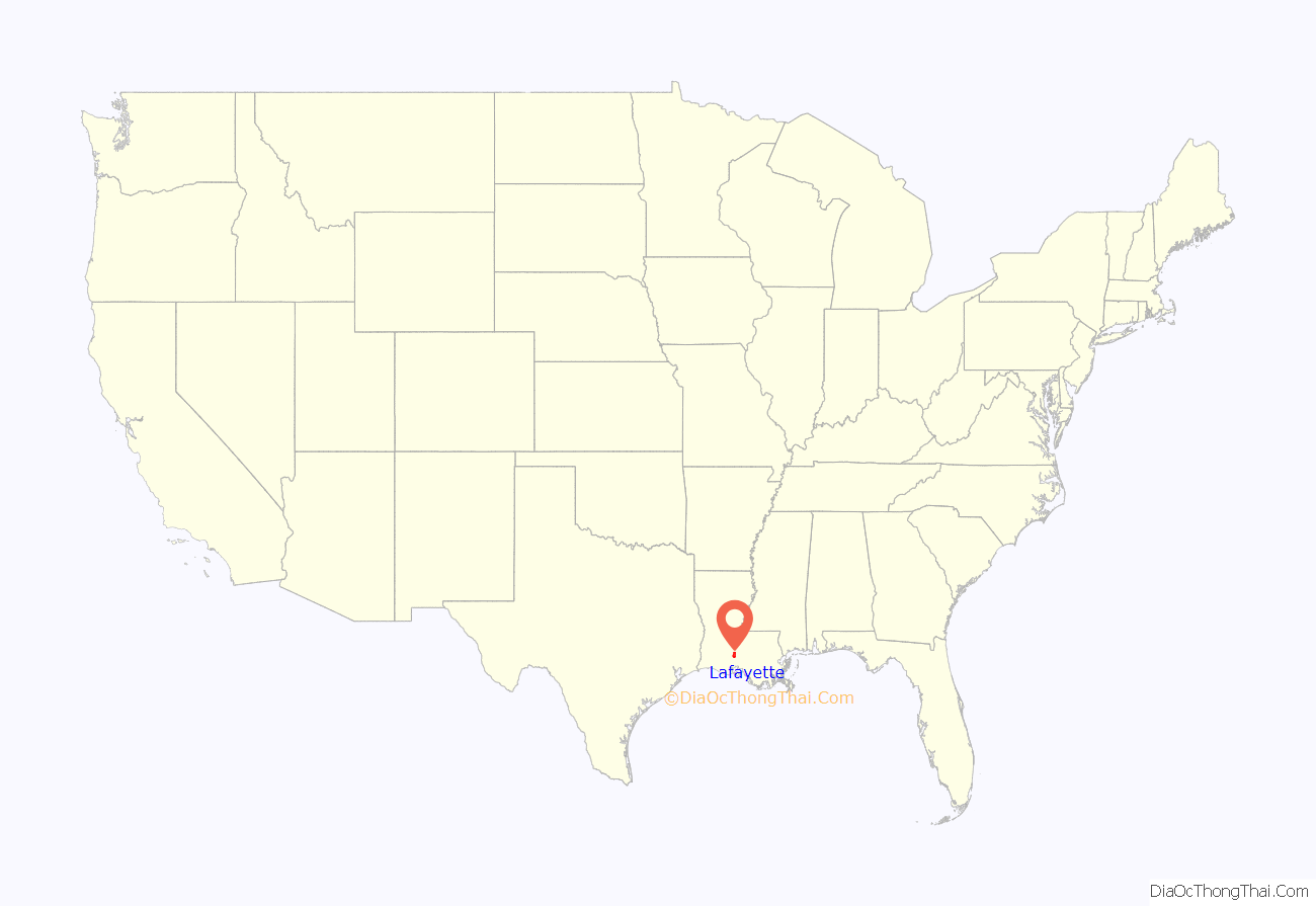
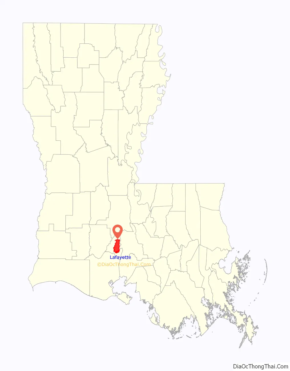
Lafayette location map. Where is Lafayette city?
History
Colonization and settlement
The Attakapa Native Americans inhabited this area at the time of the first European encounter. French colonists founded the first European settlement, Petit Manchac, a trading post along the Vermilion River. In the mid-to-late eighteenth century, numerous Acadian refugees settled in this area, after being expelled from Canada after Great Britain defeated France in the Seven Years’ War. They intermarried with other settlers, forming what became known as Cajun culture, which maintained use of the French language and adherence to the Roman Catholic Church.
Municipal incorporation
Jean Mouton, an Acadian settler, donated land to the Roman Church for construction of a small Catholic chapel at this site. In 1824, this area was selected for the Lafayette Parish seat and was named Vermilionville, for its location on the river; in 1836, the Louisiana State Legislature approved its incorporation.
The area was initially developed by Europeans for agriculture, primarily sugar plantations, which depended on the labor of numerous enslaved Africans and African Americans. They made up a large percentage of the antebellum population. According to U.S. census data in 1830, some 41 percent of the population of Lafayette Parish was enslaved. By 1860, the enslaved population had increased to 49.6 percent. Some free people of color lived in Lafayette Parish, as well; they made up 3 percent to a low of 2.4 percent between 1830 and 1860.
In 1884, Vermilionville was renamed for General Lafayette, a French aristocrat who had fought with and significantly aided the Continental Army during the American Revolutionary War. The city and parish economy continued to be based on agriculture into the early 20th century. After the American Civil War, most of the labor was done by freedmen, who worked as sharecroppers. From the 1930s, mechanization of agriculture began to reduce the need for farm workers.
Growth and consolidation
By 1898, the University of Louisiana at Lafayette was established in the city as the Southwestern Louisiana Industrial Institute. It opened in 1901, and changed its name to the University of Southwestern Louisiana in 1960. The university’s current name was chosen in 1999.
In the 1940s, after oil was discovered in the parish, the petroleum and natural gas industries expanded to dominate the economy. By 2018, Lafayette had the highest number of oil and natural gas industry workers in the state.
Since the latter half of the 20th century, Lafayette has hosted the Festivals Acadiens et Créoles, and was candidate as site for the New Orleans Pelicans NBA G League team in 2017.
In 1996, the city and parish consolidated; the governments of the city and parish were merged, though five other incorporated municipalities continued to operate with their own municipal governments and departments. Since the beginning of the 21st century, a committee proposed the deconsolidation of the city and parish.
In 2015, the city of Lafayette gained international attention for a mass shooting and murder-suicide at Grand 16 Theater; this mass shooting spurred further discussion and debate on gun control in the United States. During 2015, the Lafayette metropolitan area also overtook the Shreveport–Bossier City metropolitan area by population, becoming Louisiana’s third largest metropolitan region.
Lafayette Road Map
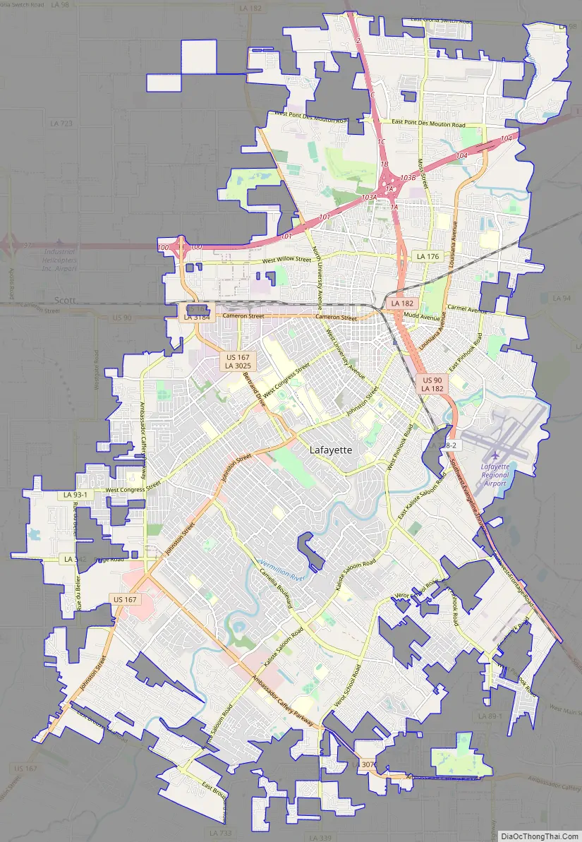
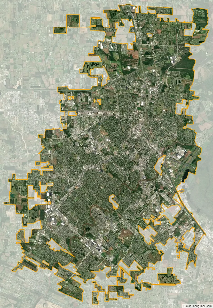
Lafayette city Satellite Map
Geography
The city of Lafayette is located at 30°13′N 92°2′W / 30.217°N 92.033°W / 30.217; -92.033 (30.2139, −92.0294), in southern Louisiana’s Acadiana region on the Gulf Coast of the United States. It was part of the seabed during the earlier Quaternary period. During this time, the Mississippi River cut a 325-foot-deep (99 m) valley between what is now Lafayette and Baton Rouge. This valley was filled and is now the Atchafalaya Basin. The city is located on the western rim of this valley.
The Lafayette area is part of the southwestern Louisiana Prairie Terrace; it is higher and not made of wetlands like much of the surrounding areas to the south and west of Lafayette. Lafayette does not suffer significant flooding problems, outside of local flash flooding. Lafayette has developed on both sides of the Vermilion River. Other significant waterways in the city are Isaac Verot Coulee, Coulee Mine, Coulee des Poches, and Coulee Ile des Cannes, which are natural drainage canals that lead to the Vermilion River.
Lafayette lies approximately 135 miles (217 km) from New Orleans, 59 miles (95 km) from the state capital of Baton Rouge, 75 miles (121 km) from Lake Charles, and 89 miles (143 km) from Alexandria. The city has an elevation ranging from 36 feet (11.0 m) to 49 feet (15 m) above sea level. According to the United States Census Bureau, the city has a total area of 55.65 square miles (144.1 km), of which 55.57 square miles (143.9 km) is land and 0.08 sq mi (0.21 km) (0.19 percent) is covered by water.
Cityscape
The city of Lafayette’s architecture is diverse, with a collection of more than eight downtown structures listed within the National Register of Historic Places. Downtown Lafayette landmarks include Old Lafayette City Hall and the Cathedral of Saint John the Evangelist. Near these structures, Chase and Doubletree have been the area’s tallest buildings at 15 and 16 stories.
With the announcement of the latest addition to the city in over 40 years, two high-rise towers were planned and would stand 4 stories higher. In October 2021, it was announced only one high-rise tower would be constructed citing lack of interest in condominiums within the area; the project was halted in January 2022 citing further difficulties. The attempted construction of new high-rises within the heart of the city followed efforts to redevelop the downtown area in the 2010s and attract further residents. Alongside high-rise construction projects throughout the downtown area, a 70-unit apartment development began in early 2022 spurring continued interest in urban development.
Climate
Lafayette’s climate is described as humid subtropical using Köppen climate classification. It has year-round precipitation, especially during summertime. Lafayette’s highest temperature was 107 °F (42 °C); it has hot, moist summers and warm, damp winters.
See also
Map of Louisiana State and its subdivision:- Acadia
- Allen
- Ascension
- Assumption
- Avoyelles
- Beauregard
- Bienville
- Bossier
- Caddo
- Calcasieu
- Caldwell
- Cameron
- Catahoula
- Claiborne
- Concordia
- De Soto
- East Baton Rouge
- East Carroll
- East Feliciana
- Evangeline
- Franklin
- Grant
- Iberia
- Iberville
- Jackson
- Jefferson
- Jefferson Davis
- La Salle
- Lafayette
- Lafourche
- Lincoln
- Livingston
- Madison
- Morehouse
- Natchitoches
- Orleans
- Ouachita
- Plaquemines
- Pointe Coupee
- Rapides
- Red River
- Richland
- Sabine
- Saint Bernard
- Saint Charles
- Saint Helena
- Saint James
- Saint John the Baptist
- Saint Landry
- Saint Martin
- Saint Mary
- Saint Tammany
- Tangipahoa
- Tensas
- Terrebonne
- Union
- Vermilion
- Vernon
- Washington
- Webster
- West Baton Rouge
- West Carroll
- West Feliciana
- Winn
- Alabama
- Alaska
- Arizona
- Arkansas
- California
- Colorado
- Connecticut
- Delaware
- District of Columbia
- Florida
- Georgia
- Hawaii
- Idaho
- Illinois
- Indiana
- Iowa
- Kansas
- Kentucky
- Louisiana
- Maine
- Maryland
- Massachusetts
- Michigan
- Minnesota
- Mississippi
- Missouri
- Montana
- Nebraska
- Nevada
- New Hampshire
- New Jersey
- New Mexico
- New York
- North Carolina
- North Dakota
- Ohio
- Oklahoma
- Oregon
- Pennsylvania
- Rhode Island
- South Carolina
- South Dakota
- Tennessee
- Texas
- Utah
- Vermont
- Virginia
- Washington
- West Virginia
- Wisconsin
- Wyoming