Map of Gifford town, South Carolina
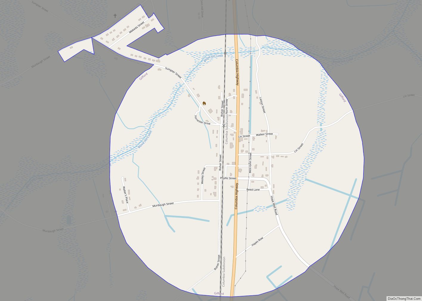
Gifford is a town in Hampton County, South Carolina, United States. The population was 288 at the 2010 census, down from 370 at the 2000 census. Gifford town overview: Name: Gifford town LSAD Code: 43 LSAD Description: town (suffix) State: South Carolina County: Hampton County Elevation: 138 ft (42 m) Total Area: 0.97 sq mi (2.50 km²) Land Area: 0.97 sq mi ... Read more
Map of Gifford town, South Carolina
Map of Georgetown city, South Carolina
Georgetown is the third oldest city in the U.S. state of South Carolina and the county seat of Georgetown County, in the Lowcountry. As of the 2010 census it had a population of 9,163. Located on Winyah Bay at the confluence of the Black, Great Pee Dee, Waccamaw, and Sampit rivers, Georgetown is the second ... Read more
Map of Georgetown city, South Carolina
Map of Gayle Mill CDP
Gayle Mill is a census-designated place (CDP) in Chester County, South Carolina, United States. The population was 913 at the 2010 census, down from 1,094 at the 2000 census. Gayle Mill CDP overview: Name: Gayle Mill CDP LSAD Code: 57 LSAD Description: CDP (suffix) State: South Carolina County: Chester County Elevation: 466 ft (142 m) Total Area: ... Read more
Map of Gayle Mill CDP
Map of Greeleyville town
Greeleyville is a town in Williamsburg County, South Carolina, United States. The population was 438 at the 2010 census. The town was originally chartered on December 20, 1893. Greeleyville’s seal and flag feature a depiction of the first Town Hall, which was built in the 1890s, as well as two arms, one black and one ... Read more
Map of Greeleyville town
Map of Great Falls town, South Carolina
Great Falls is a town in Chester County, South Carolina, United States and is located fourteen miles southwest of Lancaster, South Carolina. The population was 1,979 at the 2010 census. Great Falls town overview: Name: Great Falls town LSAD Code: 43 LSAD Description: town (suffix) State: South Carolina County: Chester County Elevation: 466 ft (142 m) Total ... Read more
Map of Great Falls town, South Carolina
Map of Gray Court town
Gray Court is a town in Laurens County, South Carolina, United States. The population was 795 at the 2010 census. It is part of the Greenville–Mauldin–Easley Metropolitan Statistical Area. Gray Court town overview: Name: Gray Court town LSAD Code: 43 LSAD Description: town (suffix) State: South Carolina County: Laurens County Elevation: 801 ft (244 m) Total Area: ... Read more
Map of Gray Court town
Map of Graniteville CDP, South Carolina
Graniteville is a census-designated place (CDP) in Aiken County, South Carolina, United States. The population was 2,614 at the 2010 census. It lies along U.S. Route 1, five miles (8.0 km) west of Aiken in Horse Creek Valley, which originates in the nearby town of Vaucluse. Graniteville is part of the Augusta, Georgia metropolitan area, also ... Read more
Map of Graniteville CDP, South Carolina
Map of Hardeeville city
Hardeeville is a city in Jasper and Beaufort counties in the U.S. state of South Carolina. The population was 7,473 as of the 2020 census, an increase of over 150% since 2010. Hardeeville is included within the Hilton Head Island–Bluffton metropolitan area. For many years, Hardeeville billed itself as the “Lowcountry Host” due to the ... Read more
Map of Hardeeville city
Map of Hanahan city
Hanahan is a city in Berkeley County, South Carolina, United States. The population was 12,937 at the 2000 census. The 2010 census puts the population at 17,997. Portions of the Naval Weapons Station Charleston, including the Naval Consolidated Brig Charleston, are located in Hanahan. As defined by the U.S. Office of Management and Budget, and ... Read more
Map of Hanahan city
Map of Hampton town, South Carolina
Hampton is a town in Hampton County, South Carolina, United States. The population was 2,808 at the 2010 census. It is the county seat of Hampton County. The town and the county are named after Wade Hampton III, a Confederate general in the Civil War. Hampton town overview: Name: Hampton town LSAD Code: 43 LSAD ... Read more
Map of Hampton town, South Carolina
Map of Greer city, South Carolina
Greer is a city in Greenville and Spartanburg counties in the U.S. state of South Carolina. The population was 35,308 as of the 2020 census. Greer is part of the Greenville–Anderson–Mauldin Metropolitan Statistical Area. The city is additionally part of the Greenville-Spartanburg-Anderson, SC Combined Statistical Area in Upstate South Carolina. Greer is adjacent to Greenville-Spartanburg ... Read more
Map of Greer city, South Carolina
Map of Greenwood city, South Carolina
Greenwood is a city in and the county seat of Greenwood County, South Carolina, United States. The population in the 2020 United States Census was 22,545 down from 23,222 at the 2010 census. The city is home to Lander University. Greenwood city overview: Name: Greenwood city LSAD Code: 25 LSAD Description: city (suffix) State: South ... Read more
Map of Greenwood city, South Carolina