Greer is a city in Greenville and Spartanburg counties in the U.S. state of South Carolina. The population was 35,308 as of the 2020 census. Greer is part of the Greenville–Anderson–Mauldin Metropolitan Statistical Area. The city is additionally part of the Greenville-Spartanburg-Anderson, SC Combined Statistical Area in Upstate South Carolina.
Greer is adjacent to Greenville-Spartanburg International Airport (GSP), which serves Greenville, Spartanburg, and the Upstate. Greer is also the site of the largest BMW manufacturing facility in North America. According to a June 2005 article in The Greenville News, BMW’s Greer plant employs about 9,000 people, and has attracted dozens of suppliers in South Carolina, providing jobs for more than 12,000 people. Greer is home to the South Carolina Inland Port, an intermodal facility that receives and sends containers by rail to the Port of Charleston.
| Name: | Greer city |
|---|---|
| LSAD Code: | 25 |
| LSAD Description: | city (suffix) |
| State: | South Carolina |
| County: | Greenville County, Spartanburg County |
| Founded: | 1876 |
| Elevation: | 1,014 ft (309 m) |
| Total Area: | 25.56 sq mi (66.20 km²) |
| Land Area: | 23.44 sq mi (60.71 km²) |
| Water Area: | 2.12 sq mi (5.49 km²) |
| Total Population: | 35,308 |
| Population Density: | 1,506.38/sq mi (581.62/km²) |
| ZIP code: | 29650-29652 |
| Area code: | 864 |
| FIPS code: | 4530985 |
| GNISfeature ID: | 1245847 |
| Website: | www.cityofgreer.org |
Online Interactive Map
Click on ![]() to view map in "full screen" mode.
to view map in "full screen" mode.
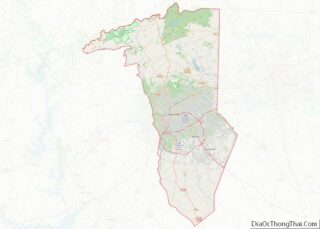
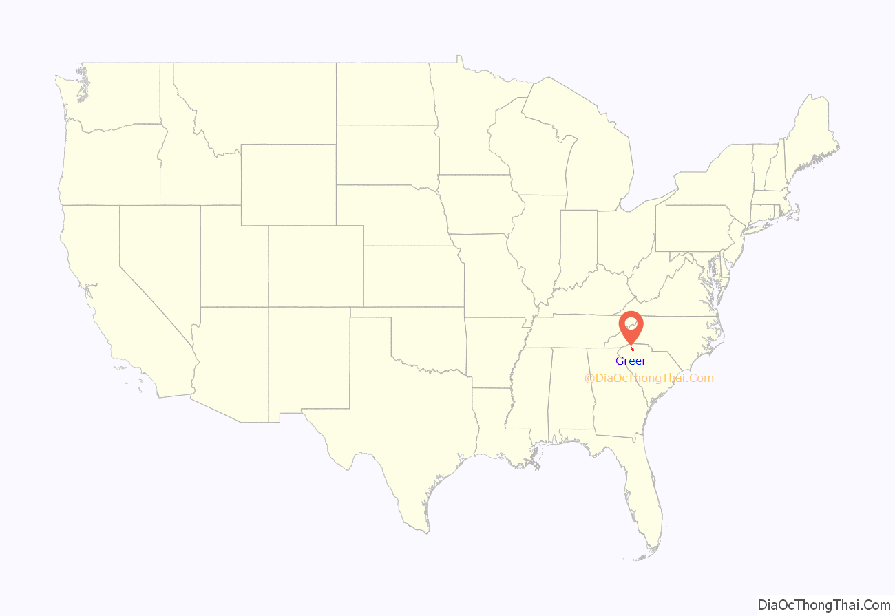
Greer location map. Where is Greer city?

History
Greer was named for James Manning Greer, whose ancestry traces from Scotland, through Ireland. Many of his descendants still reside in the region. James Manning Greer was a descendant of John Greer Sr., who surveyed his land in Laurens County in 1750. John and his family were already in Laurens County, prior to the Greer passengers who arrived aboard the ship The Falls in 1764. John Greer’s family settled at Duncans Creek between that Creek and the Enoree River and close to Duncan’s Creek Presbyterian Church. John, Sr.’s great grandson James Manning Greer settled his family near Greenville in an area that eventually became Greer’s Station.
The area now known as Greer was once part of the “Domain of the Cherokees” prior to the American Revolutionary War. In 1777, the area was added to the state of South Carolina. Development toward the birth of the town occurred in 1873, when the Richmond and Danville Air Line Railway (now the Norfolk Southern Railway) established a line between Atlanta and Charlotte. A station was built on land that belonged to James Manning Greer, and was named Greer’s Station. The first post office was located in the new depot, Greer’s Depot. That depot was a red brick, Victorian structure with a slate roof and a cupola. It was located immediately adjacent to the current Norfolk Southern rail line between Trade Street and Depot Street, facing toward Moore Street. It was demolished in 1976 by its then owner, the Southern Railway System, in order to avoid property taxes. When the town was incorporated in 1876, it was named Town of Greer’s. One hundred years later, the name was officially changed to the City of Greer without an “s” on the end.
Merchants, blacksmiths and physicians set up shop in what is now the downtown area of Greer. In 1900, Greer’s first bank, the Bank of Greer’s, opened. The Piedmont and Northern Railway laid a second railroad line through Greer in 1914. With two active train lines, Greer became an attractive site for commerce. The railway meant big business for local farmers, enabling them to ship their crops, mainly cotton and peaches, out of state. Greer also became a textile-manufacturing center, with flourishing mills that included Victor, Franklin, Apalache and Greer Mills. The communities that grew up around the mills were as close-knit as the outlying farming communities.
In 1939, artist Winfred Walkley painted a mural, Cotton and Peach Growing, for the town’s old post office as one of thirteen works commissioned by the U.S. Treasury Department’s Section of Fine Arts between 1938 and 1941 for post offices and federal buildings throughout South Carolina. The building is now home to the Greer Heritage Museum.
After World War II, the city began to grow and diversify its industrial base. A new hospital and high school were built. People came to downtown Greer from Spartanburg and Greenville to shop. In the early 1960s, Interstate 85 was opened, as well as the Greenville-Spartanburg International Airport. Imports derailed the textile industry in the 1970s and threatened to turn Greer into a ghost town, but the citizens of Greer worked together to attract new industry.
The Arthur Barnwell House, Davenport House, Gilreath’s Mill, Greer Depot, Greer Downtown Historic District, Greer Post Office, Louie James House, R. Perry Turner House, Robert G. Turner House and Earle R. Taylor House and Peach Packing Shed are listed on the National Register of Historic Places.
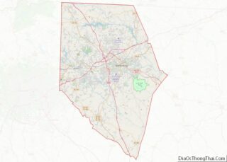
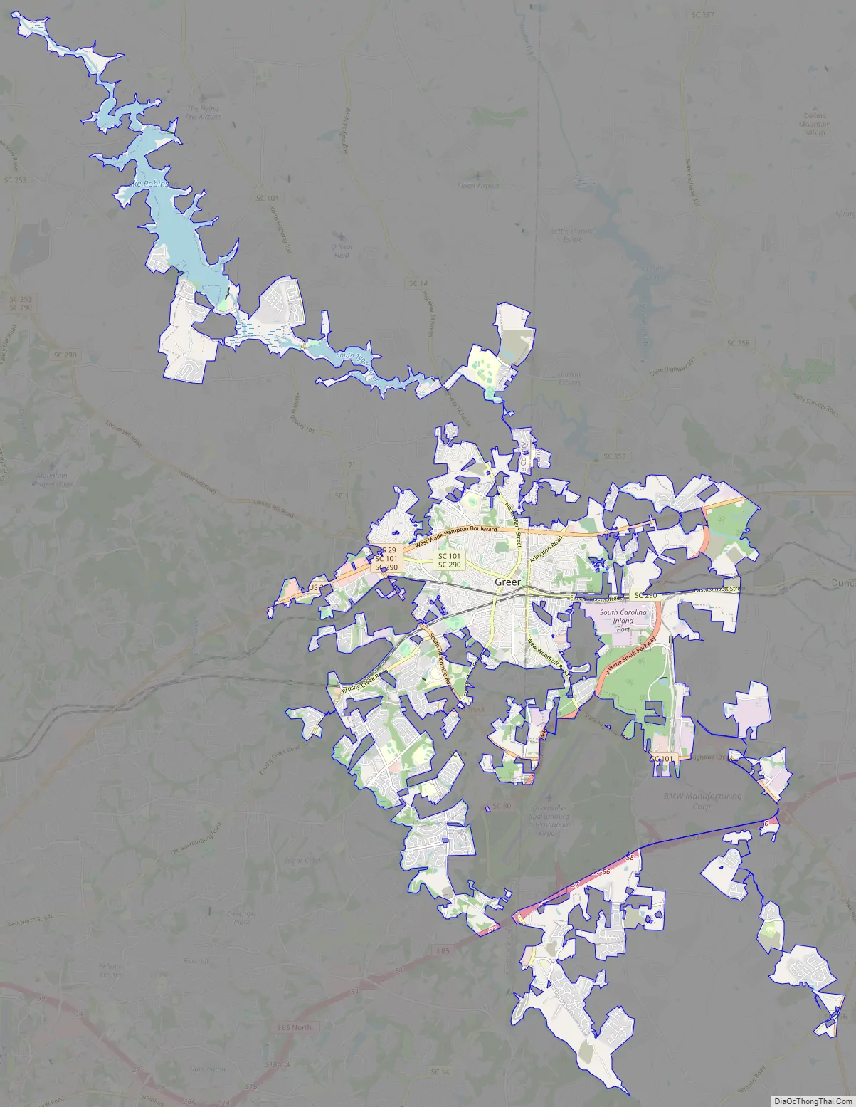
Greer Road Map
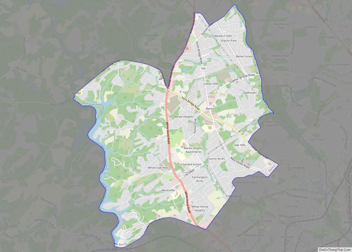
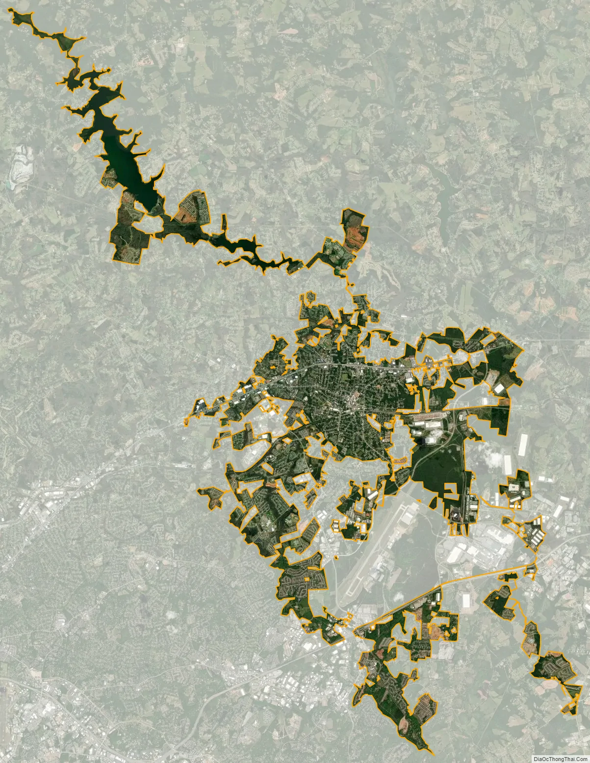
Greer city Satellite Map
Geography
Greer is located at 34°55′49″N 82°13′30″W / 34.93028°N 82.22500°W / 34.93028; -82.22500 (34.930304, -82.225052). It is 12 miles (19 km) northeast of Greenville and 17 miles (27 km) west of Spartanburg, both via U.S. Route 29.
According to the United States Census Bureau, the city has a total area of 22.7 square miles (58.9 km), of which 20.6 square miles (53.4 km) are land and 2.1 square miles (5.4 km), or 9.18%, are water. Greer has three lakes: Lake Robinson, Apalache Lake and Lake Cunningham. The South Tyger River runs through the northern part of Greer, part of the Broad River watershed.
See also
Map of South Carolina State and its subdivision:- Abbeville
- Aiken
- Allendale
- Anderson
- Bamberg
- Barnwell
- Beaufort
- Berkeley
- Calhoun
- Charleston
- Cherokee
- Chester
- Chesterfield
- Clarendon
- Colleton
- Darlington
- Dillon
- Dorchester
- Edgefield
- Fairfield
- Florence
- Georgetown
- Greenville
- Greenwood
- Hampton
- Horry
- Jasper
- Kershaw
- Lancaster
- Laurens
- Lee
- Lexington
- Marion
- Marlboro
- McCormick
- Newberry
- Oconee
- Orangeburg
- Pickens
- Richland
- Saluda
- Spartanburg
- Sumter
- Union
- Williamsburg
- York
- Alabama
- Alaska
- Arizona
- Arkansas
- California
- Colorado
- Connecticut
- Delaware
- District of Columbia
- Florida
- Georgia
- Hawaii
- Idaho
- Illinois
- Indiana
- Iowa
- Kansas
- Kentucky
- Louisiana
- Maine
- Maryland
- Massachusetts
- Michigan
- Minnesota
- Mississippi
- Missouri
- Montana
- Nebraska
- Nevada
- New Hampshire
- New Jersey
- New Mexico
- New York
- North Carolina
- North Dakota
- Ohio
- Oklahoma
- Oregon
- Pennsylvania
- Rhode Island
- South Carolina
- South Dakota
- Tennessee
- Texas
- Utah
- Vermont
- Virginia
- Washington
- West Virginia
- Wisconsin
- Wyoming