Hardeeville is a city in Jasper and Beaufort counties in the U.S. state of South Carolina. The population was 7,473 as of the 2020 census, an increase of over 150% since 2010. Hardeeville is included within the Hilton Head Island–Bluffton metropolitan area.
For many years, Hardeeville billed itself as the “Lowcountry Host” due to the prevalence of lodging and traveler-oriented facilities along U.S. Highway 17 and later Interstate 95. In recent years, the city has expanded its economic focus due to high population growth. According to Census estimates, Hardeeville posted the highest population growth rate of any municipality in South Carolina, growing 53.4 percent from 2010 to 2014.
| Name: | Hardeeville city |
|---|---|
| LSAD Code: | 25 |
| LSAD Description: | city (suffix) |
| State: | South Carolina |
| County: | Jasper County |
| Incorporated: | 1911 |
| Elevation: | 23 ft (7 m) |
| Total Area: | 56.82 sq mi (147.17 km²) |
| Land Area: | 56.71 sq mi (146.88 km²) |
| Water Area: | 0.11 sq mi (0.28 km²) |
| Total Population: | 7,473 |
| Population Density: | 131.77/sq mi (50.88/km²) |
| ZIP code: | 29927 29909 (portions of) 29936 (portions of) |
| Area code: | 843, 854 |
| FIPS code: | 4532245 |
| GNISfeature ID: | 1223032 |
| Website: | www.cityofhardeeville.com |
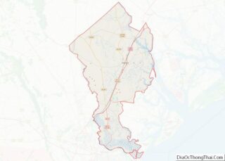
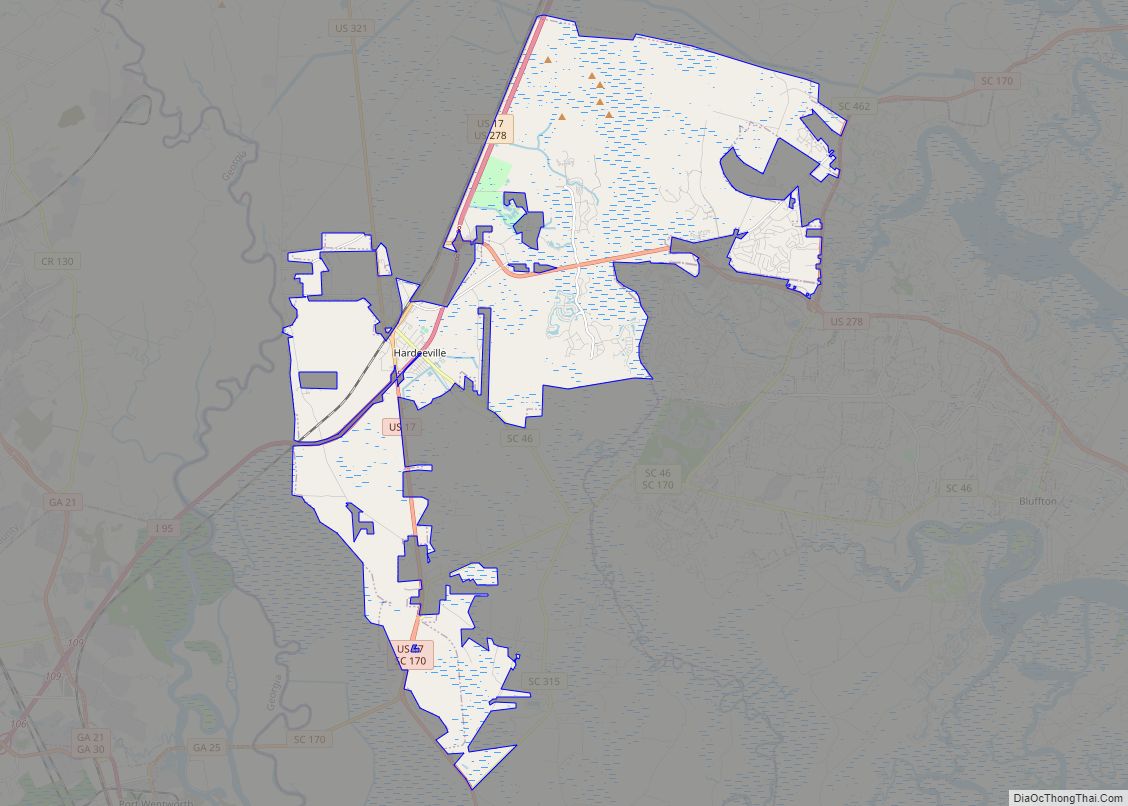
Online Interactive Map
Click on ![]() to view map in "full screen" mode.
to view map in "full screen" mode.
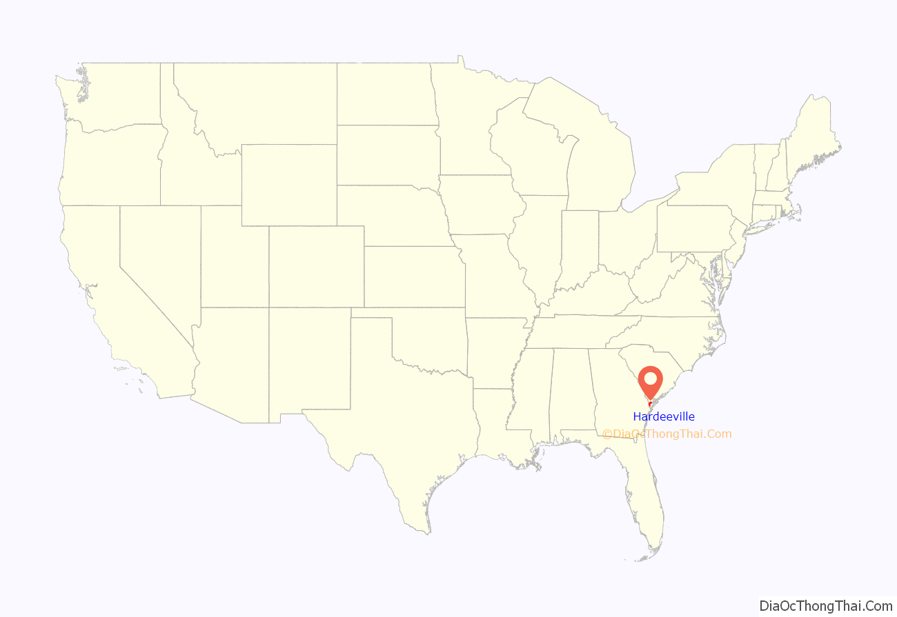
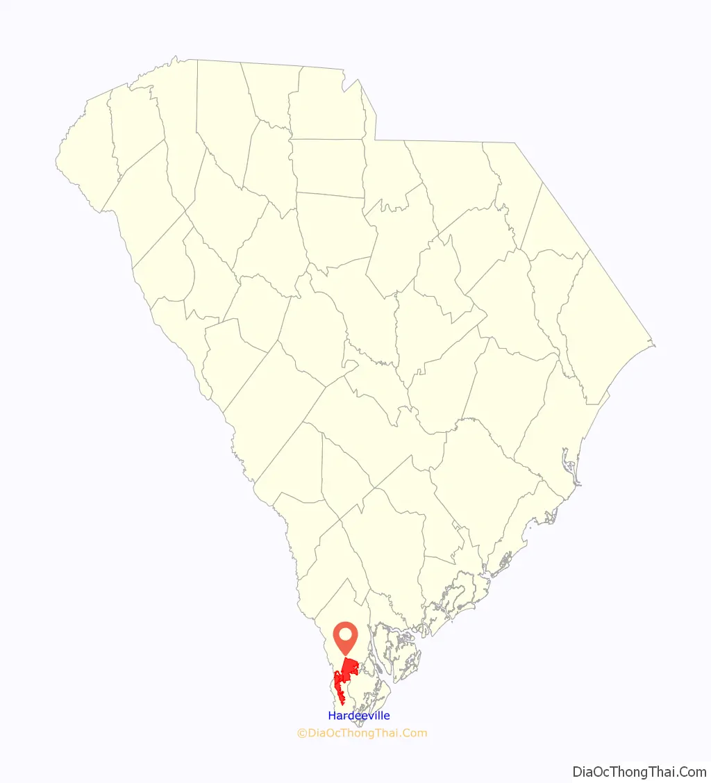
Hardeeville location map. Where is Hardeeville city?
History
The earliest European settlement in the region was Purrysburg, a former Swiss Huguenot settlement founded in 1732 on the banks of the Savannah River, about 2 miles (3 km) northwest of the current city’s center. The settlement ultimately failed, as disease and competition from growing Savannah proved too much for the local settlers to overcome. Many left the immediate area, moving elsewhere in the Lowcountry region (including a new hamlet called Switzerland) or upriver to the new communities of Augusta, Georgia, and Hamburg, South Carolina, though some remained.
The area saw some skirmishes between Union and Confederate forces during the Civil War. The Charleston and Savannah Railway (today’s CSX Transportation) was considered a prized possession and major strategic goal for Union forces. The Battle of Honey Hill, an effort to defend the railroad, was one of the later battles won by Southern forces in late 1864, shortly before General William Sherman entered South Carolina after his March to the Sea in Georgia.
The area within the city was settled in the 19th century by Isaac Hardee, a native from North Carolina. Through the efforts of his son, Whyte William Hardee, a depot and general store along the Charleston and Savannah Railway opened up. This depot and the surrounding areas became collectively known as “Hardee’s Station”, and eventually as “Hardeeville” at the town’s founding in 1911. The area became renowned for its timber operations with the Argent Lumber Company, which had one of the largest logging operations in the world. Unique to the area was the swamp logging procedure, with conditions that were far more treacherous than standard logging. 3 ft (914 mm) narrow-gauge railroads were constructed to help deliver timber to a processing area, where the lumber would be lifted onto 4 ft 8+1⁄2 in (1,435 mm) standard gauge rail cars or trucks headed to all parts of North America. As a tribute to Argent’s impact on the community, the city was donated an H.K. Porter 2-8-0 steam locomotive (c/n 4776, built January 1911), Argent Lumber Company Number 7, for display in 1960.
Growth continued at a modest pace throughout the rest of the 20th century, though timbering operations were gradually scaled back as overseas lands became more sought after due to lower costs and more standard logging procedures. In spite of the decline of the logging industry, the construction of U.S. Route 17 and later Interstate 95 provided a new type of commerce: motorist services such as motels, restaurants, and gas stations. The development of Hilton Head Island to the southeast as a resort destination had a further impact on the community, with an additional interstate exit providing greater commercial opportunity and affordable costs of living for service employees who moved to the city.
At the start of the 21st century, development pressures along the U.S. Route 278 corridor became a central concern for city leaders. In response, Hardeeville began to annex large undeveloped parcels of land that were previously held by timbering and paper concerns. These annexations were done in order to guide new growth into larger planned developments, increasing the city limits from 5 square miles (13 km) in 2000 to over 45 square miles (117 km) in 2010. In 2004, Core Communities became the first company to sign a development agreement with the city and began constructing Tradition Hilton Head. In the following years, other developments have begun or announced plans at developing in these areas. Although the recession beginning in late 2007 significantly slowed the pace of development, the city has continued to grow due to continuous commitments from existing developers, and new investment related to industrial and commercial opportunities. These investments have allowed the city to make improvements to its existing areas in the form of streetscaping projects, improved community facilities, and general reinvestment.
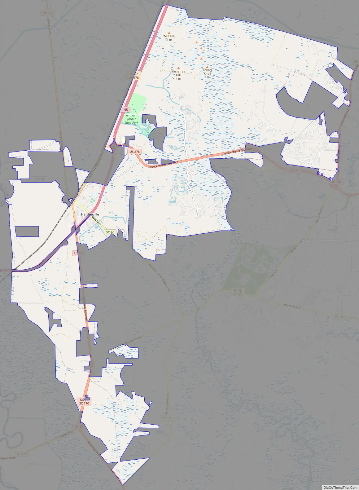
Hardeeville Road Map
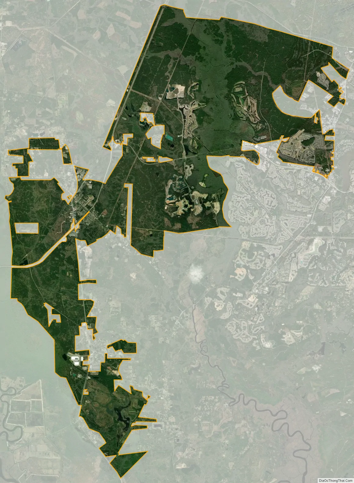
Hardeeville city Satellite Map
Geography
Hardeeville is located south of the center of Jasper County at 32°17′2″N 81°4′43″W / 32.28389°N 81.07861°W / 32.28389; -81.07861 (32.283850, -81.078496). According to the United States Census Bureau, the city had a total area of 45.27 square miles (117.25 km) in 2010, of which 45.16 square miles (116.97 km) were land and 0.11 square miles (0.28 km), or 0.24%, were water. Nearly 90 percent of the city limits was annexed between 2000 and 2010, primarily to accommodate large, planned development communities located on former lands devoted to logging and timber harvesting.
The city is located on the Atlantic coastal plain, with very few variations in elevation. The average elevation of the city is approximately 20 feet (6.1 m) above mean sea level. Most of Hardeeville is located within Jasper County, though a small portion of the city crosses into Beaufort County. Much of the city is bordered to the west by the Savannah National Wildlife Refuge, a large-scale nature preserve along the South Carolina and Georgia sides of the Savannah River.
See also
Map of South Carolina State and its subdivision:- Abbeville
- Aiken
- Allendale
- Anderson
- Bamberg
- Barnwell
- Beaufort
- Berkeley
- Calhoun
- Charleston
- Cherokee
- Chester
- Chesterfield
- Clarendon
- Colleton
- Darlington
- Dillon
- Dorchester
- Edgefield
- Fairfield
- Florence
- Georgetown
- Greenville
- Greenwood
- Hampton
- Horry
- Jasper
- Kershaw
- Lancaster
- Laurens
- Lee
- Lexington
- Marion
- Marlboro
- McCormick
- Newberry
- Oconee
- Orangeburg
- Pickens
- Richland
- Saluda
- Spartanburg
- Sumter
- Union
- Williamsburg
- York
- Alabama
- Alaska
- Arizona
- Arkansas
- California
- Colorado
- Connecticut
- Delaware
- District of Columbia
- Florida
- Georgia
- Hawaii
- Idaho
- Illinois
- Indiana
- Iowa
- Kansas
- Kentucky
- Louisiana
- Maine
- Maryland
- Massachusetts
- Michigan
- Minnesota
- Mississippi
- Missouri
- Montana
- Nebraska
- Nevada
- New Hampshire
- New Jersey
- New Mexico
- New York
- North Carolina
- North Dakota
- Ohio
- Oklahoma
- Oregon
- Pennsylvania
- Rhode Island
- South Carolina
- South Dakota
- Tennessee
- Texas
- Utah
- Vermont
- Virginia
- Washington
- West Virginia
- Wisconsin
- Wyoming