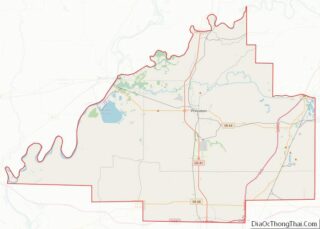
Map of Rock County, Nebraska
Rock County is a county in the U.S. state of Nebraska. As of the 2010 United States Census, the population was 1,526. Its county seat is Bassett. In the Nebraska license plate system, Rock County is represented by the prefix 81 (it had the 81st-largest number of vehicles registered in the county when the license ... Read more
Map of Rock County, Nebraska
Map of Webster County, Nebraska
Webster County is a county in the U.S. state of Nebraska. As of the 2020 United States Census, the population was 3,411. Its county seat is Red Cloud. The county was formed in 1871, and was named for Daniel Webster. In the Nebraska license plate system, Webster County is represented by the prefix 45 (it ... Read more
Map of Webster County, Nebraska
Map of Pershing County, Nevada
Pershing County is a county in the U.S. state of Nevada. As of the 2020 census, the population was 6,650. Its county seat is Lovelock. The county was named after army general John J. Pershing (1860–1948). It was formed from Humboldt County in 1919, and the last county to be established in Nevada. The Black ... Read more
Map of Pershing County, Nevada
Map of Burlington County, New Jersey
Burlington County overview: Name: Burlington County FIPS code: 34-005 State: New Jersey Founded: May 17, 1694 Named for: Bridlington, England Seat: Mount Holly Total Area: 819.84 sq mi (2,123.4 km²) Land Area: 798.58 sq mi (2,068.3 km²) Total Population: 461,860 Population Density: 560/sq mi (220/km²) Website: www.co.burlington.nj.us Burlington County location map. Where is Burlington County? History Etymology Anglo-European records of Burlington County ... Read more
Map of Burlington County, New Jersey
Map of Sussex County, New Jersey
Sussex County overview: Name: Sussex County FIPS code: 34-037 State: New Jersey Founded: June 8, 1753 Named for: Sussex, England Seat: Newton Largest city: Vernon Township (population and area) Total Area: 535.74 sq mi (1,387.6 km²) Land Area: 519.01 sq mi (1,344.2 km²) Total Population: 144,221 Population Density: 278.1/sq mi (107.4/km²) Website: www.sussex.nj.us Sussex County location map. Where is Sussex County? History ... Read more
Map of Sussex County, New Jersey
Map of Lea County, New Mexico
Lea County is a county located in the U.S. state of New Mexico. As of the 2010 census, its population was 64,727. Its county seat is Lovington. It is both west and north of the Texas state line. Lea County comprises the Hobbs, NM micropolitan statistical area. Lea County overview: Name: Lea County FIPS code: ... Read more
Map of Lea County, New Mexico
Map of Taos County, New Mexico
Taos County is a county in the U.S. state of New Mexico. As of the 2020 census, the population was 34,489. Its county seat is Taos. The county was formed in 1852 as one of the original nine counties in New Mexico Territory. Taos County comprises the Taos, New Mexico Micropolitan Statistical Area. Taos County ... Read more
Map of Taos County, New Mexico
Map of Delaware County, New York
Delaware County is a county located in the US state of New York. As of the 2020 United States census, the population was 44,308. The county seat is Delhi. The county is named after the Delaware River, which was named in honor of Thomas West, 3rd Baron De La Warr, appointed governor of Virginia in ... Read more
Map of Delaware County, New York
Map of Monroe County, New York
Monroe County is a county in the Finger Lakes region of the State of New York. The county is along Lake Ontario’s southern shore. At the 2020 census, Monroe County’s population was 759,443, an increase since the 2010 census. Its county seat and largest city is the city of Rochester. The county is named after ... Read more
Map of Monroe County, New York
Map of Rockland County, New York
Rockland County overview: Name: Rockland County FIPS code: 36-087 State: New York Founded: 1798 Named for: Its rocky terrain Seat: New City Total Area: 199.34 sq mi (516.3 km²) Land Area: 173.55 sq mi (449.5 km²) Total Population: 338,329 Time zone: UTC−5 (Eastern) Summer Time Zone (DST): UTC−4 (EDT) Website: www.rocklandgov.com Rockland County location map. Where is Rockland County? History The ... Read more
Map of Rockland County, New York
Map of Westchester County, New York
Westchester County is located in the U.S. state of New York. It is the seventh most populous county in the State of New York and the most populous north of New York City. According to the 2020 United States Census, the county had a population of 1,004,456, its highest decennial count ever and an increase ... Read more
Map of Westchester County, New York
Map of Caldwell County, North Carolina
Caldwell County is a county in the U.S. state of North Carolina. It is located in the foothills of the Blue Ridge Mountains. As of the 2020 census, the population was 80,652. Its county seat is Lenoir. Caldwell County is part of the Hickory–Lenoir–Morganton, NC Metropolitan Statistical Area. Caldwell County overview: Name: Caldwell County FIPS ... Read more
Map of Caldwell County, North Carolina