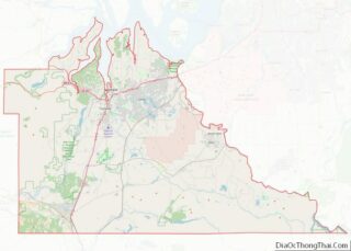
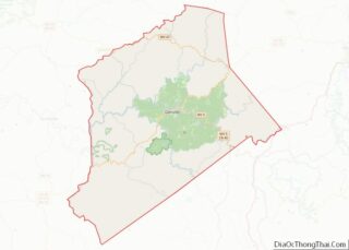
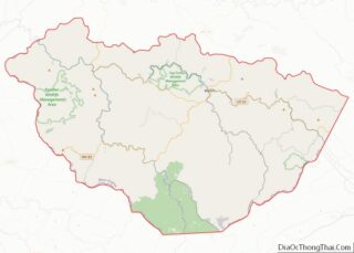
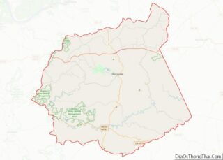
Map of Columbia County

Map of Columbia County, Georgia

Columbia County is a county located in the east central portion of the US state of Georgia. As of the 2020 census, the population was 124,035. The legal county seat is Appling, but the de facto seat of county government is Evans. Columbia County is included in the Augusta-Richmond County, GA-SC Metropolitan Statistical Area. It … Read more

Map of Elbert County

Map of Elbert County, Georgia

Elbert County is a county located in the northeastern part of the U.S. state of Georgia. As of the 2020 census, the population was 19,637. The county seat is Elberton. The county was established on December 10, 1790, and was named for Samuel Elbert. Elbert County overview: Name: Elbert County FIPS code: 13-105 State: Georgia … Read more

Map of Habersham County

Map of Habersham County, Georgia

Habersham County is a county located in the northeastern part of the U.S. state of Georgia. As of the 2020 census, the population was 46,031. The county seat is Clarkesville. The county was created on December 15, 1817, and named for Colonel Joseph Habersham of the Continental Army in the Revolutionary War. Habersham County comprises … Read more

Map of Jones County

Map of Jones County, Georgia

Jones County is a county in the central portion of the U.S. state of Georgia. As of the 2020 census, the population was 28,347. The county seat is Gray. The county was created on December 10, 1807, and named after U.S. Representative James Jones. Jones County overview: Name: Jones County FIPS code: 13-169 State: Georgia … Read more

Map of Miller County

Map of Miller County, Georgia

Miller County overview: Name: Miller County FIPS code: 13-201 State: Georgia Founded: 1856 Seat: Colquitt Largest city: Colquitt Total Area: 284 sq mi (740 km²) Land Area: 282 sq mi (730 km²) Total Population: 6,000 Population Density: 21/sq mi (8/km²) Time zone: UTC−5 (Eastern) Summer Time Zone (DST): UTC−4 (EDT) Website: www.millercountyga.gov Miller County location map. Where is Miller County? Miller County … Read more

Map of Pulaski County

Map of Pulaski County, Georgia

Pulaski County is a county located in the central portion of the U.S. state of Georgia. As of the 2020 census, the population was 9,855. The county seat is Hawkinsville. Pulaski County overview: Name: Pulaski County FIPS code: 13-235 State: Georgia Founded: 1808 Named for: Kazimierz Pułaski Seat: Hawkinsville Largest city: Hawkinsville Total Area: 251 sq mi … Read more

Map of Tattnall County

Map of Tattnall County, Georgia

Tattnall County is a county located in the southeast portion of the U.S. state of Georgia. As of the 2020 census, the population was 22,842. The county seat is Reidsville. Tattnall County was created on December 5, 1801, from part of Montgomery County, Georgia by the Georgia General Assembly. The county was named after Josiah … Read more

Map of Ware County

Map of Ware County, Georgia

Ware County overview: Name: Ware County FIPS code: 13-299 State: Georgia Founded: 1824 Named for: Nicholas Ware Seat: Waycross Largest city: Waycross Total Area: 908 sq mi (2,350 km²) Land Area: 892 sq mi (2,310 km²) Total Population: 36,251 Population Density: 41/sq mi (16/km²) Time zone: UTC−5 (Eastern) Summer Time Zone (DST): UTC−4 (EDT) Website: www.warecounty.com Ware County location map. Where is … Read more

Map of Maui County

Map of Maui County, Hawaii

Maui County, officially the County of Maui, is a county in the U.S. state of Hawaii. It consists of the islands of Maui, Lānaʻi, Molokaʻi (except for a portion of Molokaʻi that comprises Kalawao County), Kahoʻolawe, and Molokini. The latter two are uninhabited. As of the 2020 census, the population was 164,754. The county seat … Read more

Map of Cassia County

Map of Cassia County, Idaho

Cassia County is a county in the U.S. state of Idaho. As of the 2020 Census the county had a population of 24,655. The county seat and largest city is Burley. Cassia County is included in the Burley, ID Micropolitan Statistical Area. Cassia County overview: Name: Cassia County FIPS code: 16-031 State: Idaho Founded: February … Read more

Map of Lincoln County

Map of Lincoln County, Idaho

Lincoln County is a county located in the U.S. state of Idaho. As of the 2020 census, the population was 5,127. The county seat and largest city is Shoshone. The county is named after President Abraham Lincoln. The Idaho Territory was created in 1863, during the Lincoln Administration of 1861–65. Lincoln County is included in … Read more

Map of Boone County

Map of Boone County, Illinois

Boone County is a county located in the U.S. state of Illinois. As of the 2020 census, the population was 53,448. Its county seat is Belvidere. Boone County is included in the Rockford, IL Metropolitan Statistical Area. Boone County overview: Name: Boone County FIPS code: 17-007 State: Illinois Founded: 1837 Named for: Daniel Boone Seat: … Read more