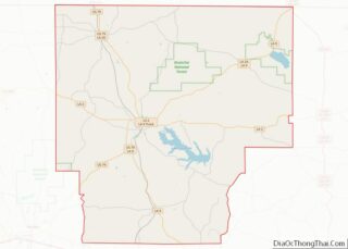
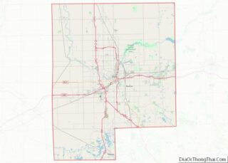
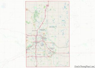
Map of Cheshire County, New Hampshire
Cheshire County is a county in the southwestern corner of the U.S. state of New Hampshire. As of the 2020 census, the population was 76,458. Its county seat is the city of Keene. Cheshire was one of the five original counties of New Hampshire, and is named for the county of Cheshire in England. It ... Read more
Map of Cheshire County, New Hampshire
Map of Hudson County, New Jersey
Hudson County is the smallest and most densely populated county in the U.S. state of New Jersey. It lies west of the lower Hudson River, which was named for Henry Hudson, the sea captain who explored the area in 1609. Part of New Jersey’s Gateway Region in the New York metropolitan area, the county seat ... Read more
Map of Hudson County, New Jersey
Map of Cibola County, New Mexico
Cibola County is a county in the U.S. state of New Mexico. As of the 2010 census, the population was 27,213. Its county seat is Grants. It is New Mexico’s youngest county, and the third youngest county in the United States, created on June 19, 1981, from the westernmost four-fifths of the formerly much larger ... Read more
Map of Cibola County, New Mexico
Map of Otero County, New Mexico
Otero County is a county located in the U.S. state of New Mexico. As of the 2010 census, the population was 63,797. Its county seat is Alamogordo. Its southern boundary is the Texas state line. It is named for Miguel Antonio Otero, the territorial governor when the county was created. Otero County includes the Alamogordo ... Read more
Map of Otero County, New Mexico
Map of Bronx County, New York
The Bronx (/brɒŋks/) is a borough of New York City, coextensive with Bronx County, in the state of New York. It is south of Westchester County; north and east of the New York City borough of Manhattan, across the Harlem River; and north of the New York City borough of Queens, across the East River. ... Read more
Map of Bronx County, New York
Map of Genesee County, New York
Genesee County is a county in the U.S. state of New York. As of the 2020 census, the population was 58,388. Its county seat is Batavia. Its name is from Seneca word Gen-nis’-hee-yo, meaning “the Beautiful Valley”. The county was created in 1802 and organized in 1803. Genesee County comprises the Batavia, NY micropolitan statistical ... Read more
Map of Genesee County, New York
Map of Onondaga County, New York
Onondaga County (/ˌɒnənˈdɑːɡə/ ON-ən-DAH-gə) is a county in the U.S. state of New York. As of the 2020 census, the population was 476,516. The county seat is Syracuse. Onondaga County is the core of the Syracuse, NY MSA. Onondaga County overview: Name: Onondaga County FIPS code: 36-067 State: New York Founded: 1794 Named for: Onondaga ... Read more
Map of Onondaga County, New York
Map of Seneca County, New York
Seneca County is located in the U.S. state of New York. As of the 2020 census, the population was 33,814. The primary county seat is Waterloo, moved there from the original county seat of Ovid in 1819. It became a two-shire county in 1822, which currently remains in effect and uses both locations as county ... Read more
Map of Seneca County, New York
Map of Anson County, North Carolina
Anson County is a county located in the U.S. state of North Carolina. As of the 2020 census, the population was 22,055. Its county seat is Wadesboro. Anson County overview: Name: Anson County FIPS code: 37-007 State: North Carolina Founded: 1750 Named for: George Anson, Baron Anson Seat: Wadesboro Largest town: Wadesboro Total Area: 537 sq mi ... Read more
Map of Anson County, North Carolina
Map of Cherokee County, North Carolina
Cherokee County is the westernmost county in the U.S. state of North Carolina. It borders Tennessee to its west and Georgia to its south. As of the 2020 census, the population was 28,774. The county seat is Murphy, elevation 1604 ft. Cherokee County overview: Name: Cherokee County FIPS code: 37-039 State: North Carolina Founded: 1839 ... Read more
Map of Cherokee County, North Carolina
Map of Gaston County, North Carolina
Gaston County is a county in the U.S. state of North Carolina. As of the 2020 census, the population was 227,943. The county seat is Gastonia. Dallas served as the original county seat from 1846 until 1911. Gaston County is included in the Charlotte-Concord-Gastonia, NC-SC Metropolitan Statistical Area. It is the fourth largest county in ... Read more
Map of Gaston County, North Carolina
Map of Jones County, North Carolina
Jones County is a county located in the U.S. state of North Carolina. As of the 2020 census, the population was 9,172, making it the fourth-least populous county in North Carolina. Its county seat is Trenton. Jones County is part of the New Bern, NC Metropolitan Statistical Area.. Jones County overview: Name: Jones County FIPS ... Read more
Map of Jones County, North Carolina