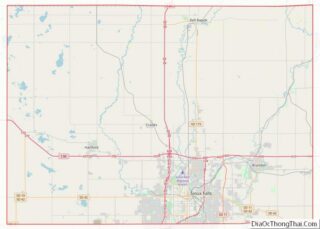
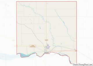
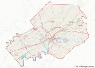
Map of Seward County

Map of Seward County, Kansas

Seward County (standard abbreviation: SW) is a county of the U.S. state of Kansas. As of the 2020 census, the county population was 21,964. The largest city and county seat is Liberal. The county was formed on March 20, 1873 and named after William Henry Seward, an American politician and Secretary of State under Abraham … Read more

Map of Woodson County

Map of Woodson County, Kansas

Woodson County (standard abbreviation: WO) is a county located in the U.S. state of Kansas. As of the 2020 census, the county population was 3,115. Its county seat is Yates Center. Woodson County overview: Name: Woodson County FIPS code: 20-207 State: Kansas Founded: 1855 Named for: Daniel Woodson Seat: Yates Center Largest city: Yates Center … Read more

Map of Bullitt County

Map of Bullitt County, Kentucky

Bullitt County is a county located in the north central portion of the U.S. state of Kentucky. As of the 2020 census, the population was 82,217. Its county seat is Shepherdsville. The county was founded in 1796. Located just south of the city of Louisville, Bullitt County is included in the Louisville/Jefferson County, KY-IN Metropolitan … Read more

Map of Edmonson County

Map of Edmonson County, Kentucky

Edmonson County is a county located in the south central portion of the U.S. state of Kentucky. As of the 2020 census, the population was 12,126. Its county seat is Brownsville. The county was formed in 1825 and named for Captain John “Jack” Edmonson (1764–1813), who was killed at the Battle of Frenchtown during the … Read more

Map of Hardin County

Map of Hardin County, Kentucky

Hardin County is a county located in the central part of the U.S. state of Kentucky. Its county seat is Elizabethtown. The county was formed in 1792. Hardin County is part of the Elizabethtown-Fort Knox, KY Metropolitan Statistical Area, as well as the Louisville/Jefferson County—Elizabethtown-Bardstown, KY-IN Combined Statistical Area. As of the 2020 census, the … Read more

Map of Laurel County

Map of Laurel County, Kentucky

Laurel County is a county located in the southeastern portion of the U.S. state of Kentucky. As of the 2020 census, the population was 62,613. Its county seat is London. After a special election in January 2016 alcohol sales are permitted only in the city limits of London. The ordinance went into effect on March … Read more

Map of McCracken County

Map of McCracken County, Kentucky

McCracken County is a county located in the far western portion of U.S. state of Kentucky. As of the 2020 census, the population was 67,875. The county seat and only municipality is Paducah. McCracken County was the 78th county formed in the state, having been created in 1825. It is part of the historic Jackson … Read more

Map of Owsley County

Map of Owsley County, Kentucky

Owsley County is a county located in the Eastern Coalfield region of the U.S. state of Kentucky. As of the 2020 census, the population was 4,051, making it the second-least populous county in Kentucky. The county seat is Booneville. The county was organized on January 23, 1843, from Clay, Estill, and Breathitt counties and named … Read more

Map of Trigg County

Map of Trigg County, Kentucky

Trigg County is a county located on the far southwestern border of the U.S. state of Kentucky. As of the 2020 census, the population was 14,061. Its county seat is Cadiz. Formed in 1820, the county was named for Stephen Trigg, an officer in the American Revolutionary War who was killed at the Battle of … Read more

Map of Bienville Parish

Map of Bienville Parish, Louisiana

Bienville Parish (French: Paroisse de Bienville, pronounced [paʁwas də bjɛ̃vil]) is a parish located in the northwestern portion of the U.S. state of Louisiana. At the 2020 census, the population was 12,981. The parish seat is Arcadia. The highest natural point in Louisiana, a hill known as Mt. Driskill, 535 feet (163 m) in elevation, is located … Read more

Map of Iberia Parish

Map of Iberia Parish, Louisiana

Iberia Parish (French: Paroisse de l’Ibérie, Spanish: Parroquia de Iberia) is a parish located in the U.S. state of Louisiana. At the 2020 census, it had a population of 69,929; the parish seat is New Iberia. The parish was formed in 1868 during the Reconstruction era and named for the Iberian Peninsula. It is part … Read more

Map of Pointe Coupee Parish

Map of Pointe Coupee Parish, Louisiana

Pointe Coupee Parish (/ˈpɔɪnt kəˈpiː/ or /ˈpwɑːnt kuːˈpeɪ/; French: Paroisse de la Pointe-Coupée) is a parish located in the U.S. state of Louisiana. As of the 2020 census, the population was 20,758. The parish seat is New Roads. Pointe Coupee Parish is part of the Baton Rouge, Louisiana Metropolitan Statistical Area. In 2010, the center … Read more