Van Buren County is a county located in the U.S. state of Michigan. As of the 2020 Census, the population was 75,587. The county seat is Paw Paw. The county was founded in 1829 and organized in 1837.
| Name: | Van Buren County |
|---|---|
| FIPS code: | 26-159 |
| State: | Michigan |
| Founded: | 1829 |
| Named for: | Martin Van Buren |
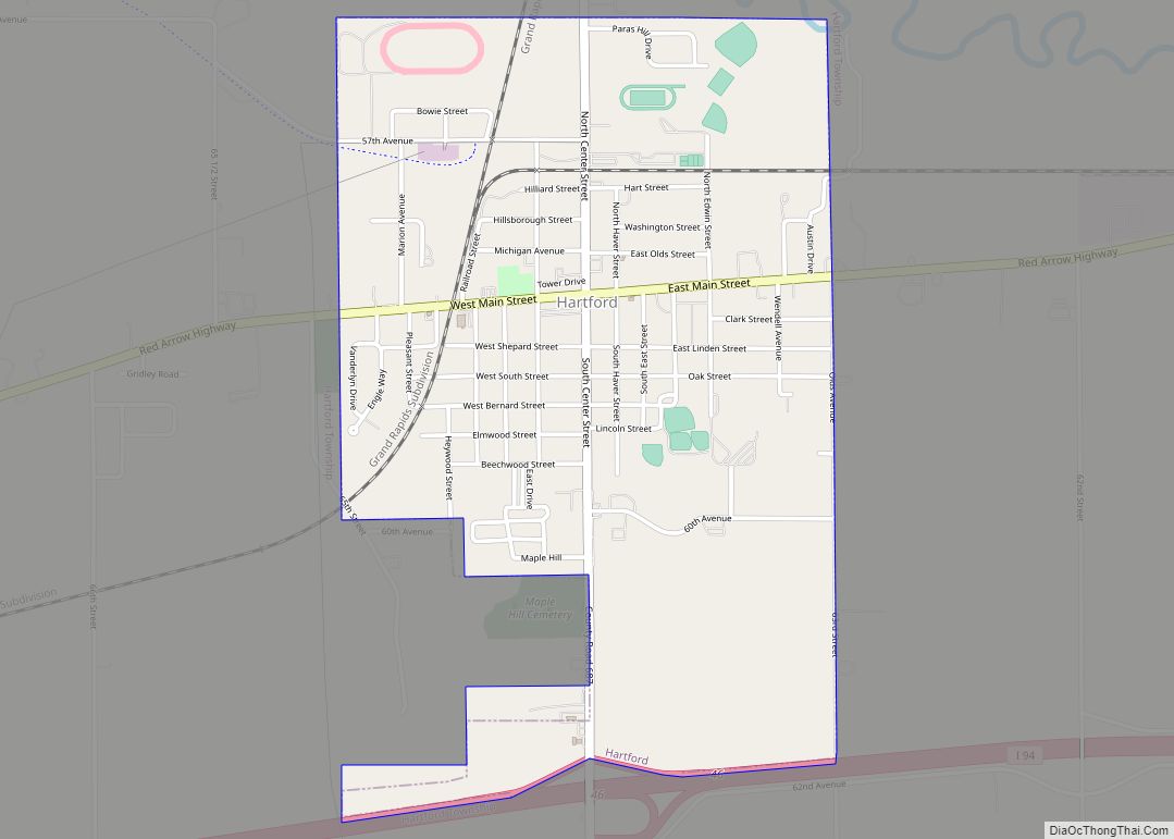
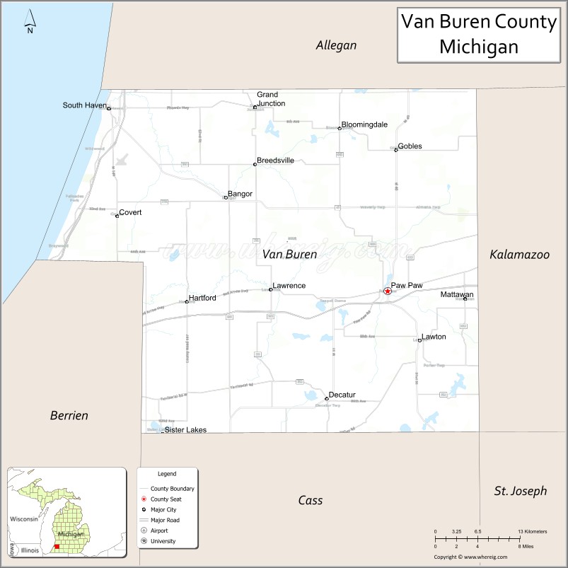
| Seat: | Paw Paw |
| Largest city: | South Haven |
| Total Area: | 1,090 sq mi (2,800 km²) |
| Land Area: | 607 sq mi (1,570 km²) |
| Total Population: | 75,587 |
| Population Density: | 124/sq mi (48/km²) |
| Time zone: | UTC−5 (Eastern) |
| Summer Time Zone (DST): | UTC−4 (EDT) |
| Website: | www.vanburencountymi.gov |
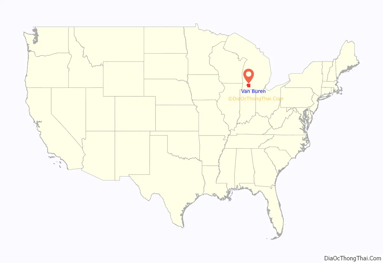
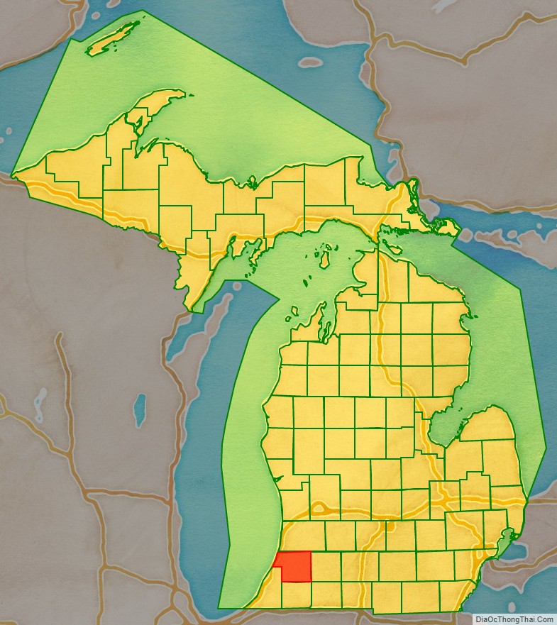
Van Buren County location map. Where is Van Buren County?
History
The county was named for Martin Van Buren before he became president. He was U.S. Secretary of State and later Vice President under President Andrew Jackson; thus Van Buren is one of Michigan’s “Cabinet counties”.
The Van Buren County Courthouse was built by Claire Allen, a prominent Southern Michigan architect; its cornerstone was laid on September 2, 1901, after a July vote to issue $35,000 in county bonds.
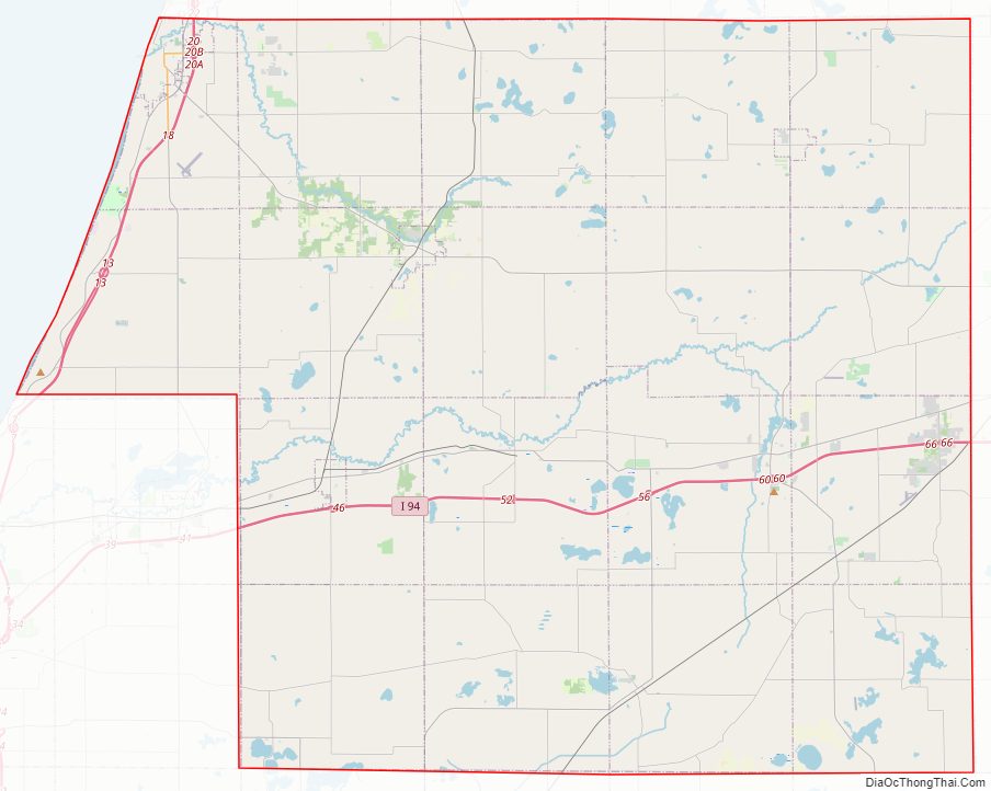
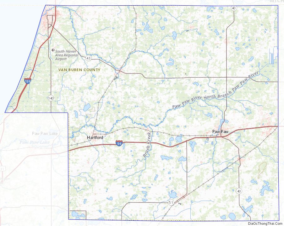
Van Buren County Road Map
Geography
According to the U.S. Census Bureau, the county has a total area of 1,090 square miles (2,800 km), of which 607 square miles (1,570 km) is land and 482 square miles (1,250 km) (44%) is water.
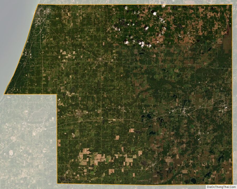
Much of the county is farmland dotted with small towns. Areas near Kalamazoo County, specifically Antwerp Township and Almena Township, are becoming suburbanized. Many of the inland lakes are ringed with homes, either by people living year-round or cottagers, generally people who live the rest of the time in Chicago. Tourism is a major industry in the areas near Lake Michigan.
Rivers
- Paw Paw River
- Black River
Adjacent counties
By land
- Allegan County (north)
- Kalamazoo County (east)
- St. Joseph County (southeast)
- Cass County (south)
- Berrien County (southwest)
By water
- Lake County, Illinois (west)
Parks, preserves, natural areas
- Dunes Parkway, an 84-acre (340,000 m) preserve of dunes in Covert Township
- Hamilton Township Coastal Plain Marsh Nature Sanctuary, a 79-acre (320,000 m) preserve of coastal plain marsh in Hamilton Township owned by the Michigan Nature Association
- Jeptha Lake Fen Preserve, a 49-acre (200,000 m) preserve in Columbia Township
- Kal-Haven Trail, a multi-use trail converted from old rail line that runs from Kalamazoo to South Haven
- Keeler State Game Area, 400 acres (162 ha) (1.6 km) in Keeler Township
- North Point Park – high dunes on 17 acres (69,000 m) on Lake Michigan, north of Van Buren State Park
- Ross Preserve, a 1,449 acre (5.9 km) preserve of coastal plain marsh in Covert Township owned by The Nature Conservancy
- Van Buren State Park
- Van Buren Trail State Park is adjacent to Kal-Haven Trail
Van Buren County Topographic Map
Van Buren County Satellite Map
Van Buren County Outline Map