Madelia (/məˈdiːli.ə/ mə-DEE-lee-ə) is a city in Watonwan County, Minnesota, United States, along the Watonwan River. The population was 2,308 at the 2010 census.
| Name: | Madelia city |
|---|---|
| LSAD Code: | 25 |
| LSAD Description: | city (suffix) |
| State: | Minnesota |
| County: | Watonwan County |
| Elevation: | 1,024 ft (312 m) |
| Total Area: | 1.51 sq mi (3.92 km²) |
| Land Area: | 1.51 sq mi (3.92 km²) |
| Water Area: | 0.00 sq mi (0.00 km²) |
| Total Population: | 2,396 |
| Population Density: | 1,584.66/sq mi (611.69/km²) |
| ZIP code: | 56062 |
| Area code: | 507 |
| FIPS code: | 2739230 |
| GNISfeature ID: | 0647358 |
| Website: | www.madeliamn.com |
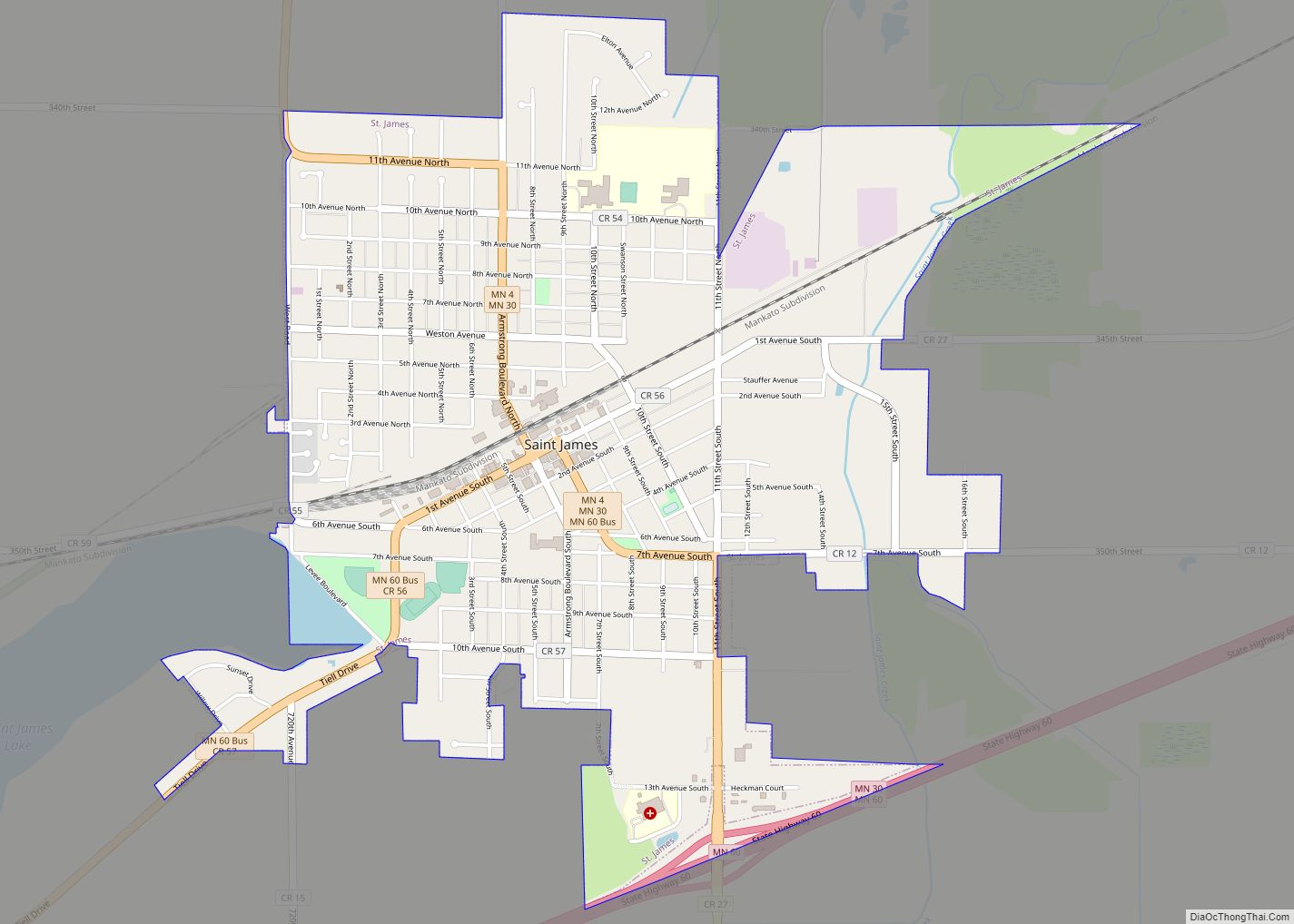
Online Interactive Map
Click on ![]() to view map in "full screen" mode.
to view map in "full screen" mode.
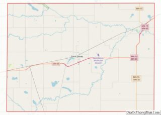
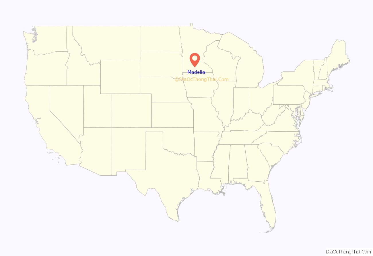
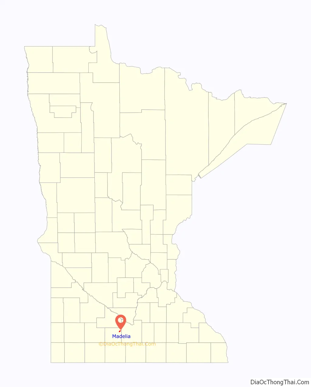
Madelia location map. Where is Madelia city?
History
Madelia was founded in 1857, and named for the daughter of a first settler. A post office has been in operation at Madelia since 1860. Madelia was incorporated in 1872.
In 1876, the remaining members of the James-Younger Gang were captured near Madelia after their failed attempt at bank robbery in Northfield, Minnesota. Madelia used to hold an event every September called Younger Brothers Day. The event included several activities including a reenactment of the bank robbery as well as the gunfight and capture of the Younger Brothers.
From 1885-1890 Winfield Scott Hammond served as the Madelia School Superintendent. Hammond later went on to pass the bar exam and serve in Minnesota State Legislature, the U.S. Congress, and eventually ran and was elected as Minnesota’s 18th Governor.
Madelia contains two properties listed on the National Register of Historic Places: the 1872 Flanders’ Block and the 1908 West Bridge.
In 2016, a fire greatly damaged downtown, destroying at least eight businesses.
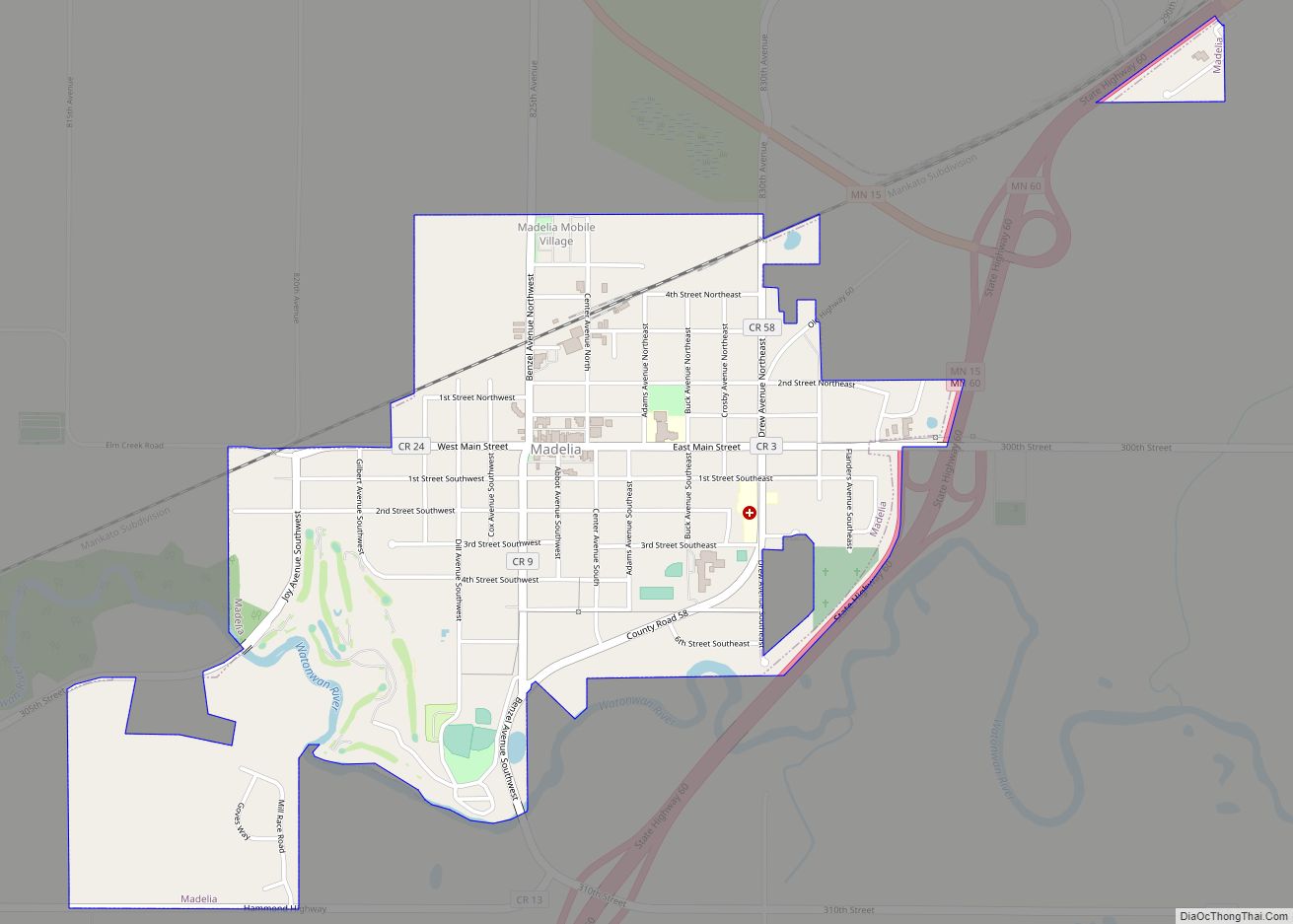
Madelia Road Map
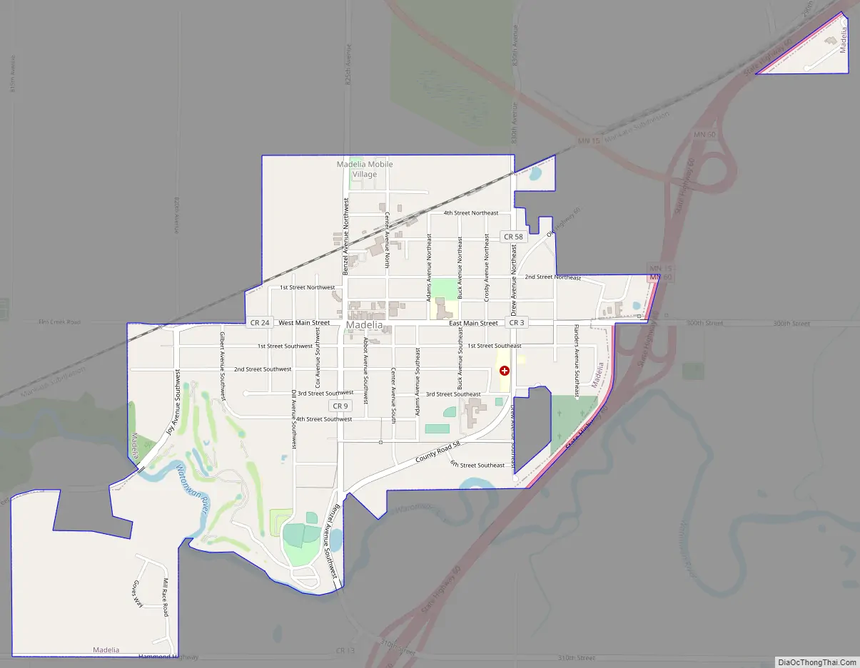
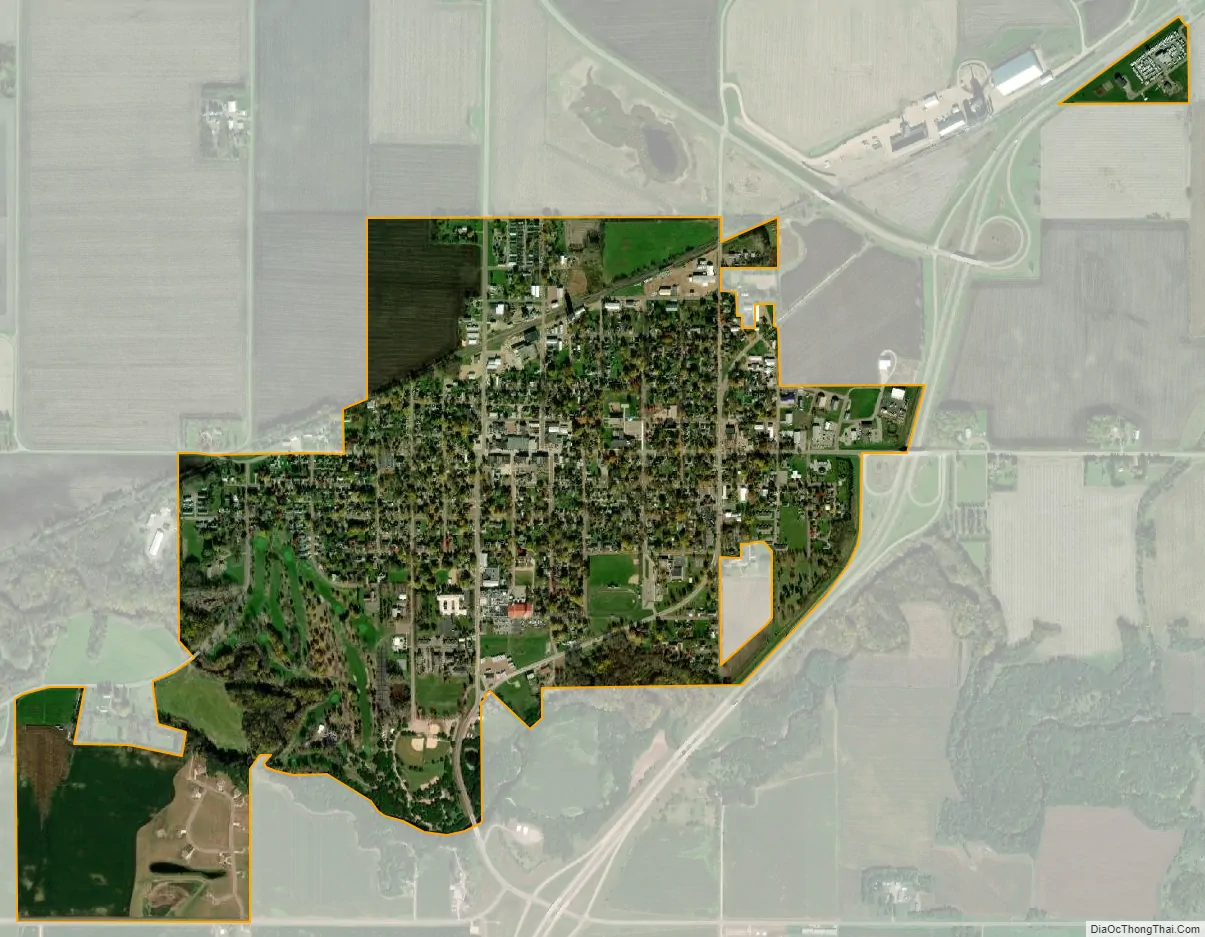
Madelia city Satellite Map
Geography
According to the United States Census Bureau, the city has a total area of 1.47 square miles (3.81 km), all land.
Minnesota State Highways 15 and 60 are two of the main routes in the city.
See also
Map of Minnesota State and its subdivision:- Aitkin
- Anoka
- Becker
- Beltrami
- Benton
- Big Stone
- Blue Earth
- Brown
- Carlton
- Carver
- Cass
- Chippewa
- Chisago
- Clay
- Clearwater
- Cook
- Cottonwood
- Crow Wing
- Dakota
- Dodge
- Douglas
- Faribault
- Fillmore
- Freeborn
- Goodhue
- Grant
- Hennepin
- Houston
- Hubbard
- Isanti
- Itasca
- Jackson
- Kanabec
- Kandiyohi
- Kittson
- Koochiching
- Lac qui Parle
- Lake
- Lake of the Woods
- Lake Superior
- Le Sueur
- Lincoln
- Lyon
- Mahnomen
- Marshall
- Martin
- McLeod
- Meeker
- Mille Lacs
- Morrison
- Mower
- Murray
- Nicollet
- Nobles
- Norman
- Olmsted
- Otter Tail
- Pennington
- Pine
- Pipestone
- Polk
- Pope
- Ramsey
- Red Lake
- Redwood
- Renville
- Rice
- Rock
- Roseau
- Saint Louis
- Scott
- Sherburne
- Sibley
- Stearns
- Steele
- Stevens
- Swift
- Todd
- Traverse
- Wabasha
- Wadena
- Waseca
- Washington
- Watonwan
- Wilkin
- Winona
- Wright
- Yellow Medicine
- Alabama
- Alaska
- Arizona
- Arkansas
- California
- Colorado
- Connecticut
- Delaware
- District of Columbia
- Florida
- Georgia
- Hawaii
- Idaho
- Illinois
- Indiana
- Iowa
- Kansas
- Kentucky
- Louisiana
- Maine
- Maryland
- Massachusetts
- Michigan
- Minnesota
- Mississippi
- Missouri
- Montana
- Nebraska
- Nevada
- New Hampshire
- New Jersey
- New Mexico
- New York
- North Carolina
- North Dakota
- Ohio
- Oklahoma
- Oregon
- Pennsylvania
- Rhode Island
- South Carolina
- South Dakota
- Tennessee
- Texas
- Utah
- Vermont
- Virginia
- Washington
- West Virginia
- Wisconsin
- Wyoming