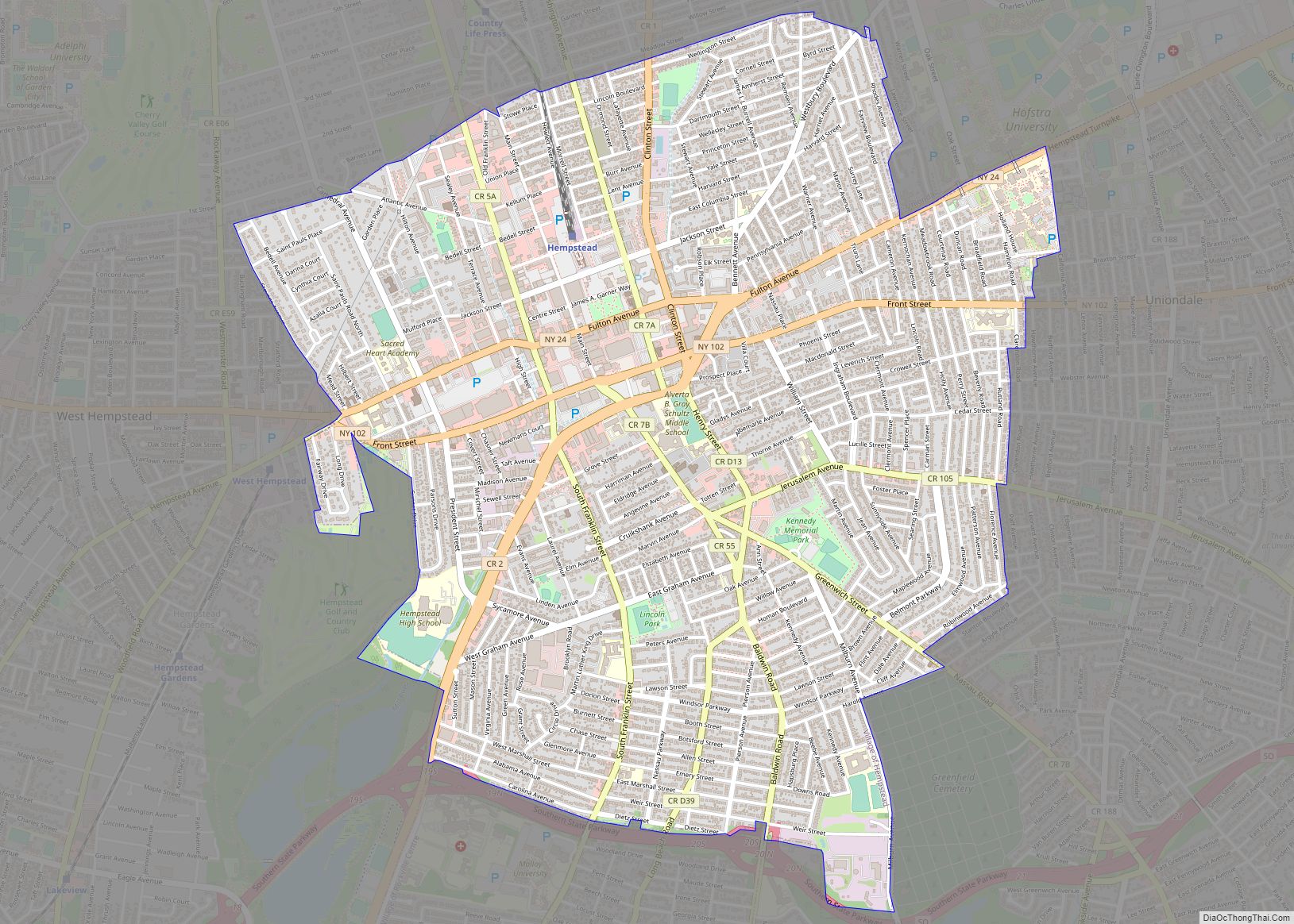
Map of Sandusky city, Ohio

Map of Sandusky city, Ohio

Sandusky (/sænˈdʌski/ san-DUSS-kee) is a city in and the county seat of Erie County, Ohio, United States. Situated along the shores of Lake Erie in the northern part of the state, Sandusky is located roughly midway between Toledo (45 miles (72 km) west) and Cleveland (50 miles (80 km) east). According to 2020 census, the city had … Read more

Map of Warren city, Ohio

Map of Warren city, Ohio

Warren is a city in and the county seat of Trumbull County, Ohio, United States. Located along the Mahoning River, Warren lies approximately 14 miles (23 km) northwest of Youngstown and 56 miles (90 km) southeast of Cleveland. The population was 39,201 at the 2020 census. The historical county seat of the Connecticut Western Reserve, it is … Read more

Map of Springfield city, Ohio

Map of Springfield city, Ohio

Springfield is a city in the U.S. state of Ohio and the county seat of Clark County. The municipality is located in southwestern Ohio and is situated on the Mad River, Buck Creek, and Beaver Creek, approximately 45 miles (72 km) west of Columbus and 25 miles (40 km) northeast of Dayton. Springfield is home to Wittenberg … Read more

Map of East Providence city

Map of East Providence city

East Providence is a city in Providence County, Rhode Island, United States. The population was 47,139 at the 2020 census, making it the fifth-largest city in the state. East Providence city overview: Name: East Providence city LSAD Code: 25 LSAD Description: city (suffix) State: Rhode Island County: Providence County Elevation: 62 ft (19 m) Total Area: 16.61 sq mi … Read more

Map of Cranston city

Map of Cranston city

Cranston, once known as Pawtuxet, is a city in Providence County, Rhode Island, United States. The official population of the city in the 2020 United States Census was 82,934, making it the second largest in the state. The center of population of Rhode Island is located in Cranston. Cranston is a part of the Providence … Read more

Map of Warwick city, Rhode Island

Map of Warwick city, Rhode Island

Warwick (/ˈwɔːrwɪk/ WOR-wik or /ˈwɒrɪk/ WORR-ik) is a city in Kent County, Rhode Island, the third largest city in the state with a population of 82,823 at the 2020 census. It is located approximately 12 miles (19 km) south of downtown Providence, Rhode Island, 63 miles (101 km) southwest of Boston, Massachusetts, and 171 miles (275 km) northeast … Read more