Newport is a seaside city on Aquidneck Island in Newport, Rhode Island, United States. It is located in Narragansett Bay, approximately 33 miles (53 km) southeast of Providence, 20 miles (32 km) south of Fall River, Massachusetts, 74 miles (119 km) south of Boston, and 180 miles (290 km) northeast of New York City. It is known as a New England summer resort and is famous for its historic mansions and its rich sailing history. The city has a population of about 25,000 residents.
Newport hosted the first U.S. Open tournaments in both tennis and golf, as well as every challenge to the America’s Cup between 1930 and 1983. It is also the home of Salve Regina University and Naval Station Newport, which houses the United States Naval War College, the Naval Undersea Warfare Center, and an important Navy training center. It was a major 18th-century port city and boasts many buildings from the colonial era.
Newport is the county seat of Newport County, which has no governmental functions other than court administrative and sheriff corrections boundaries. It was known for being the location of the “Summer White Houses” during the administrations of presidents Dwight D. Eisenhower and John F. Kennedy.
| Name: | Newport city |
|---|---|
| LSAD Code: | 25 |
| LSAD Description: | city (suffix) |
| State: | Rhode Island |
| County: | Newport County |
| Elevation: | 26 ft (8 m) |
| Total Area: | 11.37 sq mi (29.46 km²) |
| Land Area: | 7.66 sq mi (19.83 km²) |
| Water Area: | 3.72 sq mi (9.63 km²) |
| Total Population: | 25,163 |
| Population Density: | 3,286.70/sq mi (1,269.03/km²) |
| Area code: | 401 |
| FIPS code: | 4449960 |
| Website: | www.cityofnewport.com |
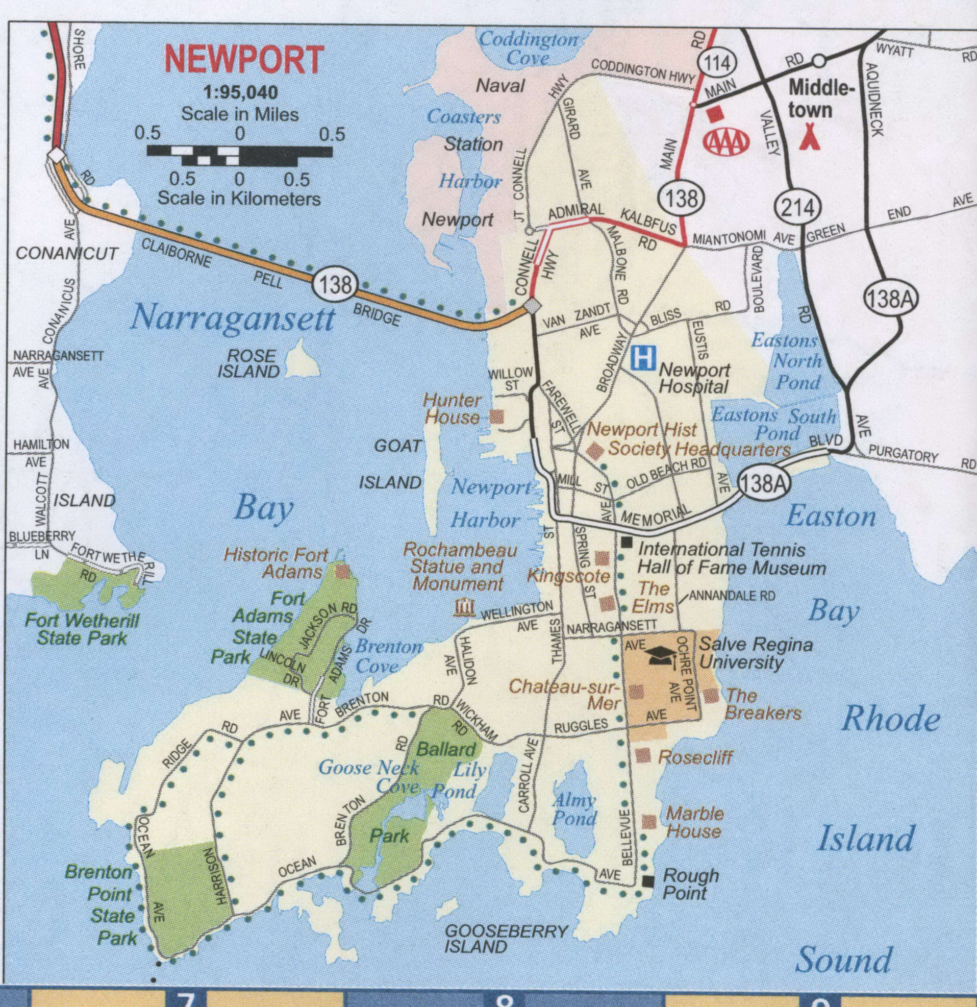
Take a look at our Newport map collection, which includes roads, points of interest, and things to do. Then, immerse yourself in the city with our interactive map provided by Google Maps. Explore and get to know the city of Newport with our collection of maps.
Online Interactive Map
Click on ![]() to view map in "full screen" mode.
to view map in "full screen" mode.
This interactive map allows you to explore Newport Rhode Island with ease. You can find all your favorite attractions so you can explore them on your next visit. Whether you’re planning a vacation or just looking for a new place to explore, this interactive map will help you find the best restaurants, hotels, and beaches in Newport.
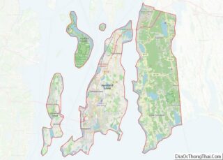
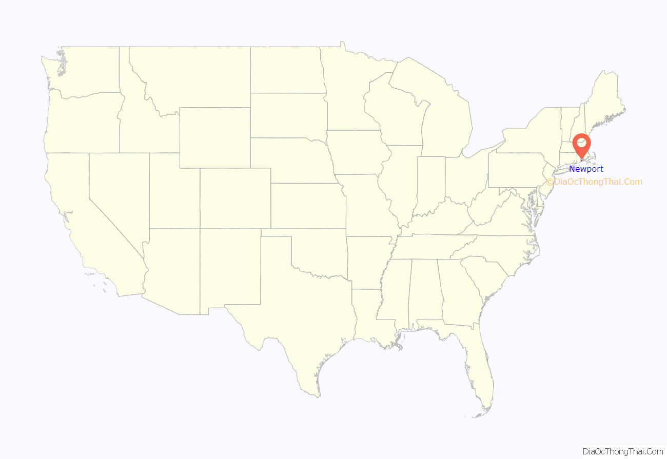
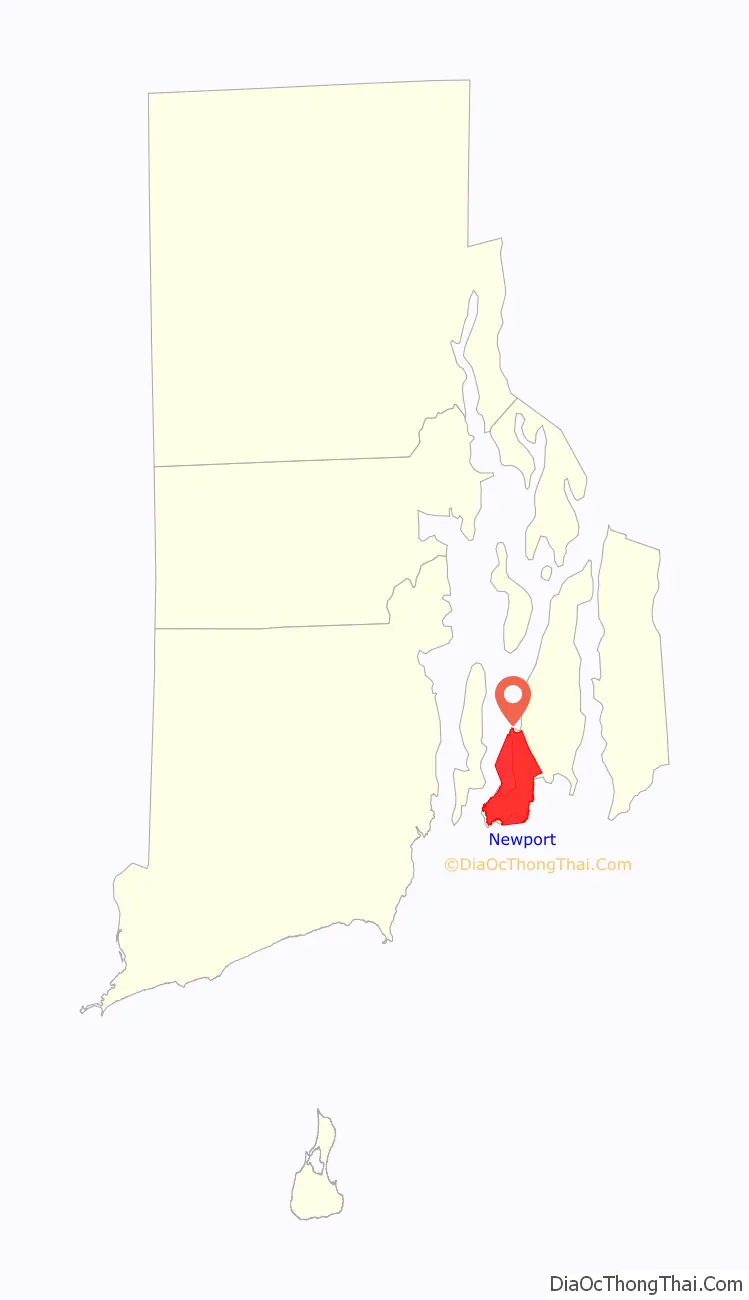
Newport location map. Where is Newport city?
History
Colonial period
Newport was founded in 1639 on Rhode Island, which is now called Aquidneck Island. Its eight founders and first officers were Nicholas Easton, William Coddington, John Clarke, John Coggeshall, William Brenton, Jeremy Clark, Thomas Hazard, and Henry Bull. Many of these people were part of the settlement at Portsmouth, along with Anne Hutchinson and her followers. They separated within a year of settling Portsmouth and began the settlement of Newport on the southern side of the island.
Newport grew to be the largest of the four original settlements that became the Colony of Rhode Island and Providence Plantations, including Providence Plantations and Shawomett. Many of the first colonists in Newport became Baptists, and the second Baptist congregation in Rhode Island was formed in 1640 under the leadership of John Clarke.
In 1658, a group of Jews was welcomed to settle in Newport, fleeing the Inquisition in Spain and Portugal. They were not allowed to settle elsewhere. This group eventually came to be known as Congregation Jeshuat Israel, and is the second-oldest Jewish congregation in the United States. They meet in Touro Synagogue, the oldest synagogue in America.
The Colony of Rhode Island and Providence Plantations received its royal charter in 1663. Benedict Arnold was elected as the first governor. The Old Colony House at the head of Washington Square in Newport served as the seat of Rhode Island’s government from 1741 until the current Rhode Island State House was completed in Providence in 1904. At that time, Providence became the state’s sole capital city.
Newport was the most important port in colonial Rhode Island, and a public school was established in 1640. The commercial activity that raised Newport to its fame as a rich port began with the immigration of a second wave of Portuguese Jews, who settled there around the middle of the 18th century. The new settlers had been practicing Judaism secretly for 300 years in Portugal, and they were attracted to Rhode Island because of its freedom of worship. They brought with them commercial experience, connections, capital, and a spirit of enterprise.
Most prominent among them was Jacob Rodrigues Rivera, who arrived in 1745 (died 1789). Rivera introduced the manufacture of sperm oil, derived from sperm whales. This became one of Newport’s leading industries and made the town a wealthy, prominent whaling community. Newport developed 17 manufacturers of oil and candles, and enjoyed a practical monopoly of this trade until the American Revolution.
Aaron Lopez is also credited with making Newport an important center of trade. He encouraged 40 Portuguese Jewish families to settle there, and Newport had 150 vessels engaged in trade within 14 years. Lopez was involved in the slave trade, as were other shipping magnates, and the manufacture of spermaceti candles, ships, barrels, rum, chocolate, textiles, clothes, shoes, hats, and bottles. Lopez became the wealthiest man in Newport, but he was denied citizenship on religious grounds, even though British law protected the rights of Jews to become citizens in England.
Lopez appealed to the Rhode Island colonial legislature for redress and was refused with this ruling:
Lopez persisted by applying for citizenship in Massachusetts Bay Colony, where it was granted.
From the mid-17th century, the religious tolerance in Newport attracted numbers of Quakers, known also as the Society of Friends. The Great Friends Meeting House in Newport (1699) is the oldest existing structure of worship in Rhode Island.
In 1727, James Franklin (brother of Benjamin Franklin) printed the Rhode-Island Almanack in Newport. In 1732, he published the first newspaper, the Rhode Island Gazette. In 1758, his son James founded the weekly newspaper Mercury. The famous 18th-century Goddard and Townsend furniture was also made in Newport.
Throughout the 18th-century, Newport suffered from an imbalance of trade with the largest colonial ports. As a result, Newport merchants were forced to develop alternatives to conventional exports. In the 1720s, Colonial leaders arrested many pirates, acting under pressure from the British government. Many were hanged in Newport and buried on Goat Island.
Colonial buildings in the Newport Historic District
Oliver Perry Monument in Eisenhower Park
Touro Synagogue, the oldest existing synagogue in the United States
Slave trade
Newport was a major center of the slave trade in colonial and early America, active in the “triangle trade” in which slave-produced sugar and molasses from the Caribbean were carried to Rhode Island and distilled into rum that was then carried to West Africa and exchanged for captives. In 1764, Rhode Island had about 30 rum distilleries, 22 in Newport alone.
Slaves were trafficked illegally into Rhode Island, breaking a 1787 law prohibiting residents of the state from trading in slaves. Slave traders were also breaking federal statutes of 1794 and 1800 barring Americans from carrying slaves to ports outside the United States, as well as the 1807 Congressional act abolishing the transatlantic slave trade.
A few Rhode Island families made substantial fortunes in the trade. William and Samuel Vernon were Newport merchants who later played an important role in financing the creation of the United States Navy; they sponsored 30 African slaving ventures. However, it was the DeWolfs of Bristol, Rhode Island, and most notably James De Wolf, who were the largest slave-trading family in America, mounting more than 80 transatlantic voyages, most of them illegal. The Rhode Island slave trade was broadly based. Seven hundred Rhode Islanders owned or captained slave ships, most of whom were substantial merchants, though many were ordinary shopkeepers and tradesmen who purchased shares in slaving voyages.
Newport was inhabited by a small group of abolitionists and free blacks. Reverend Samuel Hopkins, minister at Newport’s First Congregational Church, has been called “America’s first abolitionist”. Among subscribers to Hopkins’ writings were 17 free black citizens, most of whom lived in Newport. This community of freemen, including Newport Gardner, founded the Free African Union Society in 1780, the first African mutual aid society in America.
American Revolutionary era
Newport was the scene of much activity during the American Revolution. William Ellery was a Newport native and one of the signers of the Declaration of Independence.
In the winter of 1775 and 1776, the Rhode Island Legislature placed militia general William West in charge of rooting out loyalists in Newport, which resulted in several individuals being exiled to the northern part of the state, including Joseph Wanton and Thomas Vernon.
On 8 December 1776, the British occupied the city without opposition. Sir Peter Parker led 50-gun British ships, while Lieutenant-General Henry Clinton led 7,000 troops. According to Alfred Thayer Mahan, “The immediate effect was to close a haven of privateers, which flanked the route of all vessels bound from Europe to New York.”
In the summer of 1778, the Americans began the campaign known as the Battle of Rhode Island. This was the first joint operation between the Americans and the French after the signing of the Treaty of Alliance. The Americans based in Tiverton planned a formal siege of the town, but the French refused to take part, instead preferring a frontal assault. This weakened the American position, and the British were able to expel the Americans from the island.
In 1779, the British abandoned the location. Rodney lamented, “The evacuating Rhode Island was the most fatal measure that could possibly have been adopted. It gave up the best and noblest harbor in America, capable of containing the whole Navy of Britain, and where they could in all seasons lie in perfect security; and from whence squadrons, in forty-eight hours, could blockade the three capital cities of America; namely, Boston, New York, and Philadelphia.”
On July 10, 1780, a French expedition arrived in Narragansett Bay off Newport with an army of 450 officers and 5,300 men, sent by King Louis XVI and commanded by Jean-Baptiste Donatien de Vimeur, comte de Rochambeau. For the rest of the war, Newport served as the base of the French forces in the United States. In July 1781, Rochambeau was finally able to leave Newport for Providence to begin the decisive march to Yorktown, Virginia, along with General George Washington. The Rochambeau Monument in King Park on Wellington Avenue commemorates Rochambeau’s contributions to the Revolutionary War and to Newport’s history.
Newport’s population fell from over 9,000 (according to the census of 1774) to fewer than 4,000 by the time that the war ended (1783). Over 200 abandoned buildings were torn down in the 1780s. The war destroyed Newport’s economic wealth, because years of military occupation closed the city to any form of trade.
It was in Newport that the Rhode Island General Assembly voted to ratify the Constitution in 1790 and become the 13th state, acting under pressure from the merchant community of Providence. The city was the last residence of Commodore Oliver Hazard Perry and the birthplace of Commodore Matthew C. Perry and Unitarian William Ellery Channing.
Summer mansions
Beginning in the mid-nineteenth century, wealthy southern planters seeking to escape the heat began to build summer cottages on Bellevue Avenue, such as Kingscote (1839). Around the middle of the century, wealthy northerners, such as the Wetmore family, began construction on larger mansions, such as Chateau-sur-Mer (1852) nearby. Most of these early families made a substantial part of their fortunes in the Old China Trade.
By the turn of the 20th century, many of the nation’s wealthiest families were summering in Newport, including the Vanderbilts, Astors, and the Widener family, who constructed the largest “cottages,” such as The Breakers (1895) and Miramar (1915). They resided for a brief summer social season in grand mansions with elaborate receiving rooms, dining rooms, music rooms, and ballrooms—but with few bedrooms, since the guests were expected to have “cottages” of their own. Many of the homes were designed by New York architect Richard Morris Hunt, who kept a house in Newport himself.
The social scene at Newport is described in Edith Wharton’s novel The Age of Innocence. Wharton’s own Newport “cottage” was called Land’s End. Today, many mansions continue in private use. Hammersmith Farm is the mansion where John F. Kennedy and Jackie Kennedy held their wedding reception; it was open to tourists as a “house museum”, but has since been purchased and reconverted into a private residence. Many of the other mansions are open to tourists, and others were converted into academic buildings for Salve Regina College in the 1930s, when the owners could no longer afford their tax bills.
In the mid-19th century, a large number of Irish immigrants settled in Newport. The Fifth Ward of Newport in the southern part of the city became a staunch Irish neighborhood for many generations. To this day, St. Patrick’s Day is an important day of pride and celebration in Newport, with a large parade down Thames Street.
The oldest Catholic parish in Rhode Island is St. Mary’s, located on Spring Street, though the current building is not original.
The Breakers (1895)
The Elms (1901)
President Chester A. Arthur vacationed in Newport in 1884
20th century and beyond
Rhode Island did not have a fixed capital during and after the colonial era, but rotated its legislative sessions among Providence, Newport, Bristol, East Greenwich, and South Kingstown. In 1854, the sessions were eliminated in cities other than Providence and Newport, and Newport was ultimately dropped in 1900 as a constitutional amendment that year restricted the meetings of the legislature to Providence.
The Kennedys and Newport
First Lady Jacqueline Kennedy Onassis had many ties to Newport. She spent her childhood summers at Newport’s Hammersmith Farm. She and John Fitzgerald Kennedy attended nearby St. Mary’s Church and were married there on September 12, 1953. The Kennedys sailed their yacht Honey Fitz in Narragansett Bay, golfed at Newport Country Club, dined at The White Horse Tavern, and attended social events at The Breakers.
Presidents Kennedy and Eisenhower both made Newport the sites of their “Summer White Houses” during their years in office. Eisenhower stayed at Quarters A at the Naval War College and at what became known as the Eisenhower House, while Kennedy used Hammersmith Farm.
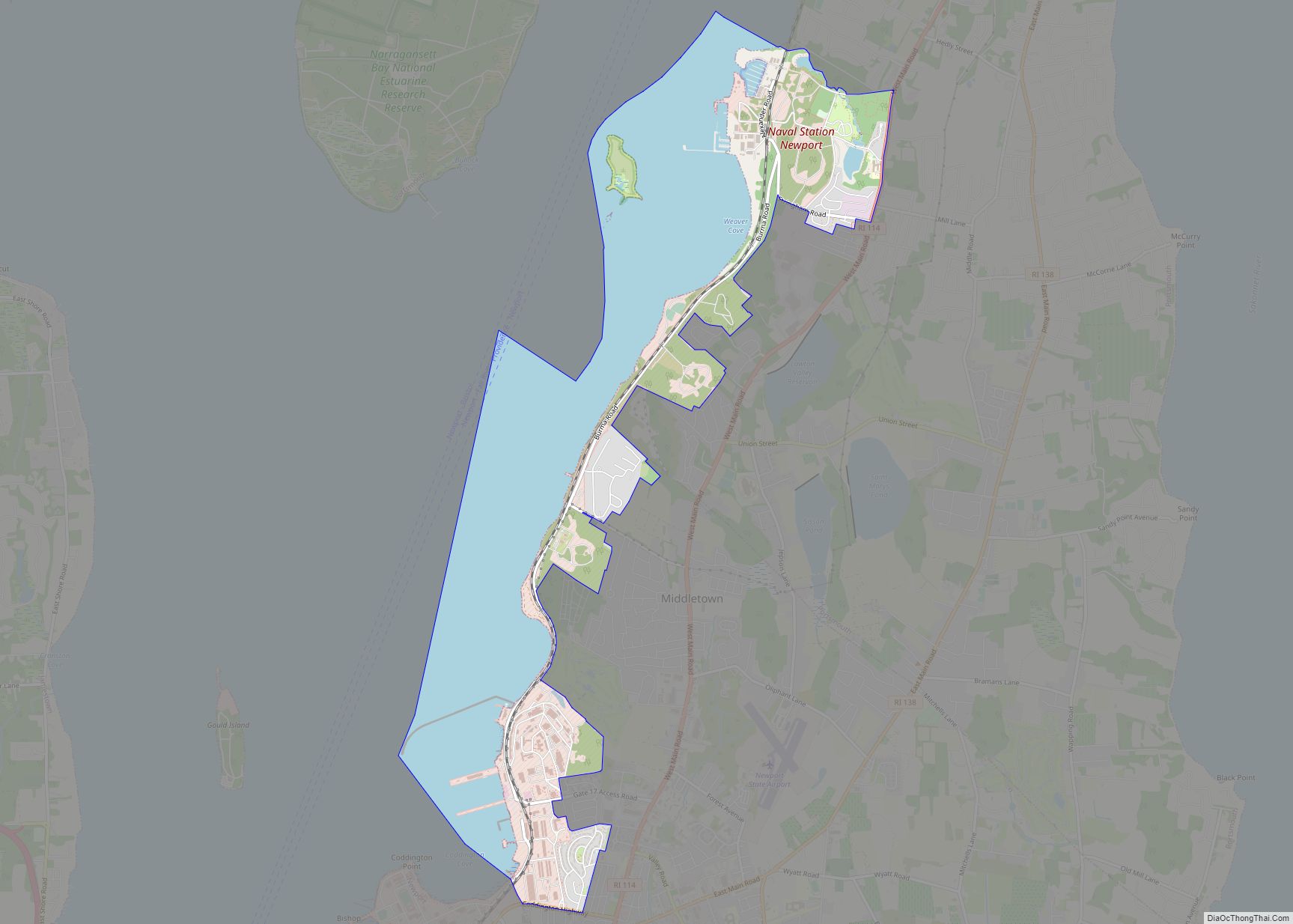
The city has long been entwined with the United States Navy. It held the campus of the U.S. Naval Academy during the American Civil War (1861–65) when the undergraduate officer training school was temporarily moved north from Annapolis, Maryland. From 1952 to 1973, it hosted the Cruiser-Destroyer Force of the U.S. Atlantic Fleet, and subsequently, it has hosted smaller numbers of warships from time to time. Today it hosts Naval Station Newport (NAVSTA Newport) and remains home to the U.S. Naval War College, the center for Surface Warfare Officer training, the Navy Supply Corps School and other schools, and the headquarters of the Naval Undersea Warfare Center. The decommissioned aircraft carrier USS Saratoga (CV-60) was moored in an inactive status at the docks previously used by the Cruiser-Destroyer Force until it was towed to Brownsville, Texas in August–September 2014 to be dismantled. The USS Forrestal (CV-59) shared the pier until June 2010.
The departure of the Cruiser-Destroyer fleet from Newport, and the closure of nearby Naval Air Station Quonset Point in 1973 were devastating to the local economy. The population of Newport decreased, businesses closed, and property values plummeted. However, in the late 1960s, the city began revitalizing the downtown area with the construction of America’s Cup Avenue, malls of stores and condominiums, and upscale hotels. Construction was also completed on the Newport Bridge. The Preservation Society of Newport County began opening Newport’s historic mansions to the public, and the tourist industry has become Newport’s primary commercial enterprise over the subsequent years.
Newport Road Map
This detailed road map has all the necessary information for planning your day out. With color-coded highways, you will be able to find your way around Newport in no time. It’s also the perfect tool for navigating the roads and walking tours because of its detailed labels. But for travel outside the city, you can download a Rhode Island road map for more highway information.
US Highways: 138, Coddington Hwy, Connell Hwy
Major Roads: Admiral Kalbfus Rd, Americas Cup Ave, Bellevue Ave, Broadway, Bull St, Carroll Ave, Coggeshall Ave, Farewell St, Girard Ave, Harrison Ave, J T Connell Rd, Kay St, Marlborough St, Memorial Blvd, Morton Ave, Ocean Ave, Ruggles Ave, Thames St, Wickham Rd
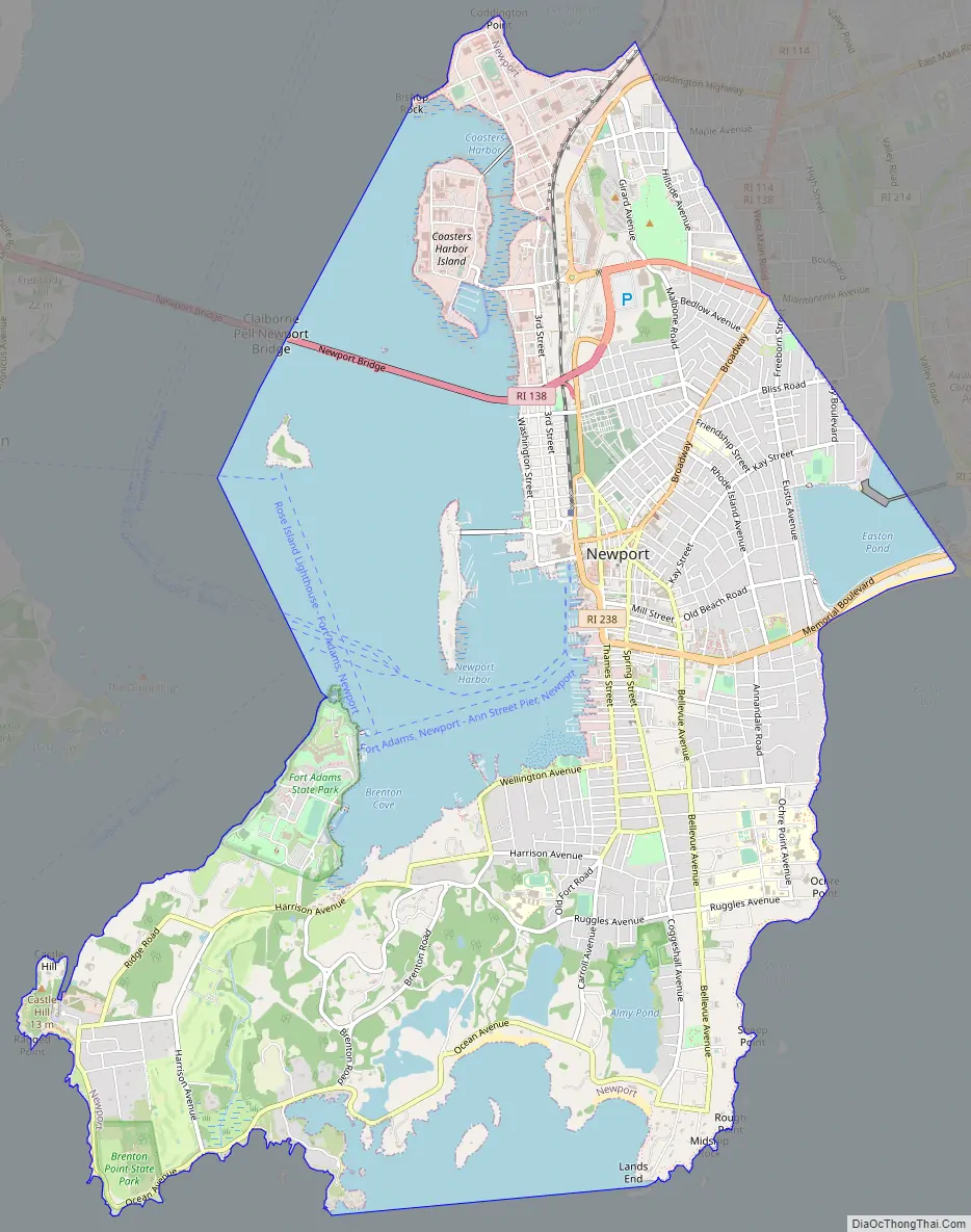
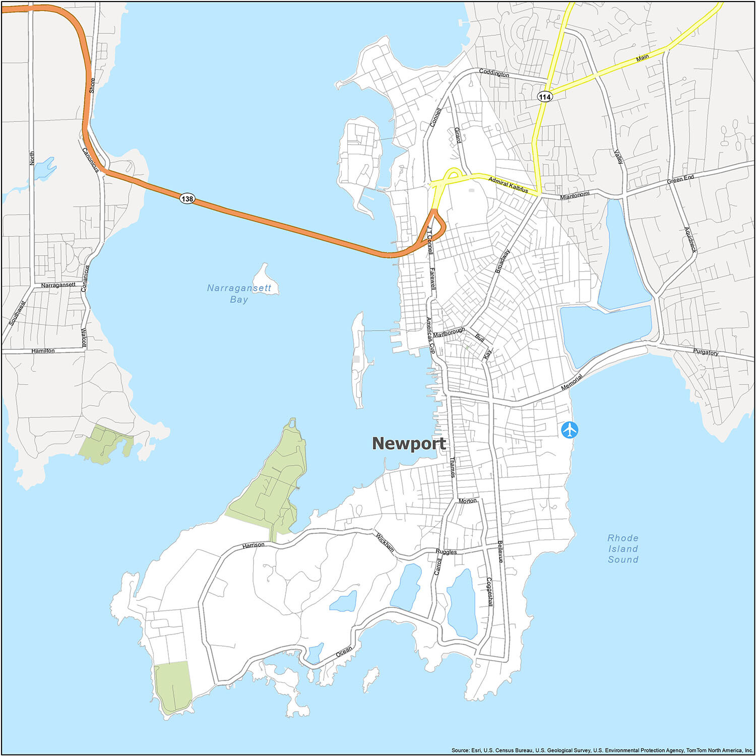
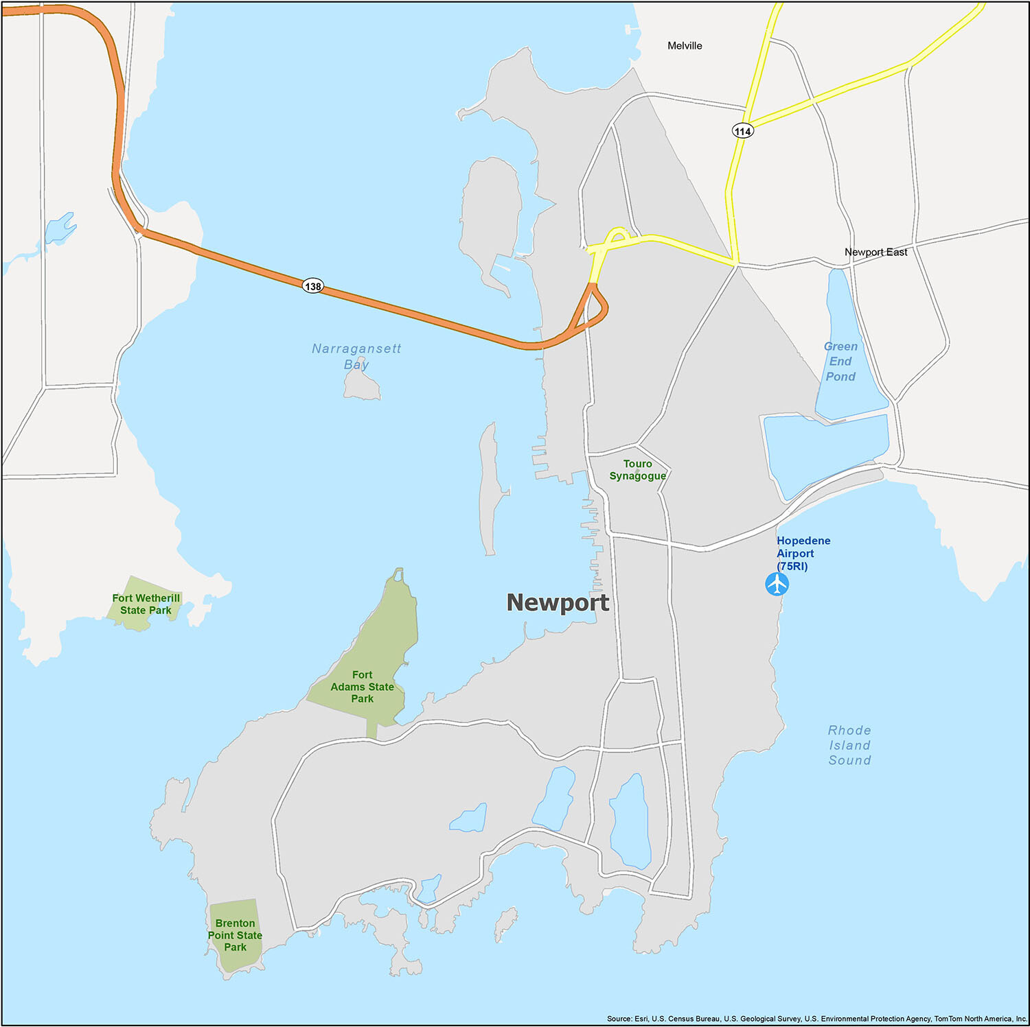
Discover the stunning beauty of Newport, RI with our interactive map. Our map includes airports, census-designated places, bays/sounds, and parks in and around the city. With this map, you can explore all that Newport has to offer, from its state parks to its cultural landmarks. Start exploring today!
10 things to do in Newport city
If you’re looking for the best places to visit in Newport, this map is your guide. Explore the top attractions and find the perfect spot to spend your day, regardless of what you’re looking for.
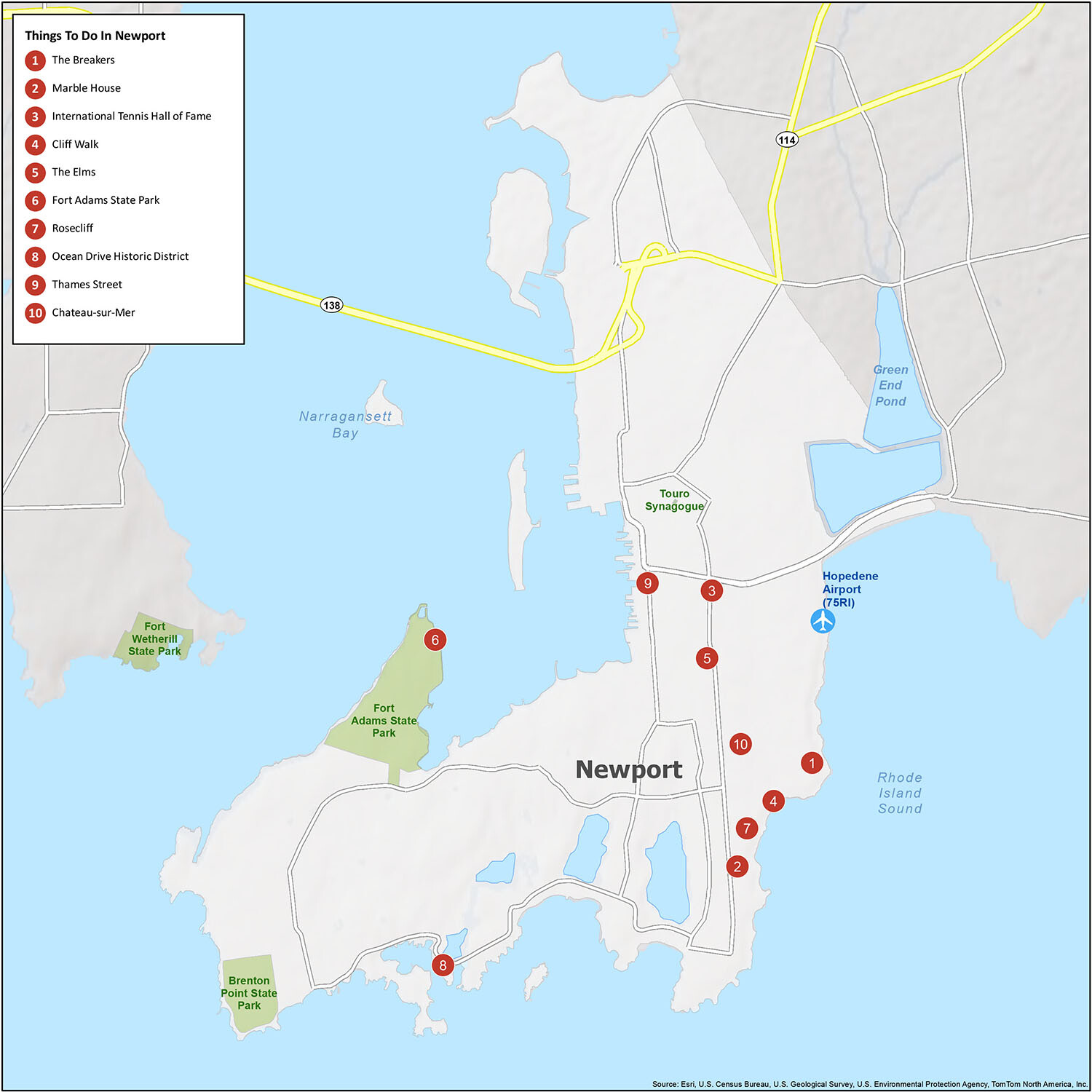
Discover the best of Newport with this comprehensive map and guide. From the iconic mansions to the scenic Cliff Walk, this map helps you find the top attractions in the city quickly and easily.
Whether you’re looking for a nearby park or the perfect spot to spend your day, this map and guide will help you find the best places to go and things to do in Newport.
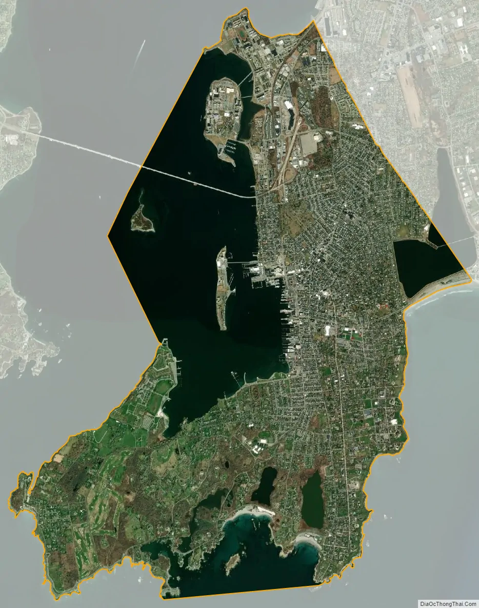
Newport city Satellite Map
Geography
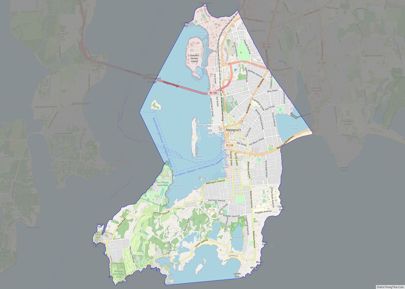
Newport is located at 41°29′17″N 71°18′45″W / 41.48806°N 71.31250°W / 41.48806; -71.31250. It is the most populous municipality on Aquidneck Island in Narragansett Bay. According to the United States Census Bureau, the city has a total area of 11.4 square miles (29.5 km), of which 7.7 square miles (19.9 km) is land and 3.7 square miles (9.6 km), or 32.64%, is water. The Newport Bridge, the longest suspension bridge in New England, connects Newport to neighboring Conanicut Island across the East Passage of the Narragansett.
Being surrounded by ocean water, Newport is often cooler in the summer than some coastal cities further north, such as Boston.
See also
Map of Rhode Island State and its subdivision: Map of other states:- Alabama
- Alaska
- Arizona
- Arkansas
- California
- Colorado
- Connecticut
- Delaware
- District of Columbia
- Florida
- Georgia
- Hawaii
- Idaho
- Illinois
- Indiana
- Iowa
- Kansas
- Kentucky
- Louisiana
- Maine
- Maryland
- Massachusetts
- Michigan
- Minnesota
- Mississippi
- Missouri
- Montana
- Nebraska
- Nevada
- New Hampshire
- New Jersey
- New Mexico
- New York
- North Carolina
- North Dakota
- Ohio
- Oklahoma
- Oregon
- Pennsylvania
- Rhode Island
- South Carolina
- South Dakota
- Tennessee
- Texas
- Utah
- Vermont
- Virginia
- Washington
- West Virginia
- Wisconsin
- Wyoming