Edmond is a city in Oklahoma County, Oklahoma, United States, and a part of the Oklahoma City metropolitan area in the central part of the state. The population was 94,428 according to the 2020 United States Census, a 16% increase from 2010. making it the fifth largest city in Oklahoma.
The city borders the northern boundary of Oklahoma City. Public transportation is provided by Citylink Edmond bus service.
| Name: | Edmond city |
|---|---|
| LSAD Code: | 25 |
| LSAD Description: | city (suffix) |
| State: | Oklahoma |
| County: | Oklahoma County |
| Founded: | April 22, 1889 |
| Elevation: | 1,204 ft (367 m) |
| Total Area: | 87.55 sq mi (226.75 km²) |
| Land Area: | 84.44 sq mi (218.71 km²) |
| Water Area: | 3.10 sq mi (8.04 km²) |
| Total Population: | 94,428 |
| Population Density: | 1,118.23/sq mi (431.75/km²) |
| ZIP code: | 73003, 73012, 73013, 73025, 73034, 73083 |
| Area code: | 405 and 572 |
| FIPS code: | 4023200 |
| GNISfeature ID: | 1092492 |
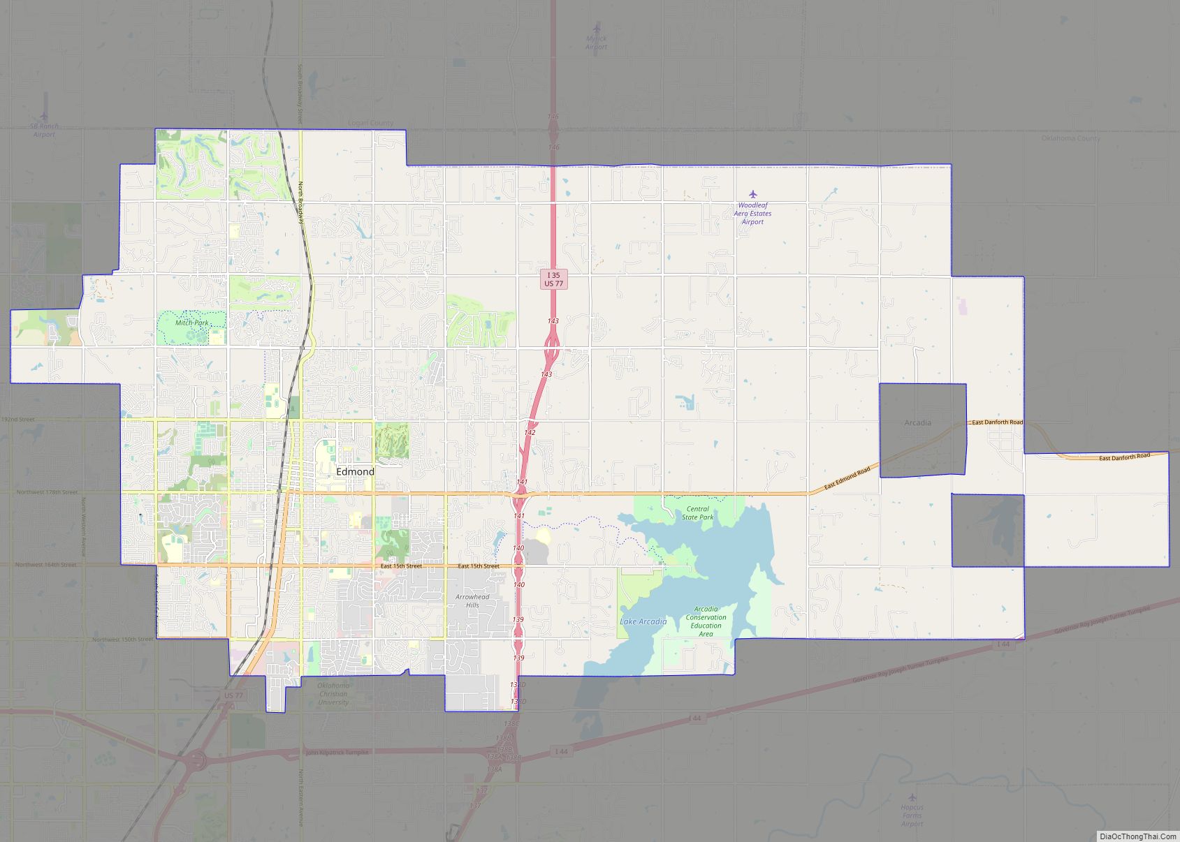
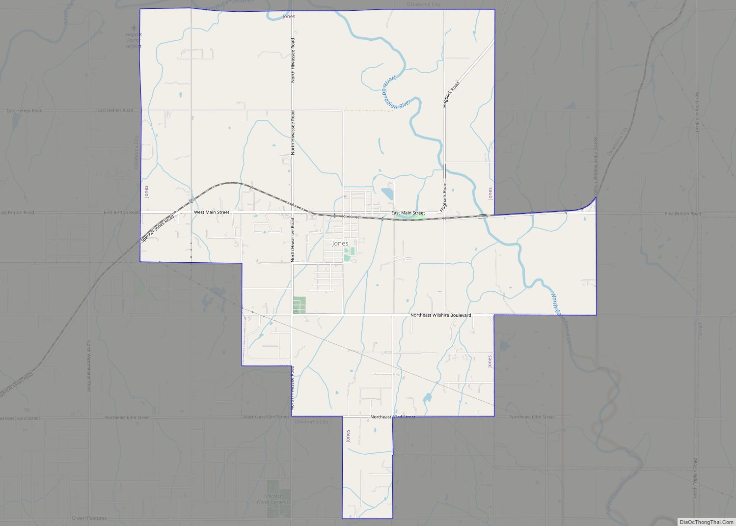
Online Interactive Map
Click on ![]() to view map in "full screen" mode.
to view map in "full screen" mode.
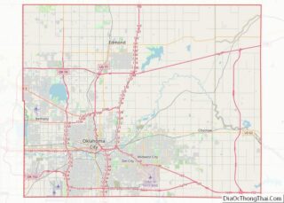
Edmond location map. Where is Edmond city?


History
19th century
The Santa Fe rail line in Oklahoma Territory established a water and coaling station for steam engines at this location when the Santa Fe Railroad built into Indian Territory in 1887. The site for the station was chosen because it was the highest point on the line in Oklahoma County; train could more easily accelerate going downhill while leaving the station in either direction. The railroad then named the station for Edmond Burdick, the Santa Fe’s traveling freight agent. When the town was formed after the Oklahoma Land Run of 1889, early settlers decided to adopt the name. Though most of the remnants of the old railroad infrastructure are gone, the Santa Fe, now BNSF, freight line still runs through the same course.
The town of Edmond sprang up overnight during the great Oklahoma land run on April 22, 1889, when homesteads were staked around the Santa Fe station. The original plat for Edmond was prepared by the Seminole Town and Development Company, a newly formed syndicate with ties to the railroad. Many of the original streets were named for men associated with either the Santa Fe Railroad or the town syndicate. The first mayor and city officers were elected in May 1889, and Edmond’s population was 294 in the 1890 census.
The first public schoolhouse in Oklahoma Territory, completed in August 1889, is in Edmond. It still stands as a historic monument on 2nd Street between Boulevard and Broadway and is open to the public on the first two Saturdays of each month or by appointment.
St. John the Baptist Catholic Church, the first church opened after the land run, was located on the southwest corner of East First and South Boulevard. The congregation still exists, although not in its original building or location.
In December 1890, the territorial legislature established three universities: the state university in Norman, the agricultural and mechanical college in Stillwater, and a “normal” or teaching school in Edmond. The first classes for the Territorial Normal School (University of Central Oklahoma) were held November 9, 1891, in the Methodist Church on the southwest corner of North Broadway and West Hurd. Old North, the Territorial Normal School’s iconic first building, was opened for classes on January 2, 1893, and ahead of Oklahoma State University’s Central Hall or Oklahoma University’s Science Hall.
The Edmond Sun, established by Milton W. “Kicking Bird” Reynolds on July 18, 1889, was the state’s oldest continuous newspaper dating from Oklahoma Territorial days.
20th century
In the early 20th century, Edmond was known as a sundown town. Racial covenants barred property sales to individuals of races other than white people or Native Americans in every neighborhood built between 1911 and 1949 except the Edmond Highway Addition in 1924. Racial housing covenants in the United States became unenforceable in 1948 after the Shelly v. Kraemer decision by the United States Supreme Court.
Edmond was the site of a workplace shooting on August 20, 1986, in which 14 people were killed and six wounded by Patrick Sherrill, an ex-postman who then committed suicide. This event was the deadliest killing in a string of U.S. postal employee murder–suicides which inspired the slang term “going postal”. A memorial to the victims of the attack stands outside the U.S. Post Office in downtown Edmond.
The city was the subject of a Tenth Circuit Court of Appeals case challenging the depiction of a Christian cross on the city seal, raising issues concerning the Establishment Clause of the U.S. Constitution. In May 1996, the Supreme Court let stand a Federal Appeals Court ruling ordering the city to remove the cross from the seal. Rather than replace the cross, the city council voted to leave the spot blank so as to “remind people of what was there,” as well as this being the least expensive way to comply.
21st century
A memorial service for famed Oklahoman baseball player Bobby Murcer was held in Edmond on August 6, 2008, at the Memorial Road Church of Christ. Among the some 2,000 attending the memorial were Reggie Jackson, Derek Jeter, Andy Pettitte, and former Yankees manager Joe Girardi.
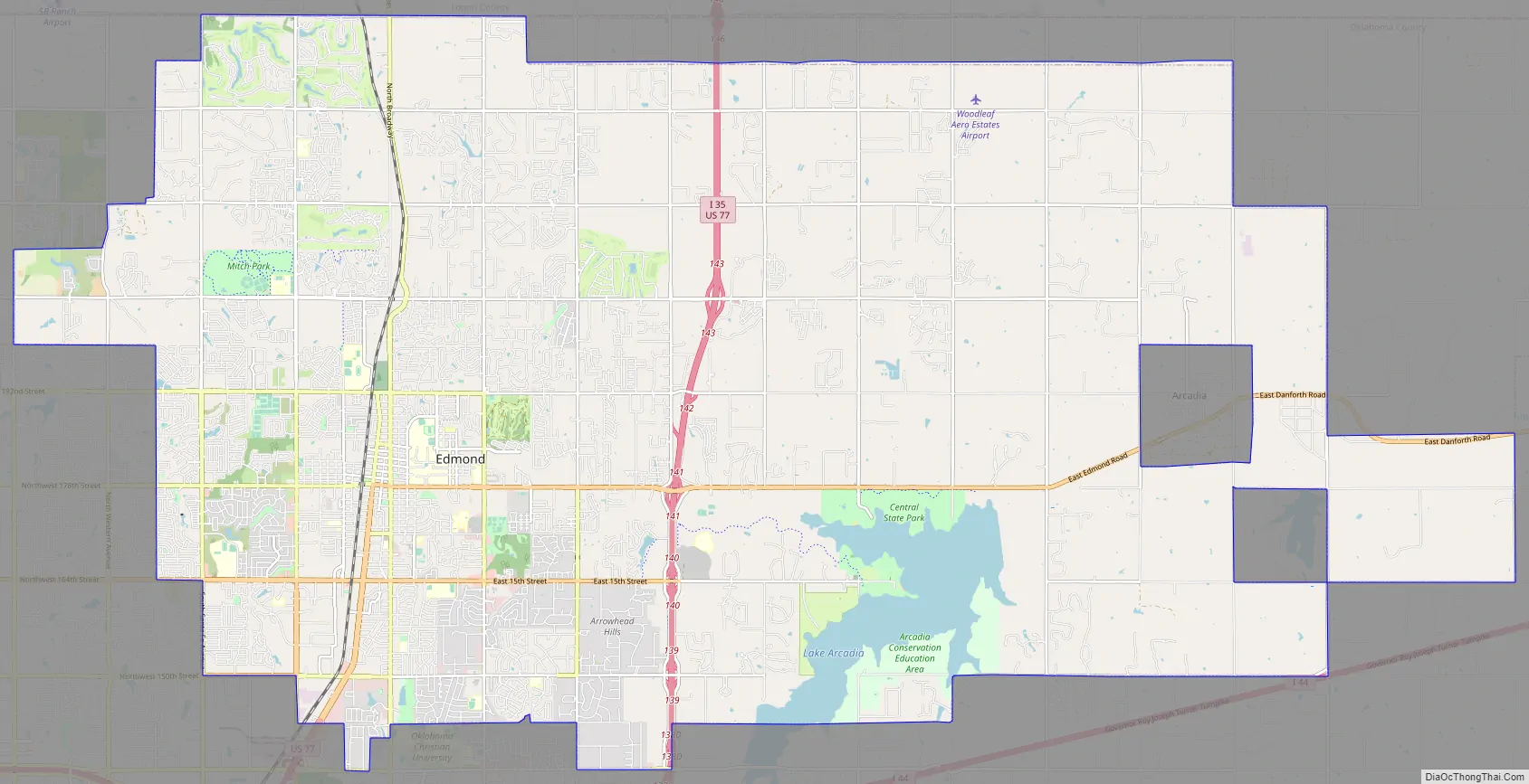
Edmond Road Map
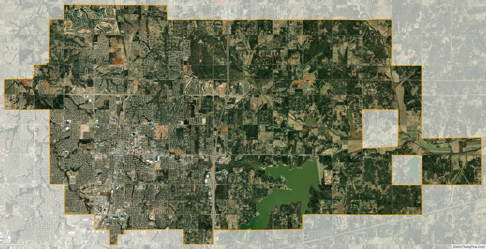
Edmond city Satellite Map
Geography
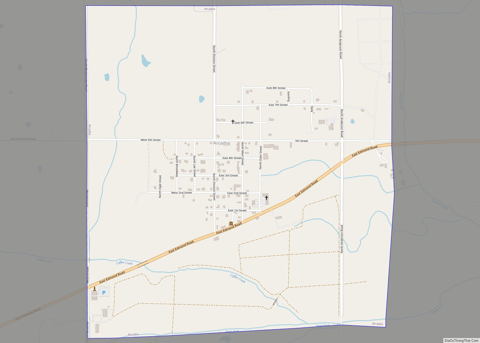
Edmond is located just north of Oklahoma City in Oklahoma County, Oklahoma. According to the United States Census Bureau, the city has a total area of 87.9 square miles (228 km), of which 85.1 square miles (220 km) is land and 2.8 square miles (7.3 km) or 3.19% is water. Arcadia Lake on the east side of the city is a fishing spot for the Oklahoma City metropolitan area and contains bluegill, channel catfish, blue catfish, and largemouth bass. Twin Bridges Lake is a second lake in the city.
Edmond lies in the Sandstone Hills region of Central Oklahoma, known for hills, blackjack oak, and post oak. The city falls into an ecological region known as the Cross Timbers.
Climate
Edmond has a humid subtropical climate with frequent variations in weather during part of the year and consistently hot summers. Prolonged and severe droughts often lead to wildfires and heavy rainfall often leads to flash flooding and flooding. Consistent winds, usually from the south or south-southeast during the summer, help temper the hotter weather. Consistent northerly winds during the winter can intensify cold periods. Severe ice storms and snowstorms happen sporadically during the winter.
The city is located in Tornado Alley and is subject to frequent and severe tornadoes and hailstorms. The Oklahoma City metropolitan area is one of the most tornado-prone major cities in the world.
See also
Map of Oklahoma State and its subdivision:- Adair
- Alfalfa
- Atoka
- Beaver
- Beckham
- Blaine
- Bryan
- Caddo
- Canadian
- Carter
- Cherokee
- Choctaw
- Cimarron
- Cleveland
- Coal
- Comanche
- Cotton
- Craig
- Creek
- Custer
- Delaware
- Dewey
- Ellis
- Garfield
- Garvin
- Grady
- Grant
- Greer
- Harmon
- Harper
- Haskell
- Hughes
- Jackson
- Jefferson
- Johnston
- Kay
- Kingfisher
- Kiowa
- Latimer
- Le Flore
- Lincoln
- Logan
- Love
- Major
- Marshall
- Mayes
- McClain
- McCurtain
- McIntosh
- Murray
- Muskogee
- Noble
- Nowata
- Okfuskee
- Oklahoma
- Okmulgee
- Osage
- Ottawa
- Pawnee
- Payne
- Pittsburg
- Pontotoc
- Pottawatomie
- Pushmataha
- Roger Mills
- Rogers
- Seminole
- Sequoyah
- Stephens
- Texas
- Tillman
- Tulsa
- Wagoner
- Washington
- Washita
- Woods
- Woodward
- Alabama
- Alaska
- Arizona
- Arkansas
- California
- Colorado
- Connecticut
- Delaware
- District of Columbia
- Florida
- Georgia
- Hawaii
- Idaho
- Illinois
- Indiana
- Iowa
- Kansas
- Kentucky
- Louisiana
- Maine
- Maryland
- Massachusetts
- Michigan
- Minnesota
- Mississippi
- Missouri
- Montana
- Nebraska
- Nevada
- New Hampshire
- New Jersey
- New Mexico
- New York
- North Carolina
- North Dakota
- Ohio
- Oklahoma
- Oregon
- Pennsylvania
- Rhode Island
- South Carolina
- South Dakota
- Tennessee
- Texas
- Utah
- Vermont
- Virginia
- Washington
- West Virginia
- Wisconsin
- Wyoming