Reading (/ˈrɛdɪŋ/ RED-ing; Pennsylvania Dutch: Reddin) is a city in and the county seat of Berks County, Pennsylvania, United States. The city had a population of 95,112 at the 2020 census and is the fourth-largest city in Pennsylvania after Philadelphia, Pittsburgh, and Allentown. Reading is located in the southeastern part of the state and is the principal city of the Greater Reading Area, which had 420,152 residents in 2020.
Reading is part of the Delaware Valley, also known as the Philadelphia metropolitan area, a region that also includes Philadelphia, Upper Darby, Camden, Atlantic City, Wilmington, and other Philadelphia-area cities and counties. With a 2020 core metropolitan statistical area population of 6.288 million and a combined statistical area population of 7.366 million, the Delaware Valley is the nation’s seventh-largest metropolitan region.
Reading gives its name to the now-defunct Reading Company, widely known as the Reading Railroad and since acquired by Conrail, that played a vital role in transporting anthracite coal from the Pennsylvania’s Coal Region to major East Coast metropolitan markets through the Port of Philadelphia for much of the 19th and 20th centuries. Reading Railroad is one of the four railroad properties in the classic U.S. version of the Monopoly board game. Reading was one of the first localities where outlet shopping became a tourist industry. It has been known as “The Pretzel City” because numerous local pretzel bakeries are based in the city and its suburbs; currently, Bachman, Dieffenbach, Tom Sturgis, and Unique Pretzel bakeries call the Reading area home. In recent years, the Reading area has become a destination for cyclists with more than 125 miles of trails in five major preserves; the region is an International Mountain Bicycling Association ride center.
According to 2010 U.S. census data, Reading had the highest share of citizens living in poverty in the nation among cities with populations exceeding 65,000. Reading’s poverty rate fell over the next decade. Reading’s poverty rate in the five-year American Community Survey, published in 2018, showed that 35.4% of the city’s residents were below the poverty line, or less “than the infamous 41.3% from 2011, when Reading was declared the poorest small city in the nation.”
Reading is located 38.8 miles (62.4 km) southwest of Allentown and 62.9 miles (101.2 km) northwest of Philadelphia.
| Name: | Reading city |
|---|---|
| LSAD Code: | 25 |
| LSAD Description: | city (suffix) |
| State: | Pennsylvania |
| County: | Berks County |
| Founded: | 1748 (1748) |
| Elevation: | 305 ft (93 m) |
| Land Area: | 9.84 sq mi (25.49 km²) |
| Water Area: | 0.24 sq mi (0.62 km²) |
| Population Density: | 9,662.91/sq mi (3,730.88/km²) |
| Area code: | 610, 484 |
| FIPS code: | 4263624 |
| Website: | www.readingpa.gov |
Online Interactive Map
Click on ![]() to view map in "full screen" mode.
to view map in "full screen" mode.
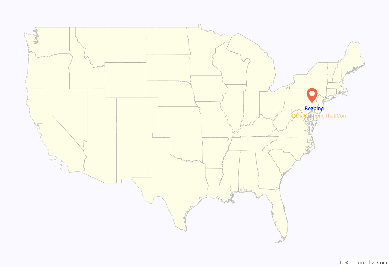
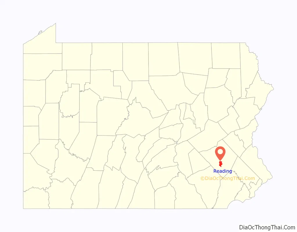
Reading location map. Where is Reading city?
History
18th century
Lenape people, also known as Delaware Indians, inhabited the Reading area prior to European settlement of the region in the 17th century. The Colony of Pennsylvania was a 1680 land grant from King Charles II of England to William Penn. Comprising more than 45,000 square miles (120,000 km2), it was named for his father, Sir William Penn.
In 1743, Richard and Thomas Penn, both sons of William Penn, mapped out the town of Reading with Conrad Weiser. Taking its name from Reading, Berkshire, England, the town was established in 1748. Upon the creation of Berks County in 1752, Reading became the county seat. The region was settled by emigrants from southern and western Germany, who bought land from the Penns. The first Amish community in the New World was established in Greater Reading, Berks County. The Pennsylvanian German dialect was spoken in the area well into the 1950s.
During the French and Indian War, Reading was a military base for a chain of forts along the Blue Mountain.
By the time of the American Revolution, the area’s iron industry had a total production exceeding England’s. There were several prominent Ironmasters like Samuel Van Leer who helped supply George Washington’s troops with cannons, rifles, and ammunition in the Revolutionary War. During the early period of the conflict, Reading was again a depot for military supply. Hessian prisoners from the Battle of Trenton were also detained here.
Philadelphia was the nation’s capital at the time of the 1793 Philadelphia yellow fever epidemic. President George Washington traveled to Reading, and considered making it the emergency national capital, but chose Germantown instead.
19th century
In 1809, Susanna Cox was tried and convicted for infanticide in Reading. Her case attracted tremendous sympathy; 20,000 viewers came to view her hanging, swamping the 3,000 inhabitants.
Census data showed that, from 1810 to 1950, Reading was among the nation’s top one hundred largest urban places.
The Schuylkill Canal, a north–south canal completed in 1825, paralleled the Schuylkill River and connected Reading with Philadelphia and the Delaware River. The Union Canal, an east–west canal completed in 1828, connected the Schuylkill and Susquehanna Rivers, and ran from Reading to Middletown, Pennsylvania, a few miles south of Harrisburg, the state capital. Railroads forced the abandonment of the canals by the 1880s.
The naturalist Spencer Fullerton Baird was born in Reading in 1823.
The Philadelphia and Reading Railroad (P&R) was incorporated in 1833. During the Long Depression following the Panic of 1873, a statewide railroad strike in 1877 over delayed wages led to a violent protest and clash with the National Guard in which six Reading men were killed. The Reading Brewing Company was also established around this same time, and was officially chartered in 1886. Following more than a century of prosperity, the Reading Company was forced to file for bankruptcy protection in 1971. The bankruptcy was a result of dwindling coal shipping revenues and strict government regulations that denied railroads the ability to set competitive prices, required high taxes, and forced the railroads to continue to operate money-losing passenger service lines. On April 1, 1976, the Reading Company sold its current railroad interests to the newly formed Consolidated Railroad Corporation (Conrail). That same month, the Reading Brewing Company closed.
The Charles Evans Cemetery is the non-sectarian cemetery where many of the city’s prominent business and community leaders have been buried since the cemetery’s opening in the 1840s. Established through the donation of land by Reading attorney and philanthropist Charles Evans and a subsequent financial endowment upon his death in 1847, which provided for future improvements to the grounds, the cemetery became a primary gathering point for annual Memorial Day activities from the late 19th through the late 20th centuries due to the presence of the Grand Army of the Republic monument, which was dedicated there in 1887.
20th century
In the early 20th century, the city participated in the burgeoning automobile and motorcycle industry as home to the pioneer “Brass Era” companies, Daniels Motor Company, Duryea Motor Wagon Company, and Reading-Standard Company.
Reading experienced continuous growth until the 1930s, when its population reached nearly 120,000. From the 1940s to the 1970s, however, the city saw a sharp downturn in prosperity, largely owing to the decline of the heavy industry and railroads, on which Reading had been built, and a national trend of urban decline.
In 1972, Hurricane Agnes caused extensive flooding in the city, not the last time the lower precincts of Reading were inundated by the Schuylkill River. A similar, though not as devastating, flood occurred during June 2006.
21st century
In December 2007, NBC’s Today show featured Reading as one of the top four “Up and Coming Neighborhoods” in the U.S. as showing potential for a real estate boom. The interviewee, Barbara Corcoran, chose the city by looking for areas of big change, renovations, cleanups of parks, waterfronts, and warehouses. Corcoran also noted Reading’s proximity to Philadelphia, New York City, and other cities.
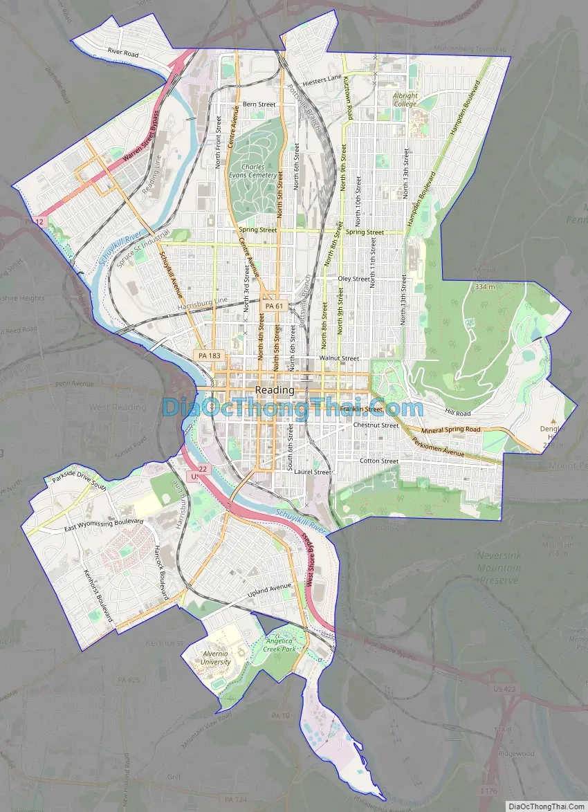
Reading Road Map
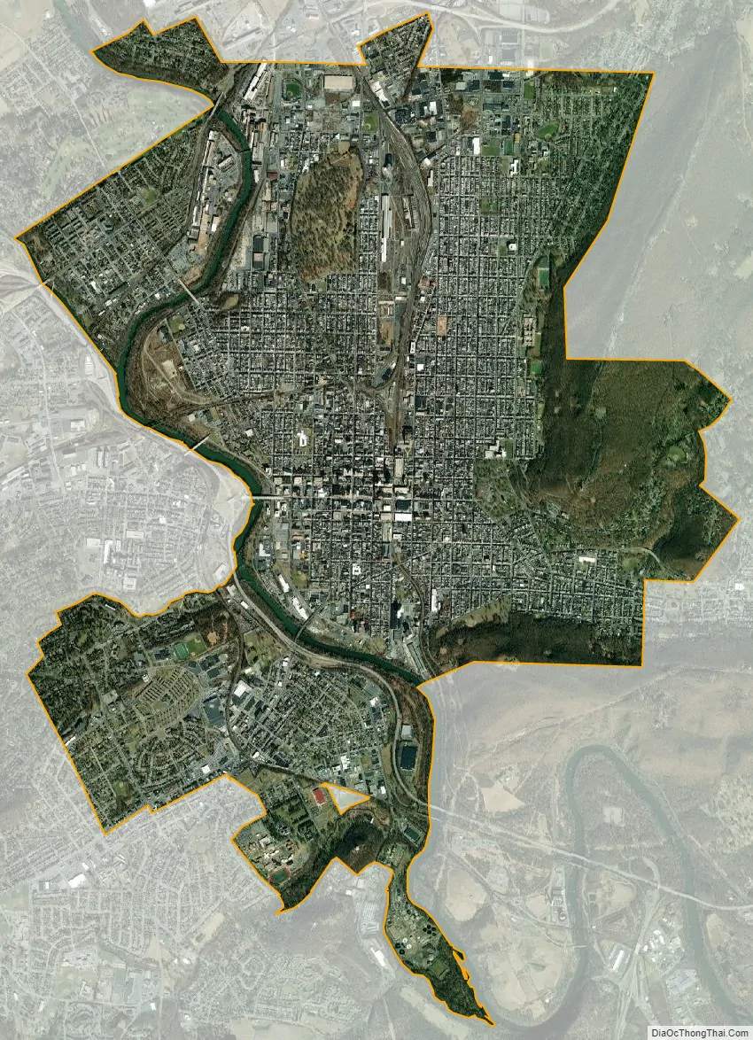
Reading city Satellite Map
Geography
Reading is located at 40°20′30″N 75°55′35″W / 40.34167°N 75.92639°W / 40.34167; -75.92639 (40.341692, −75.926301) in southeastern Pennsylvania, roughly 65 miles (105 km) northwest of Philadelphia. According to the United States Census Bureau, the city has a total area of 10.1 square miles (26 km). 9.8 square miles (25 km) of it is land and 0.2 square miles (0.52 km) of it (2.39%) is water. The city is largely bounded on the west by the Schuylkill River, on the east by Mount Penn, and on the south by Neversink Mountain. The Reading Prong, the mountain formation stretching northeast into New Jersey, has come to be associated with naturally occurring radon gas; however, homes in Reading are not particularly affected. The surrounding county is home to a number of family-owned farms.
See also
Map of Pennsylvania State and its subdivision:- Adams
- Allegheny
- Armstrong
- Beaver
- Bedford
- Berks
- Blair
- Bradford
- Bucks
- Butler
- Cambria
- Cameron
- Carbon
- Centre
- Chester
- Clarion
- Clearfield
- Clinton
- Columbia
- Crawford
- Cumberland
- Dauphin
- Delaware
- Elk
- Erie
- Fayette
- Forest
- Franklin
- Fulton
- Greene
- Huntingdon
- Indiana
- Jefferson
- Juniata
- Lackawanna
- Lancaster
- Lawrence
- Lebanon
- Lehigh
- Luzerne
- Lycoming
- Mc Kean
- Mercer
- Mifflin
- Monroe
- Montgomery
- Montour
- Northampton
- Northumberland
- Perry
- Philadelphia
- Pike
- Potter
- Schuylkill
- Snyder
- Somerset
- Sullivan
- Susquehanna
- Tioga
- Union
- Venango
- Warren
- Washington
- Wayne
- Westmoreland
- Wyoming
- York
- Alabama
- Alaska
- Arizona
- Arkansas
- California
- Colorado
- Connecticut
- Delaware
- District of Columbia
- Florida
- Georgia
- Hawaii
- Idaho
- Illinois
- Indiana
- Iowa
- Kansas
- Kentucky
- Louisiana
- Maine
- Maryland
- Massachusetts
- Michigan
- Minnesota
- Mississippi
- Missouri
- Montana
- Nebraska
- Nevada
- New Hampshire
- New Jersey
- New Mexico
- New York
- North Carolina
- North Dakota
- Ohio
- Oklahoma
- Oregon
- Pennsylvania
- Rhode Island
- South Carolina
- South Dakota
- Tennessee
- Texas
- Utah
- Vermont
- Virginia
- Washington
- West Virginia
- Wisconsin
- Wyoming


