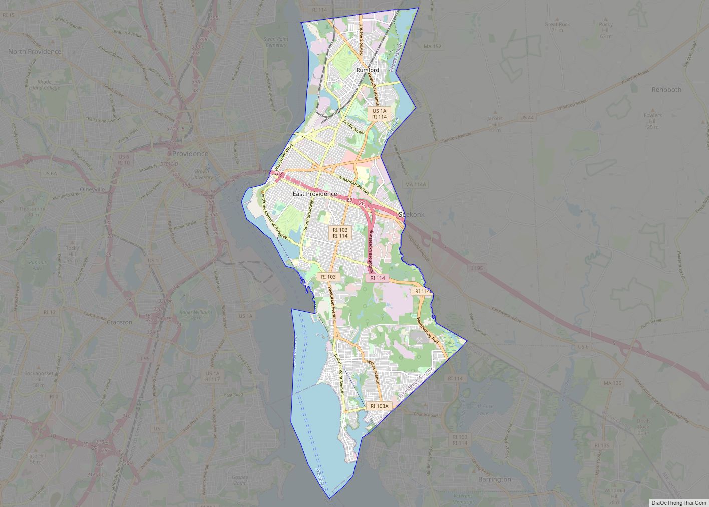
East Providence is a city in Providence County, Rhode Island, United States. The population was 47,139 at the 2020 census, making it the fifth-largest city in the state.
| Name: | East Providence city |
|---|---|
| LSAD Code: | 25 |
| LSAD Description: | city (suffix) |
| State: | Rhode Island |
| County: | Providence County |
| Elevation: | 62 ft (19 m) |
| Total Area: | 16.61 sq mi (43.01 km²) |
| Land Area: | 13.28 sq mi (34.41 km²) |
| Water Area: | 3.32 sq mi (8.60 km²) |
| Total Population: | 47,139 |
| Population Density: | 3,548.55/sq mi (1,370.08/km²) |
| ZIP code: | 02914, 02915, 02916 |
| Area code: | 401 |
| FIPS code: | 4422960 |
| GNISfeature ID: | 1219590 |
| Website: | eastprovidenceri.net |
Online Interactive Map
Click on ![]() to view map in "full screen" mode.
to view map in "full screen" mode.
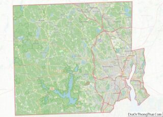
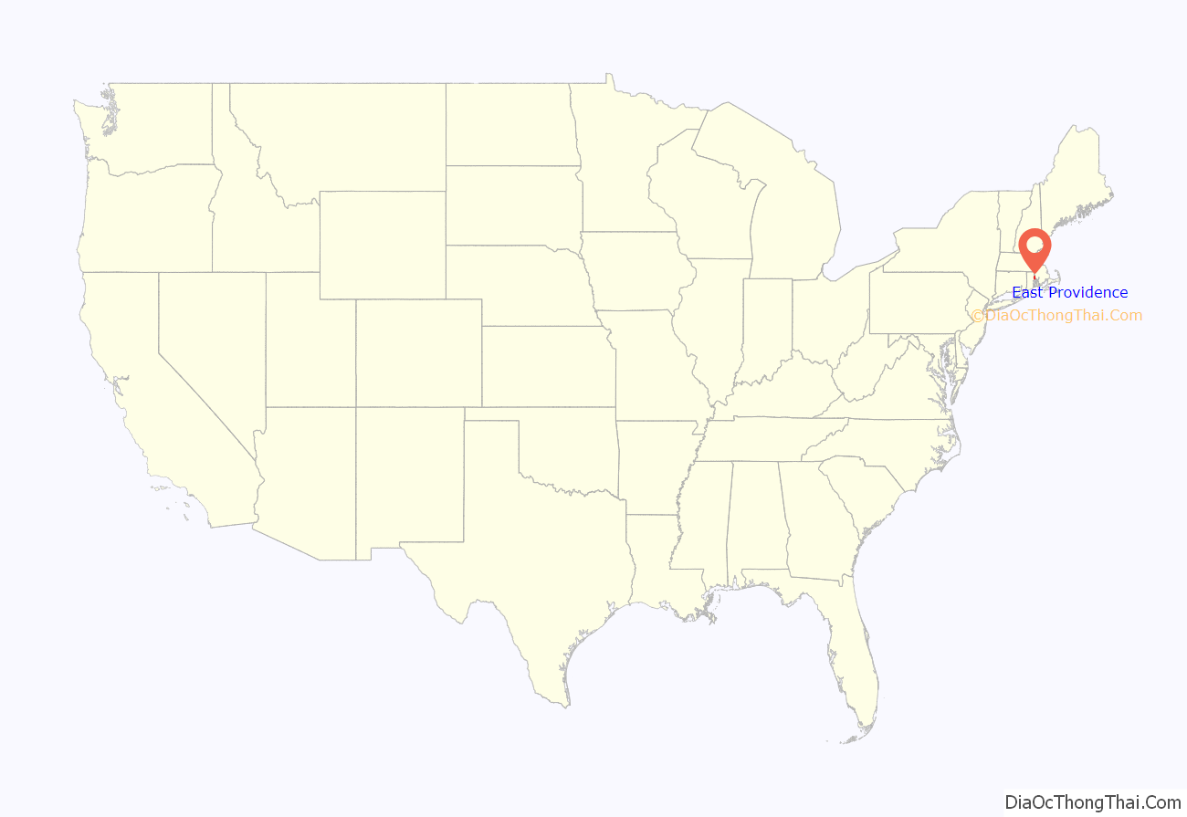
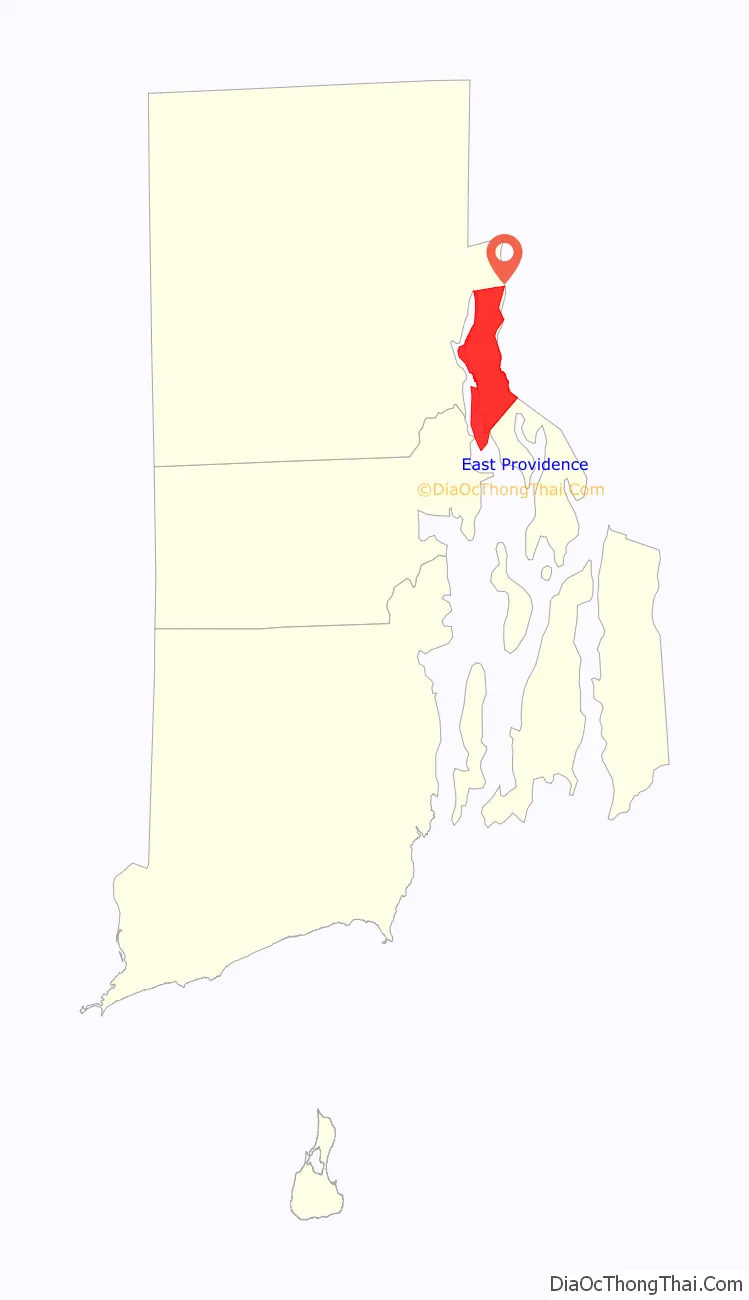
East Providence location map. Where is East Providence city?
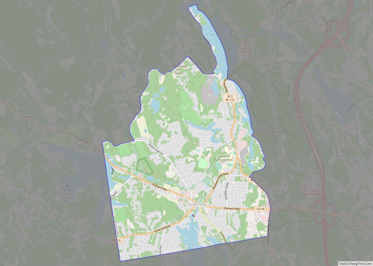
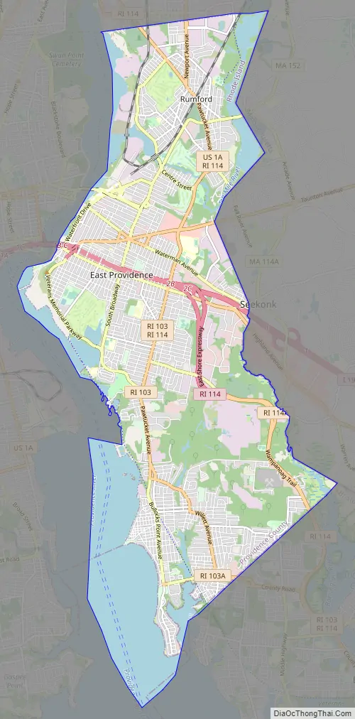
East Providence Road Map
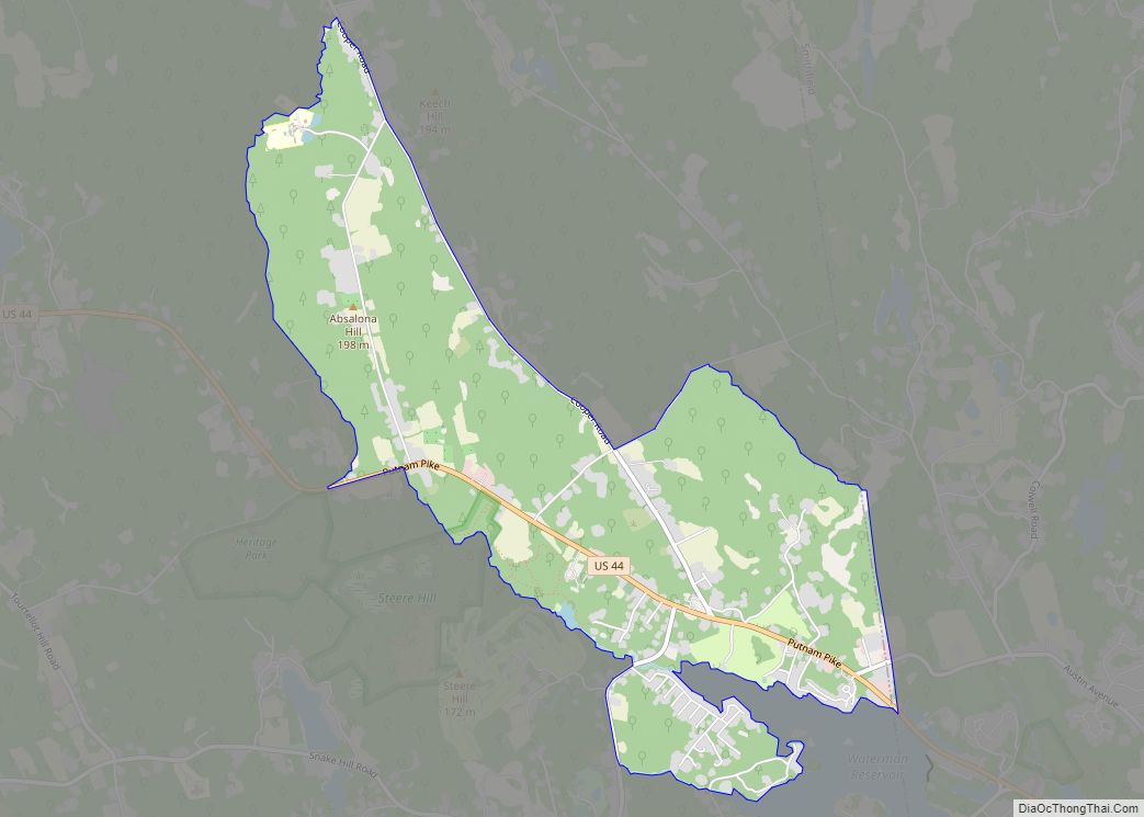
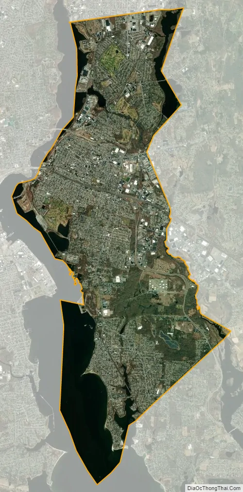
East Providence city Satellite Map
Geography
East Providence is located between the Providence and Seekonk Rivers on the west and the Seekonk area of Massachusetts on the east. According to the United States Census Bureau, the city has a total area of 16.6 square miles (43 km), of which, 13.4 square miles (35 km) of it is land and 3.2 square miles (8.3 km) of it (19.33%) is water.
The following villages are located in East Providence:
- East Providence Center
- Riverside
- Rumford
See also
Map of Rhode Island State and its subdivision: Map of other states:- Alabama
- Alaska
- Arizona
- Arkansas
- California
- Colorado
- Connecticut
- Delaware
- District of Columbia
- Florida
- Georgia
- Hawaii
- Idaho
- Illinois
- Indiana
- Iowa
- Kansas
- Kentucky
- Louisiana
- Maine
- Maryland
- Massachusetts
- Michigan
- Minnesota
- Mississippi
- Missouri
- Montana
- Nebraska
- Nevada
- New Hampshire
- New Jersey
- New Mexico
- New York
- North Carolina
- North Dakota
- Ohio
- Oklahoma
- Oregon
- Pennsylvania
- Rhode Island
- South Carolina
- South Dakota
- Tennessee
- Texas
- Utah
- Vermont
- Virginia
- Washington
- West Virginia
- Wisconsin
- Wyoming