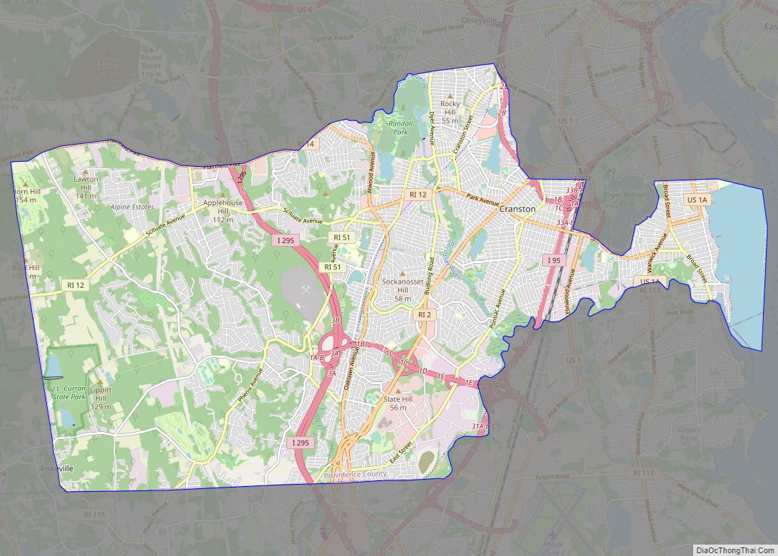
Cranston, once known as Pawtuxet, is a city in Providence County, Rhode Island, United States. The official population of the city in the 2020 United States Census was 82,934, making it the second largest in the state. The center of population of Rhode Island is located in Cranston. Cranston is a part of the Providence metropolitan area.
Cranston was named one of the “100 Best Places to Live” in the United States by Money magazine in 2006. Cranston ranked 36th on the list of “America’s 50 Best Cities to Live” in a 2014 survey done by 24/7 Wall St.
The Town of Cranston was created in 1754 from a portion of Providence north of the Pawtuxet River. After losing much of its territory to neighboring towns and the city of Providence, Cranston itself became a city on March 10, 1910.
| Name: | Cranston city |
|---|---|
| LSAD Code: | 25 |
| LSAD Description: | city (suffix) |
| State: | Rhode Island |
| County: | Providence County |
| Elevation: | 66 ft (20 m) |
| Total Area: | 30.02 sq mi (77.75 km²) |
| Land Area: | 28.34 sq mi (73.41 km²) |
| Water Area: | 1.67 sq mi (4.33 km²) |
| Total Population: | 82,934 |
| Population Density: | 2,925.88/sq mi (1,129.68/km²) |
| Area code: | 401 |
| FIPS code: | 4419180 |
| GNISfeature ID: | 1218689 |
| Website: | www.cranstonri.gov |
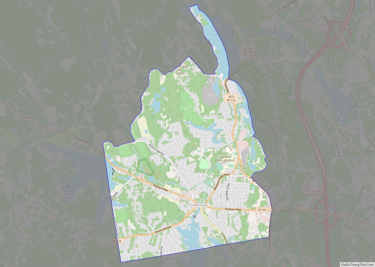
Online Interactive Map
Click on ![]() to view map in "full screen" mode.
to view map in "full screen" mode.
Cranston location map. Where is Cranston city?


History
Much of the land was purchased by Roger Williams from the Narragansett Indians in 1638 as part of the Pawtuxet Purchase, and the first settler in the area was William Arnold, who was followed shortly by William Harris, William Carpenter, and Zachariah Rhodes. Stephen Arnold, a brother-in-law of Rhodes and William Arnold, built a gristmill on the Pawtuxet falls and laid out the Arnold Road (modern-day Broad Street) connecting it to the Pequot Trail leading to Connecticut. Arnold’s son Benedict Arnold became the first Governor of Rhode Island under the charter of 1663. Residents were unable to agree upon a name for a new town for decades, and the Town of Cranston was eventually created by the General Assembly in 1754 from a portion of Providence north of the Pawtuxet River. Historians debate whether the town was named after Governor Samuel Cranston, the longest-serving Rhode Island governor, or his grandson Thomas Cranston, who was serving as Speaker of the Rhode Island House of Representatives at the time that the town was created. In the early 1770s, town meetings were held at the taverns of Caleb Arnold and Nehemiah Knight, where residents voted in favor of a resolution opposing the British Parliament’s Coercive Acts; the town heavily supported the Patriot cause during the Revolutionary War. The town lost much of its territory to neighboring towns and the city of Providence over the nineteenth century, and Cranston became a city on March 10, 1910.
Many Italian-Americans in Cranston are descended from immigrants of Itri, Italy who settled mainly in the Knightsville section of Cranston during the early 1900s. Cranston is known for the St. Mary’s Feast, inspired by the Feast of the Madonna della Civita celebrated in Itri. Since 1905, the St. Mary’s Feast has been a week-long festival celebrated in July in Cranston with vendors, a carnival, fireworks, and a religious procession from St. Mary’s Church on Sunday. In 2000, Cranston and Itri became sister cities.
For many years Cranston was the third-largest city in Rhode Island, after Providence and Warwick, both of which it borders. However, in 2017 it surpassed Warwick to take second place. Though Cranston’s overall population density was already much greater than the geographically larger Warwick, a major factor contributing to its growth has been a large and semi-rural section west of Interstate 295, which has seen a high volume of housing development in recent years; Warwick has significantly less open land available for development.
Flood of 2010
The Pawtuxet River overflowed in March 2010 after an overwhelming amount of rain. This caused many major sites to be shut down and repaired, such as the Warwick Mall, Contour Dental Laboratories, and the CLCF Building.
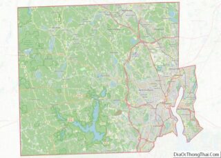
Cranston Road Map

Cranston city Satellite Map

Geography
According to the United States Census Bureau, the city has a total area of 29.9 square miles (77 km), of which, 28.6 square miles (74 km) of it is land and 1.4 square miles (3.6 km) of it (4.54%) is water.
It is roughly three percent of Rhode Island’s total land mass.
The following neighborhoods and villages are located in Cranston:
- Alpine Estates
- Apple Hill Estates
- Arlington
- Bellefonte
- Castleton Estates
- Auburn
- Dean Estates
- Eden Park
- Edgewood
- Fiskeville (also in Scituate)
- Forest Hills
- Friendly Community
- Garden City
- Garden Hills
- Glen Woods
- Hillside Farms
- Laurel Hill
- Howard
- Jackson (also in Scituate)
- Knightsville
- Meshanticut
- Oakhill Terrace
- Oak Lawn
- Orchard Valley Estates
- Pontiac
- Stadium
- Thornton (this includes part of Johnston)
- Pawtuxet Village (also in Warwick)
- Webster
- Westend
- Woodridge
- Western Hills Village
See also
Map of Rhode Island State and its subdivision: Map of other states:- Alabama
- Alaska
- Arizona
- Arkansas
- California
- Colorado
- Connecticut
- Delaware
- District of Columbia
- Florida
- Georgia
- Hawaii
- Idaho
- Illinois
- Indiana
- Iowa
- Kansas
- Kentucky
- Louisiana
- Maine
- Maryland
- Massachusetts
- Michigan
- Minnesota
- Mississippi
- Missouri
- Montana
- Nebraska
- Nevada
- New Hampshire
- New Jersey
- New Mexico
- New York
- North Carolina
- North Dakota
- Ohio
- Oklahoma
- Oregon
- Pennsylvania
- Rhode Island
- South Carolina
- South Dakota
- Tennessee
- Texas
- Utah
- Vermont
- Virginia
- Washington
- West Virginia
- Wisconsin
- Wyoming