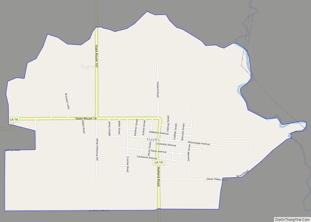
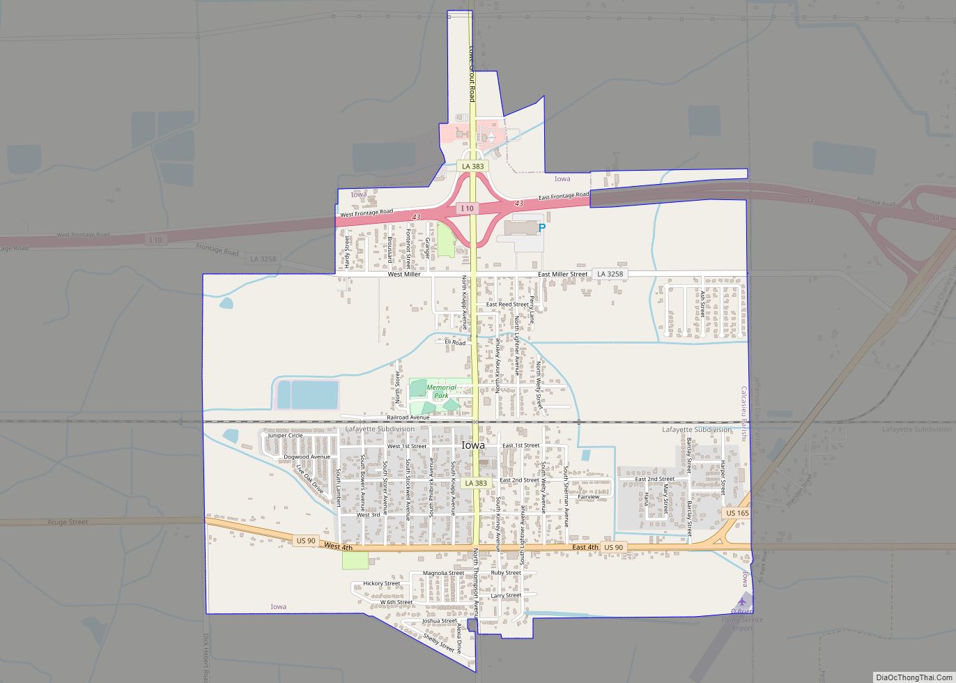
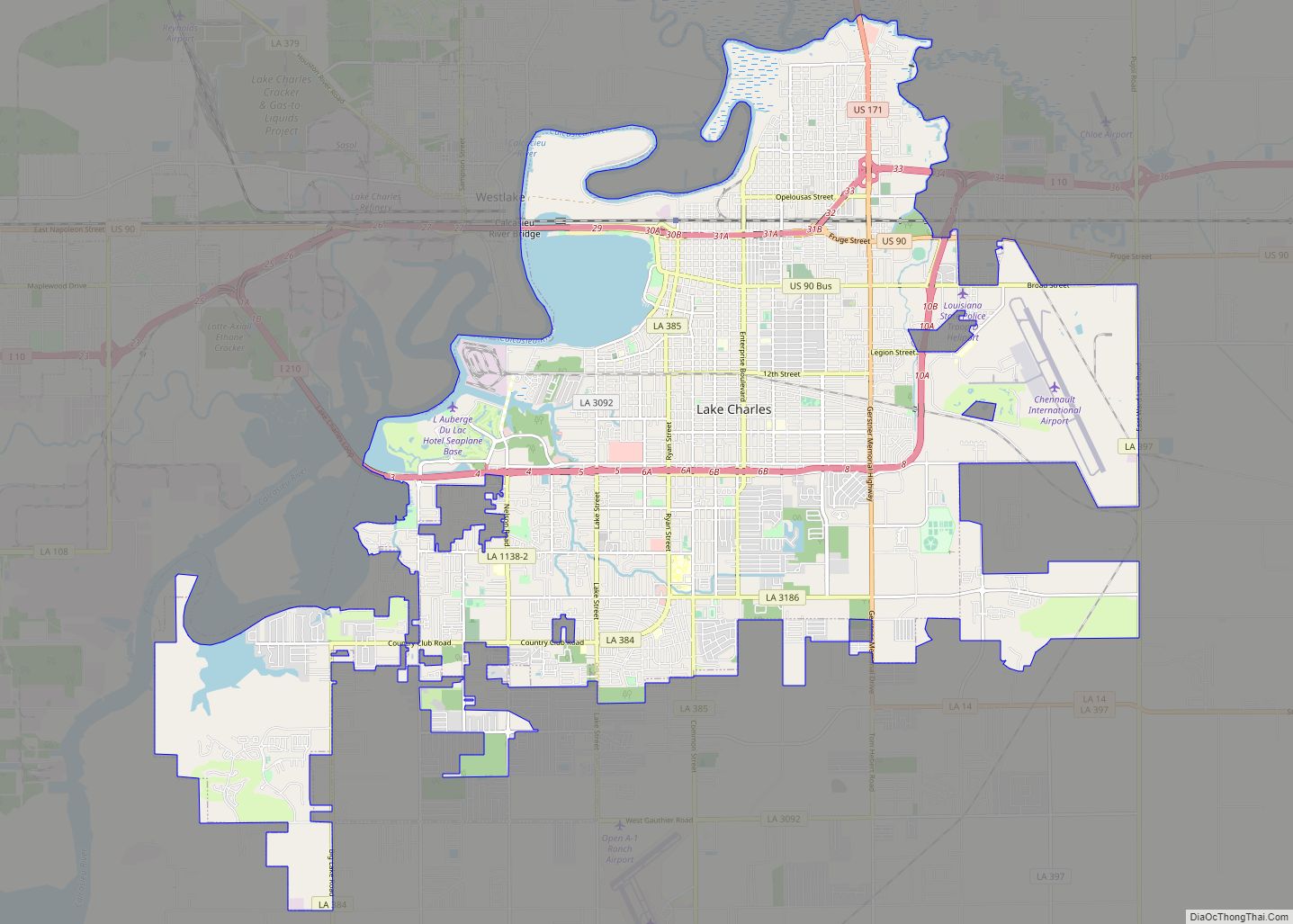
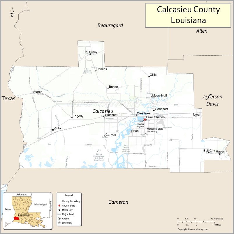
Calcasieu Parish (/ˈkælkəˌʃuː/; French: Paroisse de Calcasieu) is a parish located on the southwestern border of the U.S. state of Louisiana. As of the 2020 census, the population was 216,785. The parish seat is Lake Charles.
Calcasieu Parish is part of the Lake Charles metropolitan statistical area; it is also located near the Beaumont–Port Arthur (Texas), Lafayette, and Alexandria metropolitan areas.
Calcasieu Parish was created March 24, 1840, from the parish of Saint Landry, one of the original nineteen civil parishes established by the Louisiana Legislature in 1807 after the United States acquired the territory in the Louisiana Purchase of 1803. The original parish seat was Comasaque Bluff, a settlement east of the river and later called Marsh Bayou Bluff. On December 8, 1840, it was renamed as Marion, Louisiana.
In 1852 Jacob Ryan, a local planter and businessman, donated land and offered to move the courthouse in order to have the parish seat moved to Lake Charles. As the population in this area grew over the years, the original Calcasieu Parish has since been divided into five smaller parishes. The original area of Calcasieu Parish is called Imperial Calcasieu.
| Name: | Calcasieu Parish |
|---|---|
| FIPS code: | 22-019 |
| State: | Louisiana |
| Founded: | March 24, 1840 |
| Named for: | Atakapa word for crying eagle |
| Seat: | Lake Charles |
| Total Area: | 2,830 km² (1,094 sq mi) |
| Land Area: | 2,760 km² (1,064 sq mi) |
| Total Population: | 216,785 |
| Population Density: | 77/km² (200/sq mi) |
| Time zone: | UTC-6 (CST) |
| Summer Time Zone (DST): | UTC-5 (CDT) |
| Website: | Calcasieu Parish Police Jury |
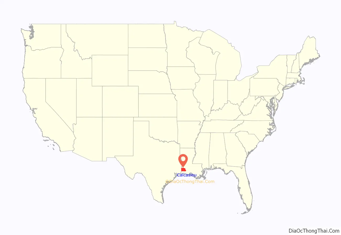
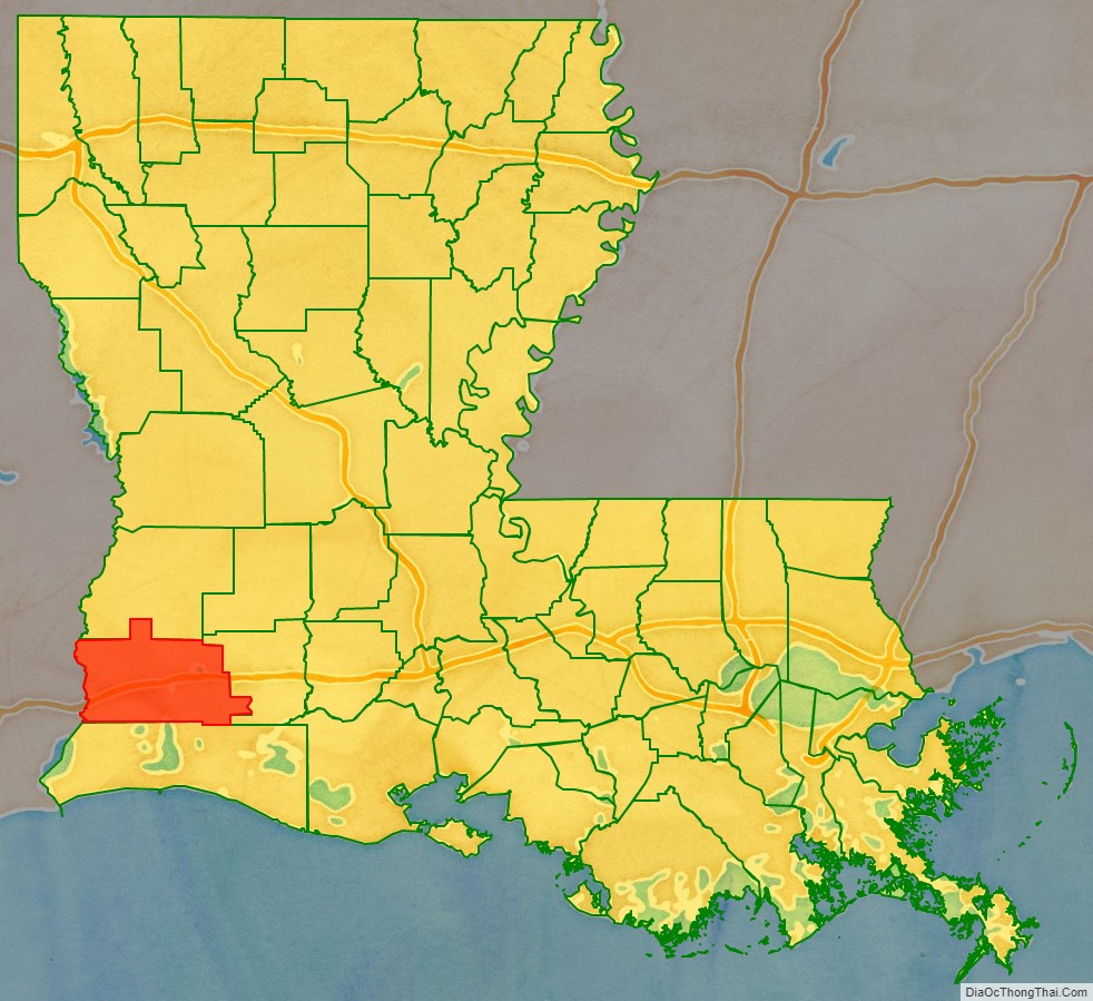
Calcasieu Parish location map. Where is Calcasieu Parish?
History
The name Calcasieu comes from the Atakapa word, spelled quelqueshue in a French transliteration, and meaning “crying eagle.” This was the name of an Atakapa chief, which French colonists applied to the local river, the Calcasieu River. When the Spanish controlled this area, they referred to this river as the Rio Hondo (Rio Stondo or “Deep River”). The Americans adopted an English transliteration of the French name for the parish. There is also some speculation that Calcasieu is simply an anglicized spelling of “quelque chose” (pronounced kel-ka-showz) which is French for “something”. Potentially it being named “Something Parish” after “Something River”.
Early history
The early history of the parish dates to the period of the Spanish occupation of Louisiana, after France had ceded this territory following its defeat by Great Britain in the Seven Years’ War. In 1797, Jose M. Mora was granted a large tract of land between the Rio Hondo (now Calcasieu River) and the Sabine River, known for years as the “Neutral Strip” between Louisiana and Texas. The area became a refuge for outlaws and filibusters from Carolina, Georgia, and Mississippi of the United States, which had recently gained independence from Great Britain.
The territory was disputed for years between Spain and the United States after France had ceded Louisiana to the American government as part of the Louisiana Purchase of 1803. It was definitively acquired by the United States from Spain with the Adams-Onis Treaty in 1819. The treaty was formally ratified on February 22, 1821. By an act of Congress, approved on March 3, 1823, this strip of land was attached to the district of the Louisiana Territory south of the Red River.
Early settlers to the area included the Ryan, Perkin, Hodges, Bilbo, LeBleu, Deviers, and Henderson families. Some of these families also brought along a few enslaved servants. Acadian settlers, from the eastern parishes of Louisiana, also migrated to this area. Of French descent and exiled by the British from Acadia (eastern Canada), many of these refugees had settled in Louisiana. The parish had a diverse ethnic mix of French and Spanish Creoles, Acadians, Anglo-Americans, Enslaved African Americans, Free African Americans, and Indians. Data compiled from historical volumes of the US Center of Population and Housing indicate that in 1850, 240 of 3914 Parish residents were “Free Men of Color”. By 1860 that number had risen to 305 of 5928. The 1860 U.S. census of Louisiana counts 1171 Slaves among Calcasieu Parish residents.
“Imperial Calcasieu” era
Calcasieu Parish was created in 1840 from the Parish of Saint Landry. The new parish was the largest in the state, larger than either of the two smallest states, Delaware and Rhode Island. This size, which ultimately was divided into five parishes, led to the parish’s nickname “Imperial Calcasieu.”
On August 24, 1840, six men met at a private home near present-day Chloe to organize as the parish police jury representing six wards. The first order of business was to elect officers, appoint a parish clerk, and settle on simple parliamentary rules that would enable the president to keep the meetings orderly and progressive. The jury adopted all of the laws then in force in Saint Landry Parish. They appointed a parish constable, a parish treasurer, two parish assessors, and an operator of the ferry at Buchanan’s crossing. The assessors were given two months to assess all of the property in the parish and a salary of $90.
On September 14, 1840, a survey was authorized of land known then as Marsh Bayou Bluff in order to establish a seat of justice (parish seat) and construct a courthouse and jail. On December 8, 1840, the jury chose to rename this community as Marion. In 1843, the Legislature authorized a vote to move the parish seat.
Finally in 1852, Jacob Ryan was successful in having the parish seat relocated from Marion to the east bank of Lake Charles. This parish seat was incorporated in 1857 as the town of Charleston; it was reincorporated in 1868 as Lake Charles. It is located about six miles (10 km) from Marion, now known as Old Town. The name Lake Charles commemorates one of the first European settlers, Charles Sallier, a Frenchman who acquired land in this area at the beginning of the 19th century.
Division
In 1870 Cameron Parish was created from the southern portion of Imperial Calcasieu. It was one of several parishes organized during the Reconstruction era by the Republican-dominated legislature, in an effort to build Republican strength. Many Freedmen had joined the Republican Party elsewhere in the state. However, while other areas of Louisiana had been developed as cotton plantations, Calcasieu Parish had not. Although the parish had been larger in land mass than the states of Delaware and Rhode Island it was primarily utilized as grazing land for cattle with no significant plantings of cotton, sugar cane or other crops requiring the utilization of enslaved labor. Therefore, Calcasieu was home to a lower percentile of African Americans slaves than many other parts of the State.
In 1912 Calcasieu Parish still comprised an area of more than 3,600 square miles (9,300 km), and remained the largest parish in the state by geographic area. In 1912, “Imperial Calcasieu” was further divided with the creation of the three new parishes of Allen, Beauregard, and Jefferson Davis, with a total area of approximately 2,548 square miles (6,600 km). These were the most recent parishes organized in Louisiana. Following these jurisdictional changes, Calcasieu Parish lost almost half of its population between the 1910 and 1920 United States census.
Calcasieu Parish Road Map
Geography
According to the U.S. Census Bureau, the parish has a total area of 1,094 square miles (2,830 km), of which 1,064 square miles (2,760 km) is land and 31 square miles (80 km) (2.8%) is water.
Major highways
- Interstate 10
- Interstate 210
- U.S. Highway 90
- U.S. Highway 165
- U.S. Highway 171
- Louisiana Highway 12
- Louisiana Highway 14
- Louisiana Highway 27
Adjacent counties and parishes
- Beauregard Parish (north)
- Jefferson Davis Parish (east)
- Cameron Parish (south)
- Orange County, Texas (west)
- Newton County, Texas (northwest)
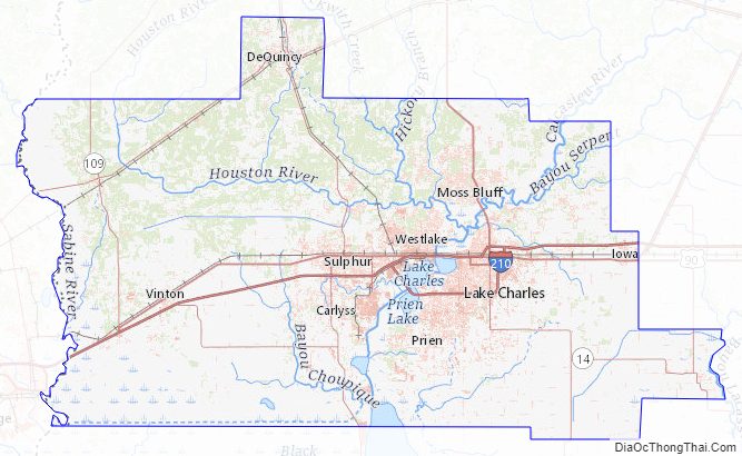
Major waterways
- Lake Charles
- Calcasieu River
- Intracoastal Canal
- Ouiski Chitto Creek
- English Bayou
- West Fork
- Calcasieu Lake
Calcasieu Parish Topographic Map
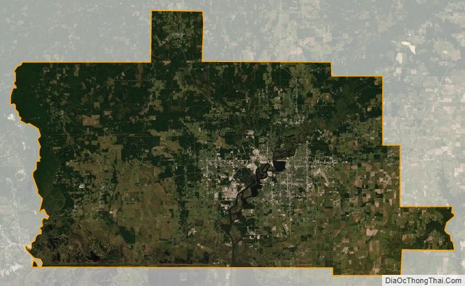
Calcasieu Parish Satellite Map
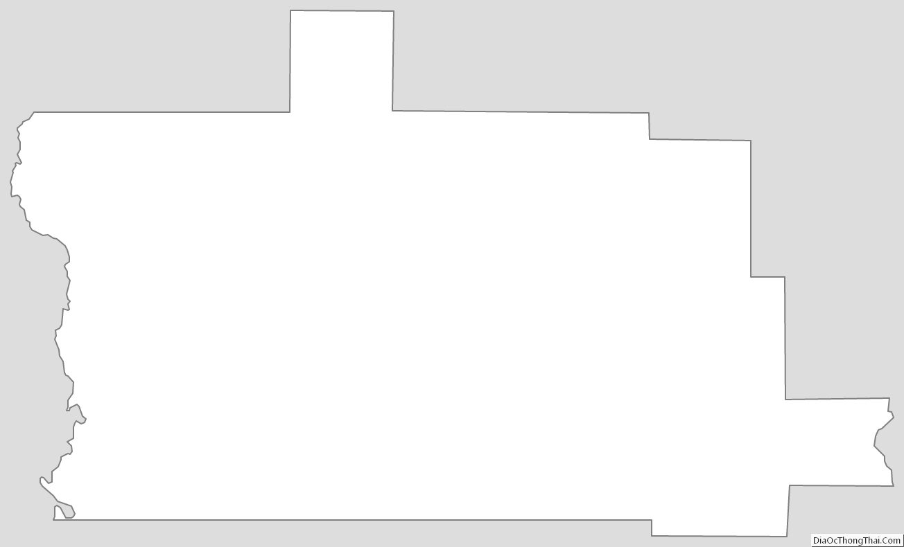
Calcasieu Parish Outline Map