Chatham County (locally /ˈtʃætəm/ CHAT-əm) is a county located in the Piedmont area of the U.S. state of North Carolina. As of the 2020 census, the population was 76,285. Its county seat is Pittsboro.
Chatham County is part of the Durham-Chapel Hill, NC Metropolitan Statistical Area, which is also included in the Raleigh-Durham-Chapel Hill Combined Statistical Area, which has a population of 2,043,867 as of 2020 U.S. Census.
| Name: | Chatham County |
|---|---|
| FIPS code: | 37-037 |
| State: | North Carolina |
| Founded: | 1771 |
| Named for: | William Pitt, 1st Earl of Chatham |
| Seat: | Pittsboro |
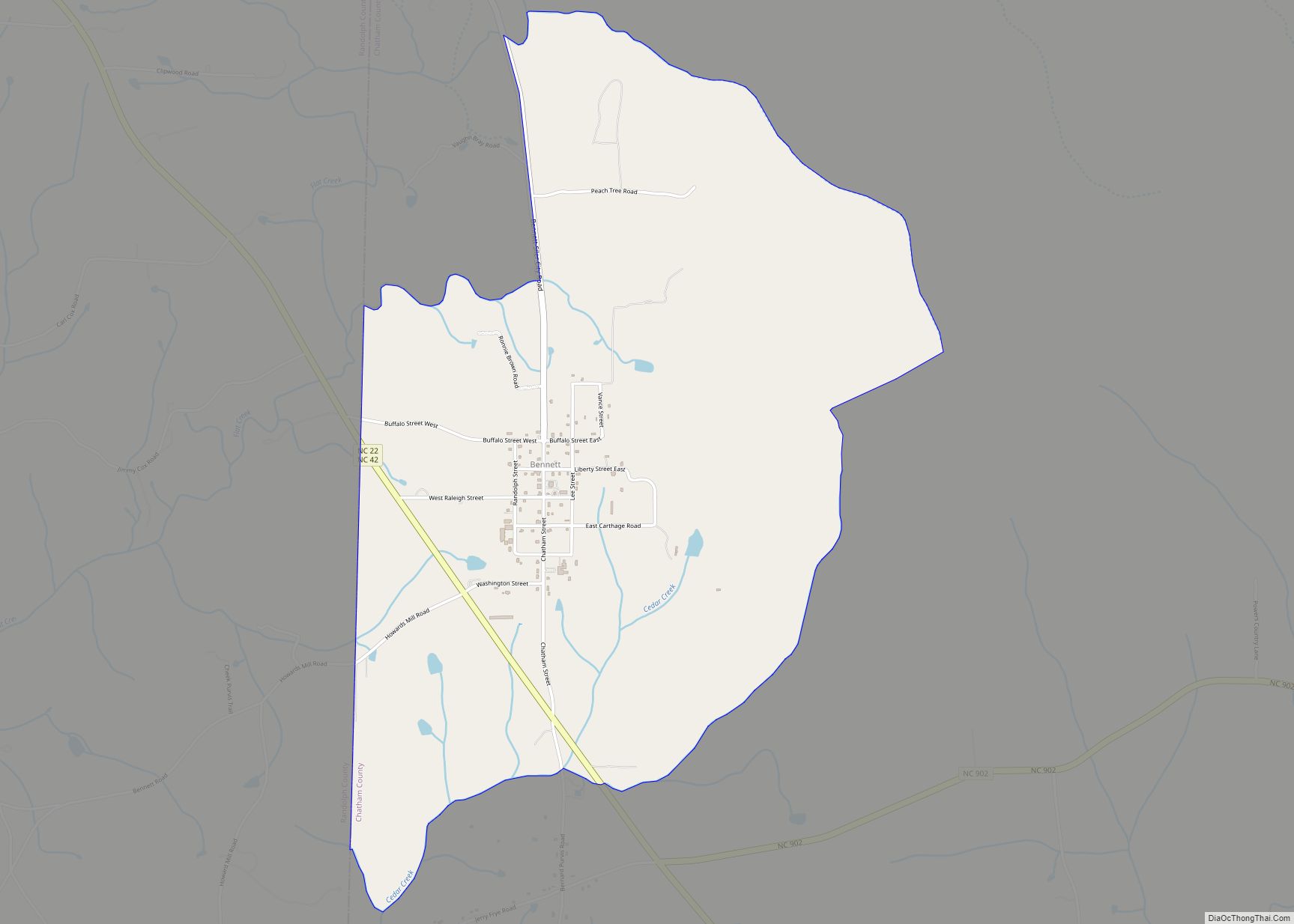
| Largest town: | Siler City |
| Total Area: | 710 sq mi (1,800 km²) |
| Land Area: | 682 sq mi (1,770 km²) |
| Total Population: | 77,889 |
| Time zone: | UTC−5 (Eastern) |
| Summer Time Zone (DST): | UTC−4 (EDT) |
| Website: | www.chathamnc.org |
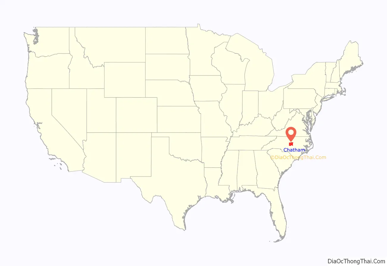
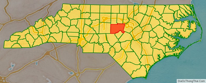
Chatham County location map. Where is Chatham County?
History
Some of the first European settlers of what would become the county were English Quakers, who settled along the Haw and Eno rivers. The county was formed in 1771 from Orange County. It had been named in 1758 for William Pitt, 1st Earl of Chatham, who served as British Prime Minister from 1766 to 1768 and opposed harsh colonial policies. In 1907, parts of Chatham County and Moore County were combined to form Lee County.
The county did not have a county seat until 1778 when Chatham Courthouse was built. It was not until 1787 that it was renamed Pittsboro In 1781, Chatham Courthouse was located the south side of Robeson Creek, where the Horton Middle school is currently located. The Chatham Courthouse was the site of an engagement during the American Revolution on July 17, 1781. On July 16, 1781, Patriot leaders had tried and sentenced to hang several Loyalist leaders. Hearing of their fate, Loyalist leader Colonel David Fanning and his men encircled Chatham Courthouse and took 53 prisoners including Colonel Ambrose Ramsey, some local militia, and three members of the North Carolina General Assembly.
While not devoted to large plantations, the county was developed for small farms, where slave labor was integral to the owners’ productivity and success. By 1860 one-third of the county population were African Americans, chiefly enslaved.
George Moses Horton, Historic Poet Laureate of Chatham County, (1798–1883) lived most of his life enslaved on a farm in Chatham County, moving North after emancipation. In one period he would write poems on commission for students at University of North Carolina after delivering produce to the campus. It was the first money he earned from his poems. He is among the few poets to have published his work while still held as a slave.
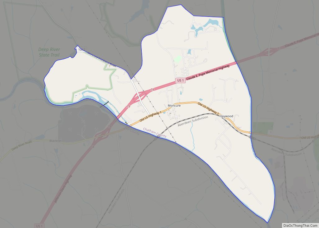
Moncure, located at the confluence of the Deep and Haw rivers forming the Cape Fear River, once served as the westernmost inland port in the state. Steamships could travel between it and the Atlantic Coast along that major river.
After the Civil War and emancipation, white violence against freedmen increased in an assertion of white supremacy and enforced dominance after emancipation. From the late 1860s secret terrorist organizations such as the Ku Klux Klan, Constitutional Union Guard, and White Brotherhood were active against blacks in the county. After Reconstruction and into the early 20th century, a total of six lynchings of African Americans were recorded here. Harriet Finch, Jerry Finch, Lee Tyson, John Pattishall on September 30, 1885. Harriet Finch is 1 of only 4 lynchings of women to occur in North Carolina. Henry Jones was lynched on January 12, 1899, after being accused of raping and murdering Nancy Welch/Welsh, a white widow in Chatham County. The sixth person to be lynched was Eugene Daniel who was hanged and then had his body riddled with bullets on September 18, 1921.
There was a notorious mass lynching of four African Americans on September 29, 1885, who were taken from the county jail in Pittsboro by a disguised mob at 1 am. The mob of 50–100 people hanged and killed Jerry Finch, his wife Harriet, and Lee Tyson, arrested for a robbery/murder. Harriet Finch was one of four black women to be lynched in the state. They also hanged John Pattishall, who was awaiting trial for two other unrelated robbery/murders. Afterward, the editor of The Chatham Record strongly condemned the lynchings. The county had the second-highest total of lynchings in the state, a number equaled by two other counties in this period.
On March 25, 2010, the Chatham County Courthouse, built in 1881 in the county seat of Pittsboro, caught fire while undergoing renovations. It has now been rebuilt.
Coal mining
Spanning the southern border of Chatham County, the Deep River Coal Field contains the only known potentially economic bituminous coal deposits in the state. Coal was mined here on an artisan scale in colonial times. It was commercially produced beginning from the early 1850s.
The communities of Carbonton and Cumnock (formerly called Egypt in Lee County) developed with the coal mining industry. Much of the coal mined in the field during the Civil War was used for Confederate operations.
The Coal Glen mine disaster of the 1920s, frequent flooding by the Deep River, the depth of the coal seam, and faulting of the seam sealed the fate of the mines. Production ceased in 1953.
Agriculture and industry
The county was long dependent on agriculture as the basis of the economy, and there were numerous subsistence farmers in historic times. The area’s natural soil conditions (composed mostly of the hard red clay soil common to the Piedmont) did not support the cultivation of commodity cash crops such as tobacco; this was never important in the county’s economy. As a result, settlers held fewer slaves than in some areas of the state, but by 1860 enslaved African Americans constituted about one-third of the county population. The production of livestock has always been more important to the county, especially the breeding of cattle and poultry.
The county once had a thriving dairy industry, but in recent years most farms have been sold and developed. The county is one of the state leaders in the poultry industry. Forage crops such as hay are also grown in large quantities in the county. Carolina Farm Stewardship Association has been housed in Chatham County, along with many organic agriculture farmers, including Councilman Farms and Phillips Dairy Farms.
Industrial growth in the county has been focused around the Siler City and Moncure areas of the county, with Moncure dominating. Companies in that area include, Progress Energy, Boise Cascade, Honeywell, and Arauco. Brick manufacturing, which makes use of the local red clay soil, has been an important economic factor in the Moncure area, with several brick plants operating there and in Brickhaven.
3M operates a greenstone mine south of Pittsboro along US 15-501. Greenstone is processed to manufacture roofing-shingle granules. In 2007, residents opposed to industrialization successfully blocked a similar quarry from being developed in the western part of the county.
The scenic rural environment has attracted many artists (Chatham Artists Guild), and arts-related tourism is a growing economic influence.
Chatham County has a deep tradition in southern music. Tommy Thompson, of the Red Clay Ramblers, and Tommy Edwards have entertained for decades with traditional, old time and bluegrass. Artists in many styles of music have emerged, from rock and roll to big band. Of late, Shakori Hills Grassroots Festival of Music and Dance hosts various styles of music. A four-day outdoor festival is held twice each year, in April and October. Artists who have performed at Shakori Hills include Patty Loveless, Ralph Stanley, Hugh Masekela, Donna the Buffalo, Carolina Chocolate Drops, Avett Brothers and Jim Lauderdale. Shakori Hills is also the location of the Hoppin John Fiddlers Convention and Mountain Aid benefit concert.
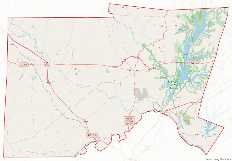
Chatham County Road Map
Geography
According to the U.S. Census Bureau, the county has a total area of 710 square miles (1,800 km), of which 682 square miles (1,770 km) is land and 28 square miles (73 km) (3.9%) is water.
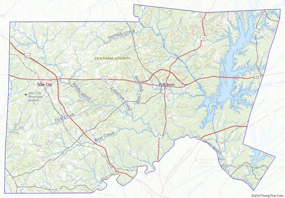
The county lies totally within the Piedmont physiographic region. The topography of the county is generally gently rolling with several higher hills rising above the general terrain. One of these hills, Terrells Mountain, on the Orange County line is the transmitter site for several radio and TV stations for the Raleigh-Durham market, including WUNC-TV 4, WDCG (G105), WNCB (B93.9), and WUNC 91.5 FM (NC Public Radio).
The county lies within the Cape Fear River drainage basin. The Cape Fear River begins in the county near the community of Moncure, at the confluence of the Haw River and the Deep River below Jordan Lake. B. Everett Jordan Lake, a major reservoir and flood-control lake, is located within the New Hope River basin and lies mainly in eastern Chatham County. The lake is owned by the US Army Corps of Engineers and is partially leased by the state of North Carolina as Jordan Lake State Recreation Area.
Much of the eastern part of the county lies within the Triassic Basin, a subregion of the Piedmont. Much of the bedrock in the county is volcanic in origin and formed during the Triassic period (hence the name). The Triassic origins have led to the formation of coal deposits in the southern part of the county. The Boren Clay Products Pit just north of Gulf in extreme southern Chatham County is a place where Triassic flora fossils persist. The volcanic origins also led to the creation of high amounts of metamorphic-based rocks in the county. The county lies on the Carolina Slate Belt. Soils in the county are mostly clay based and have a deep red color, as do most soils in the Piedmont. Groundwater in the county is generally full of minerals and tends to be “hard” if not softened. Mineral-based water was the attraction at Mt. Vernon Springs during the latter part of the 19th century and the early part of the 20th century. A resort spa was established at the mineral springs. Visitors would drink the water in the hopes of curing ailments and diseases. The resort closed in the early 20th century and is now gone. The springs are still there and are maintained by a local church.
Major water bodies
- Bear Creek
- Brush Creek
- Cape Fear River
- Deep River
- Harlands Creek
- Haw River
- Jordan Lake
- Landrum Creek (Rocky River tributary)
- Little Brush Creek
- Loves Creek (Rocky River tributary)
- Roberson Creek (Haw River tributary)
- Rocky River
- Shearon Harris Reservoir
- Tick Creek (Rocky River tributary)
- Varnell Creek (Rocky River tributary)
- Wilkinson Creek (Haw River tributary)
Adjacent counties
- Durham County – north
- Orange County – north
- Alamance County – north
- Wake County – east
- Harnett County – southeast
- Lee County – south
- Moore County – south
- Randolph County – west
Chatham County Topographic Map
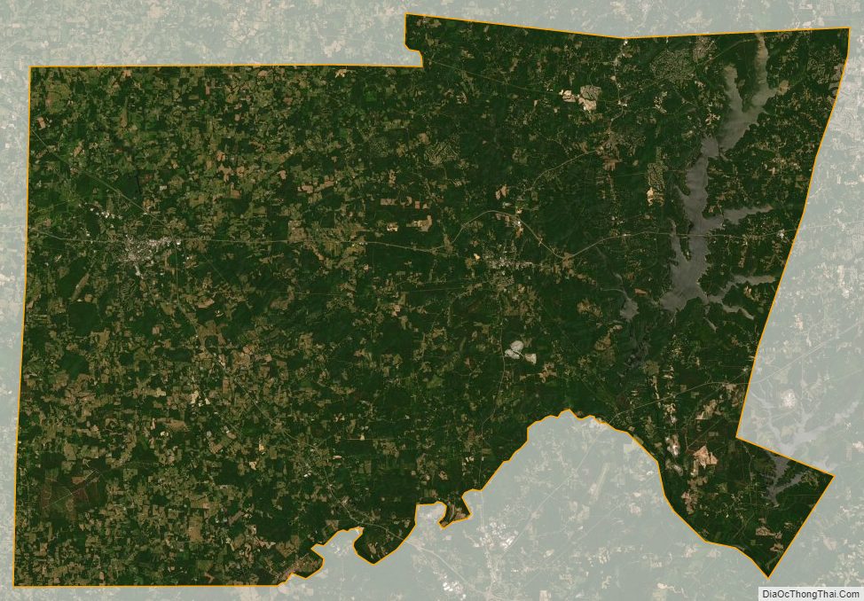
Chatham County Satellite Map
Chatham County Outline Map