Siler City is a town in western Chatham County, North Carolina, United States. As of the 2020 census, the town’s population was 7,702.
| Name: | Siler City town |
|---|---|
| LSAD Code: | 43 |
| LSAD Description: | town (suffix) |
| State: | North Carolina |
| County: | Chatham County |
| Elevation: | 607 ft (185 m) |
| Total Area: | 6.07 sq mi (15.72 km²) |
| Land Area: | 6.05 sq mi (15.66 km²) |
| Water Area: | 0.02 sq mi (0.05 km²) |
| Total Population: | 7,702 |
| Population Density: | 1,273.48/sq mi (491.68/km²) |
| ZIP code: | 27344 |
| Area code: | 919 |
| FIPS code: | 3761860 |
| GNISfeature ID: | 0994799 |
| Website: | www.silercity.org |
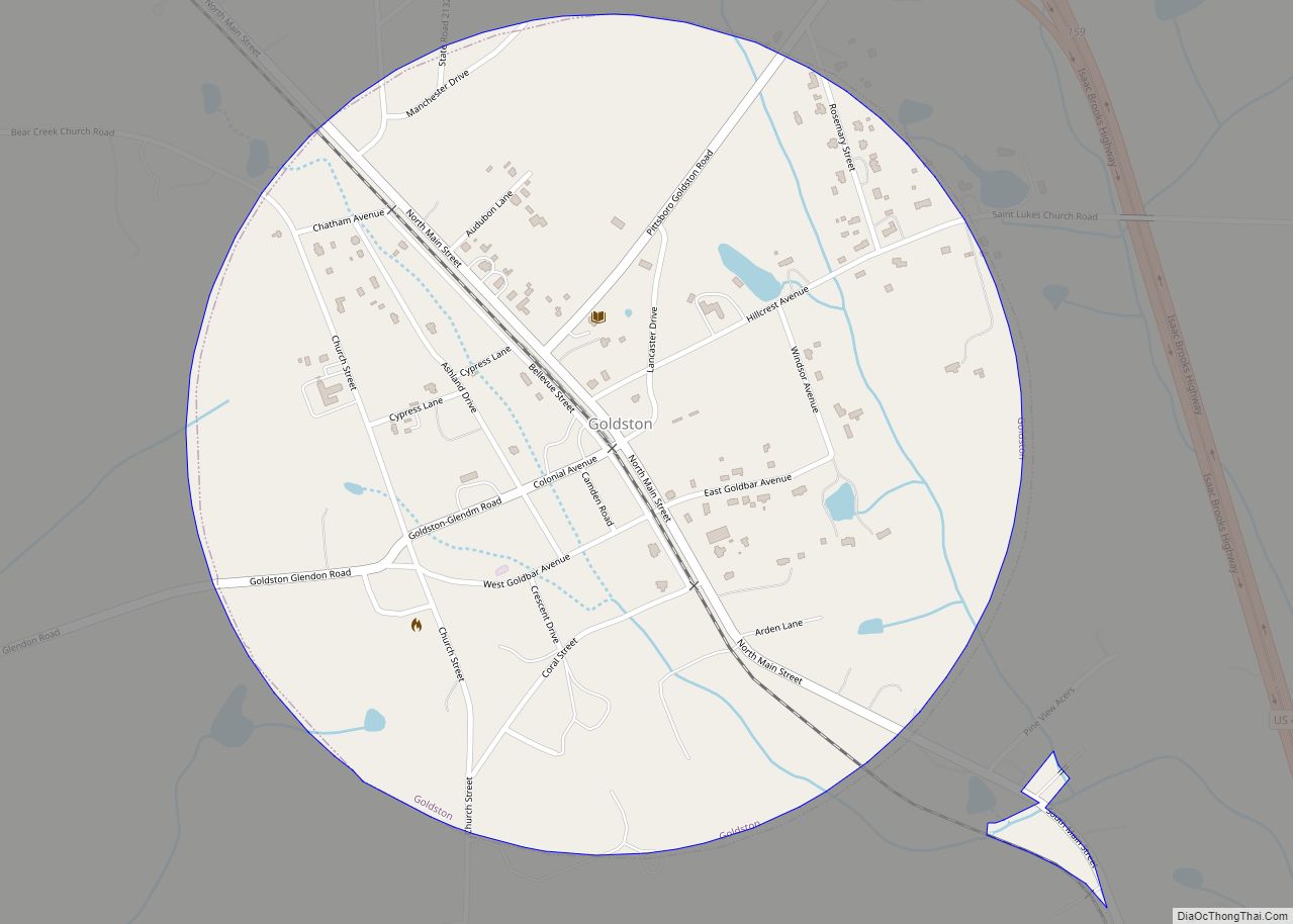
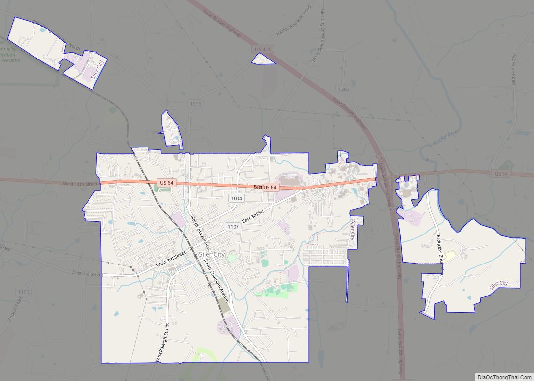
Online Interactive Map
Click on ![]() to view map in "full screen" mode.
to view map in "full screen" mode.
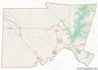
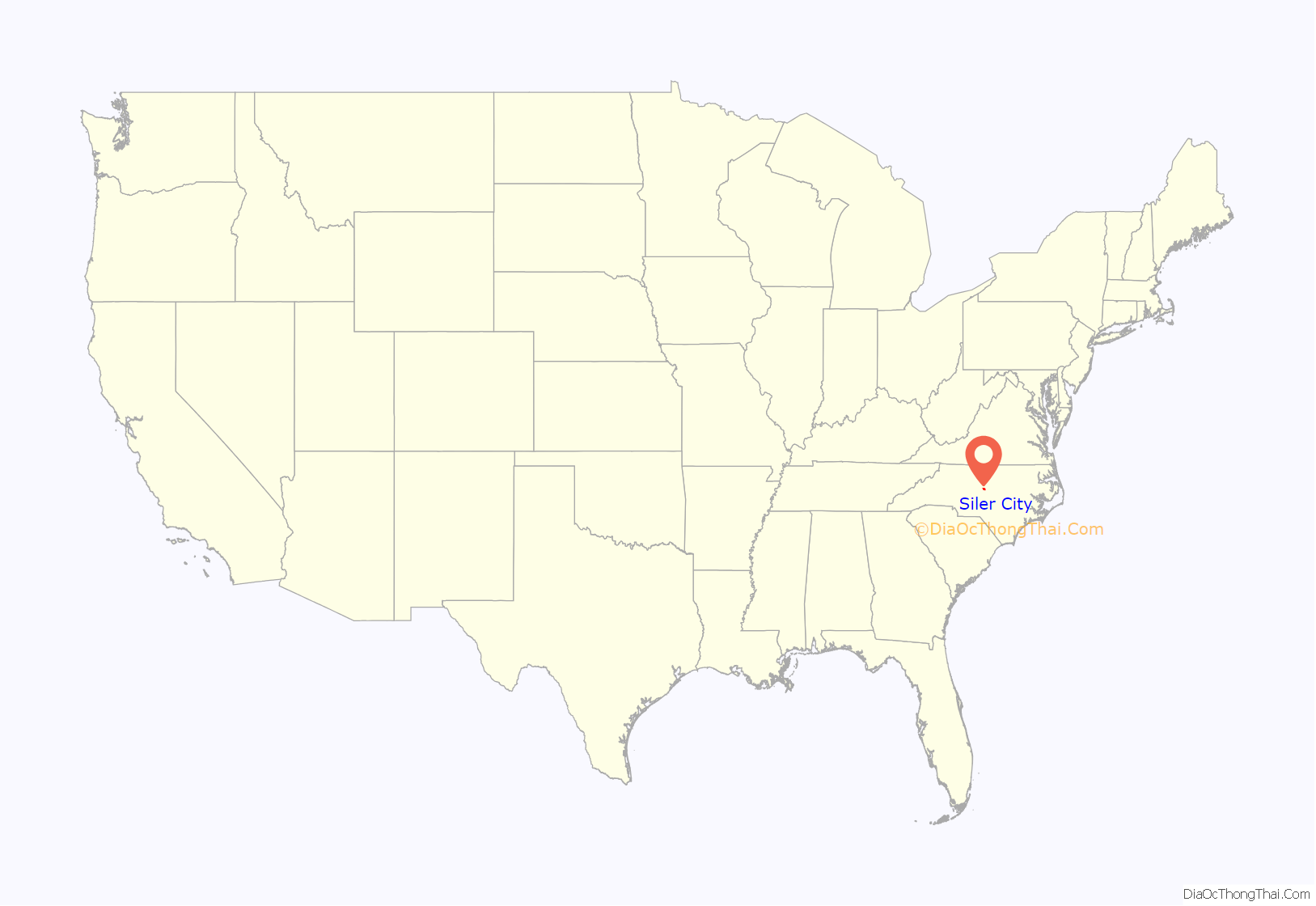
Siler City location map. Where is Siler City town?

History
Siler City began when Plikard Dederic Siler and his wife, Elizabeth Hartsoe Siler, settled about four miles north of the town’s current location. They had met aboard the Two Sisters, a ship from Germany. The ship landed in Philadelphia, where Plikard paid leaf tobacco to marry Elizabeth. The couple briefly lived in Pennsylvania, then Virginia, and then settled near Lacy’s Creek (the location near today’s Siler City). They had ten children.
In recent years, Siler City has become a suburb of Greensboro and the Research Triangle Park. Since 1997, it has developed as a center of industrial-scale poultry processing, and attracted numerous immigrants and Latinos for the jobs. The changing demographics have challenged the town as it works to absorb the new population and different cultures. In three years, the majority-Latino soccer team of the high school qualified for the state championship, creating a new fan base.
The Bowen-Jordan Farm, Cadmus N. Bray House, Bray-Paschal House, East Raleigh Street Historic District, Gregson-Hadley House, Former High Point Bending and Chair Company, Hotel Hadley, North Third Avenue Historic District, Siler City City Hall, Siler City Commercial Historic District, Siler City High School, Snipes-Fox House, William Teague House, and Burdett Woody House are listed on the National Register of Historic Places.
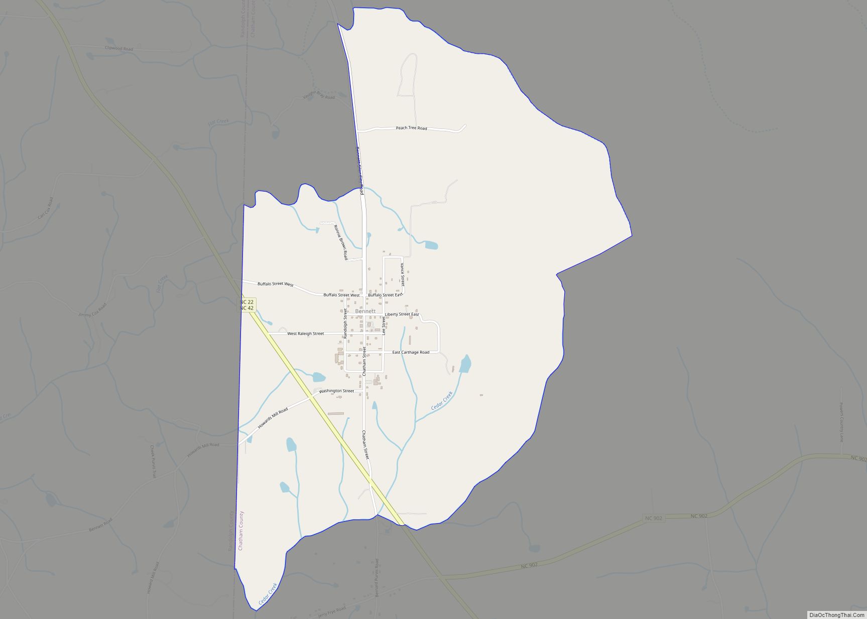
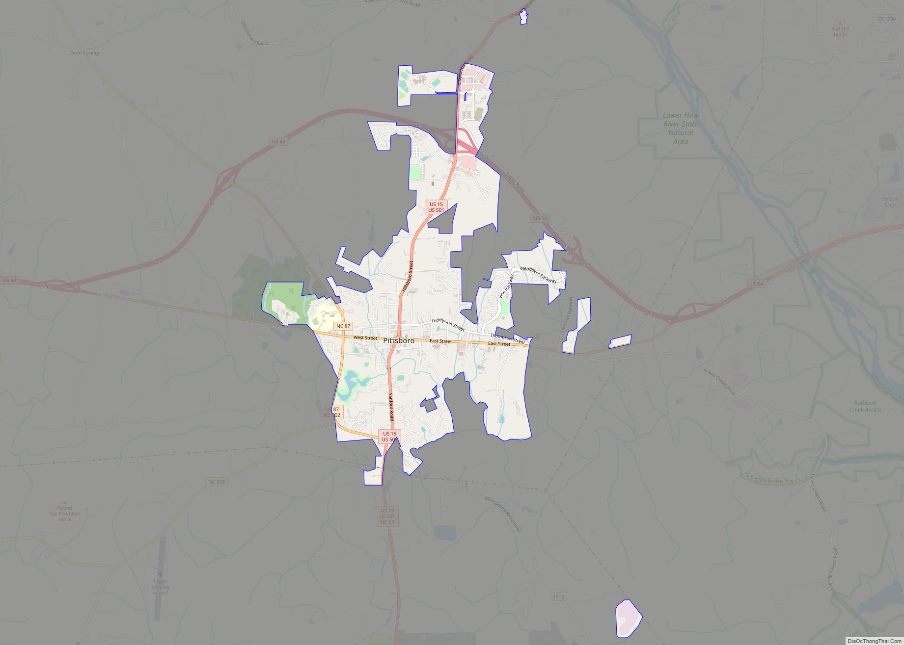
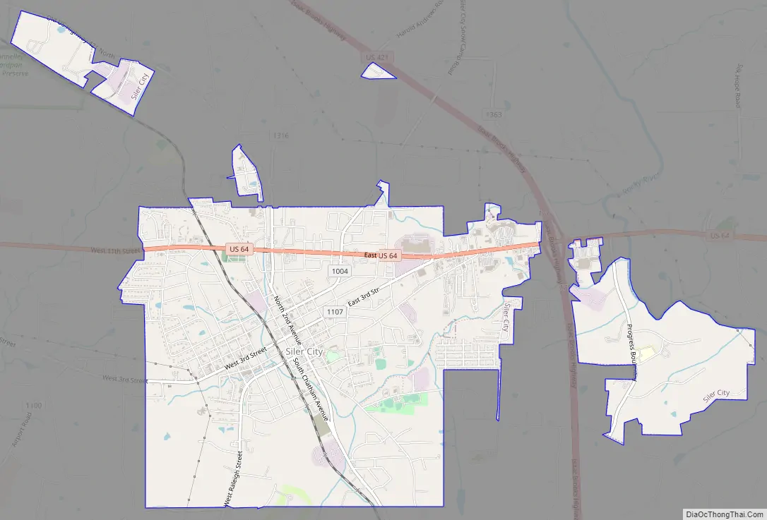
Siler City Road Map
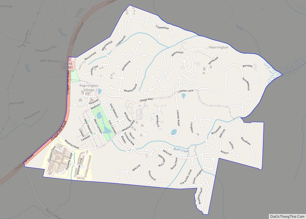
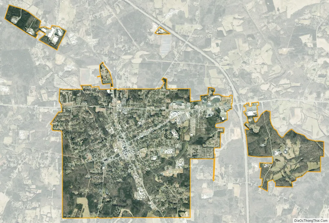
Siler City city Satellite Map
Geography
Siler City is located in western Chatham County at 35°43′34″N 79°27′47″W / 35.72611°N 79.46306°W / 35.72611; -79.46306 (35.726030, -79.462962). U.S. Route 64 passes through the northern part of the town as 11th Street, leading east 16 miles (26 km) to Pittsboro, the Chatham County seat, and west 21 miles (34 km) to Asheboro. U.S. Route 421 bypasses Siler City to the northeast, with access from Exits 168, 171, and 174. US 421 leads northwest 32 miles (51 km) to Greensboro and southeast 24 miles (39 km) to Sanford.
According to the United States Census Bureau, the town has a total area of 6.0 square miles (15.6 km), of which 0.02 square miles (0.06 km), or 0.37%, is water.
Loves Creek, a tributary to the Rocky River is the main watershed that drains Siler City.
See also
Map of North Carolina State and its subdivision:- Alamance
- Alexander
- Alleghany
- Anson
- Ashe
- Avery
- Beaufort
- Bertie
- Bladen
- Brunswick
- Buncombe
- Burke
- Cabarrus
- Caldwell
- Camden
- Carteret
- Caswell
- Catawba
- Chatham
- Cherokee
- Chowan
- Clay
- Cleveland
- Columbus
- Craven
- Cumberland
- Currituck
- Dare
- Davidson
- Davie
- Duplin
- Durham
- Edgecombe
- Forsyth
- Franklin
- Gaston
- Gates
- Graham
- Granville
- Greene
- Guilford
- Halifax
- Harnett
- Haywood
- Henderson
- Hertford
- Hoke
- Hyde
- Iredell
- Jackson
- Johnston
- Jones
- Lee
- Lenoir
- Lincoln
- Macon
- Madison
- Martin
- McDowell
- Mecklenburg
- Mitchell
- Montgomery
- Moore
- Nash
- New Hanover
- Northampton
- Onslow
- Orange
- Pamlico
- Pasquotank
- Pender
- Perquimans
- Person
- Pitt
- Polk
- Randolph
- Richmond
- Robeson
- Rockingham
- Rowan
- Rutherford
- Sampson
- Scotland
- Stanly
- Stokes
- Surry
- Swain
- Transylvania
- Tyrrell
- Union
- Vance
- Wake
- Warren
- Washington
- Watauga
- Wayne
- Wilkes
- Wilson
- Yadkin
- Yancey
- Alabama
- Alaska
- Arizona
- Arkansas
- California
- Colorado
- Connecticut
- Delaware
- District of Columbia
- Florida
- Georgia
- Hawaii
- Idaho
- Illinois
- Indiana
- Iowa
- Kansas
- Kentucky
- Louisiana
- Maine
- Maryland
- Massachusetts
- Michigan
- Minnesota
- Mississippi
- Missouri
- Montana
- Nebraska
- Nevada
- New Hampshire
- New Jersey
- New Mexico
- New York
- North Carolina
- North Dakota
- Ohio
- Oklahoma
- Oregon
- Pennsylvania
- Rhode Island
- South Carolina
- South Dakota
- Tennessee
- Texas
- Utah
- Vermont
- Virginia
- Washington
- West Virginia
- Wisconsin
- Wyoming