Cary is a town in Wake and Chatham counties in the U.S. state of North Carolina and is part of the Raleigh–Cary, NC Metropolitan Statistical Area. According to the 2020 Census, its population was 174,721, making it the seventh largest municipality in North Carolina, and the 148th largest in the United States. In 2021, the town’s population had increased to 176,987.
Cary began as a railroad village and became known as an educational center in the late 19th and early 20th centuries. In April 1907, Cary High School became the first state-funded public high school in North Carolina. The creation of the nearby Research Triangle Park in 1959 resulted in Cary’s population doubling in a few years, tripling in the 1970s, and doubling in both the 1980s and 1990s. Cary is now the location of numerous technology companies, including the world’s largest privately held software company.
In Cary, 68.4% of adults hold a bachelor’s degree or higher, which is higher than the state average. In 2021, it was identified as the safest mid-sized place to live in the United States, based on 2019 FBI data. It also has a median household income of $107,463, higher than the county average of $83,567 or the state average of $56,642.
| Name: | Cary town |
|---|---|
| LSAD Code: | 43 |
| LSAD Description: | town (suffix) |
| State: | North Carolina |
| County: | Chatham County, Wake County |
| Founded: | 1750 |
| Incorporated: | April 3, 1871 |
| Elevation: | 495 ft (151 m) |
| Total Area: | 61.05 sq mi (158.12 km²) |
| Land Area: | 59.94 sq mi (155.24 km²) |
| Water Area: | 1.11 sq mi (2.88 km²) 1.83% |
| Total Population: | 174,721 |
| Population Density: | 2,915.03/sq mi (1,125.49/km²) |
| Area code: | 919, 984 |
| FIPS code: | 3710740 |
| Website: | www.carync.gov |
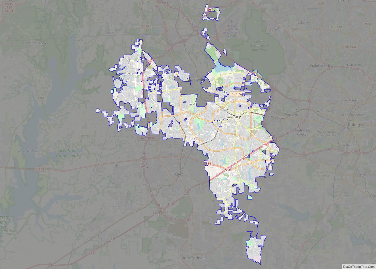
Online Interactive Map
Click on ![]() to view map in "full screen" mode.
to view map in "full screen" mode.
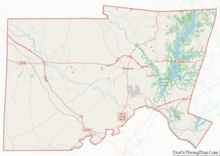
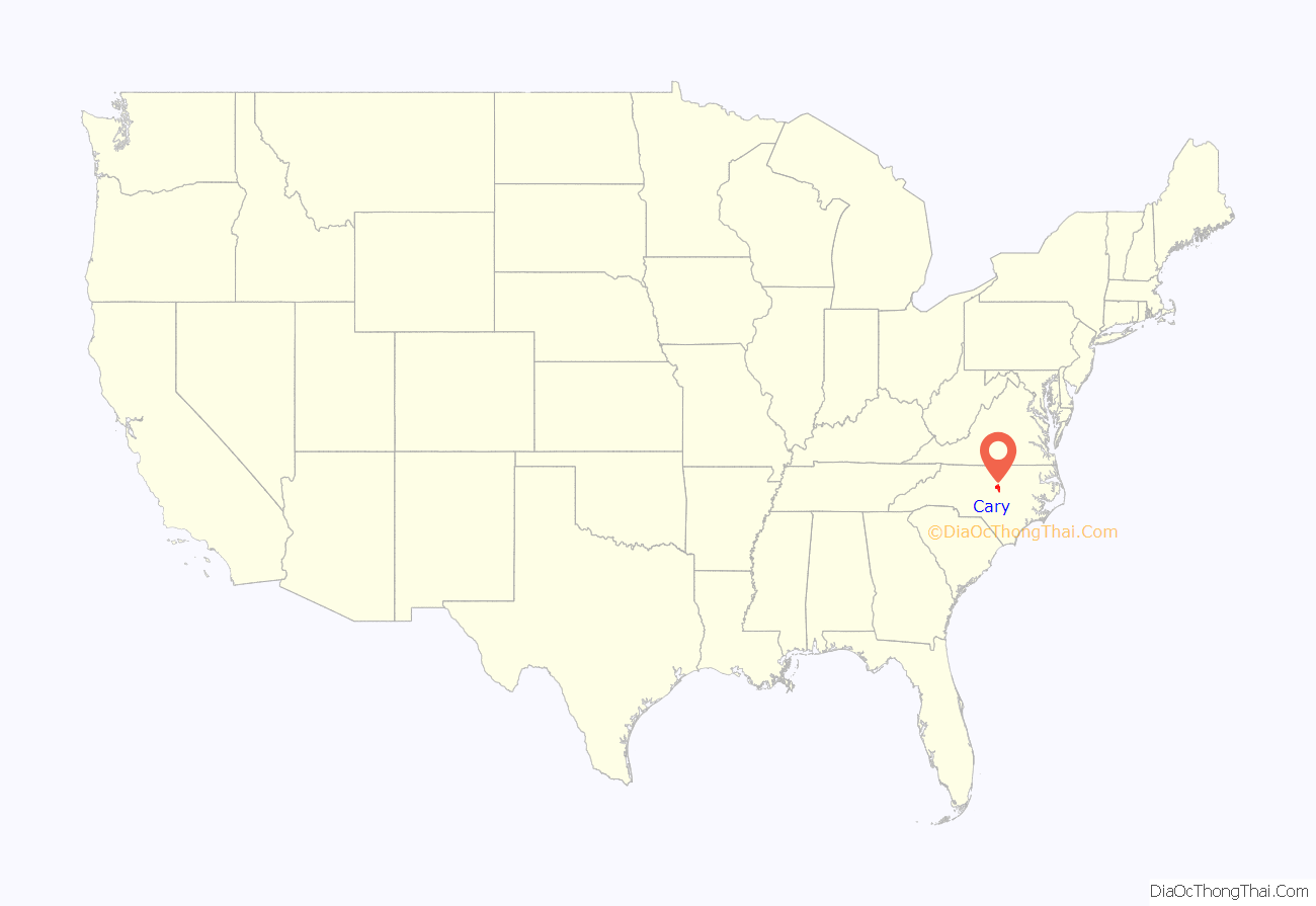
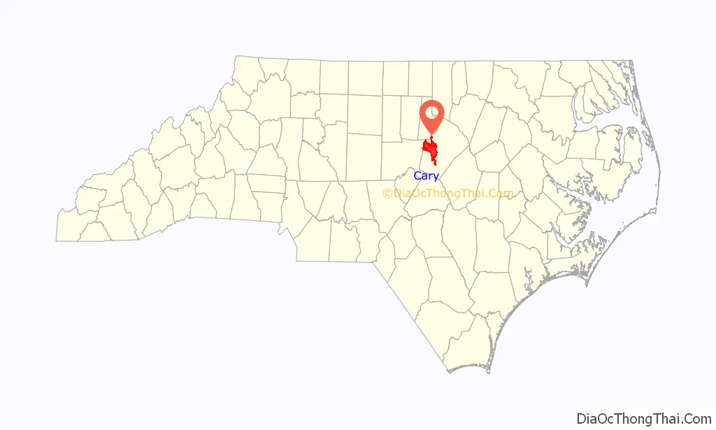
Cary location map. Where is Cary town?
History
Before the arrival of European settlers, the Tuscarora and Catawba people lived in what is now called Cary. However, their numbers were greatly reduced due to smallpox epidemics, resulting from contact with Europeans who carried the disease.
In the 1750s, John Bradford moved to the area and opened an ordinary or inn, giving Cary its first name—Bradford’s Ordinary. However, most of the land remained in the hands of two men, both named Nathaniel Jones. Arriving around 1775, Jones of White Plains plantation owned 10,461 acres (4,233 ha) in eastern Cary, while Jones of Crabtree owned most of what is now western Cary. After the Revolutionary War, the community was on the road between the new capital in Raleigh and the University of North Carolina in Chapel Hill. In the early 19th-century, Eli Yates added a gristmill and sawmill to the community, while Rufus Jones founded the first free school in the 1840s, along with Asbury Methodist Church, the community’s first church.
In 1854, Bradford’s Ordinary was linked to a major transportation route when the North Carolina Railroad came through the settlement, followed by the Chatham Railroad in 1868. The railroad tracks were laid mostly by enslaved people. Wake County farmer and lumberman Allison Francis “Frank” Page also arrived in 1854 and is credited with founding the town. For $2,000, Page purchased 300 acres (121.4 ha) surrounding the planned railroad junction and built his home called Pages, a sawmill, and a general store. Page also donated 10 acres (4.0 ha) for a railroad depot.
The community was unofficially known as Page, Page’s Siding, Page’s Station, Page’s Tavern, and Page’s Turnout. In 1856, Page added a post office and became the town’s first postmaster. Page named the community Cary because of his admiration for Samuel Fenton Cary, head of the Sons of Temperance in North America, who had delivered an oration in Raleigh two months prior.
The Civil War did not come to Cary until April 16, 1865—the same day Confederate General Robert E. Lee surrendered—when 5,000 Confederate troops under General Wade Hampton III encamped there. The next day, Raleigh surrendered to Union General William T. Sherman, and Major General Francis Preston Blair Jr. led the XVII Corps (Union Army) into Cary and established headquarters at the Nancy Jones House, the former home of Jones of Crabtree that had become a tavern and stagecoach stop on the road between Raleigh and Chapel Hill. With Blair’s arrival, Cary’s enslaved population was emancipated; some went to Raleigh and joined the 135th U.S. Colored Troops. Blair remained in Cary until the surrender of Confederate General Joseph E. Johnston on April 27, 1865.
Cary’s population grew after the Civil War with the completion of the Chatham Railroad junction. Around 1868, the town’s first depot was built for the Chatham Railroad, and Page laid out 1 acre (0.40 ha) residential lots and streets, including Academy and Chatham Streets. At the time, most of Cary’s men worked for the railroads, but other businesses included a furniture factory, two shingle factories, a tannery, a shoe factory, a brick factory, and a window sash and blind factory. Around 1868, Page also built a Second Empire style hotel for railroad passengers, known today as the Page-Walker Hotel.
Page, Adolphus Jones, and Rufus Jones established Cary Academy, a private boarding school later known as the Female Institute and Cary Female Academy. The two-story school was built in 1870 on Page’s land at the end of Academy Street with lumber milled on-site by Page. Other additions to the town included Page’s tobacco warehouse, First Methodist Church, First Baptist Church, and the Cary Colored Christian Church (the latter on land donated by Page), along with two free schools for whites and two free schools for blacks.
Cary was incorporated on April 3, 1871, with Page serving as the first mayor. Its boundaries were established as 1 sq mi (2.6 km), with the center being the Chatham Railroad warehouse. Because Page supported temperance, Cary’s Act of Incorporation prohibited the sale of whiskey in the town’s boundary and its surrounding 2 sq mi (5.2 km); an 1889 addition the Act of Incorporation also banned “any vinous, spirituous or malt liquors, cider or peach brandies”. Page left Cary in 1880, following lumber opportunities in Moore County. However, Cary’s prohibition law was in place until 1964 when it was superseded by State and county laws.
The Raleigh and Augusta Air–Line Railroad arrived in Cary in 1879, creating Fetner Junction just north of downtown and spurring further growth. Sixteen Cary residents purchased Cary Academy in 1896 and converted it into the private boarding school, Cary High School, which had 248 students from across the state by 1900. When the North Carolina legislature passed a law establishing a system of public high schools in 1907, Cary High School was transferred to the State for $2,750, giving Cary its claim of having the first state-funded public high school in the state. Town bonds and the State funded a new brick school building in 1913; it was expanded in 1939 with WPA assistance. Today that structure survives as the Cary Arts Center.
In the 1920s, the paved Western Wake Highway (now Western Blvd.) connected Cary to Raleigh via automobile, followed by paved roads to Durham and Apex. This enabled Cary’s residents to commute for work, and the town’s population grew by 64% during the decade. Electricity came to Cary in 1921. For the first time, Cary had housing developments, along with a volunteer fire department and municipal water and sewage system. A Masonic Lodge was added to downtown in the 1920s. During the Great Depression, the Bank of Cary failed, and the town went bankrupt. Conditions were so challenging that Cary had four mayors in two years.
In the 1930s, a new North Carolina State University research farm supported Cary’s farmers. One Cary garden club began growing gourds and showed their products and related crafts at the North Carolina State Fair. After the club’s first annual Gourd Festival in 1944, they sent exhibits to the International Gourd Society Festival in Pasadena, California and took many prizes This earned Cary the nickname “Gourd Capital of the World,” a designation reflected by gourds circling the original version of the town seal. Now named North Carolina Gourd Festival, the annual event moved to the North Carolina State Fairgrounds in 2000.
After World War II, Cary began to attract industry, including the Taylor Biscuit Company (later Austin Foods), which became the town’s largest employer with some 200 employees. Cary expanded its original single square mile boundary and created a Planning and Zoning Board in 1949. All the streets in Cary were paved by the early 1950s and residential suburbs began forming around the downtown area, including Veteran Hills, Russell Hills, and Montclair subdivisions. The town gained its first supermarket, Piggy Wiggly, in 1950, followed by the Cary Public Library in 1960, and a town-funded fire department in 1961. The population and number of developments in Cary continued to increase in the 1960s and 1970s after the opening of the nearby Research Triangle Park (RTP) in 1959. This rapid growth was planned; the State built a four-lane road between Cary and the Research Triangle Park as part of the agreement to attract RTP to North Carolina. Historian Jordan R. Bauer says, “The sleepy town of Cary…was the ideal place for an emerging class of scientific and technical workers”.
Initially, Cary adopted zoning and other ordinances on an ad hoc basis to control growth and give the town structure, including its first subdivision regulations in 1961 and a zoning and land-use plan in 1963. To deal with the problem of overcrowding in schools, several new schools were constructed in the 1960s. Cary High School was the first school in Wake County to integrate in 1963. Other ways Cary dealt with the rapid growth in the 1960s was adopting subdivision regulations in 1961, updating zoning ordinances and their land use plan in 1963, and connecting to Raleigh’s sewer and water systems in the early 1960s.
In 1971, the town created Planned Unit Development (PUD) zoning, which lets a developer plan an entire community before beginning construction, allowing future residents to know where churches, schools, commercial, and industrial areas will be located in advance. Developed on the Pine State Dairy’s former Kildaire Farm, the 967-acre (391.3 ha) Kildaire Farms development in Cary was North Carolina’s first PUD.
In 1960, Cary’s population was 3,356 but by 1970, it had grown to 7,686. To preserve its small-town feel, of Cary formed the Community Appearance Commission in 1972, which focused on regulating the look of downtown through sign ordinances. The Land Dedication Ordinance of 1974 required developers to set aside one acre of green space for every 35 housing units constructed. During the 1980s, Cary created Industrial Performance Districts, which increased the town’s tax base by encouraging businesses to build within the town’s limits. Cary had its own sewer system by the 1980s. The PUD model became so popular in Cary that 22 more were created between 1980 and 1992.
By 2000, Cary’s population had grown to 94,536. Concerned about forty years of steady growth, in 2008 the town council commissioned the Cary Historic Preservation Master Plan to establish a coordinated approach to historic preservation. Cary now has three districts recognized by the National Register of Historic Places: the Carpenter Historic District, the Green Level Historic District, and the Cary Historic District. In addition, the town has designed ten local landmarks which receive a property tax break in exchange for oversight of exterior changes to the structures by the town’s Historic Preservation Commission.
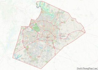
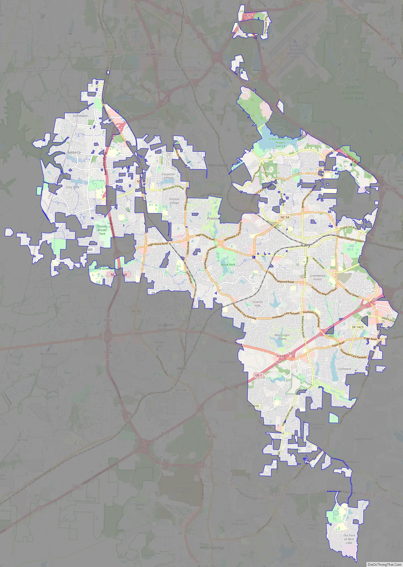
Cary Road Map
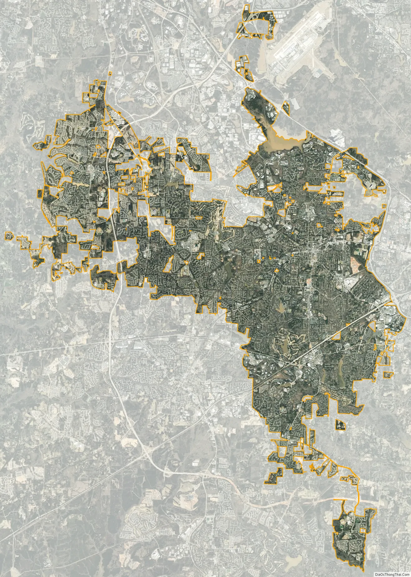
Cary city Satellite Map
Geography
Located in the piedmont region of North Carolina, most of Cary is in western Wake County, with neighborhood-sized sections in the northeast corner of Chatham County. According to the 2020 U.S. Census, Cary has a total area of 58.7 sq mi (152 km). Cary is bordered on the north and east by Raleigh, generally toward the north by Research Triangle Park and Morrisville, on the south by Apex and Holly Springs, and on the west by the Jordan Lake area.
Cary is seated on the boundary between the Durham Basin with its softer sedimentary rocks and the piedmont with its harder metamorphic rocks; both geologic provinces have igneous rock intrusions. The landscape is typically gentle to moderate sloping hills separated by narrow V-shaped valleys, but there are areas with steeper slopes and broader, U-shaped valleys in western Cary, roughly along NC 55 near the Research Triangle Park and north of Green Hope School Road. Cary’s average elevation is 495 ft (151 m).
The Cary drainage basin includes three main creeks—the Crabtree, the Swift, and the Walnut—which are all tributaries of the Neuse River. Most streams in the area have narrow floodplains with riverine wetlands, but Crabtree, Middle, Swift, and White Oak Creeks are larger and have broader floodplains. There are several small lakes in the area, most notably Lake Crabtree, created for flood control of Crabtree Creek. Jordan Lake is a large reservoir, flood control, and recreational facility that abuts part of western Cary.
Suburbanization is the typical land use in Cary. However, some areas are still undeveloped forests or agricultural, such as the agricultural areas west of NC 55 in Green Level, Upper Middle Creek and the Carpenter community. There is a mixture of mature conifers and broadleaf trees in Cary’s parks, nature preserves, and older subdivisions such as Farmington Woods, Greenwood Forest, and Kildaire Farms because tree preservation was a key design element. According to the Town of Cary Land Use Plan, newer construction in Cary, both residential and commercial, shows “less regard for tree preservation and replanting.”
Climate
Cary has a humid subtropical climate (Cfa) under the Köppen climate classification system, with hot summers, mildly cold winters with 3.2 in (8.1 cm) of snow annually, and several months of pleasant weather each year. Temperature extremes in Cary range from the negatives to over 100 °F (38 °C). Tropical cyclones can affect Cary, usually after weakening substantially from being over land. Some, such as Hurricane Fran in 1996, have caused great damage in the area.
See also
Map of North Carolina State and its subdivision:- Alamance
- Alexander
- Alleghany
- Anson
- Ashe
- Avery
- Beaufort
- Bertie
- Bladen
- Brunswick
- Buncombe
- Burke
- Cabarrus
- Caldwell
- Camden
- Carteret
- Caswell
- Catawba
- Chatham
- Cherokee
- Chowan
- Clay
- Cleveland
- Columbus
- Craven
- Cumberland
- Currituck
- Dare
- Davidson
- Davie
- Duplin
- Durham
- Edgecombe
- Forsyth
- Franklin
- Gaston
- Gates
- Graham
- Granville
- Greene
- Guilford
- Halifax
- Harnett
- Haywood
- Henderson
- Hertford
- Hoke
- Hyde
- Iredell
- Jackson
- Johnston
- Jones
- Lee
- Lenoir
- Lincoln
- Macon
- Madison
- Martin
- McDowell
- Mecklenburg
- Mitchell
- Montgomery
- Moore
- Nash
- New Hanover
- Northampton
- Onslow
- Orange
- Pamlico
- Pasquotank
- Pender
- Perquimans
- Person
- Pitt
- Polk
- Randolph
- Richmond
- Robeson
- Rockingham
- Rowan
- Rutherford
- Sampson
- Scotland
- Stanly
- Stokes
- Surry
- Swain
- Transylvania
- Tyrrell
- Union
- Vance
- Wake
- Warren
- Washington
- Watauga
- Wayne
- Wilkes
- Wilson
- Yadkin
- Yancey
- Alabama
- Alaska
- Arizona
- Arkansas
- California
- Colorado
- Connecticut
- Delaware
- District of Columbia
- Florida
- Georgia
- Hawaii
- Idaho
- Illinois
- Indiana
- Iowa
- Kansas
- Kentucky
- Louisiana
- Maine
- Maryland
- Massachusetts
- Michigan
- Minnesota
- Mississippi
- Missouri
- Montana
- Nebraska
- Nevada
- New Hampshire
- New Jersey
- New Mexico
- New York
- North Carolina
- North Dakota
- Ohio
- Oklahoma
- Oregon
- Pennsylvania
- Rhode Island
- South Carolina
- South Dakota
- Tennessee
- Texas
- Utah
- Vermont
- Virginia
- Washington
- West Virginia
- Wisconsin
- Wyoming