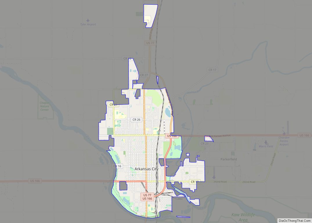
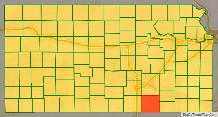
Cowley County (county code CL) is a county located in the U.S. state of Kansas. As of the 2020 census, the county population was 34,549. Its county seat is Winfield, and its most populous city is Arkansas City.
| Name: | Cowley County |
|---|---|
| FIPS code: | 20-035 |
| State: | Kansas |
| Founded: | February 26, 1867 |
| Named for: | Matthew Cowley |
| Seat: | Winfield |
| Largest city: | Arkansas City |
| Total Area: | 1,132 sq mi (2,930 km²) |
| Land Area: | 1,126 sq mi (2,920 km²) |
| Total Population: | 34,549 |
| Population Density: | 30.7/sq mi (11.9/km²) |
| Time zone: | UTC−6 (Central) |
| Summer Time Zone (DST): | UTC−5 (CDT) |
| Website: | cowleycounty.org |
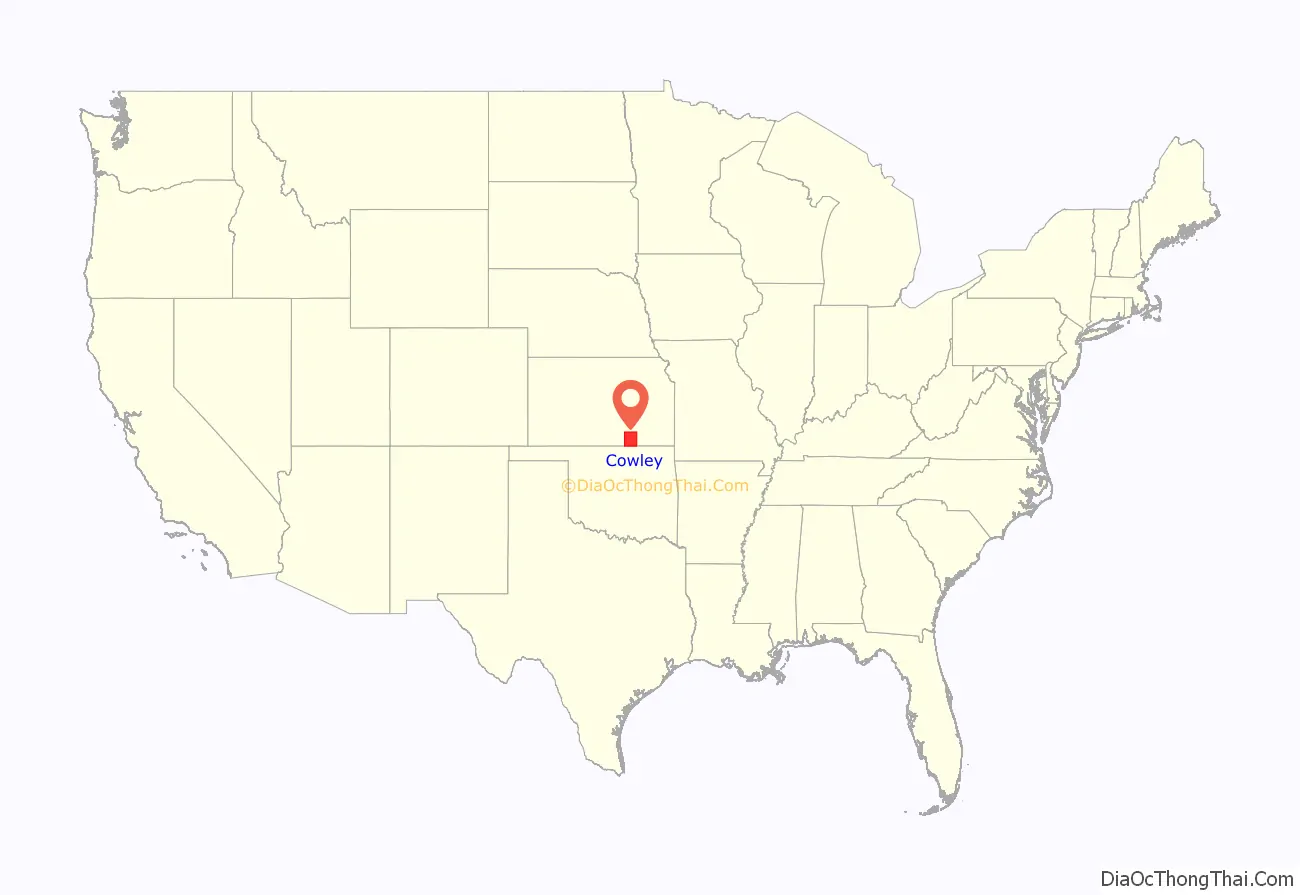
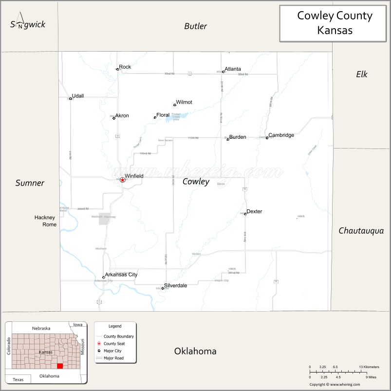
Cowley County location map. Where is Cowley County?
History
For millennia, the land now known as Kansas was inhabited by Native Americans. The first European visitor to Kansas was the Spanish explorer Francisco Vasquez de Coronado in 1541. In 1601, the Governor of New Mexico, Juan de Oñate, visited Etzanoa, a settlement of several thousand Wichita people near Arkansas City along the Walnut River. The ruins of Etzanoa have been found by archaeologists.
19th century
In 1803, most of modern Kansas was secured by the United States as part of the Louisiana Purchase. In 1854, the Kansas Territory was organized, then in 1861 Kansas became the 34th U.S. state. Cowley County was officially organized as a county, but reserved for the Osage Indians, by the Kansas Legislature in March 1867, originally named Hunter County for Robert Mercer Taliaferro Hunter (1809–1887), a Virginia Representative and Senator to Congress and Speaker of the House in the twenty-sixth Congress. In 1870, the county was renamed for Matthew Cowley, First Lieutenant in Company I, 9th Kansas Cavalry, who died at Little Rock, Arkansas, on October 7, 1864. Officially opened for settlement July 15, 1870, there was a lengthy and bitter disagreement between the towns of Winfield and Cresswell (the town now named Arkansas City) over the possession of the county seat of government. Finally settled after two special elections and numerous petitions to the Governor and Legislature, Winfield was determined to be the county seat and a courthouse was constructed in 1873 at a cost of $11,500.
21st century
In 2010, the Keystone-Cushing Pipeline (Phase II) was constructed north to south through Cowley County. Controversy arose from the Kansas legislature’s decision to grant the pipeline a ten-year exemption from property taxes; it was estimated that this would mean $15 million per year in lost revenue to the six counties through which the pipeline passed. The counties were unsuccessful in an attempt to eliminate the exemption.
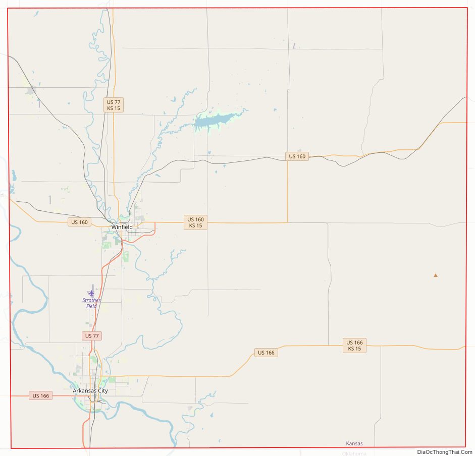
Cowley County Road Map
Geography
According to the U.S. Census Bureau, the county has a total area of 1,132 square miles (2,930 km), of which 1,126 square miles (2,920 km) is land and 6.7 square miles (17 km) (0.6%) is water.
Adjacent counties
- Butler County (north)
- Elk County (northeast)
- Chautauqua County (east)
- Osage County, Oklahoma (south)
- Kay County, Oklahoma (southwest)
- Sumner County (west)
- Sedgwick County (northwest)
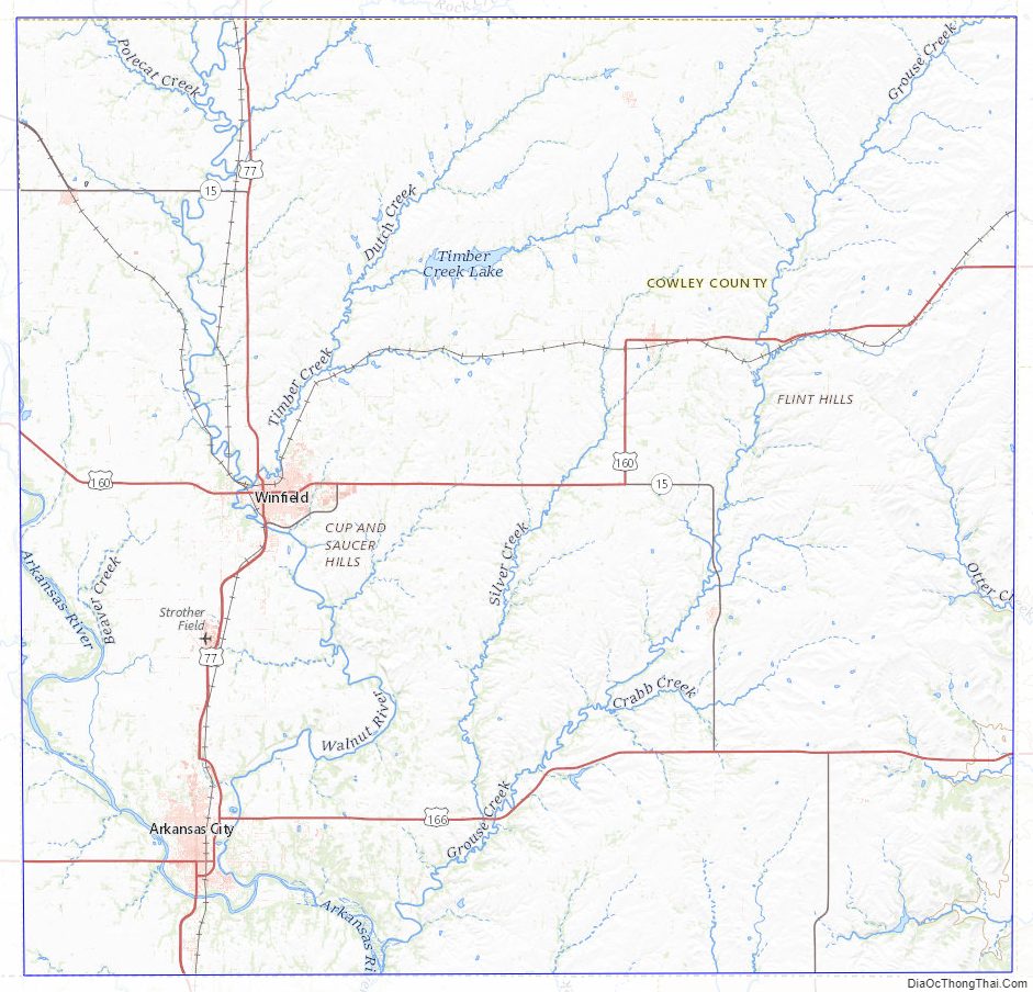
Cowley County Topographic Map
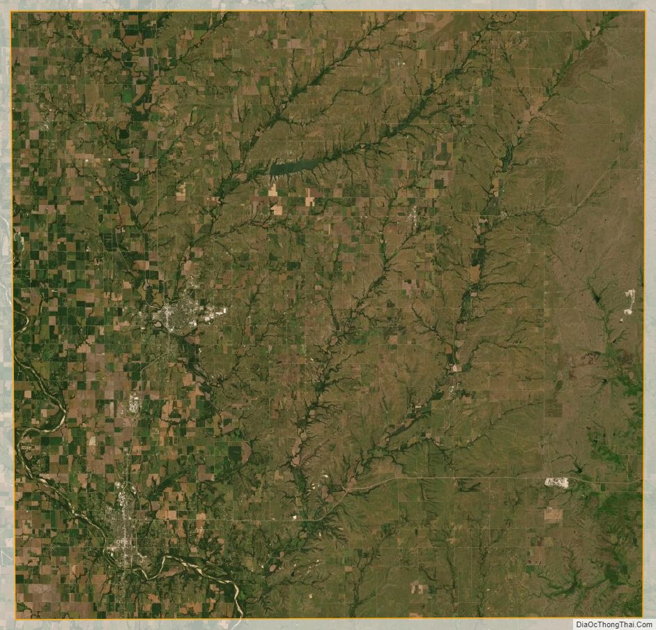
Cowley County Satellite Map
Cowley County Outline Map