Sumner County (standard abbreviation: SU) is a county located in the U.S. state of Kansas. As of the 2020 census, the population was 22,382. Its county seat is Wellington.
| Name: | Sumner County |
|---|---|
| FIPS code: | 20-191 |
| State: | Kansas |
| Founded: | December 20, 1870 |
| Named for: | Charles Sumner |
| Seat: | Wellington |
| Largest city: | Wellington |
| Total Area: | 1,185 sq mi (3,070 km²) |
| Land Area: | 1,182 sq mi (3,060 km²) |
| Total Population: | 22,382 |
| Population Density: | 18.9/sq mi (7.3/km²) |
| Time zone: | UTC−6 (Central) |
| Summer Time Zone (DST): | UTC−5 (CDT) |
| Website: | County website |
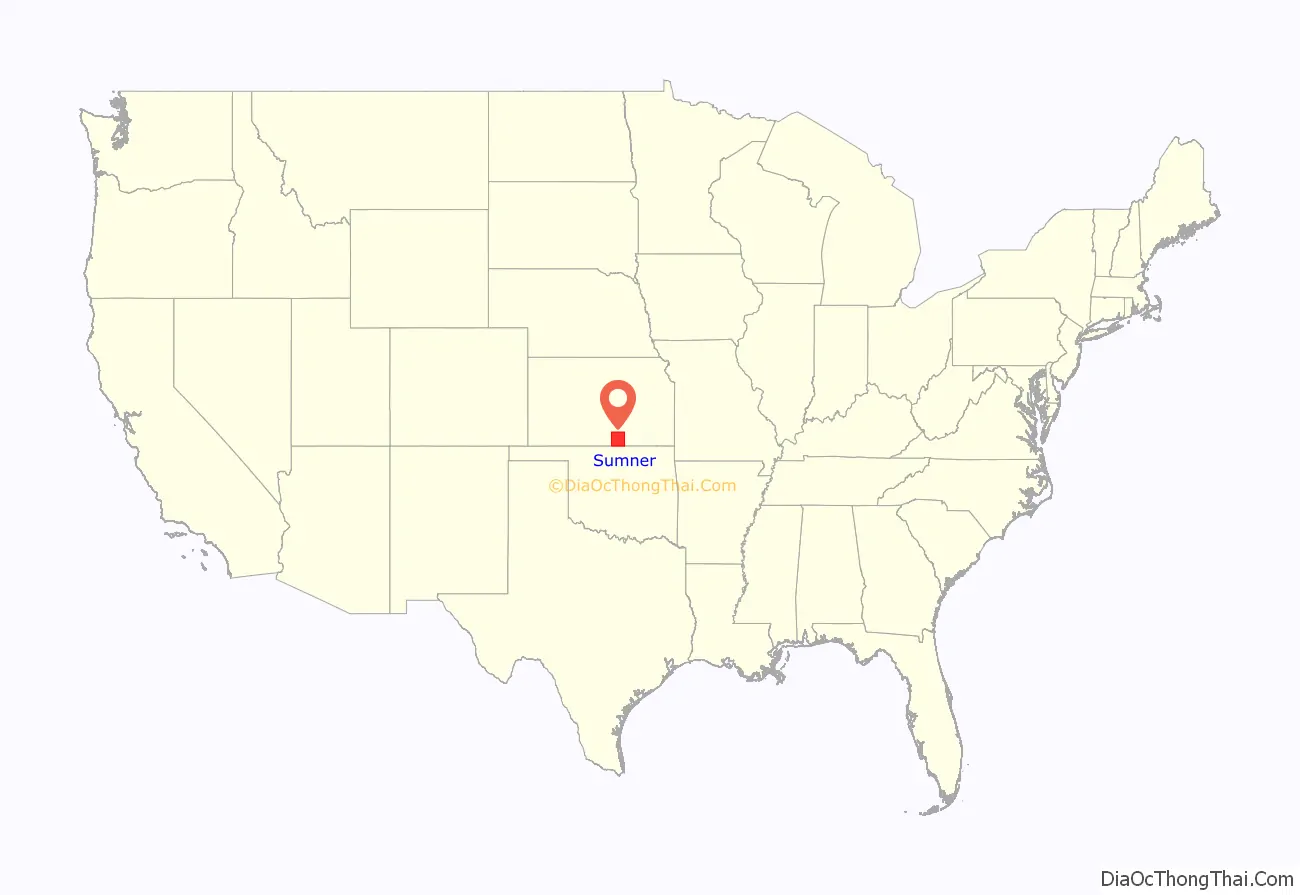
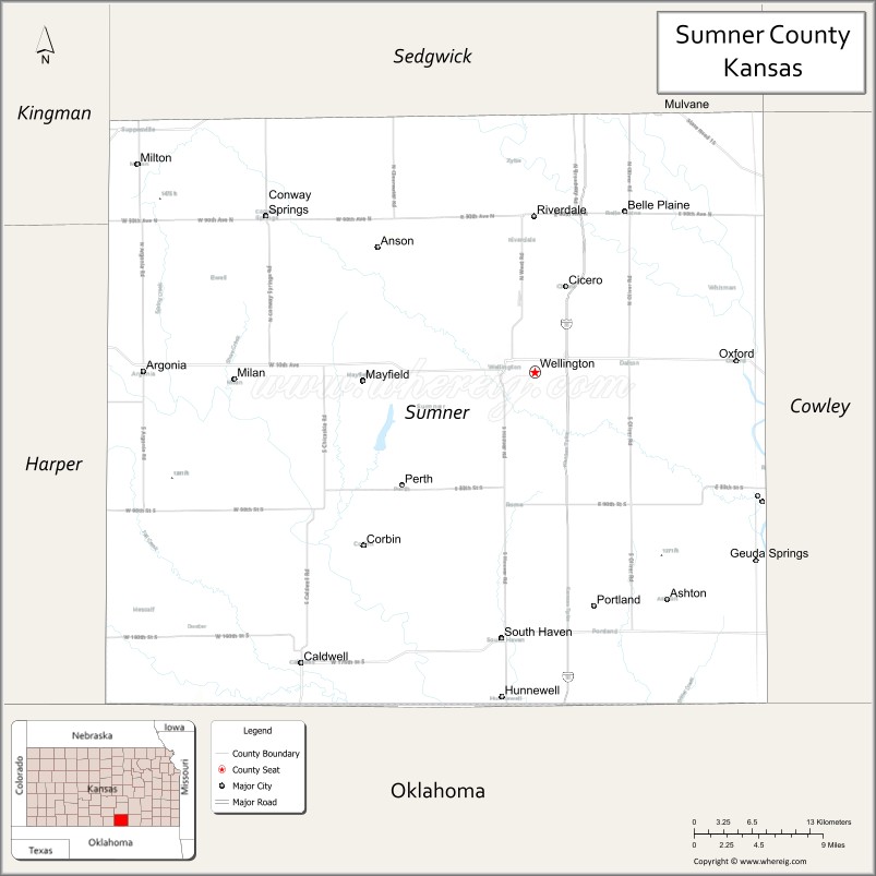
Sumner County location map. Where is Sumner County?
History
Early history
For many millennia, the Great Plains of North America was inhabited by nomadic Native Americans. From the 16th century to 18th century, the Kingdom of France claimed ownership of large parts of North America. In 1762, after the French and Indian War, France secretly ceded New France to Spain, per the Treaty of Fontainebleau. In 1802, Spain returned most of the land to France, but keeping title to about 7,500 square miles.
In 1803, most of the land for modern day Kansas was acquired by the United States from France as part of the 828,000 square mile Louisiana Purchase for 2.83 cents per acre. In 1848, after the Mexican–American War, the Treaty of Guadalupe Hidalgo with Spain brought into the United States all or part of land for ten future states, including southwest Kansas. In 1854, the Kansas Territory was organized, then in 1861 Kansas became the 34th U.S. state.
19th century
On February 26, 1867, Sumner County was created from parts of Marion County and Butler County. It was named in honor of Charles Sumner, a U.S. Senator from Massachusetts (1811–74), who was a strong advocate of Kansas becoming a free state.
In 1887, the Chicago, Kansas and Nebraska Railway built a branch line north–south from Herington to Caldwell. This branch line connected Herington, Lost Springs, Lincolnville, Antelope, Marion, Aulne, Peabody, Elbing, Whitewater, Furley, Kechi, Wichita, Peck, Corbin, Wellington, Caldwell. By 1893, this branch line was incrementally built to Fort Worth, Texas. This line is called the “OKT”. The Chicago, Kansas and Nebraska Railway was foreclosed in 1891 and was taken over by Chicago, Rock Island and Pacific Railway, which shut down in 1980 and reorganized as Oklahoma, Kansas and Texas Railroad, merged in 1988 with Missouri Pacific Railroad, and finally merged in 1997 with Union Pacific Railroad. Most locals still refer to this railroad as the “Rock Island”.
21st century
In December 2011, the Kansas Star Casino opened approximately 4.5 miles (7.2 km) west of the center of Mulvane, adjacent to an exit on the Kansas Turnpike that was added in the mid 1980s. The casino is located a couple blocks west of the turnpike exit.
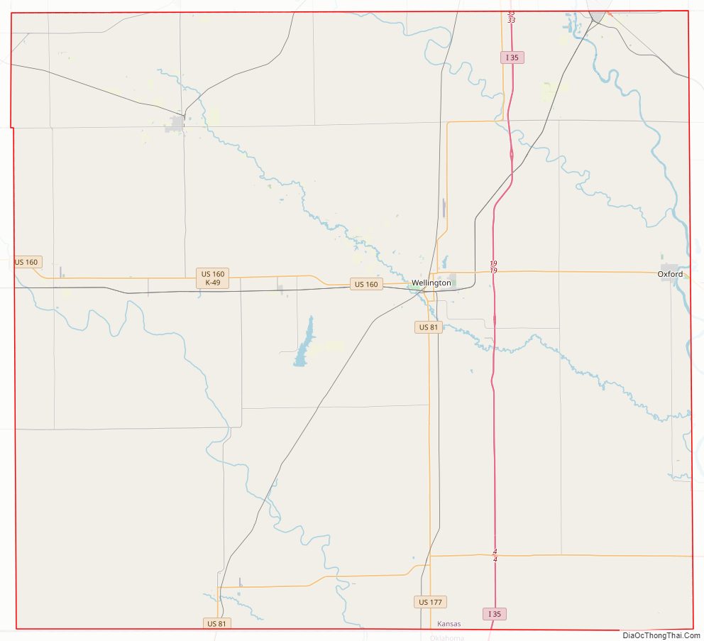
Sumner County Road Map
Geography
According to the U.S. Census Bureau, the county has a total area of 1,185 square miles (3,070 km), of which 1,182 square miles (3,060 km) is land and 3.0 square miles (7.8 km) (0.3%) is water.
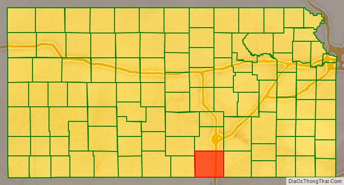
Adjacent counties
- Sedgwick County (north)
- Butler County (northeast)
- Cowley County (east)
- Kay County, Oklahoma (southeast)
- Grant County, Oklahoma (southwest)
- Harper County (west)
- Kingman County (northwest)
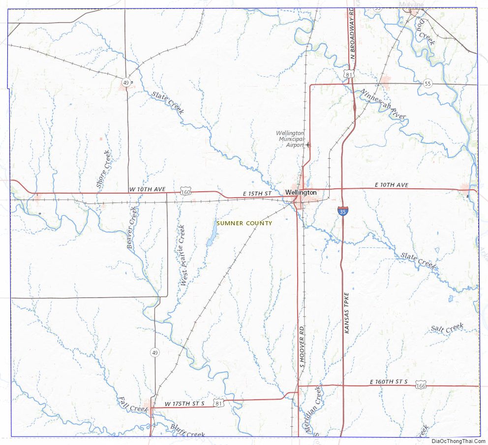
Sumner County Topographic Map
Sumner County Satellite Map

Sumner County Outline Map