Emporia is an independent city in the Commonwealth of Virginia, surrounded by Greensville County, United States. Emporia and a predecessor town have been the county seat of Greensville County since 1791. As of the 2020 census, the population was 5,766, making it the third-least populous city in Virginia. The Bureau of Economic Analysis combines the city of Emporia with surrounding Greensville County for statistical purposes.
| Name: | Emporia City |
|---|---|
| FIPS code: | 51-595 |
| State: | Virginia |
| Total Area: | 6.97 sq mi (18.05 km²) |
| Land Area: | 6.90 sq mi (17.88 km²) |
| Total Population: | 5,766 |
| Population Density: | 830/sq mi (320/km²) |
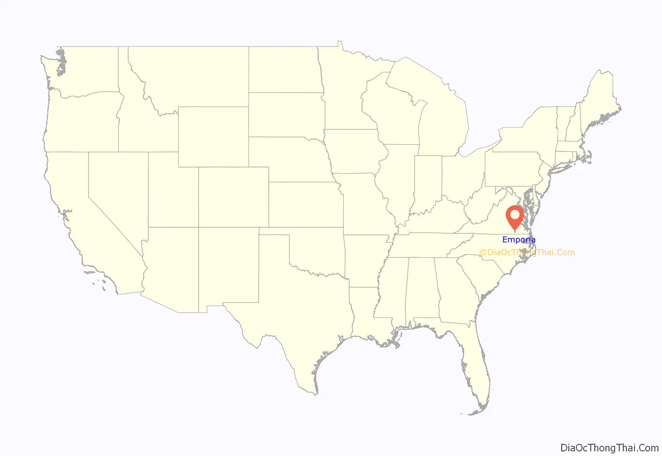
Emporia City location map. Where is Emporia City?

History
Emporia has long been a transportation crossroads. The Meherrin River, like the Nottoway River and the Blackwater River, empties to the southeast into Albemarle Sound. The Town of Hicksford (originally Hicks’ Ford) was settled by Captain Robert Hicks (1658-1739) in the Virginia Colony, where the Fort Road of eastern Virginia crossed the Meherrin River en route to Fort Christanna. The road was a major north-south trail used by native peoples and sometimes called the “Halifax road”. Capt. Hicks was an Indian trader who resided in Prince George Co. prior to moving his family to Hicksford upon becoming the Commander of Fort Christanna. (His surname is spelled both “Hicks” and “Hix” in colonial records.) In 1709, Hicks purchased a land tract of 1280 acres along the northside of the Meherrin River that has been previously surveyed by Arthur Kavanaugh.
Greensville County separated from Brunswick county in 1781 and Hicksford became the county seat (court convening monthly at a nearby tavern). In May 1781, British Col. Banastre Tarleton’s cavalry crossed at Hicksford while raiding Greensville and Southampton counties.
After statehood, the Virginia General Assembly recognized the Town of Belfield on the river’s northern bank in 1798, and Hicksford on the southern bank the next year.
In the following decades, the surrounding area remained rural, and development in Hicksford exceeded that of Belfield. An 1847 account documented 12-20 dwellings in Hicksford worth about $10,025 and Belfield’s buildings worth $3050; in 1865 Hicksford’s buildings were valued at $20,700 and Belfield’s at $3650. However, by 1885 Hicksford had only grown to $22,915 while Belfield had grown to $7300.
During the American Civil War, the Petersburg Railroad (to Weldon), built in 1830, was a tactical prize as Union troops sought to isolate the confederate capitol. In 1857, Belfield was a stop on the Petersburg Railroad. Two battles for the control of the Weldon Railroad were fought near Petersburg during the Siege of Petersburg in June 1864 and September 1864. On December 7, 1864, 28,000 Union troops led by Major General Gouverneur K. Warren tried to sever that key supply route further south by uprooting tracks, and managed to stop Confederate troops under Major General Wade Hampton from destroying the Meherrin river bridge. However, when they retreated, Confederates rebuilt the railway line. After the war, the Wilmington and Weldon Railroad was leased to the Wilmington, Columbia and Augusta Railroad, which went bankrupt in 1878.
Greensville County native and delegate Benjamin D. Tillar Jr. (1855-1887) received a charter for the Atlantic and Danville Railway, which he planned would go from Portsmouth as had the Weldon railroad, but more westward through the Meherrin river towns. In 1887, Hicksford and Belfield merged, forming the newly incorporated town of Emporia. It was named after the town of Emporia, Kansas, home town of Tillar’s friend U.S. Senator Preston B. Plumb of Kansas. However, the railroad boom proved short-lived, as poor farm conditions and the Panic of 1893 caused the county’s population to decrease between 1880 and 1890. The Seaboard and Roanoke Railroad also ran through Emporia.
Emporia was re-chartered in 1892, and the town issued its first bonds (to establish a water plant, lighting and street improvements) in 1900. It hosted an agricultural fair in 1906, and brick buildings replaced frame structures. Banks were chartered, followed by land improvement companies and insurance companies, then various stores, automobile companies and cola bottlers.
The Virginia General Assembly re-chartered the Town of Emporia as an independent city in 1967, five years after the Norfolk and Western Railway purchased and reorganized the Atlantic and Danville Railway. Now, a major north-south CSX railway line crosses a Norfolk Southern east-west line in Emporia. Also, U.S. Route 58 crosses Emporia east-west and Interstate 95 and U.S. Route 301 crosses north-south, so providing services for travelers continues to be important in modern Emporia.
Historic buildings in Emporia include the Belfield-Emporia Historic District, Hicksford-Emporia Historic District, Greensville County Courthouse Complex, Greensville County Training School, H. T. Klugel Architectural Sheet Metal Work Building, Old Merchants and Farmers Bank Building, and Village View, all of which are listed on the National Register of Historic Places.
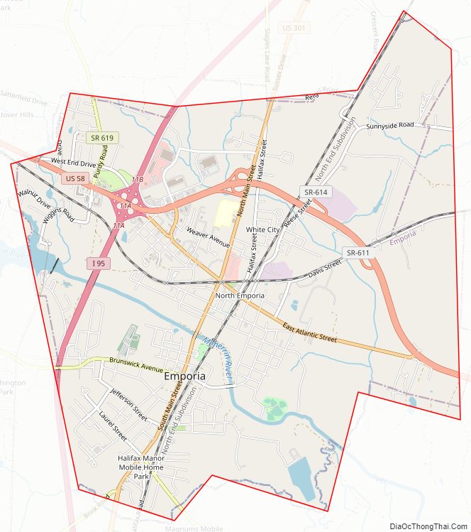
Emporia City Road Map
Geography
Emporia is located at 36°41′34″N 77°32′17″W / 36.69278°N 77.53806°W / 36.69278; -77.53806 (36.693018, -77.53809).
According to the United States Census Bureau, the city has a total area of 7.0 square miles (18.1 km), of which 6.9 square miles (17.9 km) is land and 0.1 square miles (0.26 km) (1.1%) is water. The city is located about 65 miles south of Richmond, about 80 miles west of Norfolk and about 60 miles north of Rocky Mount, North Carolina.
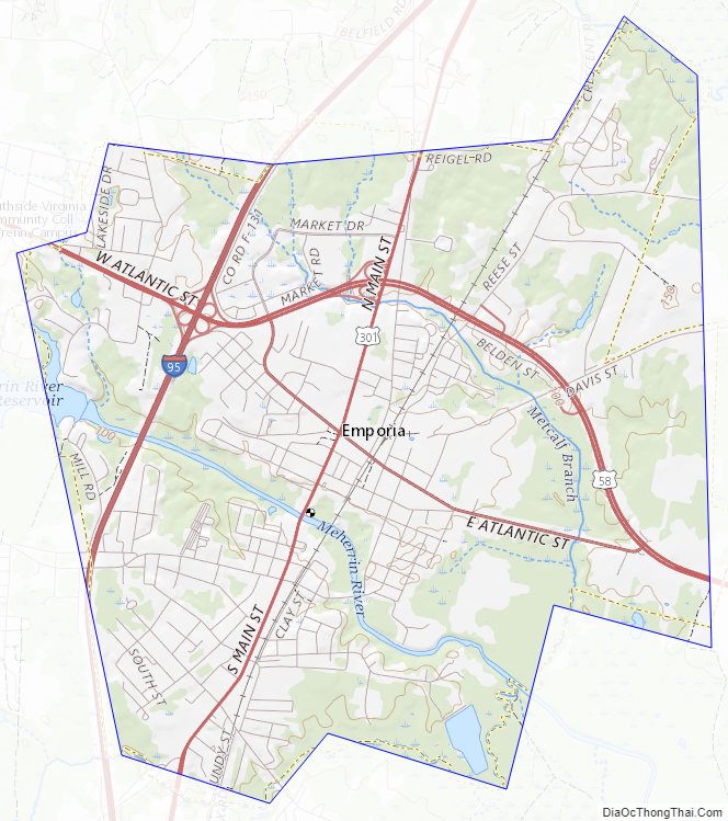
Emporia City Topographic Map
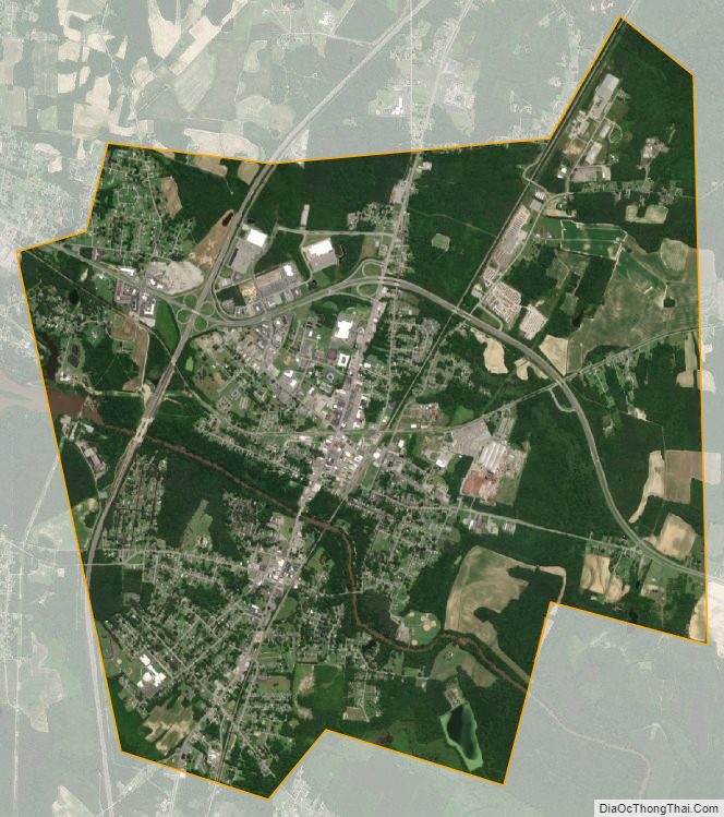
Emporia City Satellite Map
Emporia City Outline Map