Fairfield County is a county located in the U.S. state of South Carolina. As of the 2020 census, its population was 20,948. Its county seat is Winnsboro.
Fairfield County is part of the Columbia, SC Metropolitan Statistical Area.
| Name: | Fairfield County |
|---|---|
| FIPS code: | 45-039 |
| State: | South Carolina |
| Founded: | 1785 |
| Named for: | Comment made by General Cornwallis stating “”How Fair These Fields” |
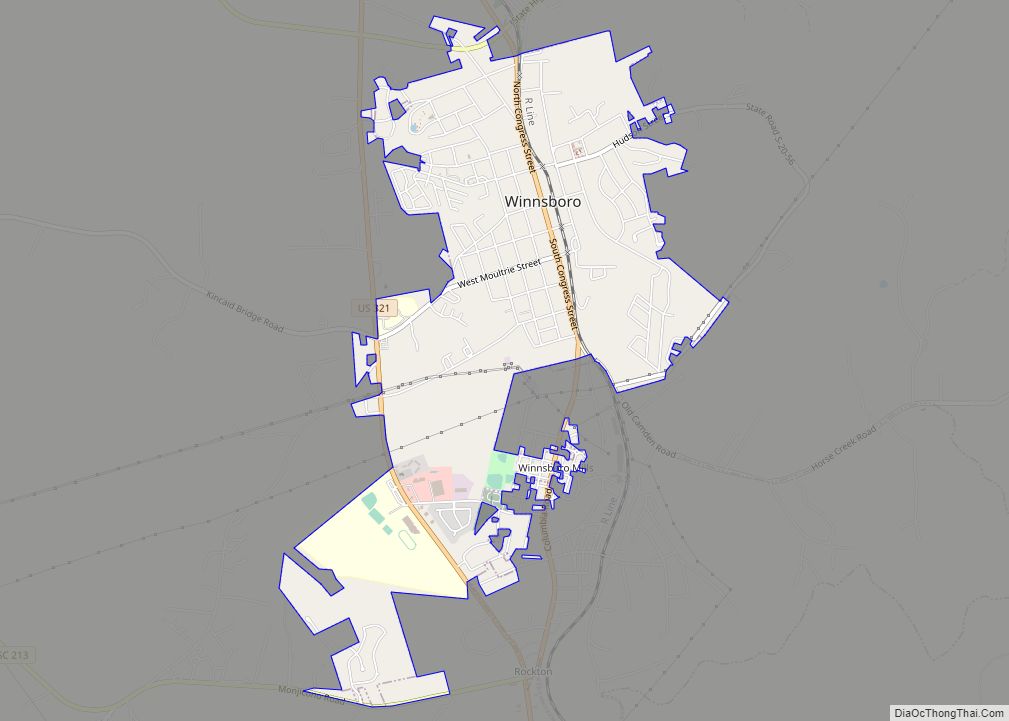
| Seat: | Winnsboro |
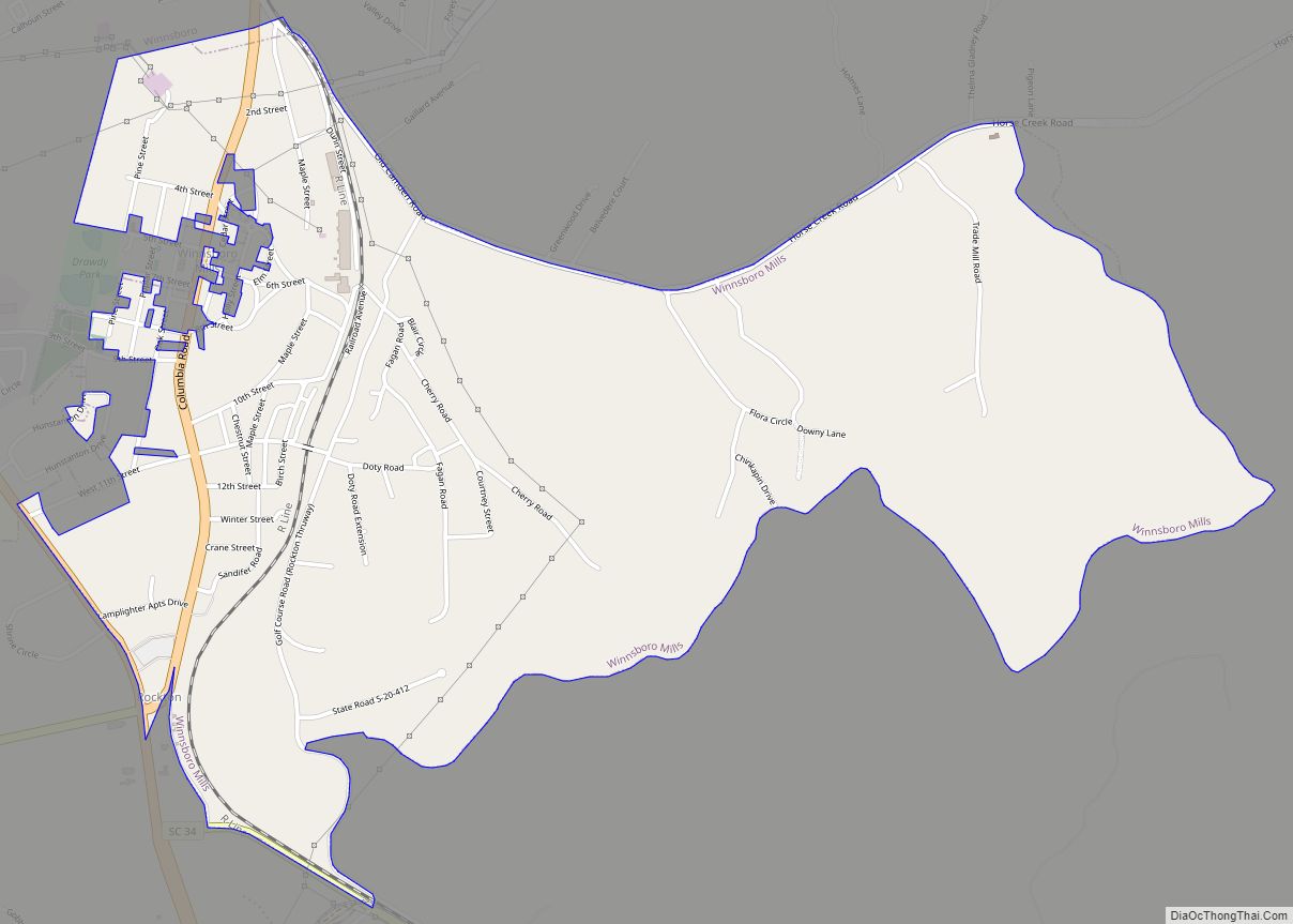
| Largest town: | Winnsboro |
| Total Area: | 710 sq mi (1,800 km²) |
| Land Area: | 686 sq mi (1,780 km²) |
| Total Population: | 20,690 |
| Population Density: | 30.5/sq mi (11.8/km²) |
| Time zone: | UTC−5 (Eastern) |
| Summer Time Zone (DST): | UTC−4 (EDT) |
| Website: | www.fairfieldsc.com |
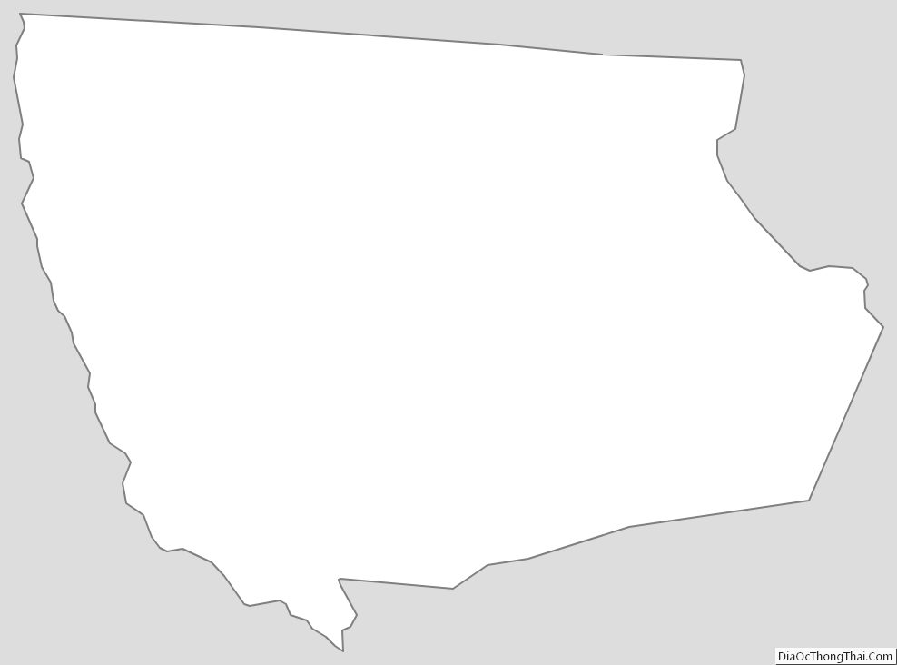
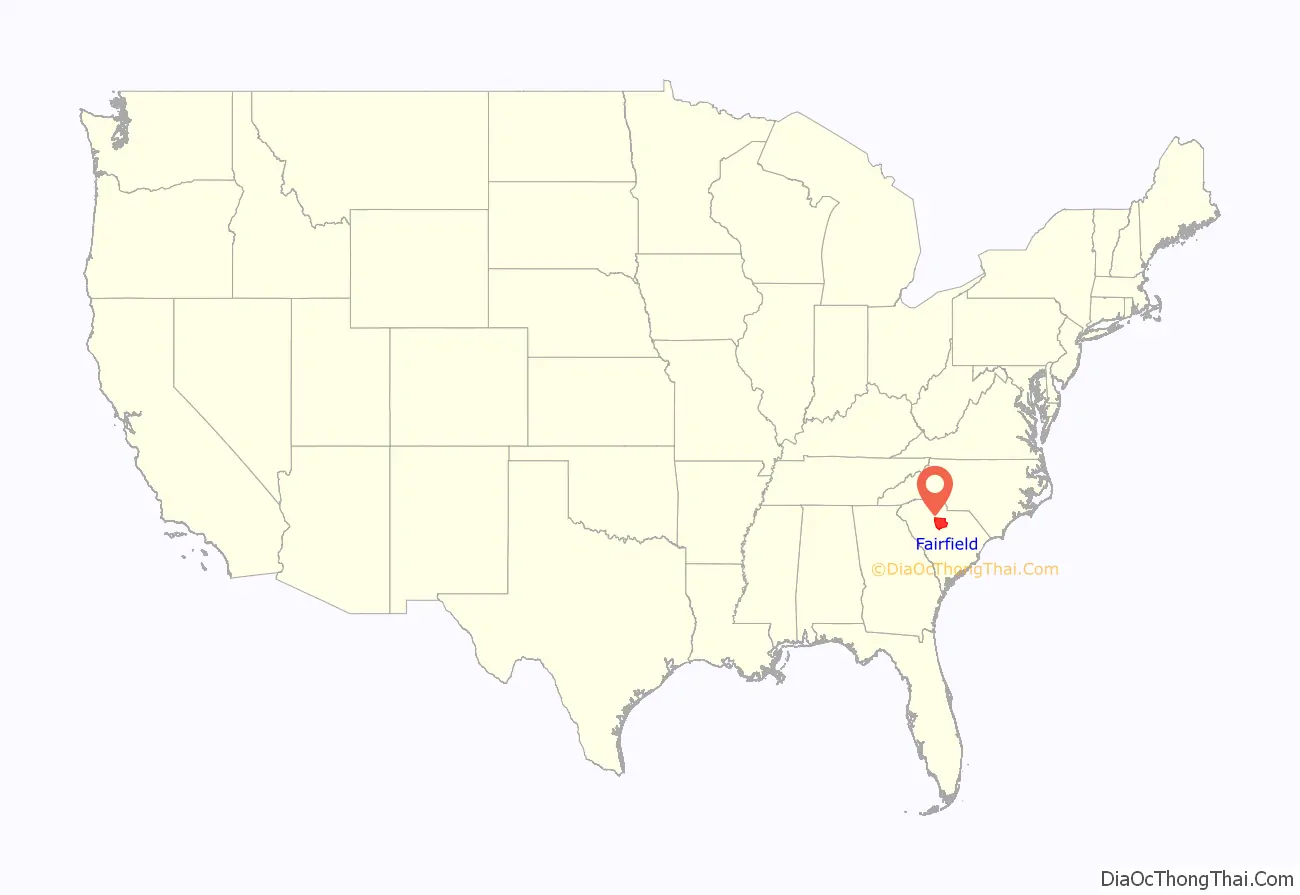
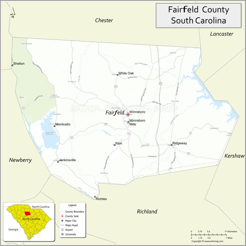
Fairfield County location map. Where is Fairfield County?
History
18th century
It is alleged that the county name originated from a statement made by General Cornwallis when he declared “How Fair These Fields” during the British occupation of the area in 1780–81. The house Cornwallis stayed in during the occupation is still standing.
Several years before the Revolution, Richard Winn from Virginia moved to what is now called Fairfield County. His lands covered the present site of Winnsboro, and as early as 1777 the settlement was known as “Winnsborough”.
The village was laid out and chartered in 1785 upon petition of Richard Winn, John Winn and John Vanderhorst. John Richard, and Minor Winn all served in the Revolutionary War. Richard was a General and he is said to have fought in more battles than any patriot in South Carolina.
Fairfield County has numerous churches, some of which have existed for over 200 years. Perhaps the most famous church, built in 1788, is the Old Brick Church, where the Associate Reformed Presbyterian Synod of the Carolinas was organized in 1803. A note penciled on the wall of the Old Brick Church is testimony to a Union soldier’s regret at the church’s floor boards being taken up to build a crossing over the nearby river for General Sherman’s troops during the American Civil War.
The early settlers in the mid-18th century brought cotton to the county. It was soon supported as a commodity crop by the labor of enslaved African Americans.
19th century
Invention of the cotton gin enabled the cultivation of short-staple cotton through the upcountry regions of the South. It was the chief commodity crop for this county from the early 19th century through the 1920s. In the antebellum era, most of the intensive labor was accomplished by African-American slaves, many of whose descendants still live in this rural area. After the Civil War, many African Americans initially worked as sharecroppers and tenant farmers. Over time the soil became depleted, but more damaging was infestation in the 20th century by the boll weevil. Together with mechanization of agriculture, the need for labor was reduced. In the first half of the 20th century through the 1940s, millions of African Americans left the rural South in the Great Migration to northern and midwestern cities for other job opportunities and the chance to escape Jim Crow restrictions.
In December 1832 Winnsboro was incorporated as a town to be governed by an intendant and wardens. The most prominent architectural feature of Fairfield County is the Town Clock in Winnsboro. South Carolina’s General Assembly authorized Winnsboro’s town fathers to build a market house that “shall not be of greater width than 30 feet (9.1 m)” to allow 30 feet (9.1 m) of wagon travel on either side. The narrow building was modeled after Independence Hall in Philadelphia and built on the site of a duck pond. A clock was added in 1837, and the building has since been known as the Town Clock.
The County Courthouse, across from the Town Clock, dates back to 1823. Designed by South Carolina architect Robert Mills, the courthouse houses records dating to the mid-18th century.
During Reconstruction the Fairfield District was changed into Fairfield County and was occupied by Union troops. The South Carolina state constitution of 1868 was such that those who fought for the confederacy were barred from voting in the 1868 elections. As a result most eligible voters in Fairfield County were African-American. In 1868 there were 942 whites in the county were eligible to vote and 2,434 African-Americans who were eligible to vote. In the election held under these circumstances an African-American man, George Barber, was elected to represent Fairfield County in the South Carolina State Senate. In the same election the county elected three people to the South Carolina state house of representatives. Henry Jacob and Henry Johnson, who were African-Americans and L.W. Duvall who was white. This was considered revolutionary at the time and those who had previously been slave owners were extremely angry. Due to how much social spending the Reconstruction government engaged in, by the end of 1870 Fairfield County was one of only two counties in the state that was not in debt. During the Presidential election of 1872, there were three companies of U.S. troops stationed in Fairfield County to prevent the Ku Klux Klan from disrupting voting.
Granite deposits in the County led to the early development of quarrying. Winnsboro blue granite, “The Silk of the Trade,” is used worldwide in buildings and monuments.
20th century
The county was home to the Carolinas–Virginia Tube Reactor during the 1960s. In 1984 the Virgil C. Summer Nuclear Generating Station was built here. The county owns the Fairfield County Airport, in operation since 1975. The Ridgeway gold mine, east of Ridgeway, was in operation from 1988 to 1999.
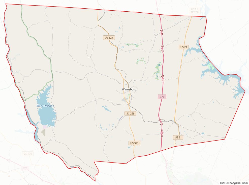
Fairfield County Road Map
Geography
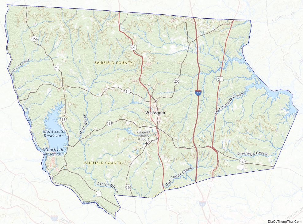
According to the U.S. Census Bureau, the county has a total area of 710 square miles (1,800 km), of which 686 square miles (1,780 km) is land and 24 square miles (62 km) (3.3%) is water. The Enoree Ranger District of the Sumter National Forest provides opportunities for outdoor recreation. The county has an abundance of deer and wild turkeys, making it an attraction for hunters. It is home to the Lake Wateree State Recreation Area.
National Protected area
- Sumter National Forest (part)
State and local protected areas/sites
- Lake Monticello Park
- Lake Wateree State Park
- Monticello Recreational Lake Beach
- The South Carolina Railroad Museum
- Upland Wings Preserve
Major water bodies
- Big Cedar Creek
- Broad River
- Catawba River
- Great Falls Lake
- Lake Wateree
- Monticello Reservoir
- Persimmon Creek
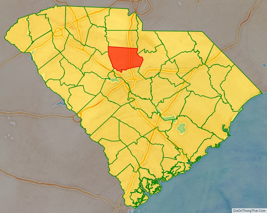
Adjacent counties
- Chester County – north
- Lancaster County – northeast
- Union County – northwest
- Kershaw County – east
- Richland County – south
- Newberry County – southwest
Major highways
- I-77
- US 21
- US 21 Conn.
- US 321
- US 321 Bus.
- SC 34
- SC 200
- SC 200 Conn.
- SC 213
- SC 215
- SC 269
- SC 901
Major infrastructure
- Fairfield County Airport
Fairfield County Topographic Map
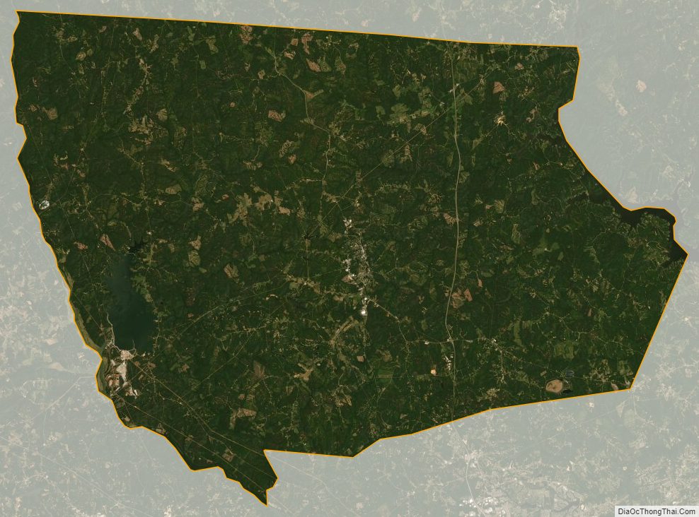
Fairfield County Satellite Map
Fairfield County Outline Map