Ridgeway is a town in Fairfield County, South Carolina, United States. The population was 319 at the 2010 census. It is part of the Columbia, South Carolina Metropolitan Statistical Area.
| Name: | Ridgeway town |
|---|---|
| LSAD Code: | 43 |
| LSAD Description: | town (suffix) |
| State: | South Carolina |
| County: | Fairfield County |
| Elevation: | 614 ft (187 m) |
| Total Area: | 0.48 sq mi (1.26 km²) |
| Land Area: | 0.48 sq mi (1.26 km²) |
| Water Area: | 0.00 sq mi (0.00 km²) |
| Total Population: | 266 |
| Population Density: | 548.45/sq mi (211.91/km²) |
| ZIP code: | 29130 |
| Area code: | 803, 839 |
| FIPS code: | 4560415 |
| GNISfeature ID: | 1231730 |
| Website: | www.ridgewaysc.org |
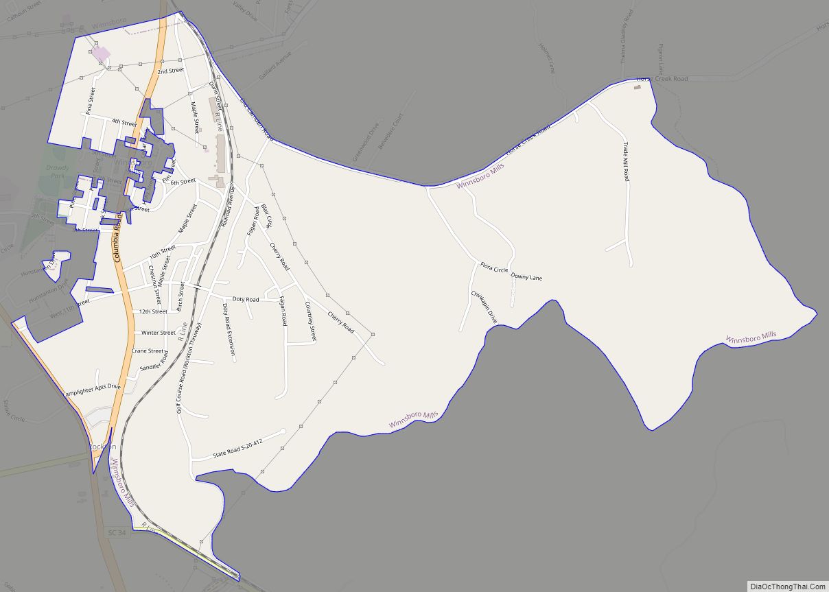
Online Interactive Map
Click on ![]() to view map in "full screen" mode.
to view map in "full screen" mode.
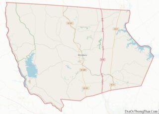
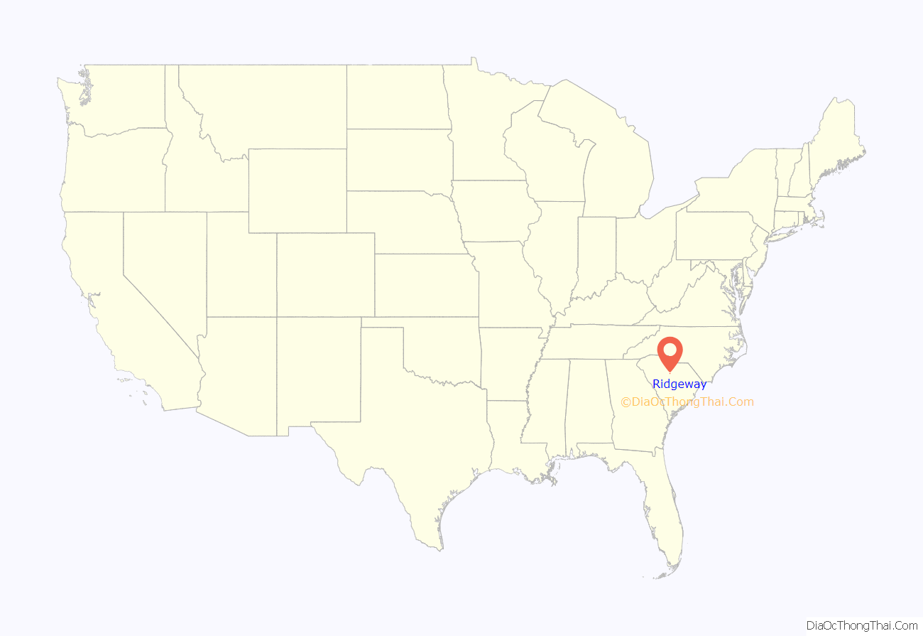
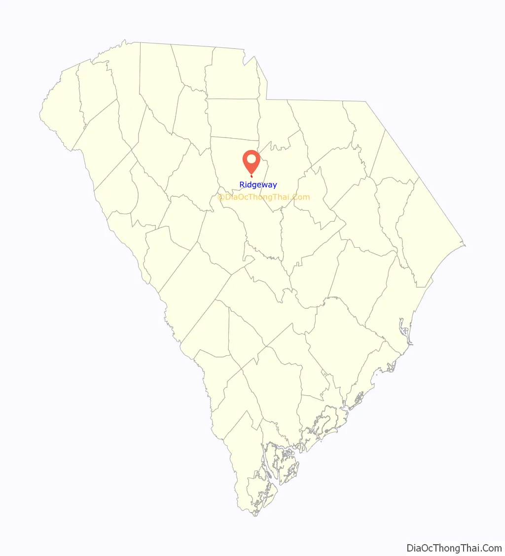
Ridgeway location map. Where is Ridgeway town?
History
Blink Bonnie, Camp Welfare, Century House, Hunter House, Mount Hope, Ridgeway Historic District, Ruff’s Chapel, St. Stephen’s Episcopal Church, Valencia, Vaughn’s Stage Coach Stop, and the Monroe Wilson House are listed on the National Register of Historic Places.
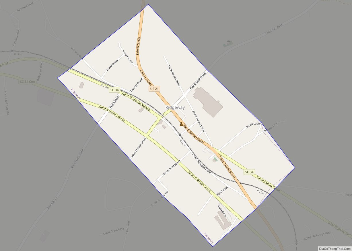
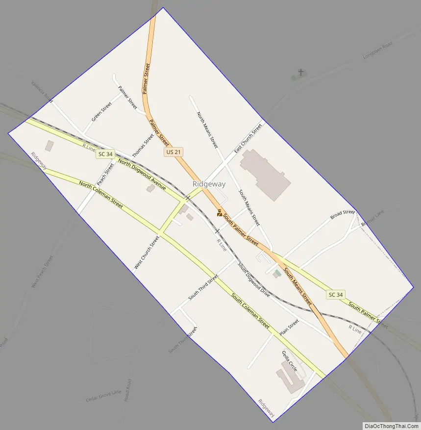
Ridgeway Road Map
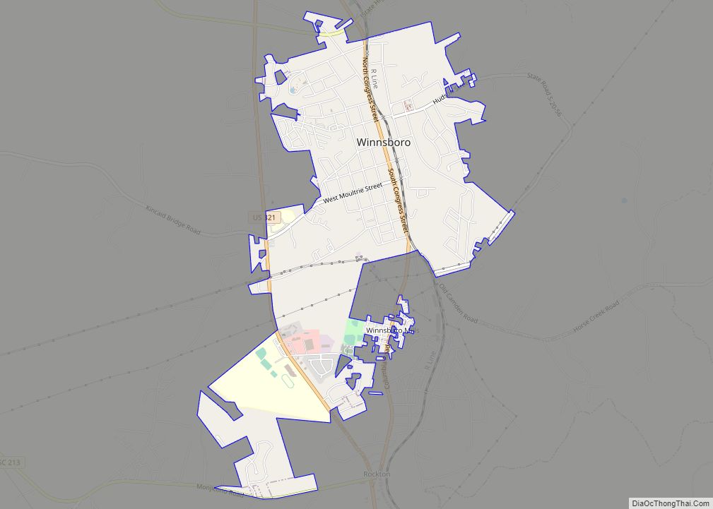
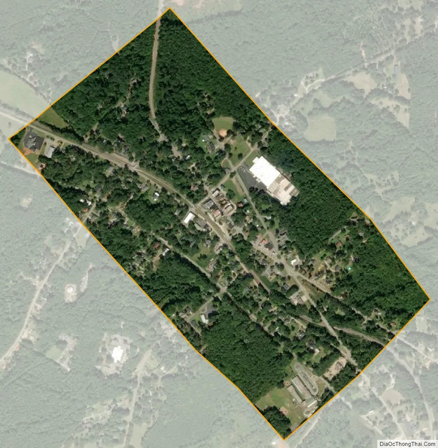
Ridgeway city Satellite Map
Geography
Ridgeway is located in southeastern Fairfield County at 34°18′21″N 80°57′41″W / 34.30583°N 80.96139°W / 34.30583; -80.96139 (34.305777, -80.961390). U.S. Route 21 passes through the towns, leading north 19 miles (31 km) to Great Falls and south 24 miles (39 km) to Columbia. South Carolina Highway 34 leads west 2 miles (3 km) to Interstate 77 and east 17 miles (27 km) to Lugoff. Winnsboro, the county seat, is 11 miles (18 km) to the northwest via SC 34.
According to the United States Census Bureau, Ridgeway has a total area of 0.50 square miles (1.3 km), all of it land.
See also
Map of South Carolina State and its subdivision:- Abbeville
- Aiken
- Allendale
- Anderson
- Bamberg
- Barnwell
- Beaufort
- Berkeley
- Calhoun
- Charleston
- Cherokee
- Chester
- Chesterfield
- Clarendon
- Colleton
- Darlington
- Dillon
- Dorchester
- Edgefield
- Fairfield
- Florence
- Georgetown
- Greenville
- Greenwood
- Hampton
- Horry
- Jasper
- Kershaw
- Lancaster
- Laurens
- Lee
- Lexington
- Marion
- Marlboro
- McCormick
- Newberry
- Oconee
- Orangeburg
- Pickens
- Richland
- Saluda
- Spartanburg
- Sumter
- Union
- Williamsburg
- York
- Alabama
- Alaska
- Arizona
- Arkansas
- California
- Colorado
- Connecticut
- Delaware
- District of Columbia
- Florida
- Georgia
- Hawaii
- Idaho
- Illinois
- Indiana
- Iowa
- Kansas
- Kentucky
- Louisiana
- Maine
- Maryland
- Massachusetts
- Michigan
- Minnesota
- Mississippi
- Missouri
- Montana
- Nebraska
- Nevada
- New Hampshire
- New Jersey
- New Mexico
- New York
- North Carolina
- North Dakota
- Ohio
- Oklahoma
- Oregon
- Pennsylvania
- Rhode Island
- South Carolina
- South Dakota
- Tennessee
- Texas
- Utah
- Vermont
- Virginia
- Washington
- West Virginia
- Wisconsin
- Wyoming